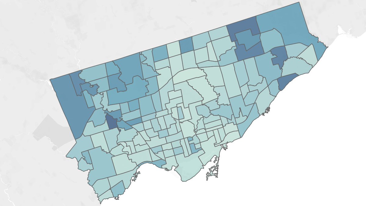
Looking at the City of Toronto& #39;s just released data and it& #39;s clear that this is a pandemic by postal code. Here& #39;s the map of cases per 100,000 population. https://www.toronto.ca/home/covid-19/covid-19-latest-city-of-toronto-news/covid-19-status-of-cases-in-toronto/">https://www.toronto.ca/home/covi...
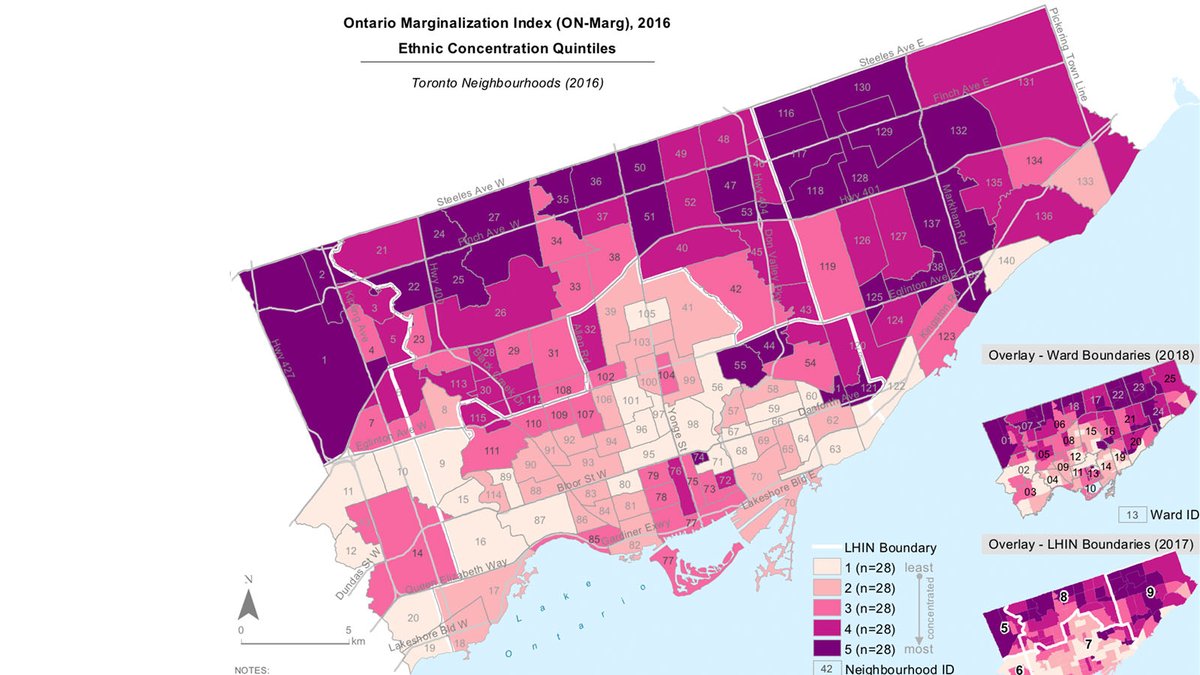
COVID-19 is most prevalent in neighbourhoods with high ethnical concentrations, i.e. visible minorities and recent immigrants.
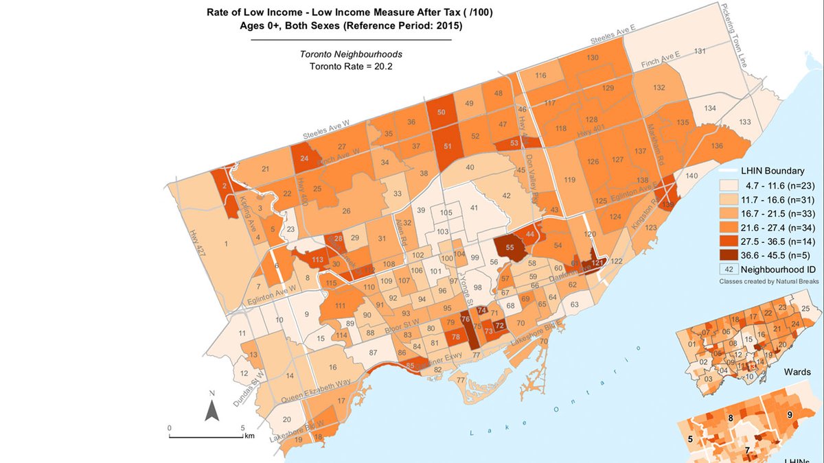
What& #39;s surprising is that COVID is not as prevalent in low-income neighbourhoods as initially thought. Here& #39;s map of low income measure after tax (LIM-AT) per 2016 census.
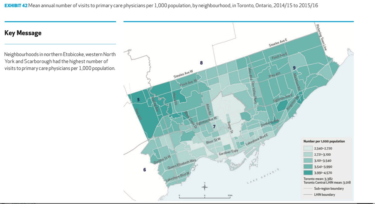
Not sure how to interpret this yet, but high COVID cases in neighbourhoods where people go see their family doctor most frequently.
What& #39;s clear is that those living in the affluent neighbourhoods along the Yonge Street corridor appear almost immune to COVID, as they are to a range of other ills. I wrote about this previously in @thelocalhealth https://thelocal.to/mapping-our-divisions/">https://thelocal.to/mapping-o...

 Read on Twitter


