With the #SpaceX DM-2 mission coming up I thought I& #39;d collect some unique images of the space coast and make a a bit of a thread! All of these images have the space coast in them somewhere.
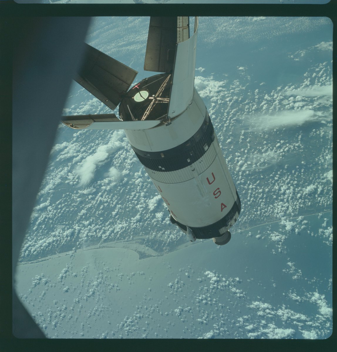
1 - Saturn S-IVB stage after stage separtion for the Apollo 7 mission on 1974-01-22
1 - Saturn S-IVB stage after stage separtion for the Apollo 7 mission on 1974-01-22
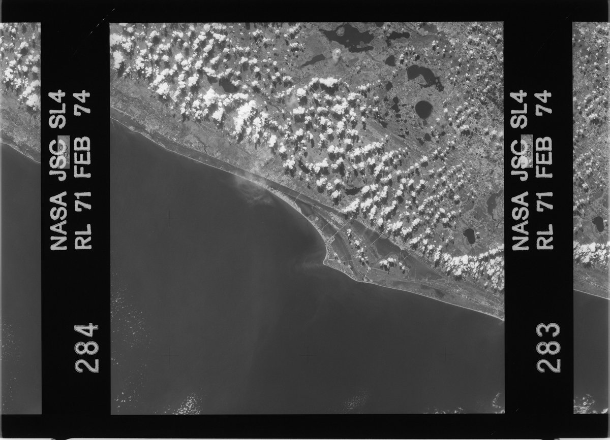
1 - An image taken from Skylab during the SL4 mission on 1974-01-22
2 - The first satellite image of the space coast I can find. Taken by Landsat-4 on 1982-12-08
2 - The first satellite image of the space coast I can find. Taken by Landsat-4 on 1982-12-08
1 - An image from STS-37 to deploy the Compton Gamma Ray Observatory on 1991-04-04.
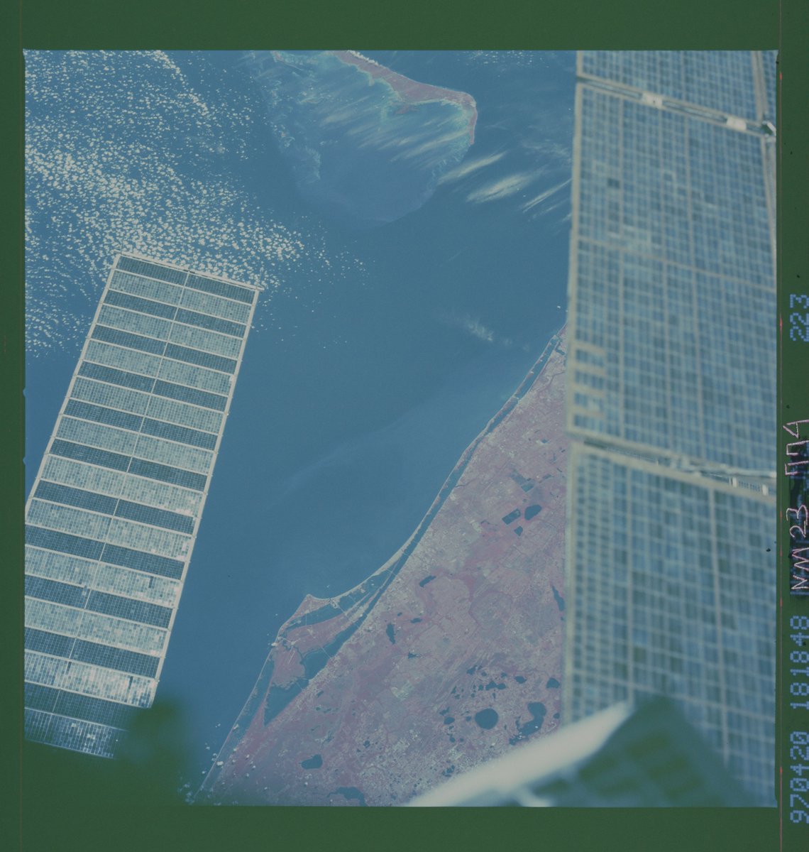
2 - Taken from Mir on 1997-04-20 during the Shuttle-Mir program.
2 - Taken from Mir on 1997-04-20 during the Shuttle-Mir program.
1 - STS-103 during a @NASAHubble servicing mission, with the Space Coast below the solar array.
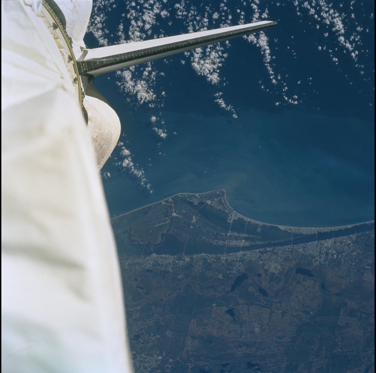
2 - The tail end of Endeavour over the Space Coast during a Shuttle Radar Topography Mission on 2000-02-??
2 - The tail end of Endeavour over the Space Coast during a Shuttle Radar Topography Mission on 2000-02-??
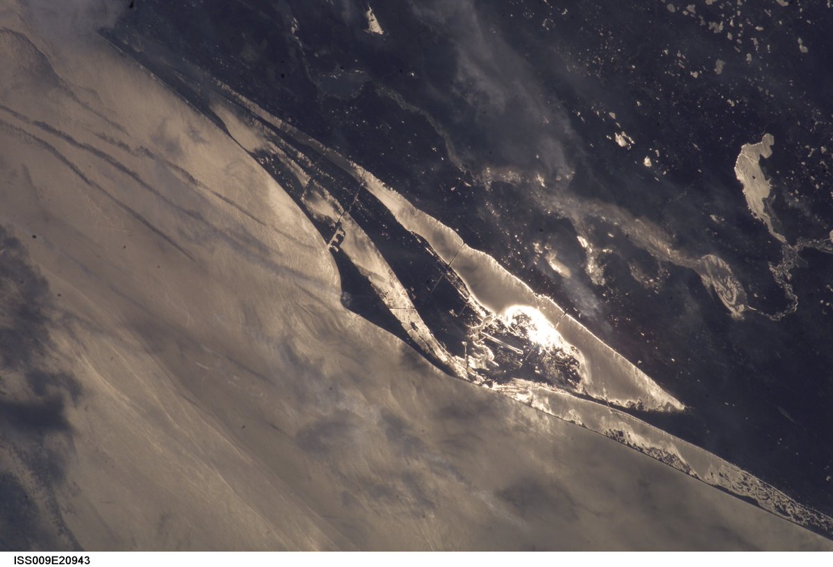
1 - A grogeous image from ISS009 (I don& #39;t fully understand the code on these images but if anyone can help that would be great!) on 2004-08-30.
2 - Another beautiful shot from the ISS on 2009-02-18. All those launch pads https://abs.twimg.com/emoji/v2/... draggable="false" alt="😀" title="Grinning face" aria-label="Emoji: Grinning face">
2 - Another beautiful shot from the ISS on 2009-02-18. All those launch pads
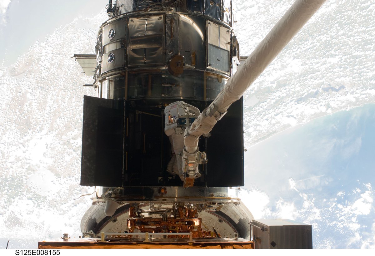
Taken during the servicing of @NASAHubble on STS-125. You can& #39;t see the Space Coast directly in this image, but if you follow the coastline you can see that it is right behind Hubble  https://abs.twimg.com/emoji/v2/... draggable="false" alt="😄" title="Smiling face with open mouth and smiling eyes" aria-label="Emoji: Smiling face with open mouth and smiling eyes">
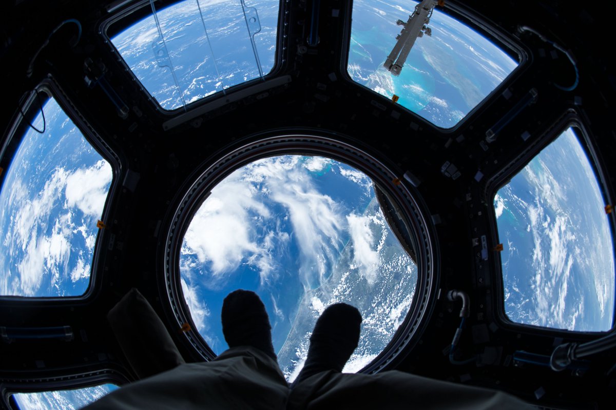
An image from ISS Expedition 44, the Space Coast from the Cupola. I& #39;m assuming this image was taken by @StationCDRKelly during his one year in space on 2015-07-06.
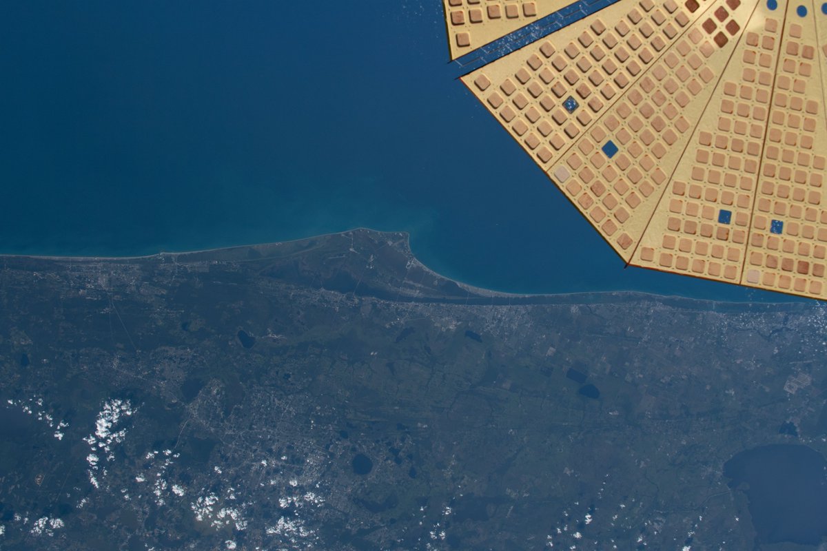
A more recent image of the sapce coast from ISS Expedition 59, with one of the solar arrays from Cygnus NG-11 Roger Chaffee on 2019-05-26!
After looking back through these images I can& #39;t wait to see the images that @AstroBehnken & @Astro_Doug capture during their upcoming missions!
Credit for image: Earth Science and Remote Sensing Unit, NASA Johnson Space Center
Credit for image: Earth Science and Remote Sensing Unit, NASA Johnson Space Center
@NASAGroundSys https://eol.jsc.nasa.gov/ ">https://eol.jsc.nasa.gov/">...

 Read on Twitter



 " title="1 - A grogeous image from ISS009 (I don& #39;t fully understand the code on these images but if anyone can help that would be great!) on 2004-08-30.2 - Another beautiful shot from the ISS on 2009-02-18. All those launch pads https://abs.twimg.com/emoji/v2/... draggable="false" alt="😀" title="Grinning face" aria-label="Emoji: Grinning face">">
 " title="1 - A grogeous image from ISS009 (I don& #39;t fully understand the code on these images but if anyone can help that would be great!) on 2004-08-30.2 - Another beautiful shot from the ISS on 2009-02-18. All those launch pads https://abs.twimg.com/emoji/v2/... draggable="false" alt="😀" title="Grinning face" aria-label="Emoji: Grinning face">">
 " title="Taken during the servicing of @NASAHubble on STS-125. You can& #39;t see the Space Coast directly in this image, but if you follow the coastline you can see that it is right behind Hubble https://abs.twimg.com/emoji/v2/... draggable="false" alt="😄" title="Smiling face with open mouth and smiling eyes" aria-label="Emoji: Smiling face with open mouth and smiling eyes">" class="img-responsive" style="max-width:100%;"/>
