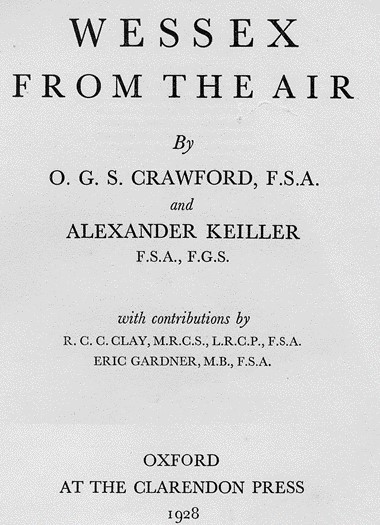
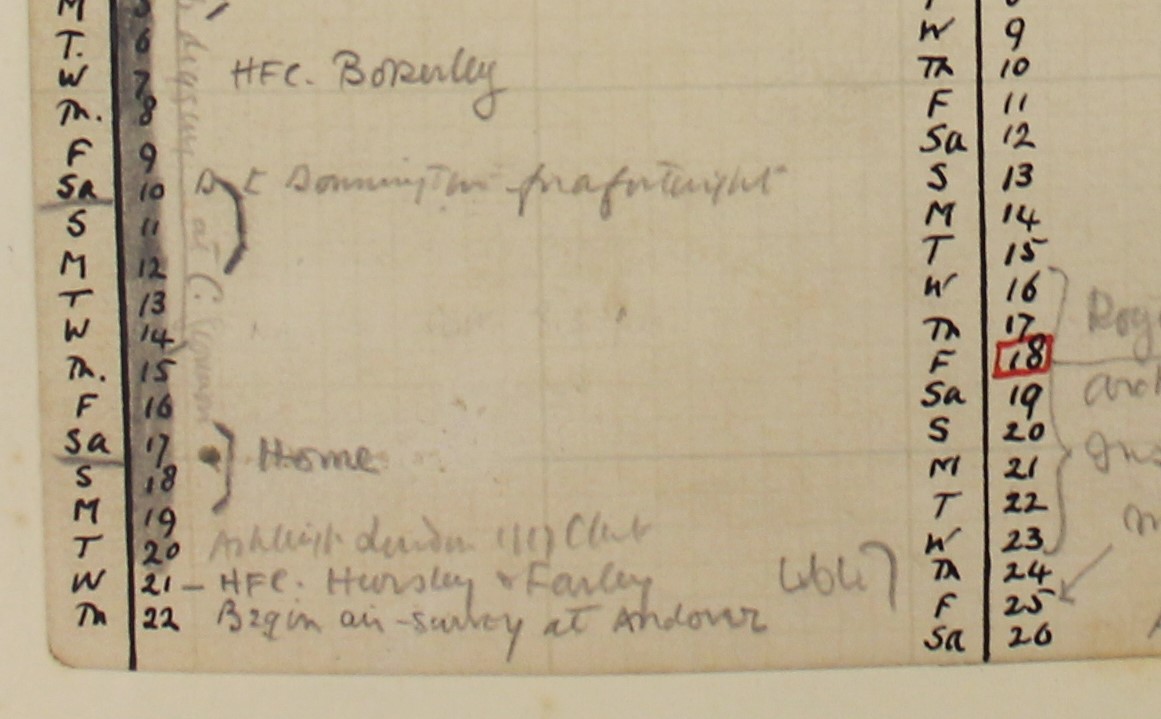
#otd thread for #aerialarchaeology fans - 22nd May 1924 was the day that OGS Crawford and Alexander Keiller headed to Andover to begin the series of flights published in the book & #39;Wessex from the Air& #39; (1928). This is Crawford& #39;s rather low-key diary entry (Bodleian Lib). (1/X)
Keiller had suggested "financing a special expedition to take archaeological air-photographs of Wessex from a hired aeroplane" after reading of Crawford& #39;s spectacular discoveries in 1923, including the Stonehenge Avenue. He bought a captured German camera - an Ica - from (2/x)
the War Disposals Board, and hired an aeroplane - an Avro - from De Haviland. The Avro came with a pilot, Capt. Gaskell (centre in the photo). They got permission to base themselves at RAF Weyhill, nr Andover. [Photo: Institute of Archaeology, Oxford Crawford Coll] (3/x)
The Avro proved unsuitable, so was replaced by a DH9. This meant the camera could be fixed in the floor of the observer& #39;s cockpit, rather than being stuck on the side of the plane, making it easier to frame sites. The weather was also unsuitable...[Photo: Inst Archaeol Ox](4/x)
meaning things got off to a slow start, with the flying extended into June and July. Crawford chose the main targets - all known sites - for each flight, but eyes were open for the unexpected. Crawford& #39;s first encounter with cropmarks had only occurred the previous year... (5/x)
and he was keen to find more. However, the summer of 1924 was pretty damp, so few were spotted. Only a quarter of the sites in & #39;Wessex from the Air& #39; were partly or wholly cropmarks. Incidentally, the term & #39;cropmarks& #39; hadn& #39;t been coined yet. Instead, they were called... (6/x)
& #39;streak-sites& #39;. Yes they were. They called this one & #39;Sparrow Croft& #39;, the name of one of the fields in the photograph. [print in the HE Archive ALK 7429/226, 12th July 1924] (7/x).
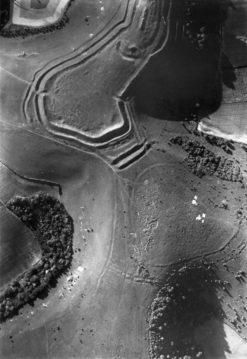
The flights, and the book, are perhaps better known for some remarkable overhead (vertical) shots of earthwork sites, such as this one of part of the complex of Neolithic and Iron Age monuments at Hambledon Hill, Dorset [print in HE Archive ALK 7442/245, 14th July 1924). (8/x)
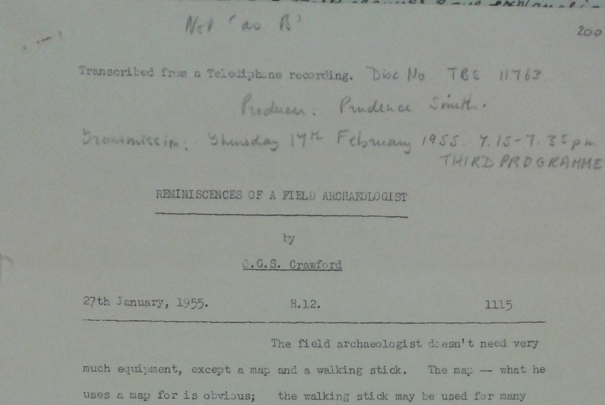
Just as important as the photos was what happened next, on the ground. Crawford recognised that a single photo was not a sound basis for interpretaion, but the book offered few clues about his methods. However, he did offer more detail in a BBC talk in 1955... (9/x)
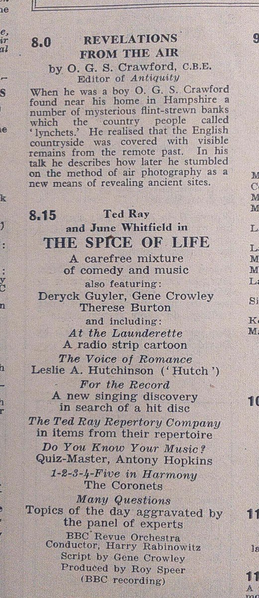
the transcript of which survives in Crawford& #39;s archive at the Bodleian, Oxford. The talk was first broadcast on 17th Feb 1955 and, as this extract from the Radio Times shows, that was quite a night of entertainment. Note: apparently he & #39;stumbled& #39;. In the air. (10/x)
50 sites were selected for closer scrutiny. Crawford visited each one with a matte enlargement (matte=easier to scribble on). Historic maps and other documents were studied, as were records of previous finds, excavations etc. He was interested in the complete... (11/x)
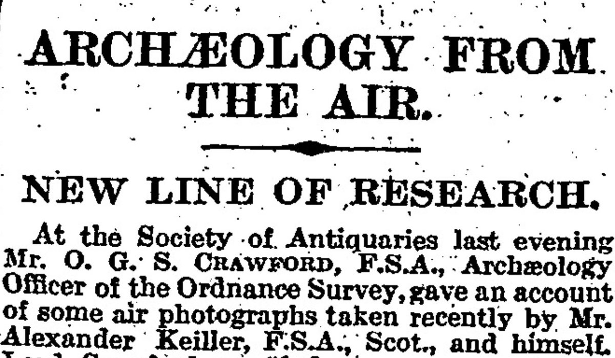
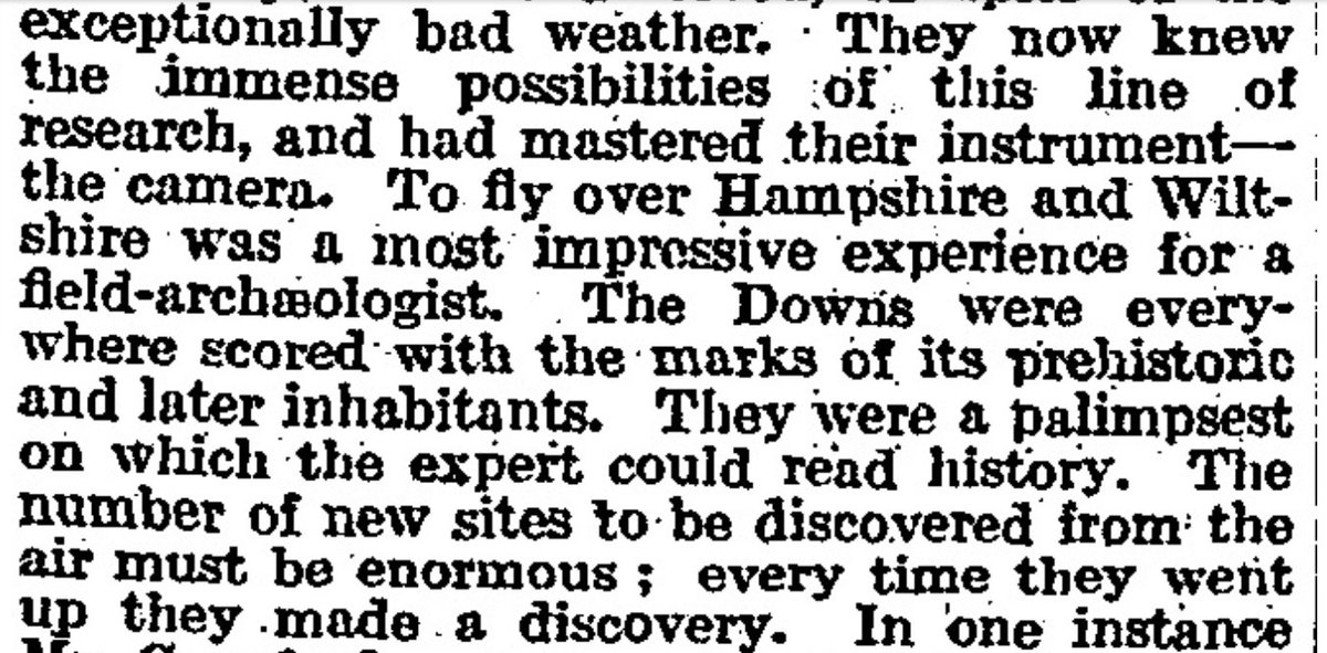
landscape history, not just the specific details of a site in isolation from its wider (landscape and historic) context. The first results were presented to the Society of Antiquaries, London, in December 1924, as reported (below) in The Times... (12/x)
the amonymous reporter enthusiastically & #39;borrowing& #39; some of Crawford& #39;s own words in the process. However, at this point there was still a lot of work to be done in the field, library, archive and office, the book not appearing until the summer of 1928... (13/x)
The book focused on 50 sites, mostly earthworks, but in total 297 photos were taken, all but 23 by Crawford. In addition, they compiled a list of further sites seen but not photographed (including the enclosure later known as Little Woodbury, nr Salisbury). Crawford later (14/x)
expressed some disenchantment with the book. Too large, too detailed, too expensive (50 shillings) - it& #39;s regarded as a milestone now, but he felt its impact was rather limited and short-lived. It was, however, the first time in the UK that archaeologists themselves had (15/x)
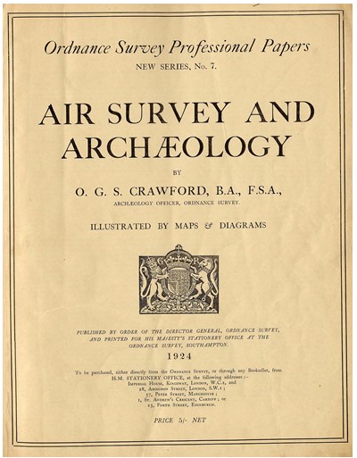
planned and undertaken flights. Previously, and for some time after, Crawford was heavily reliant on the RAF, as in his first book on the subject & #39;Air Survey and Archaeology& #39;, published in 1924, and based on a paper he published in the Geographical Journal in 1923. (16/x)
It wasn& #39;t really until after WW2 that the kind of approaches outlined in & #39;Wessex from the Air& #39; began to be more widely adopted and developed further.
Copies remain v. expensive but look here! A pdf!!: https://archive.org/details/in.ernet.dli.2015.282493
(17/x).">https://archive.org/details/i...
Copies remain v. expensive but look here! A pdf!!: https://archive.org/details/in.ernet.dli.2015.282493
(17/x).">https://archive.org/details/i...
Further reading? Why, of course. Useful starters are Kitty Hauser& #39;s & #39;Shadow Sites& #39; (2007) and & #39;Bloody Old Britain& #39; (2008), and my own & #39;A History of Aerial Photography & Archaeology& #39; (2011), plus sources cited therein.
#aerialphotography #AerialSurvey
#aerialphotography #AerialSurvey

 Read on Twitter
![the War Disposals Board, and hired an aeroplane - an Avro - from De Haviland. The Avro came with a pilot, Capt. Gaskell (centre in the photo). They got permission to base themselves at RAF Weyhill, nr Andover. [Photo: Institute of Archaeology, Oxford Crawford Coll] (3/x) the War Disposals Board, and hired an aeroplane - an Avro - from De Haviland. The Avro came with a pilot, Capt. Gaskell (centre in the photo). They got permission to base themselves at RAF Weyhill, nr Andover. [Photo: Institute of Archaeology, Oxford Crawford Coll] (3/x)](https://pbs.twimg.com/media/EYm6PzXWoAAV9bm.jpg)
 The Avro proved unsuitable, so was replaced by a DH9. This meant the camera could be fixed in the floor of the observer& #39;s cockpit, rather than being stuck on the side of the plane, making it easier to frame sites. The weather was also unsuitable...[Photo: Inst Archaeol Ox](4/x)](https://pbs.twimg.com/media/EYm7YNLXYAABQeO.jpg)
![& #39;streak-sites& #39;. Yes they were. They called this one & #39;Sparrow Croft& #39;, the name of one of the fields in the photograph. [print in the HE Archive ALK 7429/226, 12th July 1924] (7/x). & #39;streak-sites& #39;. Yes they were. They called this one & #39;Sparrow Croft& #39;, the name of one of the fields in the photograph. [print in the HE Archive ALK 7429/226, 12th July 1924] (7/x).](https://pbs.twimg.com/media/EYm9uMnWAAA-mGG.jpg)
