#THREAD 1: Some maps of the #IndoPacific:
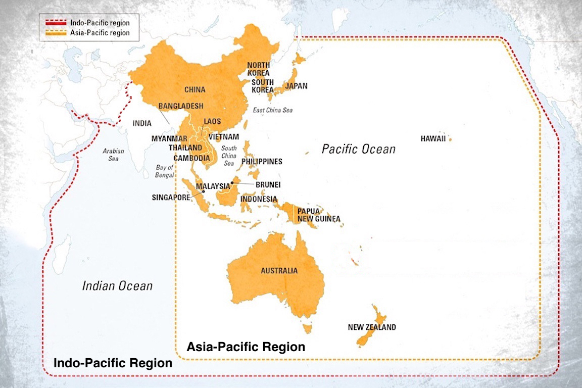
A) #IndoPacific & #AsiaPacific regions
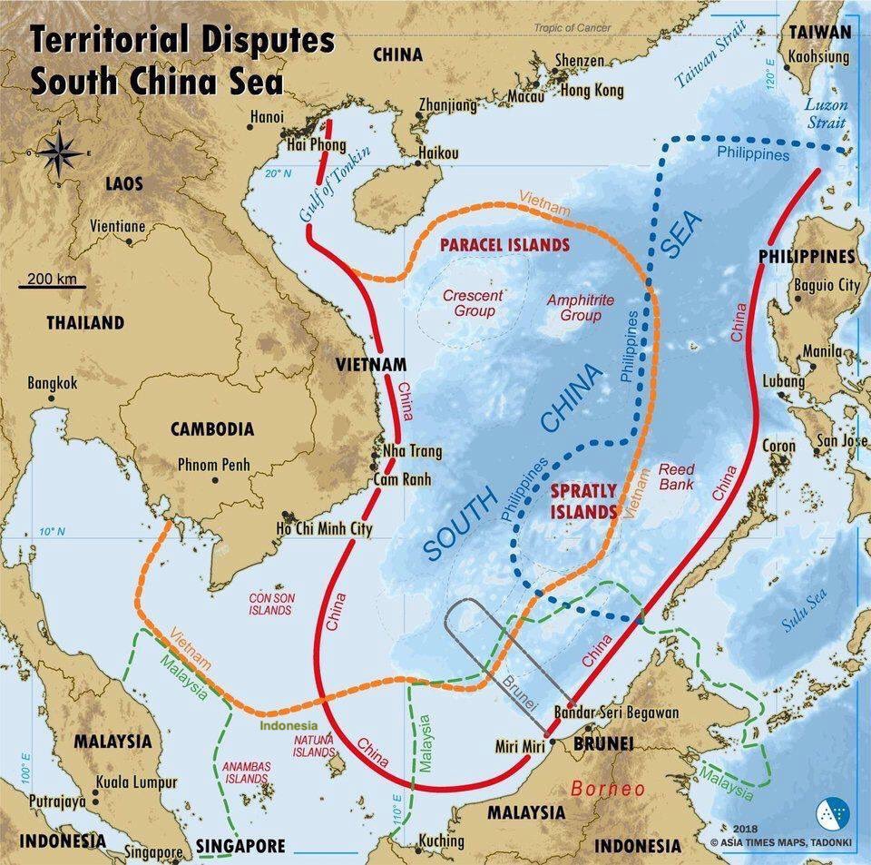
B) EEZ zones & 9 Dash line claims in the #SouthChinaSea
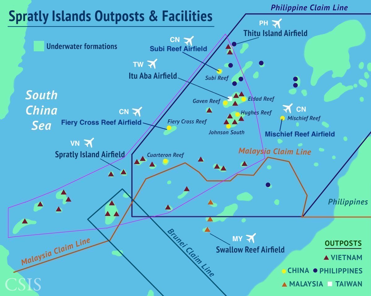
C) Spratly Islands outposts, facilities & runways
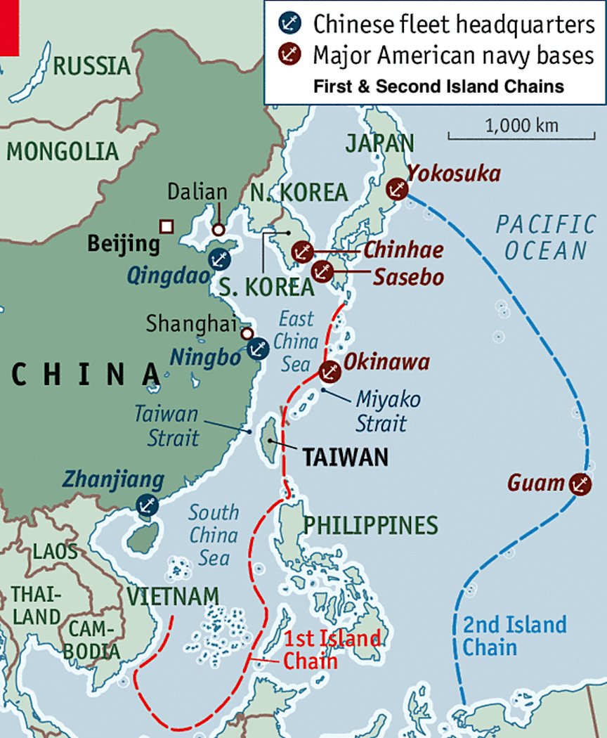
D) First & Second island chains, the 2 defensive maritime lines to contain #China
A) #IndoPacific & #AsiaPacific regions
B) EEZ zones & 9 Dash line claims in the #SouthChinaSea
C) Spratly Islands outposts, facilities & runways
D) First & Second island chains, the 2 defensive maritime lines to contain #China
2: Some maps of the #IndoPacific:
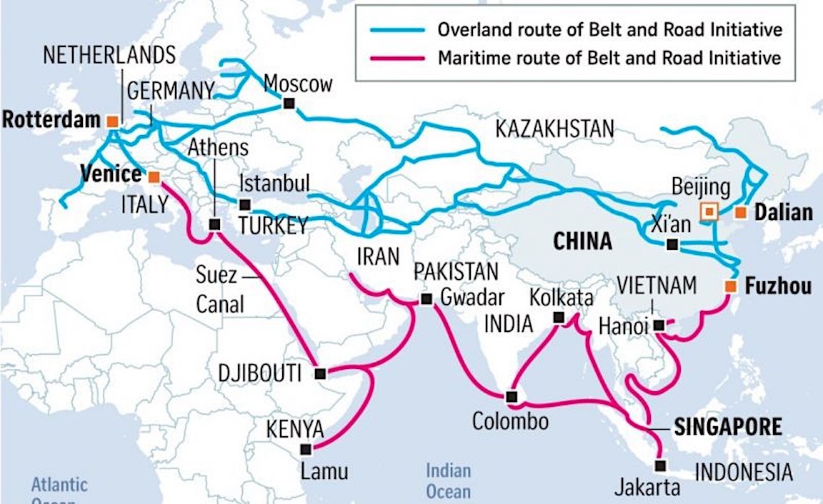
A) #China& #39;s Belt & Road Initiative (BRI)
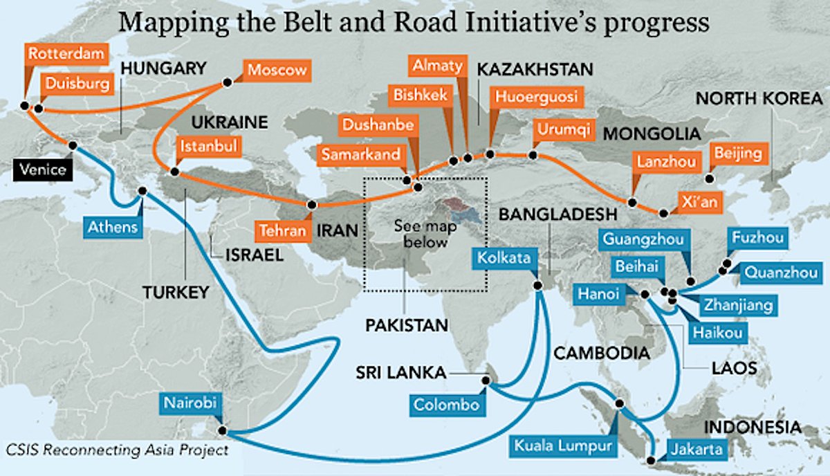
B) Another map of China& #39;s #BeltandRoadInitiative (BRI)
C) #China #Pakistan Economic Corridor #CPEC
D) #China #Myanmar Economic Corridor #CMEC
A) #China& #39;s Belt & Road Initiative (BRI)
B) Another map of China& #39;s #BeltandRoadInitiative (BRI)
C) #China #Pakistan Economic Corridor #CPEC
D) #China #Myanmar Economic Corridor #CMEC
3: Some maps of the #IndoPacific:
A) Attacking #Taiwan by sea, departing & landing sites
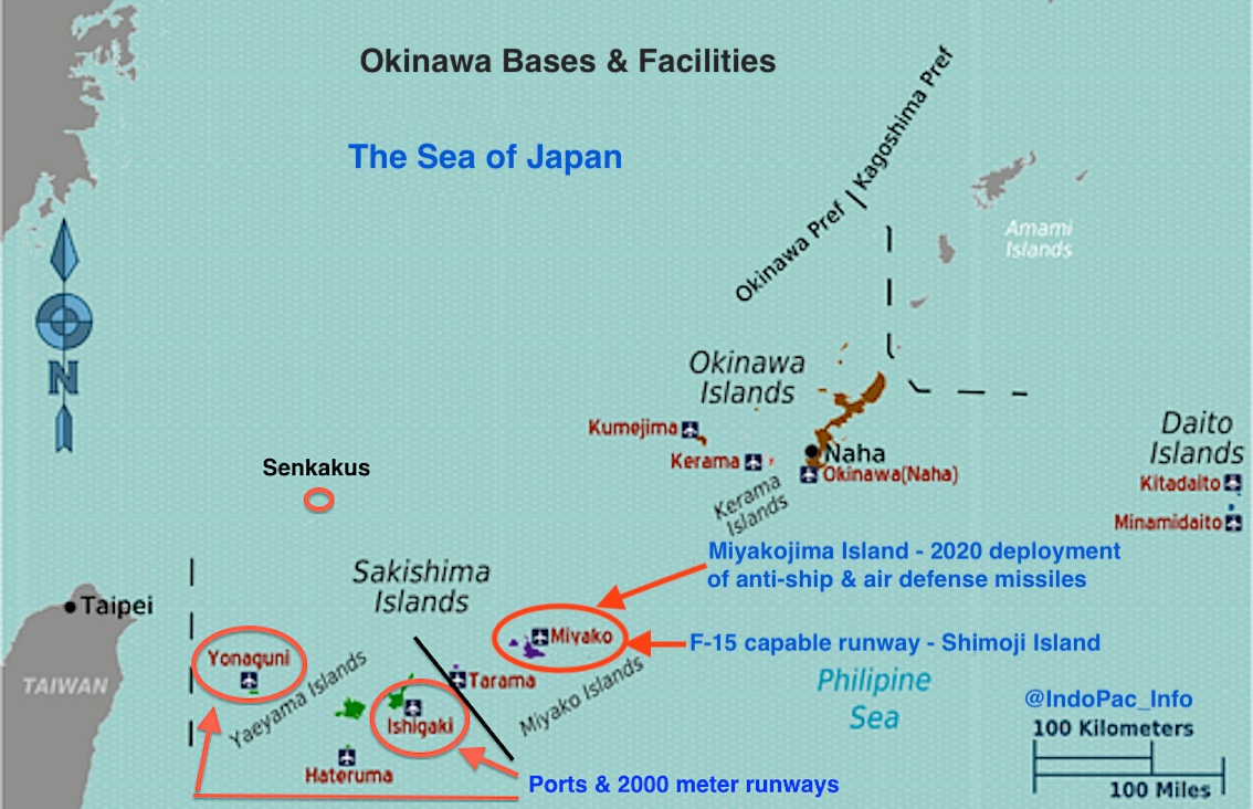
B) #Japan& #39;s Okinawa Islands, bases & facilities
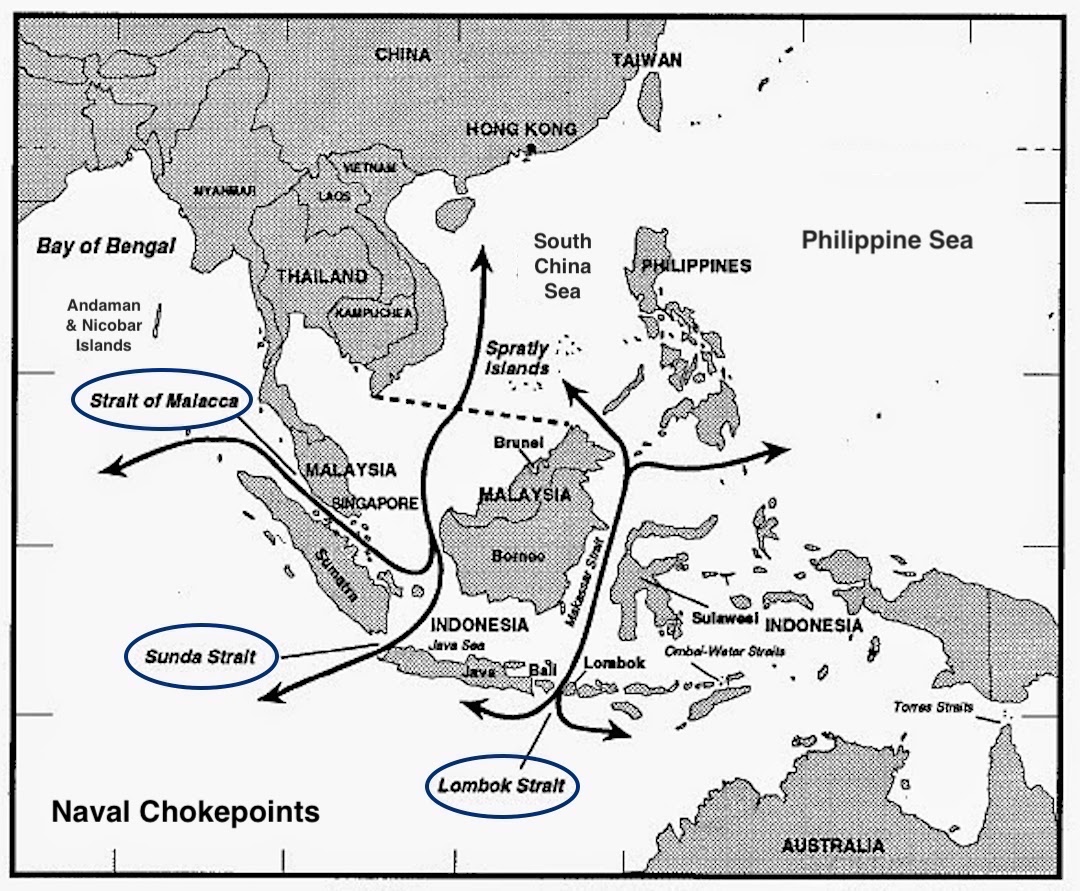
C) Naval chokepoints in the Malacca Strait region
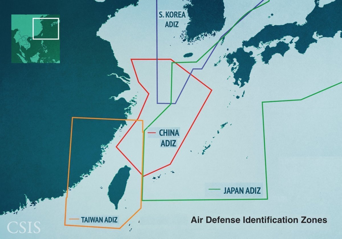
D) Air Defense Identification Zones in the West Pacific
A) Attacking #Taiwan by sea, departing & landing sites
B) #Japan& #39;s Okinawa Islands, bases & facilities
C) Naval chokepoints in the Malacca Strait region
D) Air Defense Identification Zones in the West Pacific
4: Some maps of the #IndoPacific:
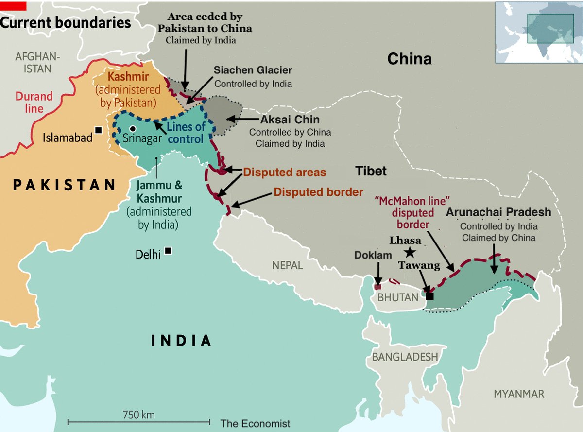
A) Disputed borders between #India, #China & #Pakistan
B) #Kashmir border disputes
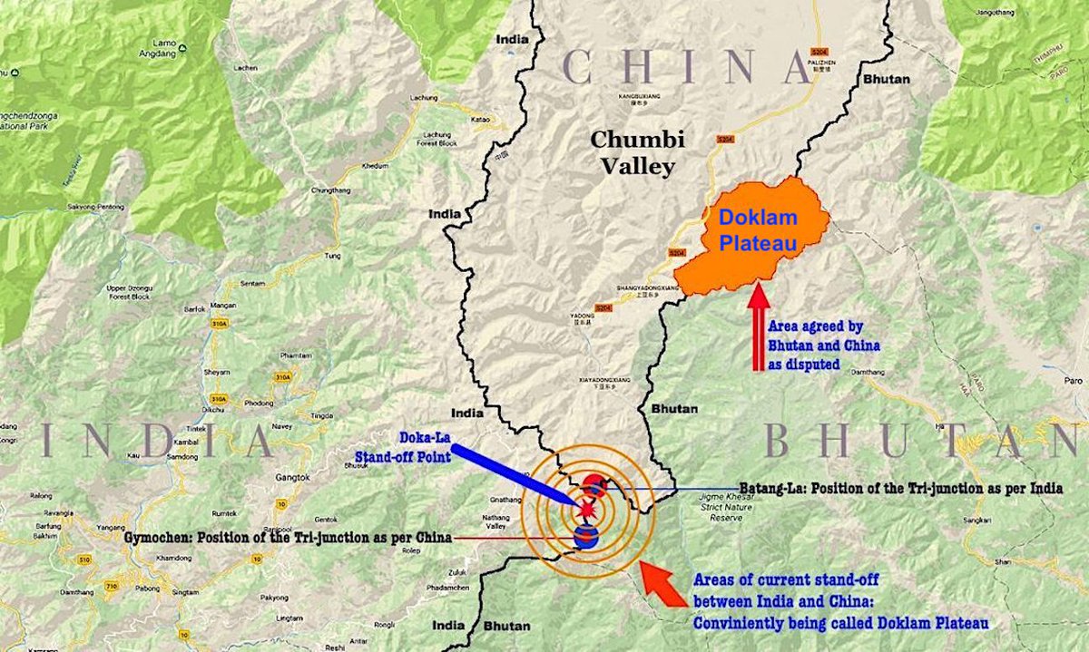
C) Doklam border disputes, India, China & #Bhutan
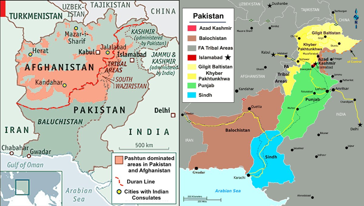
D) #Pakistan - #Afghanistan maps, Pashtun ethnic areas
A) Disputed borders between #India, #China & #Pakistan
B) #Kashmir border disputes
C) Doklam border disputes, India, China & #Bhutan
D) #Pakistan - #Afghanistan maps, Pashtun ethnic areas
5: Some maps of the #IndoPacific:
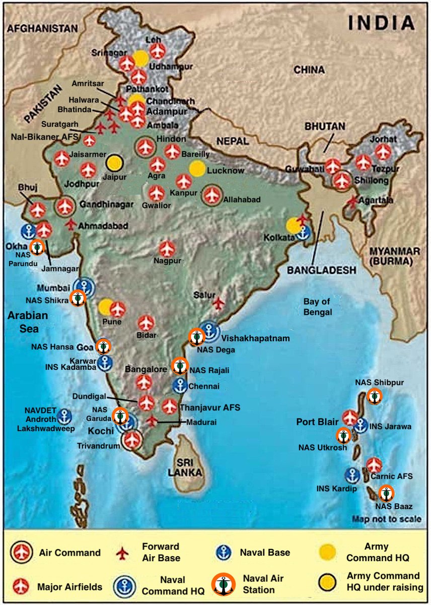
A) #Indian military bases
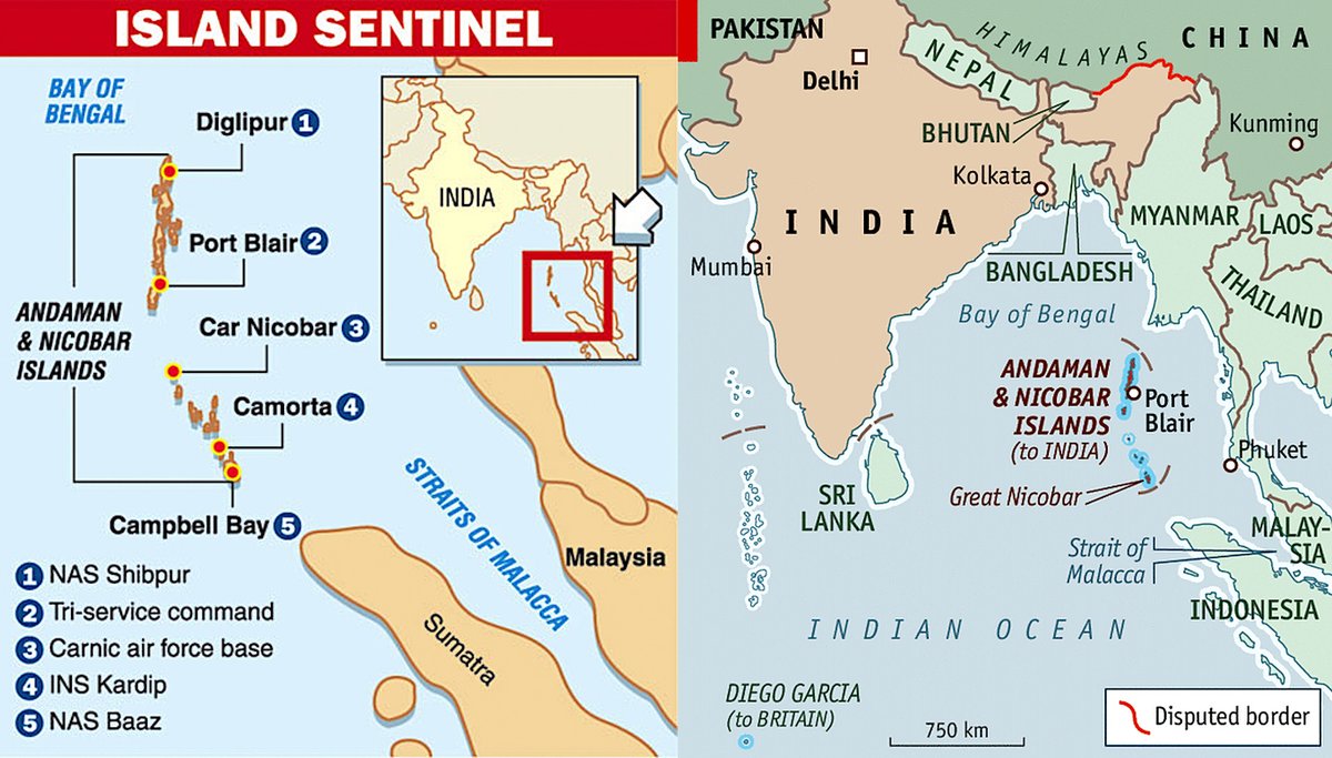
B) Andaman & Nicobar islands
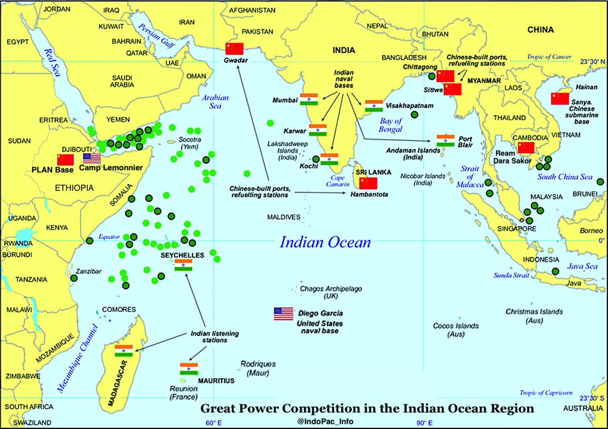
C) Great power competition in the Indian Ocean
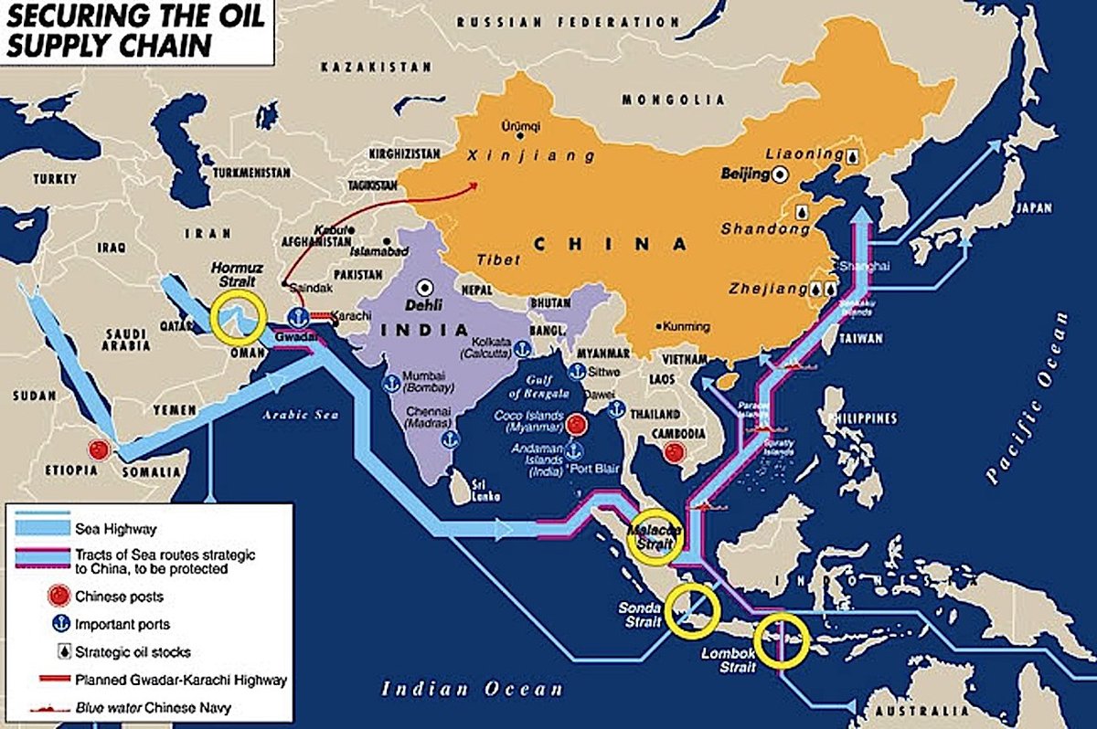
D) Securing the oil supply chain for #China
A) #Indian military bases
B) Andaman & Nicobar islands
C) Great power competition in the Indian Ocean
D) Securing the oil supply chain for #China

 Read on Twitter