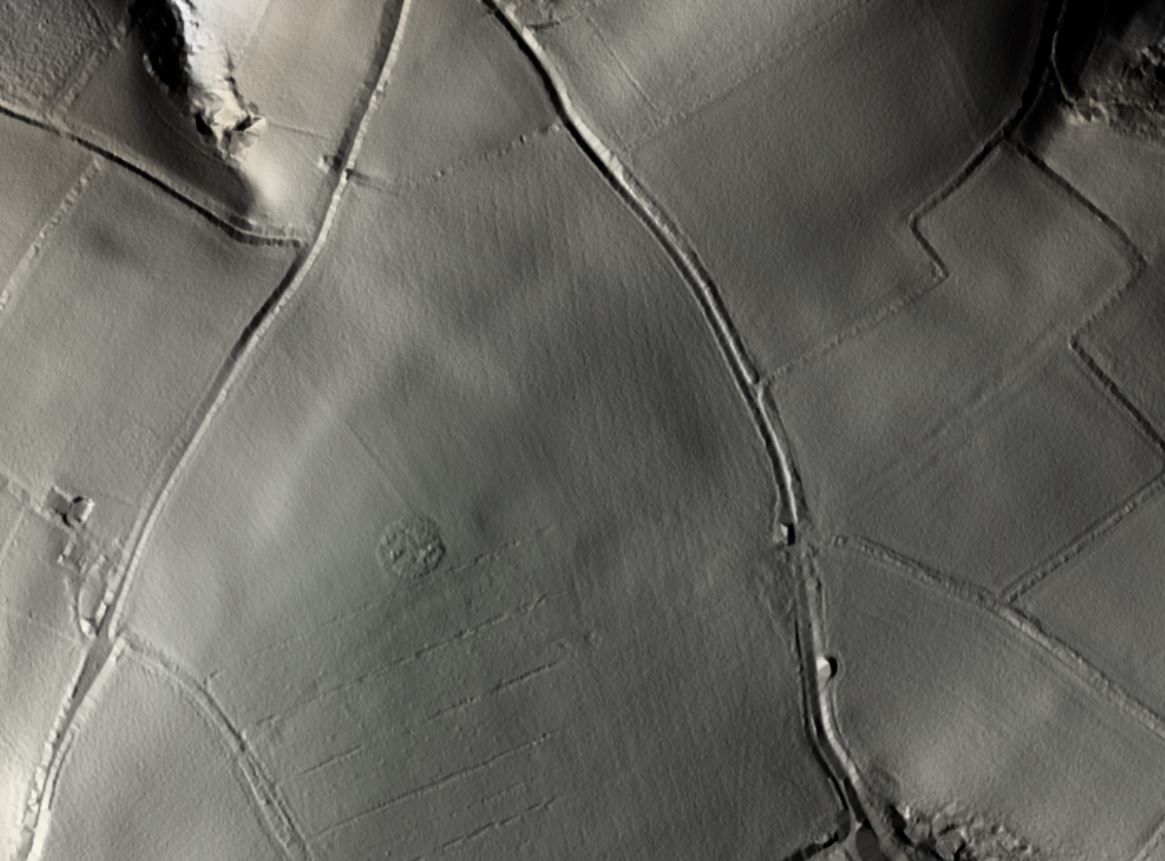
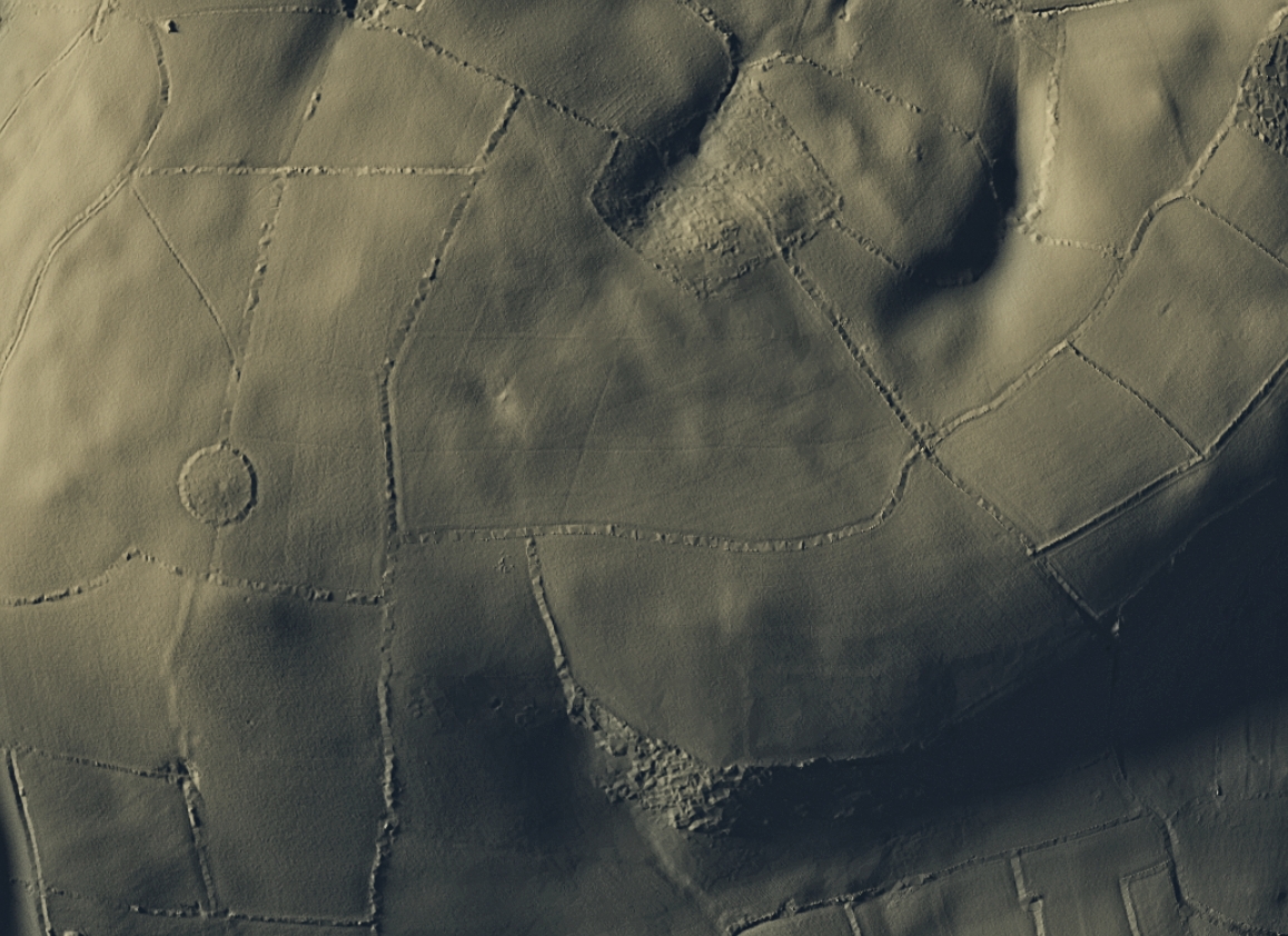
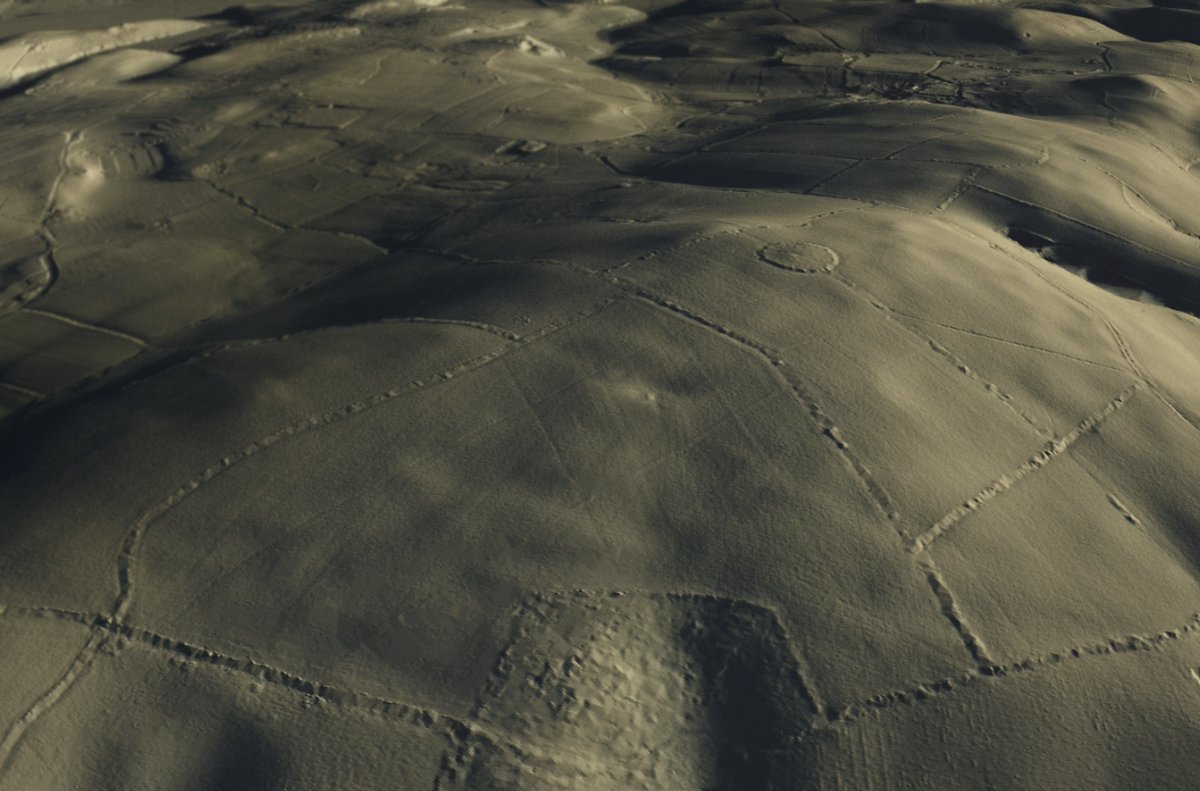
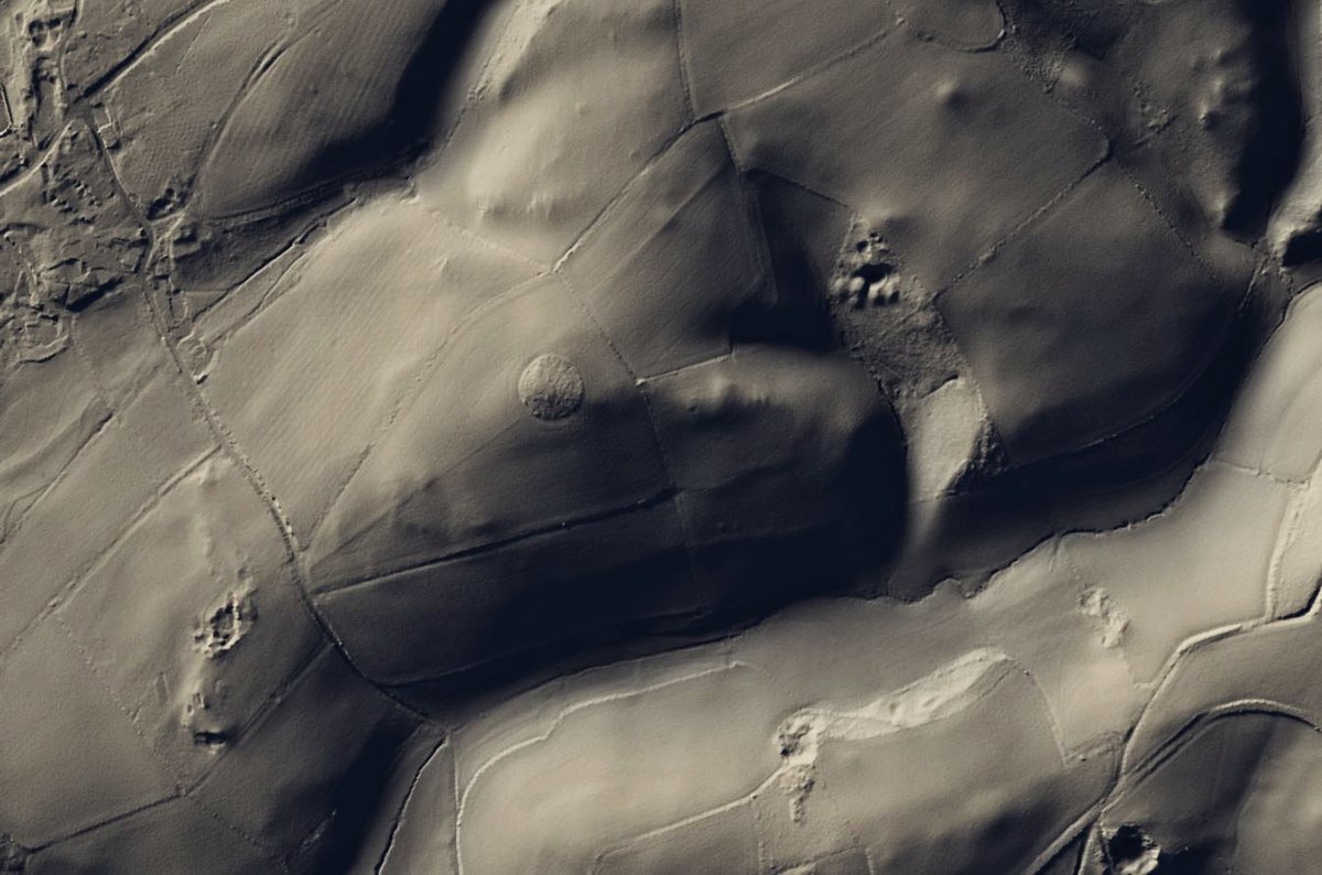
Good to see #LiDAR getting more use / coverage ... "Lost Bronze Age hill forts discovered in Devon" https://www.devonlive.com/news/devon-news/lost-bronze-age-hill-forts-4091969.">https://www.devonlive.com/news/devo... That& #39;s Windmill Clump https://www.heritagegateway.org.uk/Gateway/Results_Single.aspx?uid=MDV123583&resourceID=104">https://www.heritagegateway.org.uk/Gateway/R... - the question for me tho& #39; - is what& #39;s been happening in the adjacent fields to mark them quite so evenly? https://abs.twimg.com/emoji/v2/... draggable="false" alt="🤔" title="Thinking face" aria-label="Emoji: Thinking face">
So, lets turn this into a thread and see what we can find to help the local paper out. I& #39;ll start by deconstructing the article to give some local context. 1/n
1. The article mentions two sites, but only describes / shows one of them. I suspect I know which the second site is, but we& #39;ll come back to that in the coming days. (The DTM data does show them to be of very similar appearance, whatever *they* might turn out to be). 2/n
2. The article also mentions the Noss Iron Age Hill Fort near Dartmouth. This is the [~prehistoric & unexcavated] Greenway Camp #Hillfort & associated #earthwork. (I posted it way back in my history, but here is it again for reference - its not shown in the article). 3/n
3. There is mention of #BronzeAge burial mounds in the area, & there are a small number of known barrows in the area. 4/n
4. Both the site shown in the article, and what is likely the second site, are pretty much next door to the [already listed] #enclosure site above Berry Pomeroy, & that @jost_hobic helped me out with, re-looking at the data & the extent of the site: https://twitter.com/Monk_Po/status/1106883274864054272?s=20">https://twitter.com/Monk_Po/s... 5/n
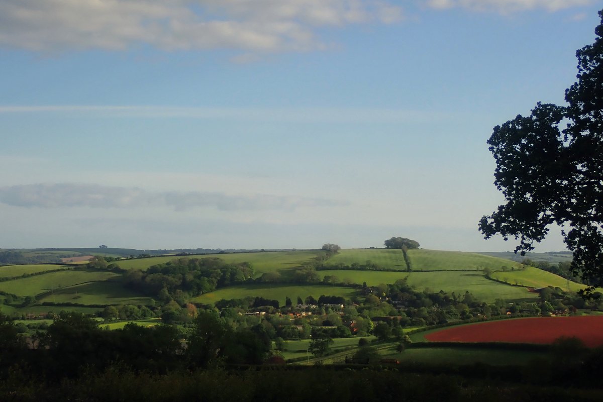
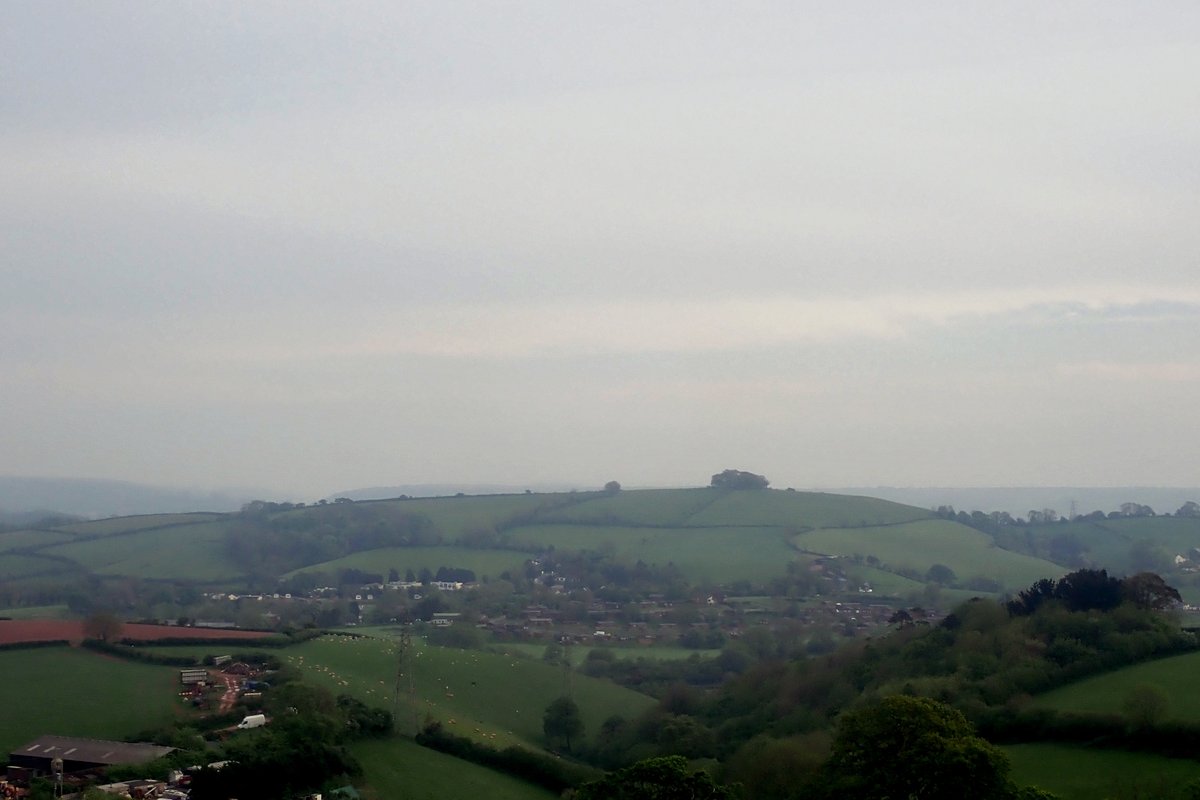
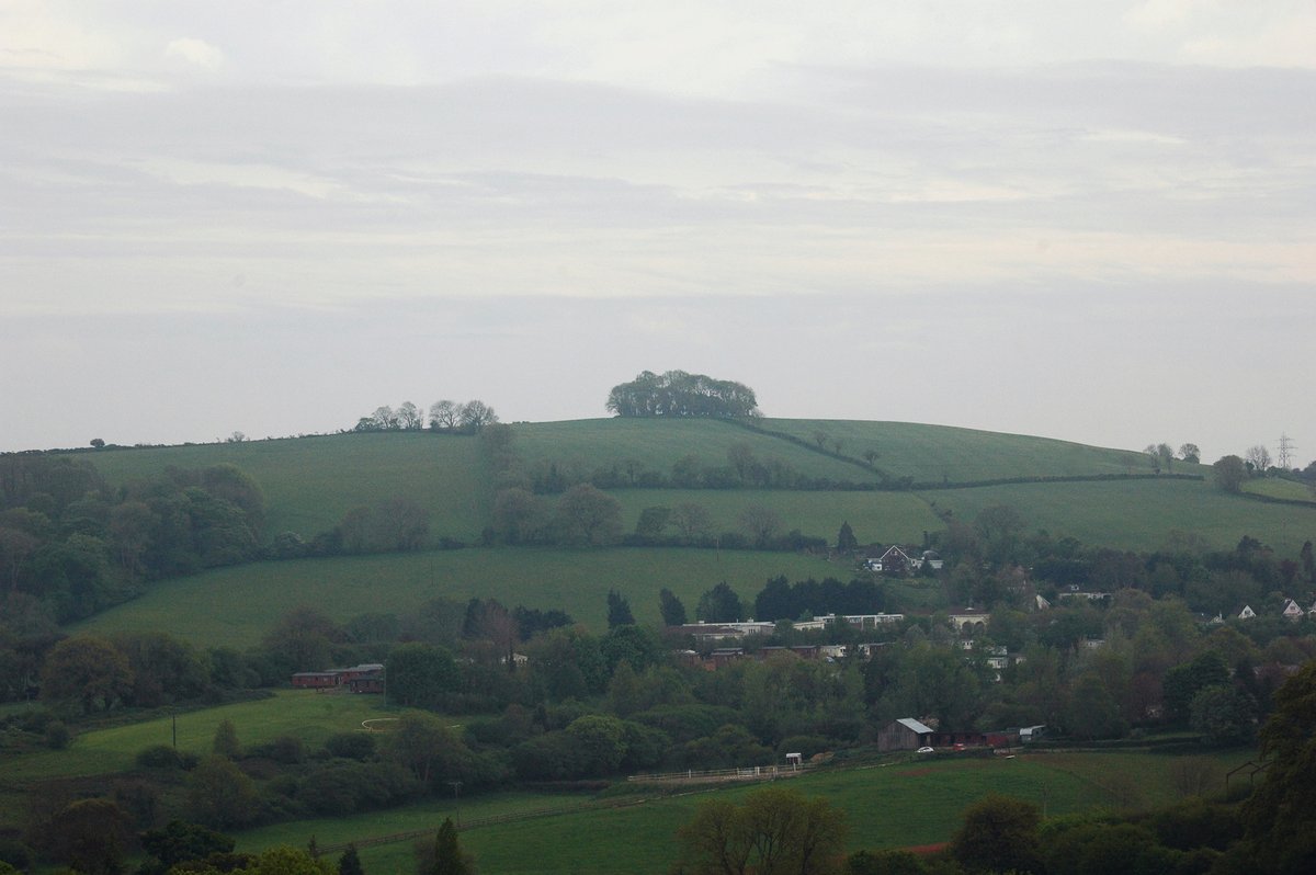
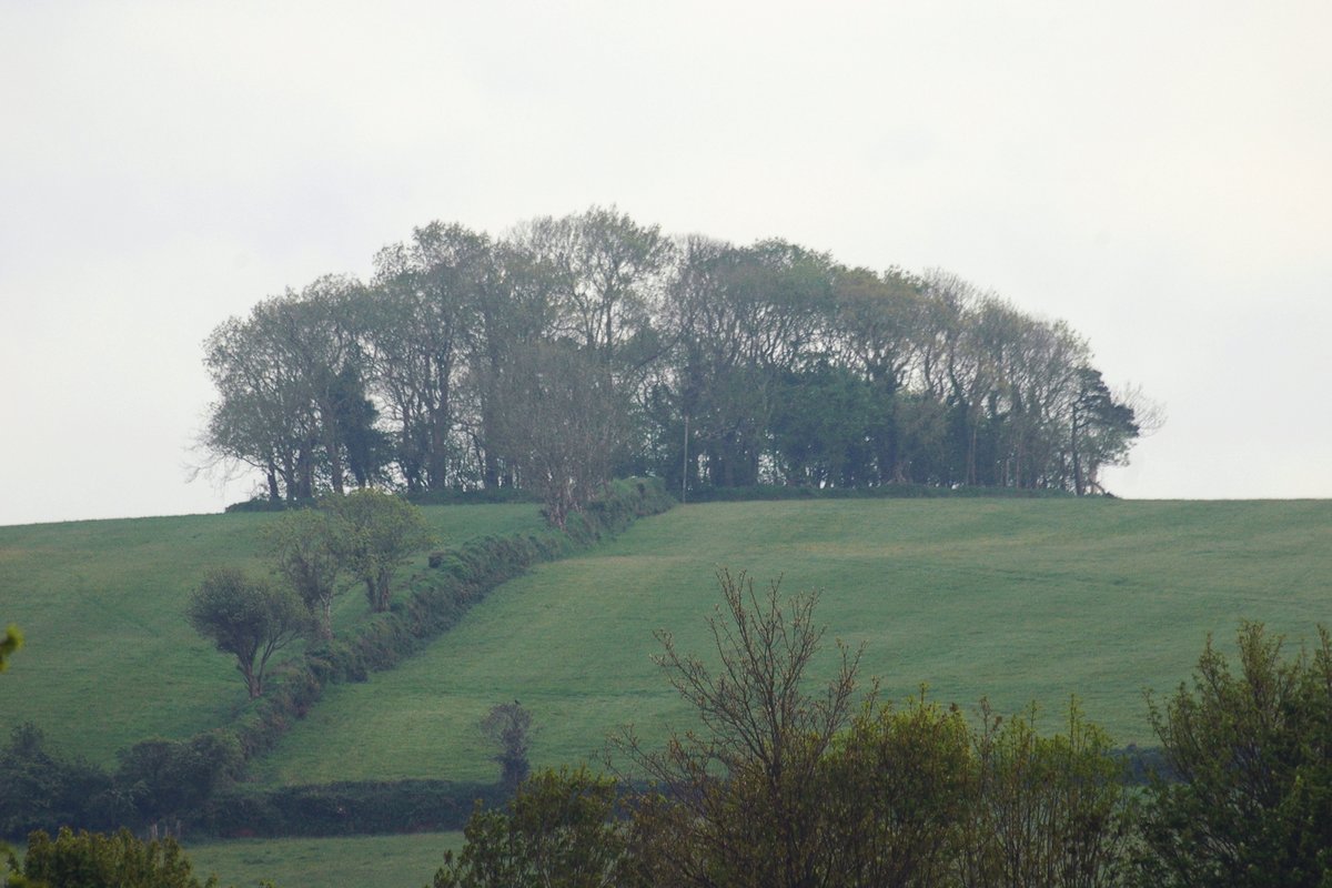
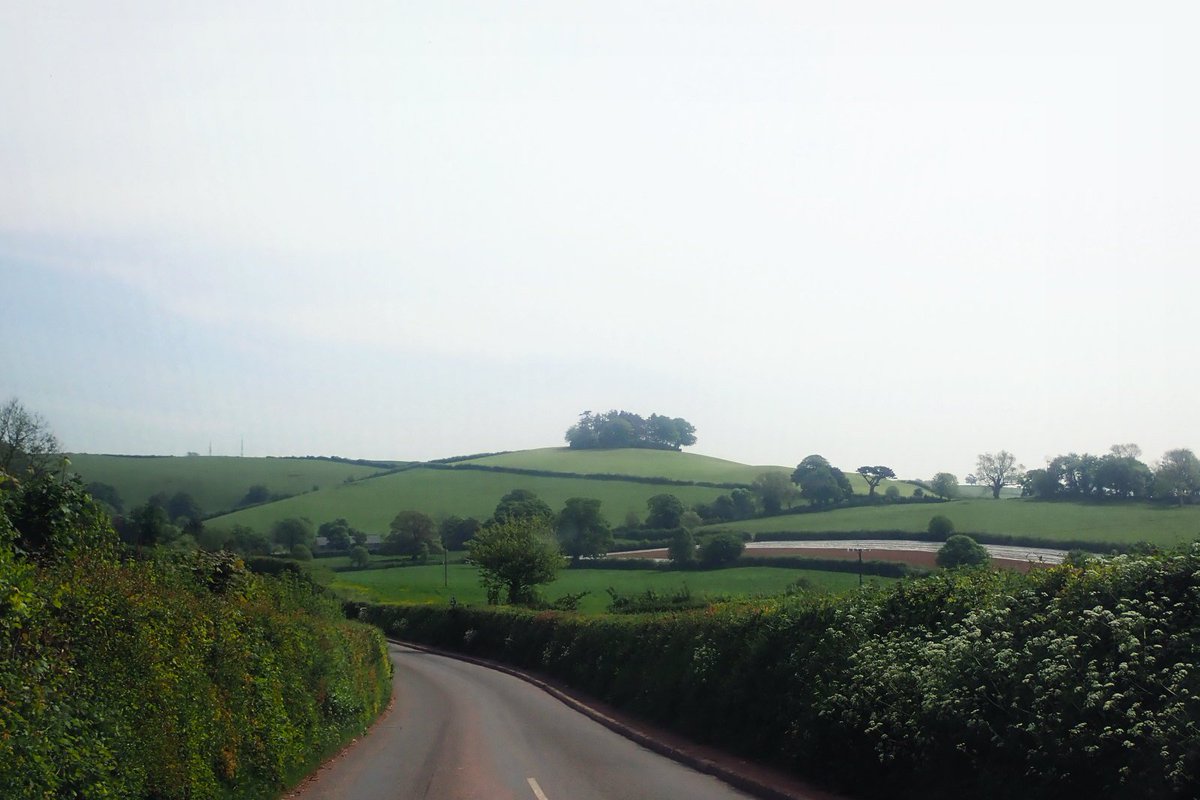
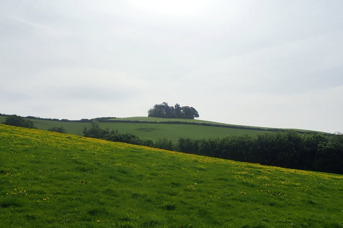
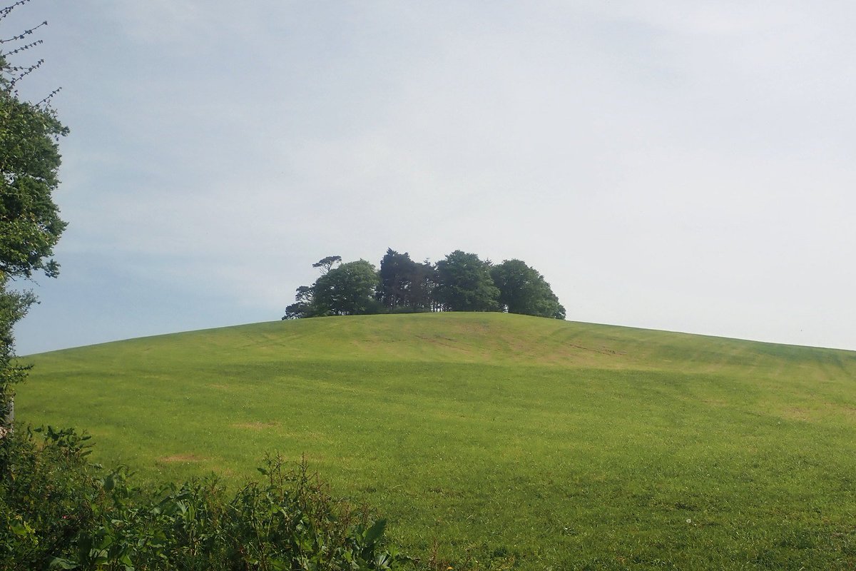
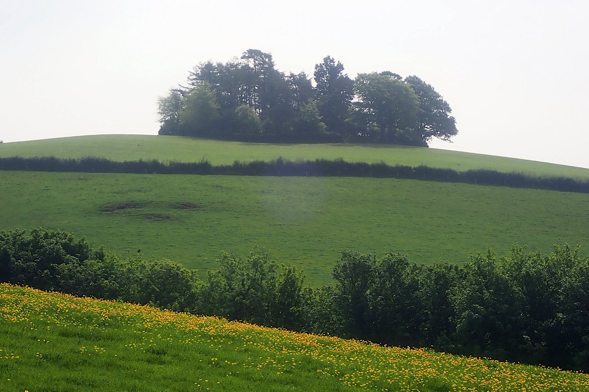
5. So, lets dig in & see what we can find out about the sites - starting with the site pictured in the article. To set us off on this journey, here are some photos of the site from last night - I& #39;m N, shooting S - so this is the & #39;Beechdown& #39; side of the hill (above the A385). 6/n
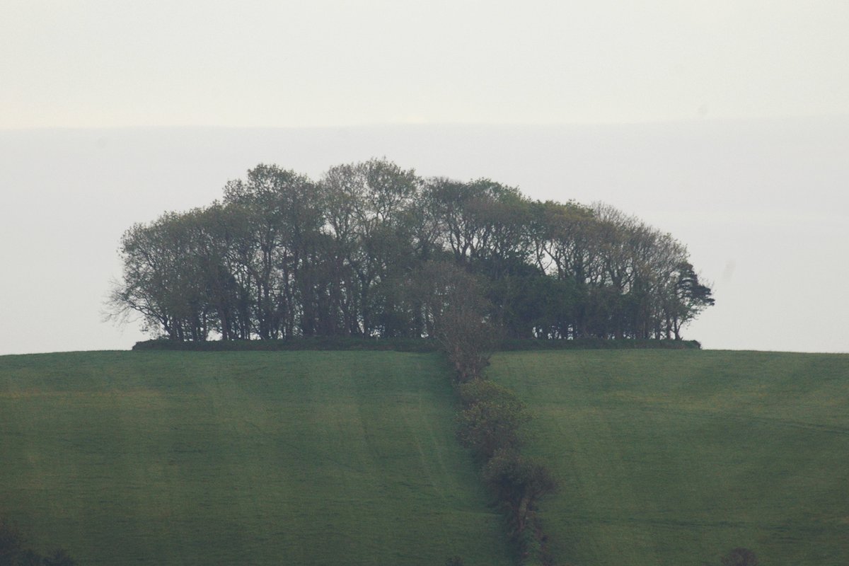
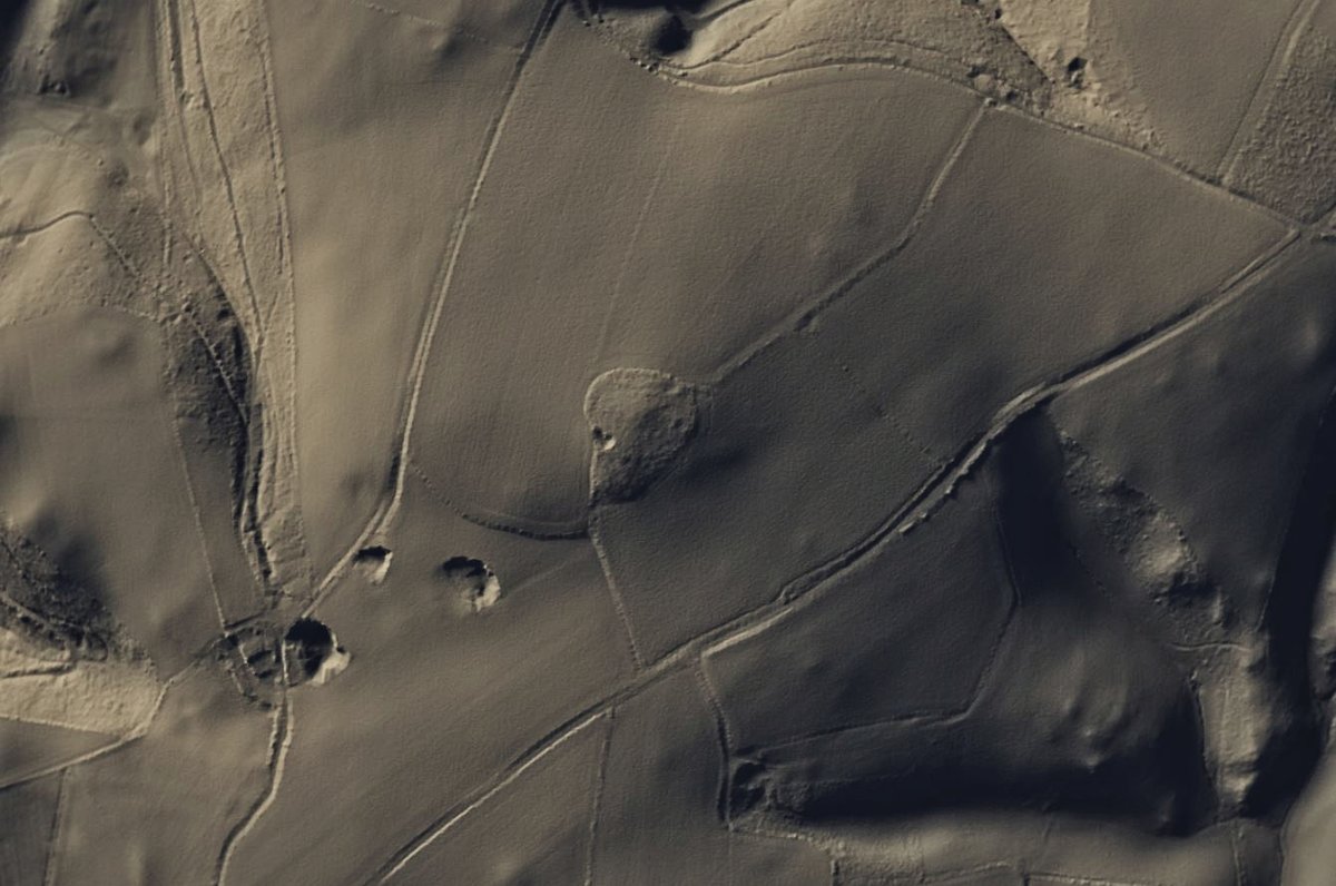
6. A closer look brings out the circular perimeter which was so clearly visible in the #Lidar data (and brings out that kinda lumpiness in the fields). 7/n
7. As linked above ^, the site is known, and listed in the HER - It& #39;s listed as & #39;Windmill Hill Clump& #39;, and that the & #39;name is suggestive of a windmill& #39;. There is a second listing inside the circular perimeter of a windmill. The HER suggests the OS map of 1809 as the source. 8/n
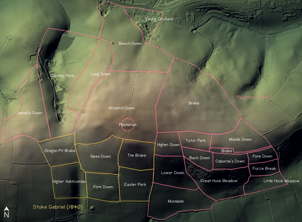
8. Perhaps unsurprisingly - it retains that name on the subsequent OS maps. Interestingly tho& #39; on the 1841 tithe map, the circular site is listed as & #39;Plantation& #39;, and the field in which it sits is listed as & #39;Windmill Down& #39;. 9/n
9. Slight tangent #1 - The tithe maps show several #fields that have been removed since those surveys, but the field that contains that circular site has been split - it& #39;s one field on the first edition OS 25 map, and two on the second edition OS 25 map, so sometime ~1900. 10/n
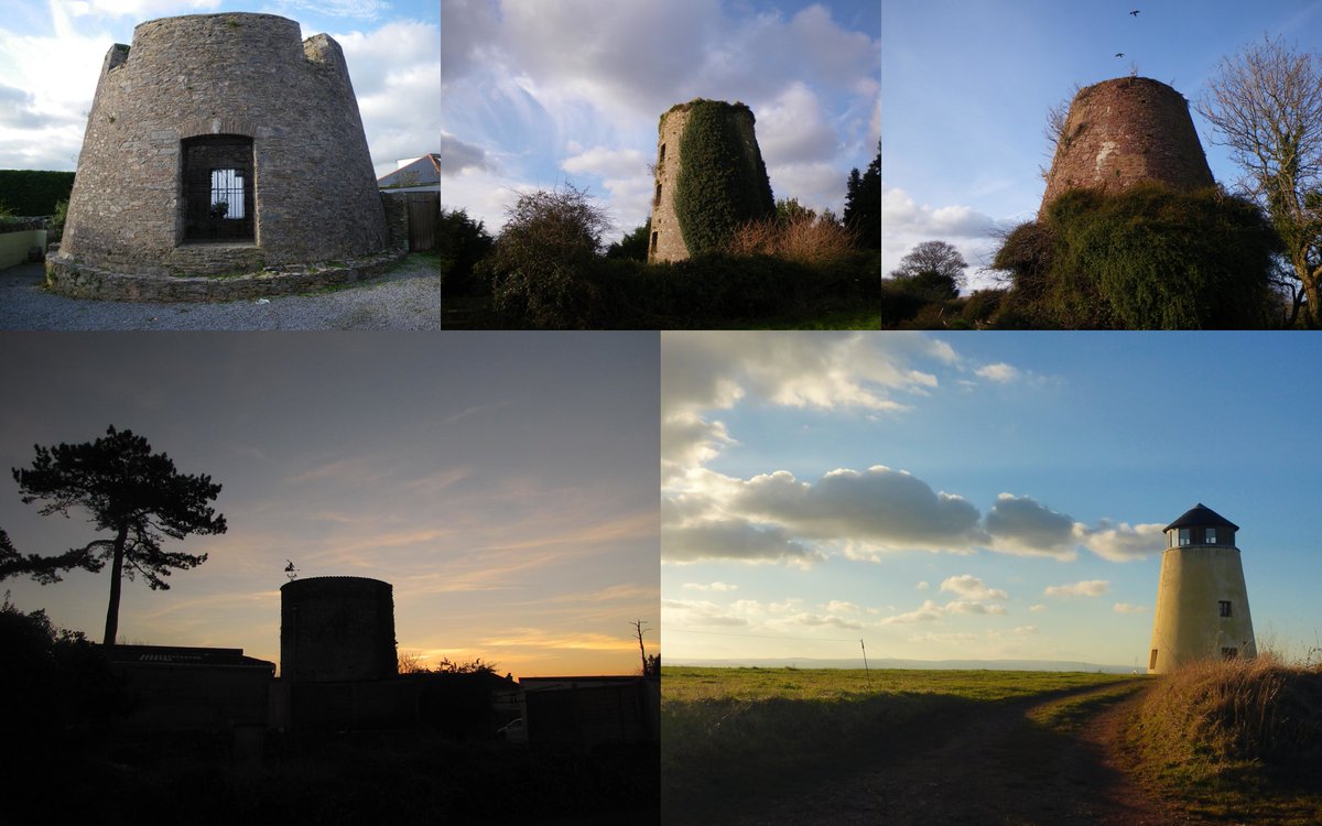
10. Slight tangent #2 - The HER lists 11 windmill sites locally, although acknowledges the potential for duplicates in that list - there are five extant windmills locally. 11/n
11. Which are: (going with the sun from the TL)
Little Rey - #Brixham
Warborough Windmill - #Galmpton
Fernacombe Windmill - #Paignton
Yaddon Down - #Torquay
Long Barrow - North Whilborough
One of the 11 sites, Flete Mill, was a watermill - now lost under #Torquay town centre
12/n
Little Rey - #Brixham
Warborough Windmill - #Galmpton
Fernacombe Windmill - #Paignton
Yaddon Down - #Torquay
Long Barrow - North Whilborough
One of the 11 sites, Flete Mill, was a watermill - now lost under #Torquay town centre
12/n
12. Ok, back on track - the HER listing notes a degree of looseness over the name - citing an 1803 map as listing the hill as possibly being called & #39;Willman& #39;, rather than Windmill, although in the later 1809 map, it& #39;s Windmill Hill - So what& #39;s up there? ... 13/n
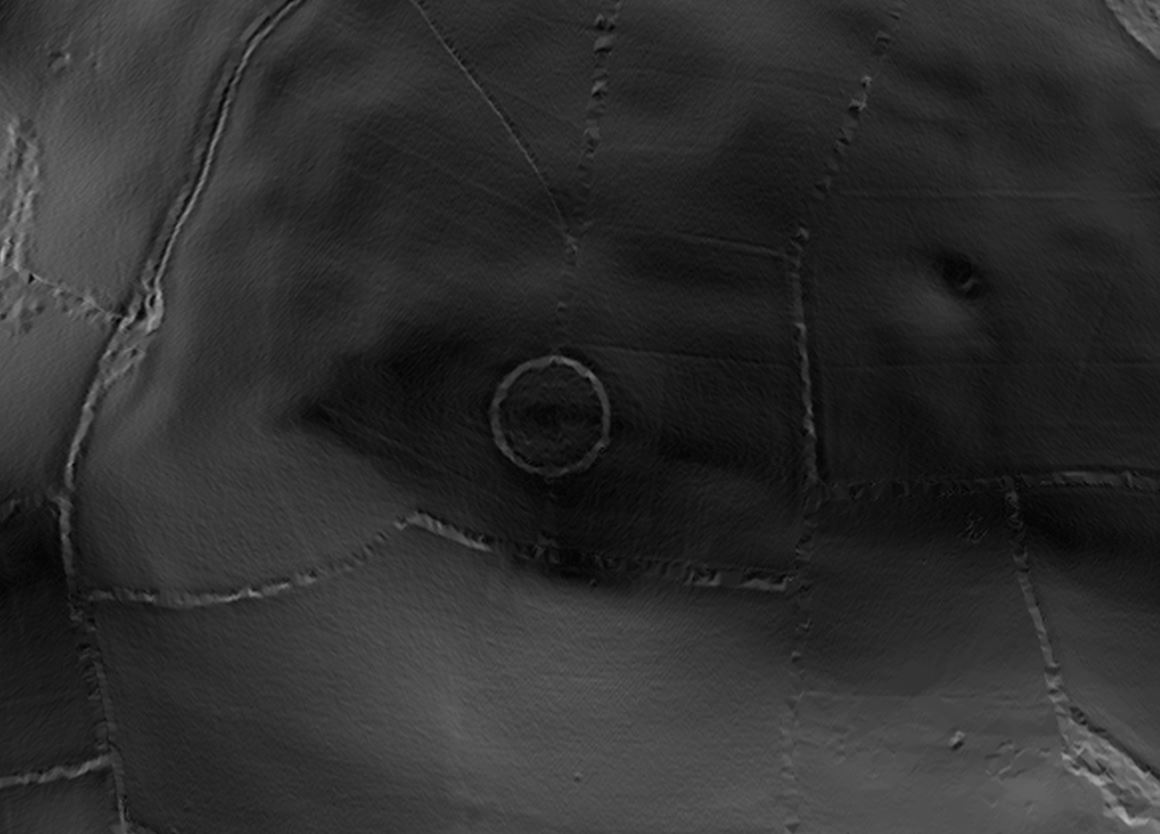
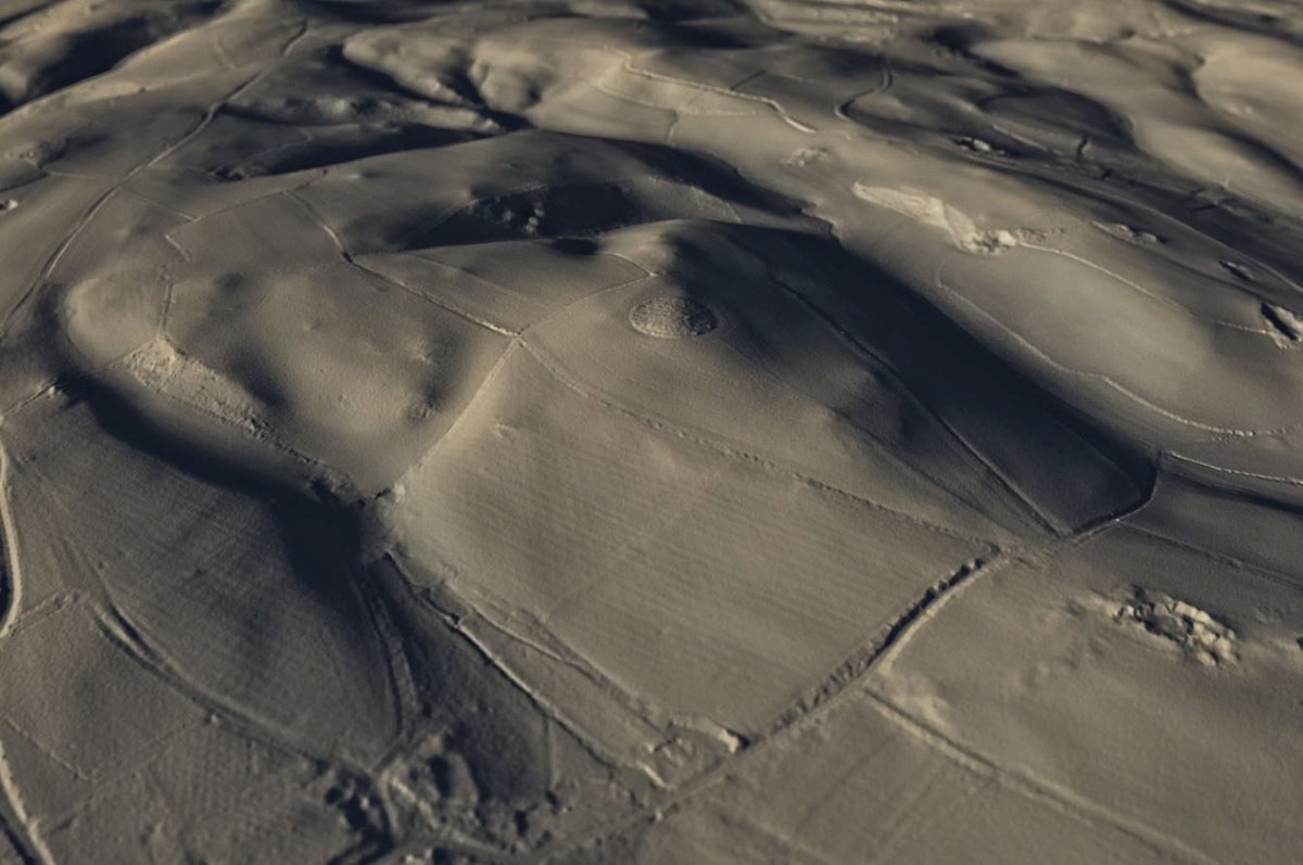
13. You& #39;d need to discuss access - it& #39;s on farmland, so working with just data for now. There& #39;s a *very* circular shape visible in the data with a circumference of just under ~200mtrs. The surrounding ground is pretty lumpy, but nothing that really suggests any #earthworks 14/n
14. Slight Tangent #3. Stating the obvious now, but #Groundtruthing it would be really useful at this point to see what& #39;s actually there, you& #39;d be able to get a feel for the age of the hedge in the divided field, & see what the modern groundworking is too (land drains?) 15/n
15. The reworked #LiDAR image is via the Relief Visualization Toolbox. There is a wider, concentric& #39;ish shape around the site, but it significantly follows a very regular pattern, so my instinct is that& #39;s entirely modern work, & not part of any early, larger #enclosure. 16/n
16. The precise circular shape is the significant part of this, & I wonder if we are actually looking at a post-medieval folly here? Folly in this context being that extant copse of trees (or their descendants). Folly is not without precedent for just such a clump of trees. 17/n
17. Granted some older sites are pretty precisely circular too of course - Ringlestown, Mountfortescue and Tara - (all in Co Meath) - are good examples, and not too removed in terms of the size either - but they are hardly local. 18/n
18. Slight Tangent #4. About 15km N as the crow files is another circle in the landscape needing a second look. (There& #39;s no deeper connection at all suggested here, other than the pretty trivial fact it& #39;s a very circular *something* in the data)  https://abs.twimg.com/emoji/v2/... draggable="false" alt="🙄" title="Face with rolling eyes" aria-label="Emoji: Face with rolling eyes"> 19/n https://twitter.com/Monk_Po/status/1177679746492239877?s=20">https://twitter.com/Monk_Po/s...
19. Background #reading for today, looking to get a sense of these sites in a wider context - be they the last strands of remnant #wildwood, localised ~17thC #landscape enhancement planting, or here, actually a windmill. (Sites plural, as the second one will be along soon https://abs.twimg.com/emoji/v2/... draggable="false" alt="😉" title="Winking face" aria-label="Emoji: Winking face">) 20/n
20. ... and here it is - The second site, which is mentioned in passing, but not pictured / identified is *almost certainly* Rypen Clump, a few 100mtrs SE of #BerryPomeroy, and about 2km NW of Windmill Hill Clump. 21/n
21. So, Rypen is of very similar size and appearance to the Windmill Hill site, both in the #landscape & in the #LiDAR. There& #39;s no HER entry, & yeah absence of evidence isn& #39;t evidence of absence, but here I think it probably is, and that & #39;clump& #39; tells you all you need. 22/n
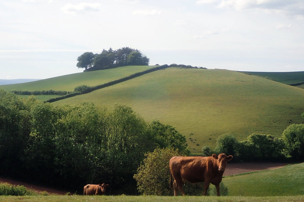
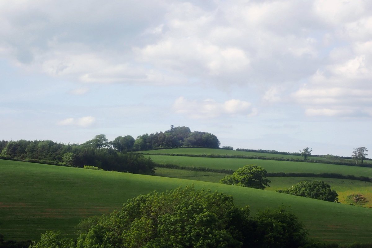
22. Slight Tangent #5. Some ~900mtrs NE of Rypen, and on the hill above, is another local landmark clump of trees - Blackpool Clump. It& #39;s about half as big again, & of an irregular shape, but has an intriguingly circular edge (NW) ~about the same size as Rypen. 23/n
23. Slight Tangent #6. Bare with me here - but if you draw / complete that circular boundary, you& #39;d end up with another [circular] clump of a similar size, right on the top of that little bit of hill - giving it the same relationship to the landscape as the others have.  https://abs.twimg.com/emoji/v2/... draggable="false" alt="🤔" title="Thinking face" aria-label="Emoji: Thinking face"> 24/n
24. I don& #39;t actually think this is the & #39;2nd& #39; site mentioned in the article tho& #39; - Given the similarity with Windmill Hill Clump, Rypen is the obvious choice. Locally (ish), there is one other site we& #39;ll quickly visit for completeness tho& #39;. Fire Beacon Hill, above #Dittisham. 25/n
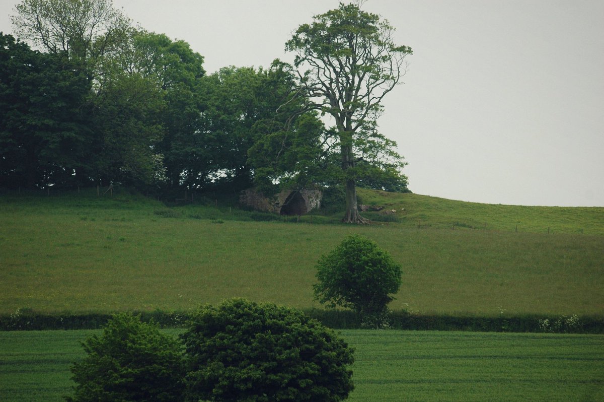
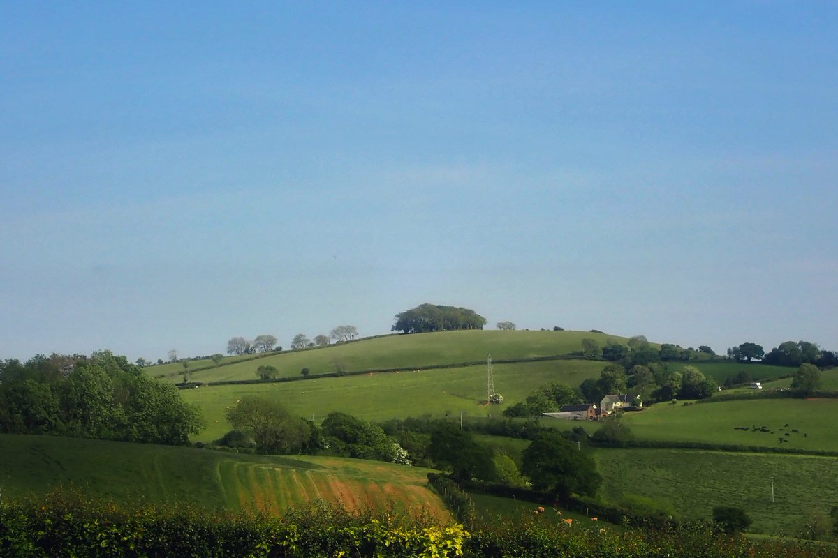
25. Slight Tangent #7. This site is ~8km downriver as the crow flies. The (16thC) beacon itself is the lower of the mounds on the lane, below the top of the hill. A hill which has a small, circular clump on it. It& #39;s the far clump in the photo (again, of Windmill Hill Clump). 26/n
26. Slight Tangent #8. Almost all of those pits and scrapes in the landscape renders are small, localised limestone extractive / surface pits - some of which had kilns on site - one extant example is the site just to the west of Rypen. 27/n
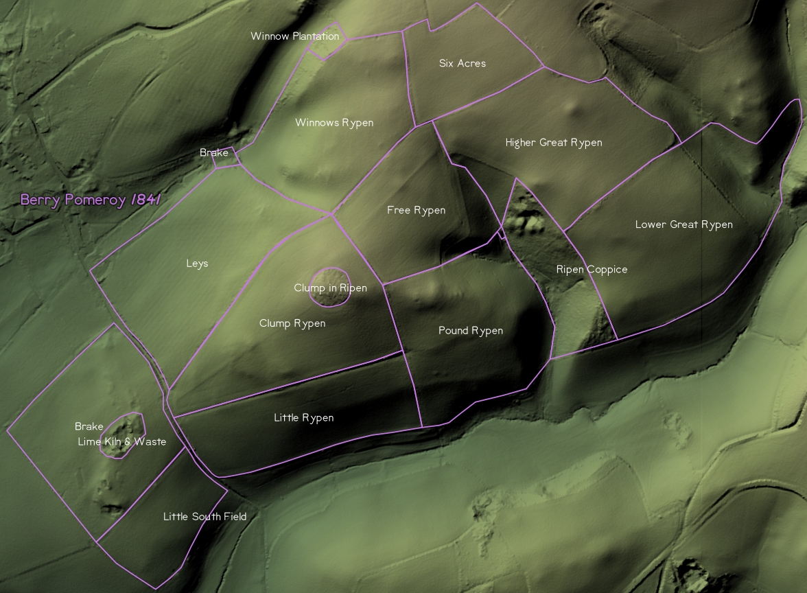
27. This is the 1841 tithe map - noting that the whole hill is named Rypen. The clump being descriptive of both the feature, & used as the field name. How to interpret the name is an open question tho& #39;, as both & #39;Ripen& #39; and & #39;pen& #39; would make sense in an agricultural context. 28/n
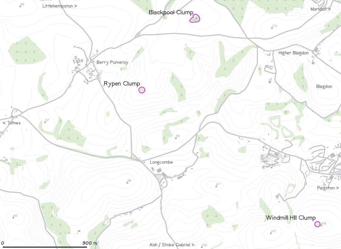
28. Probably a good time to put these sites on a map to show how close they are to each other. Some element of common landownership perhaps (or maybe rivalry?). 29/n
29. Adding to that #map - these photos were all taken in the same location - near the bottom end of Glazegate lane.
Rypen > N > Blackpool >E > Windmill Hill. 30/n
Rypen > N > Blackpool >E > Windmill Hill. 30/n
30. There is strong familial connections between Berry Pomeroy, and an estate called Sandridge, just to the south of Stoke Gabriel. I& #39;ve been unable to find any land-transaction records / holdings pre-tithe tho& #39;- by which time, these clumps are already established. 31/n
31. The tithe apportionment for Blackpool shows it containing / straddling a field boundary, that, & it& #39;s loose shape, apparent absence of discrete boundary work & slightly lopsided position on the hill, suggest it& #39;s an & #39;everyday& #39; farm copse & not & #39;planned& #39; like the others. 32/n
32. So, where does this leave us:
• Two hilltop clumps, very similar in size, shape, position in the landscape & from the maturity of the trees, age.
• A familial connection in the broader landscape (although lacking any deeper detail).
• Uncorroborated site names. 33/n
• Two hilltop clumps, very similar in size, shape, position in the landscape & from the maturity of the trees, age.
• A familial connection in the broader landscape (although lacking any deeper detail).
• Uncorroborated site names. 33/n
33. On what we have so far, a definite conclusion is still an open question, but let& #39;s take a view on a couple of points:
• There& #39;s nothing to suggest a #hillfort.
• Other than the name & associated mentions of the name, I& #39;ve found nothing to place a windmill on the site. 34/n
• There& #39;s nothing to suggest a #hillfort.
• Other than the name & associated mentions of the name, I& #39;ve found nothing to place a windmill on the site. 34/n
34. • There& #39;s no history of, nor extant big, formal & #39;parks& #39; locally.
• There are some small country & #39;estates& #39; tho& #39; - w/what could be seen as a kinda & #39;little park& #39; by the house - gentrified farmland not anything formal - specimen trees, a small orchard, that kinda thing. 35/n
• There are some small country & #39;estates& #39; tho& #39; - w/what could be seen as a kinda & #39;little park& #39; by the house - gentrified farmland not anything formal - specimen trees, a small orchard, that kinda thing. 35/n
35. The clumps are clearly deliberate, and intended to be seen, possibly from the same location too, which would including travel along much of True Street ( #Totnes > Paignton rd), & the 18thC turnpike sits nicely with the landscape architecture work of Brown/Repton et al. 36/n
36. Whilst these clumps are on an entirely different scale to the big formal parks (obviously https://abs.twimg.com/emoji/v2/... draggable="false" alt="🙄" title="Face with rolling eyes" aria-label="Emoji: Face with rolling eyes">), it& #39;s tempting to imagine that a range of ideas / ideals from those parks would be picked up and find their way out into the countryside at large (including hilltop clumps). 37/n

 Read on Twitter
 " title="Good to see #LiDAR getting more use / coverage ... "Lost Bronze Age hill forts discovered in Devon" https://www.devonlive.com/news/devo... That& #39;s Windmill Clump https://www.heritagegateway.org.uk/Gateway/R... - the question for me tho& #39; - is what& #39;s been happening in the adjacent fields to mark them quite so evenly?https://abs.twimg.com/emoji/v2/... draggable="false" alt="🤔" title="Thinking face" aria-label="Emoji: Thinking face">">
 " title="Good to see #LiDAR getting more use / coverage ... "Lost Bronze Age hill forts discovered in Devon" https://www.devonlive.com/news/devo... That& #39;s Windmill Clump https://www.heritagegateway.org.uk/Gateway/R... - the question for me tho& #39; - is what& #39;s been happening in the adjacent fields to mark them quite so evenly?https://abs.twimg.com/emoji/v2/... draggable="false" alt="🤔" title="Thinking face" aria-label="Emoji: Thinking face">">
![2. The article also mentions the Noss Iron Age Hill Fort near Dartmouth. This is the [~prehistoric & unexcavated] Greenway Camp #Hillfort & associated #earthwork. (I posted it way back in my history, but here is it again for reference - its not shown in the article). 3/n 2. The article also mentions the Noss Iron Age Hill Fort near Dartmouth. This is the [~prehistoric & unexcavated] Greenway Camp #Hillfort & associated #earthwork. (I posted it way back in my history, but here is it again for reference - its not shown in the article). 3/n](https://pbs.twimg.com/media/EXNSkipXQAER7Tw.jpg)
![2. The article also mentions the Noss Iron Age Hill Fort near Dartmouth. This is the [~prehistoric & unexcavated] Greenway Camp #Hillfort & associated #earthwork. (I posted it way back in my history, but here is it again for reference - its not shown in the article). 3/n 2. The article also mentions the Noss Iron Age Hill Fort near Dartmouth. This is the [~prehistoric & unexcavated] Greenway Camp #Hillfort & associated #earthwork. (I posted it way back in my history, but here is it again for reference - its not shown in the article). 3/n](https://pbs.twimg.com/media/EXNSl67X0AAfQ2i.jpg)
 ) 20/n" title="19. Background #reading for today, looking to get a sense of these sites in a wider context - be they the last strands of remnant #wildwood, localised ~17thC #landscape enhancement planting, or here, actually a windmill. (Sites plural, as the second one will be along soonhttps://abs.twimg.com/emoji/v2/... draggable="false" alt="😉" title="Winking face" aria-label="Emoji: Winking face">) 20/n" class="img-responsive" style="max-width:100%;"/>
![Thinking face 23. Slight Tangent #6. Bare with me here - but if you draw / complete that circular boundary, you& #39;d end up with another [circular] clump of a similar size, right on the top of that little bit of hill - giving it the same relationship to the landscape as the others have. https://abs.twimg.com/emoji/v2/... draggable=](https://pbs.twimg.com/media/EX7HyZTX0AIwV-t.jpg) 24/n" title="23. Slight Tangent #6. Bare with me here - but if you draw / complete that circular boundary, you& #39;d end up with another [circular] clump of a similar size, right on the top of that little bit of hill - giving it the same relationship to the landscape as the others have. https://abs.twimg.com/emoji/v2/... draggable="false" alt="🤔" title="Thinking face" aria-label="Emoji: Thinking face"> 24/n">
24/n" title="23. Slight Tangent #6. Bare with me here - but if you draw / complete that circular boundary, you& #39;d end up with another [circular] clump of a similar size, right on the top of that little bit of hill - giving it the same relationship to the landscape as the others have. https://abs.twimg.com/emoji/v2/... draggable="false" alt="🤔" title="Thinking face" aria-label="Emoji: Thinking face"> 24/n">
![Thinking face 23. Slight Tangent #6. Bare with me here - but if you draw / complete that circular boundary, you& #39;d end up with another [circular] clump of a similar size, right on the top of that little bit of hill - giving it the same relationship to the landscape as the others have. https://abs.twimg.com/emoji/v2/... draggable=](https://pbs.twimg.com/media/EX7Hz_oXYAEVSpL.jpg) 24/n" title="23. Slight Tangent #6. Bare with me here - but if you draw / complete that circular boundary, you& #39;d end up with another [circular] clump of a similar size, right on the top of that little bit of hill - giving it the same relationship to the landscape as the others have. https://abs.twimg.com/emoji/v2/... draggable="false" alt="🤔" title="Thinking face" aria-label="Emoji: Thinking face"> 24/n">
24/n" title="23. Slight Tangent #6. Bare with me here - but if you draw / complete that circular boundary, you& #39;d end up with another [circular] clump of a similar size, right on the top of that little bit of hill - giving it the same relationship to the landscape as the others have. https://abs.twimg.com/emoji/v2/... draggable="false" alt="🤔" title="Thinking face" aria-label="Emoji: Thinking face"> 24/n">
![Thinking face 23. Slight Tangent #6. Bare with me here - but if you draw / complete that circular boundary, you& #39;d end up with another [circular] clump of a similar size, right on the top of that little bit of hill - giving it the same relationship to the landscape as the others have. https://abs.twimg.com/emoji/v2/... draggable=](https://pbs.twimg.com/media/EX7H1fLXYAIkydn.jpg) 24/n" title="23. Slight Tangent #6. Bare with me here - but if you draw / complete that circular boundary, you& #39;d end up with another [circular] clump of a similar size, right on the top of that little bit of hill - giving it the same relationship to the landscape as the others have. https://abs.twimg.com/emoji/v2/... draggable="false" alt="🤔" title="Thinking face" aria-label="Emoji: Thinking face"> 24/n">
24/n" title="23. Slight Tangent #6. Bare with me here - but if you draw / complete that circular boundary, you& #39;d end up with another [circular] clump of a similar size, right on the top of that little bit of hill - giving it the same relationship to the landscape as the others have. https://abs.twimg.com/emoji/v2/... draggable="false" alt="🤔" title="Thinking face" aria-label="Emoji: Thinking face"> 24/n">
