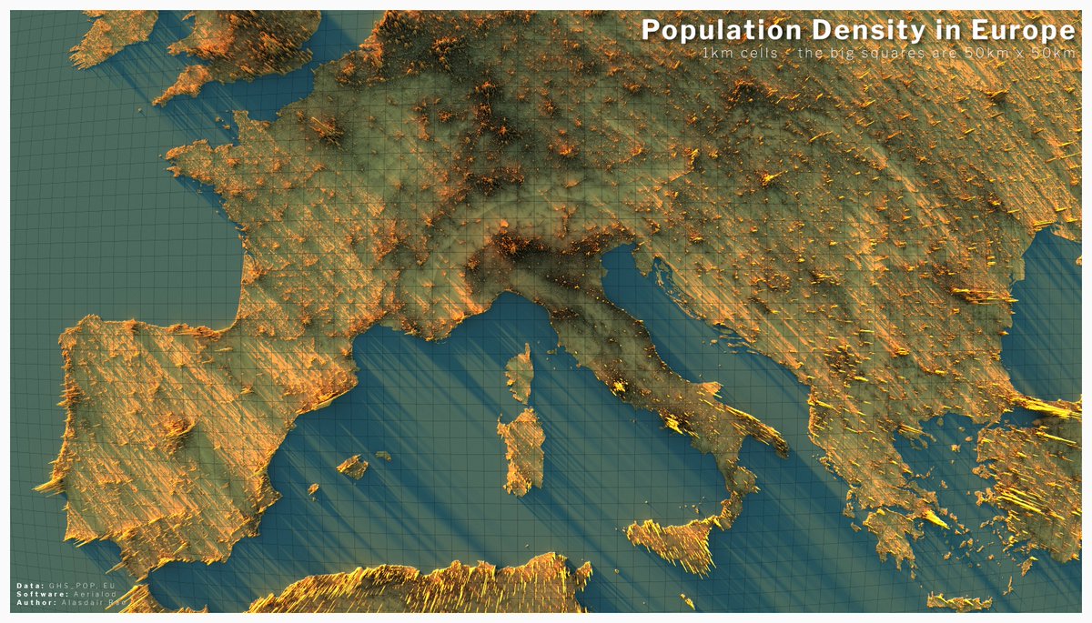
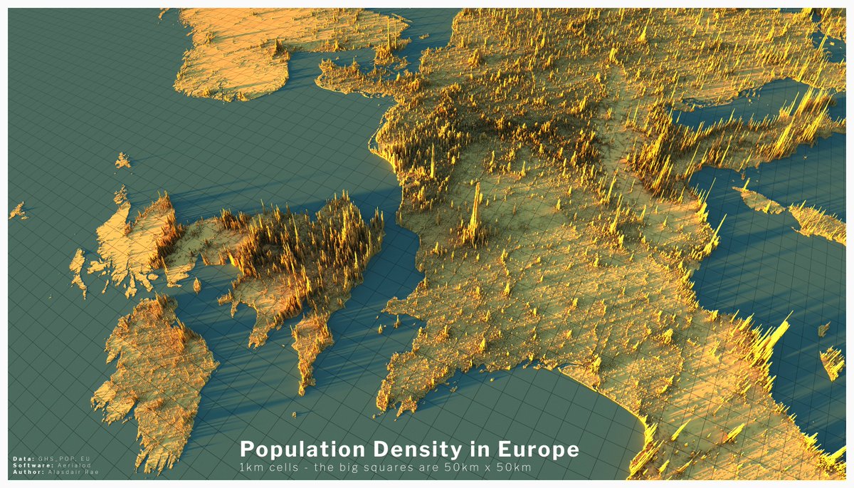
I decided to create a few more European population density renders - you can find more here if you need a break from the doomscrolling:
http://www.statsmapsnpix.com/2020/04/population-density-in-europe.html">https://www.statsmapsnpix.com/2020/04/p...
http://www.statsmapsnpix.com/2020/04/population-density-in-europe.html">https://www.statsmapsnpix.com/2020/04/p...
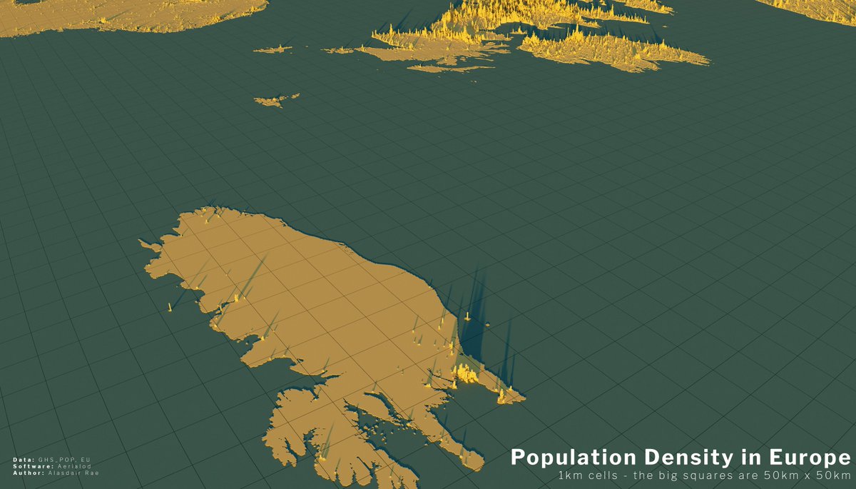
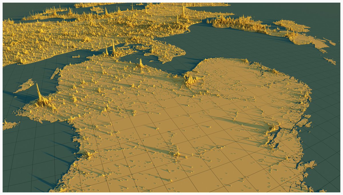
the view from the east over the Baltic Sea, with St. Petersburg in the borttom left and and a good chunk of Finland in the middle of the image. The UK and Ireland are in the distance here. I find this particular view very interesting.
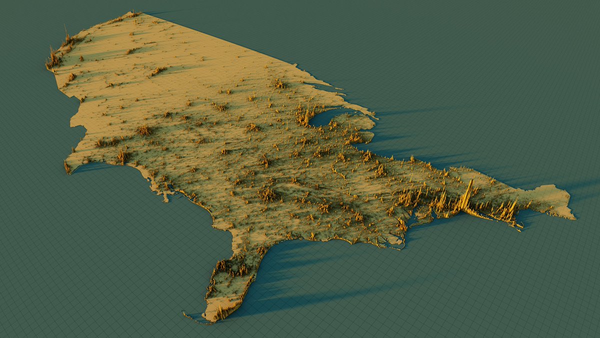
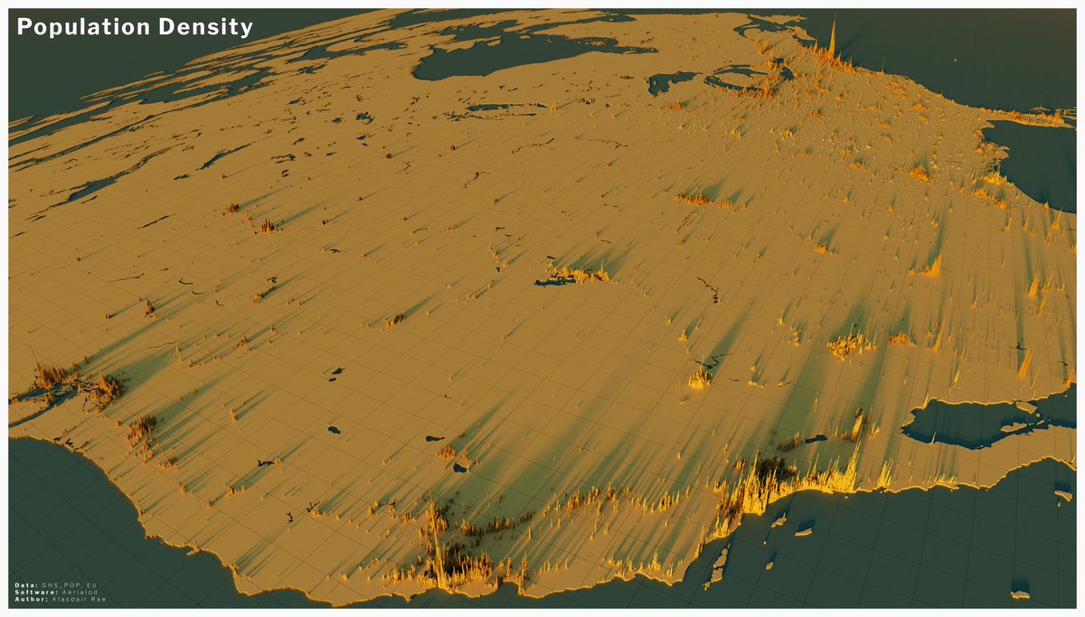
I haven& #39;t really got very far with other parts of the world but here& #39;s a fairly basic version for the lower 48 in the US, in roughly the same style as the European ones
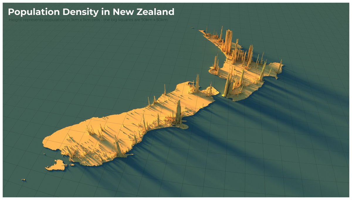
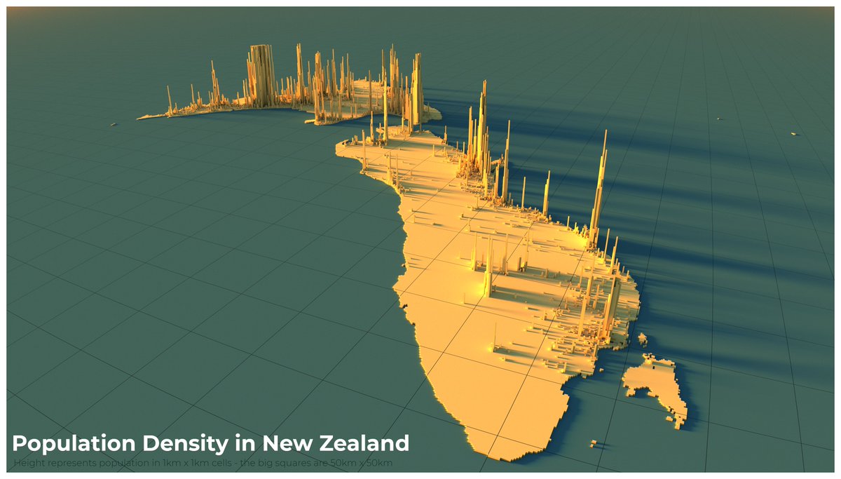
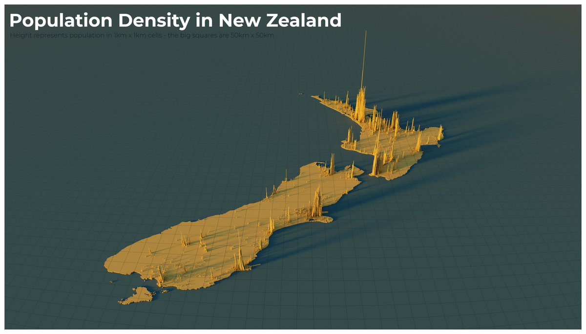
I ran off a few of these for New Zealand overnight, because & #39;maps without New Zealand& #39; is not part of my modus operandi
(a bit rough round the edges perhaps, but they look about right to me)
cc @iain_white
(a bit rough round the edges perhaps, but they look about right to me)
cc @iain_white
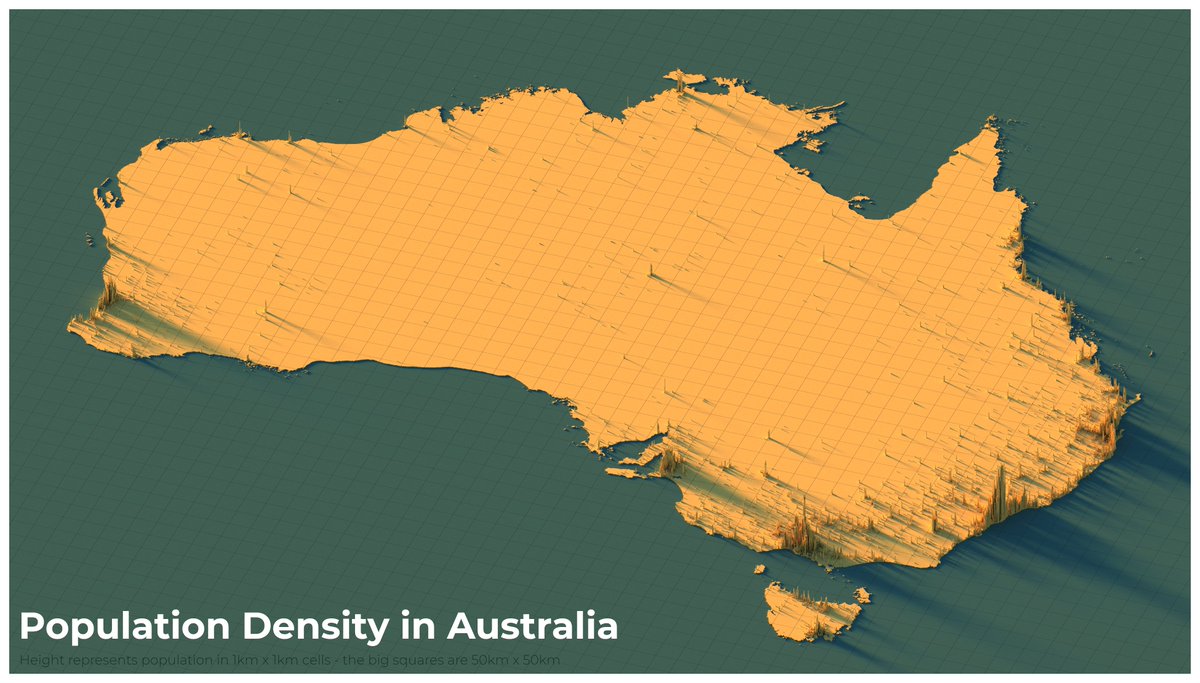
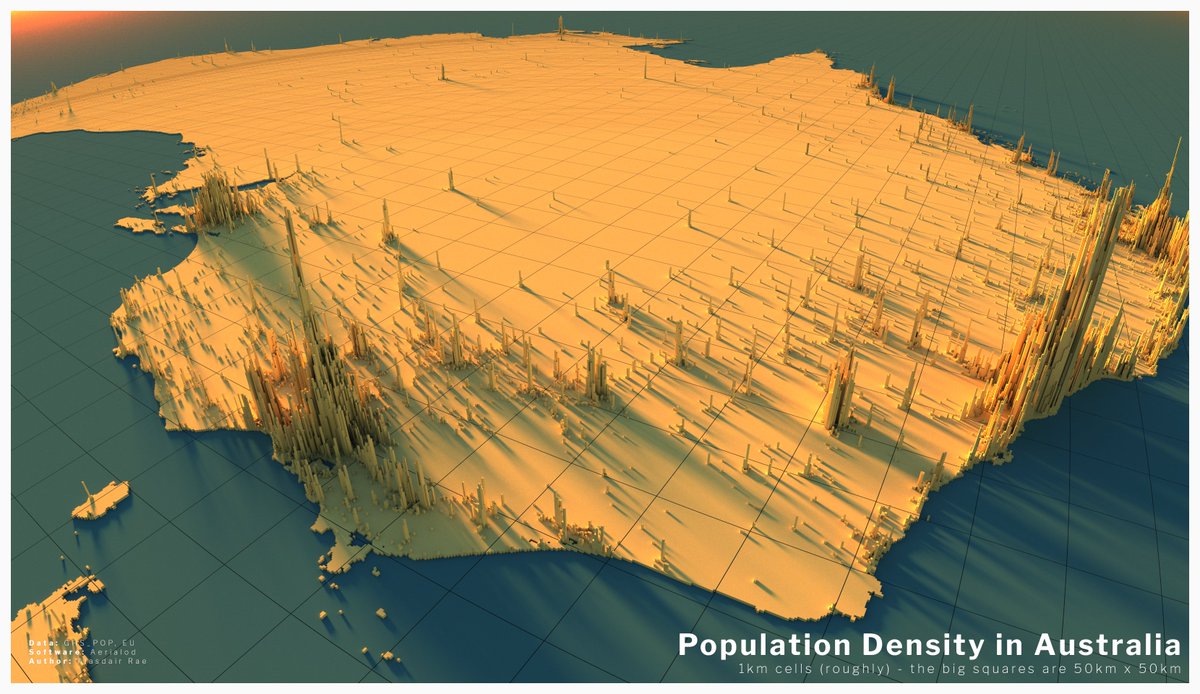
Australia joins the gang too now, even though it& #39;s so big it almost broke my computer.
Nice though that the 1km population data picks out some quite small, isolated settlements.
Nice though that the 1km population data picks out some quite small, isolated settlements.
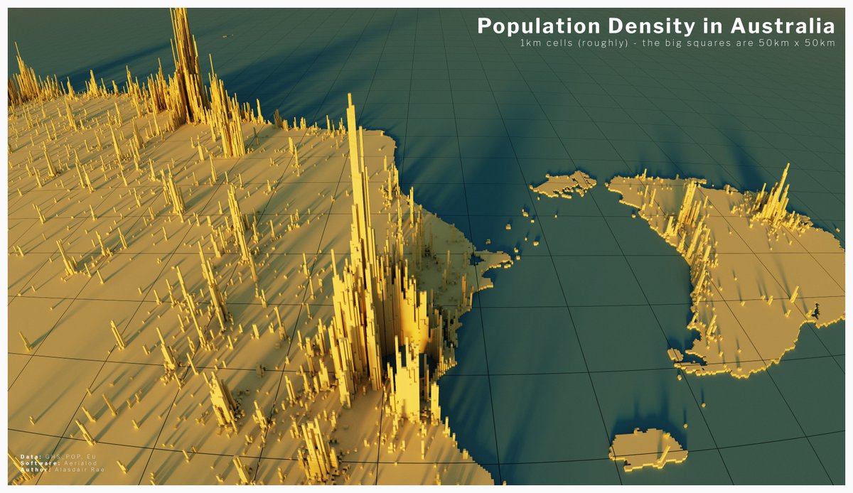
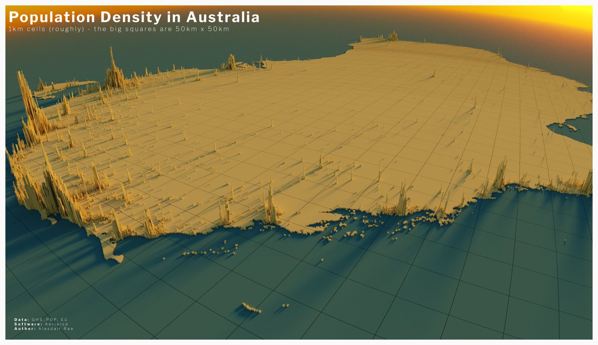
I think I& #39;m just going to keep exploring the world in this way, so here& #39;s a few more population density renders from Australia
(next up, North America)
(next up, North America)
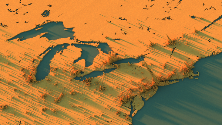
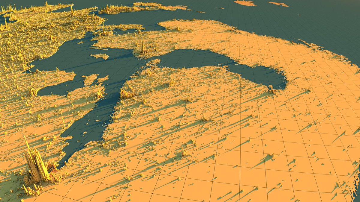
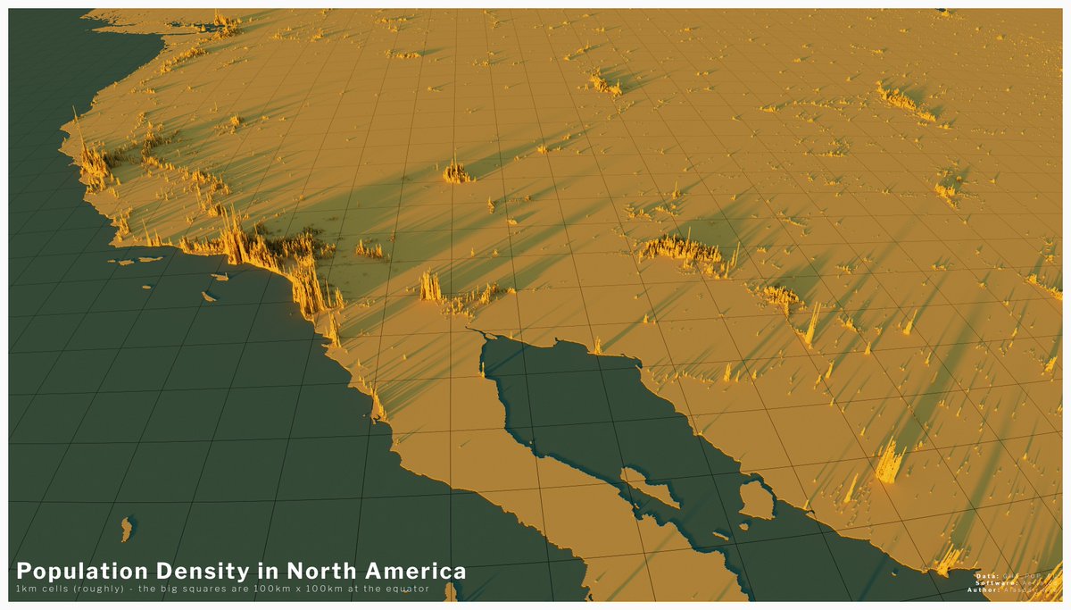
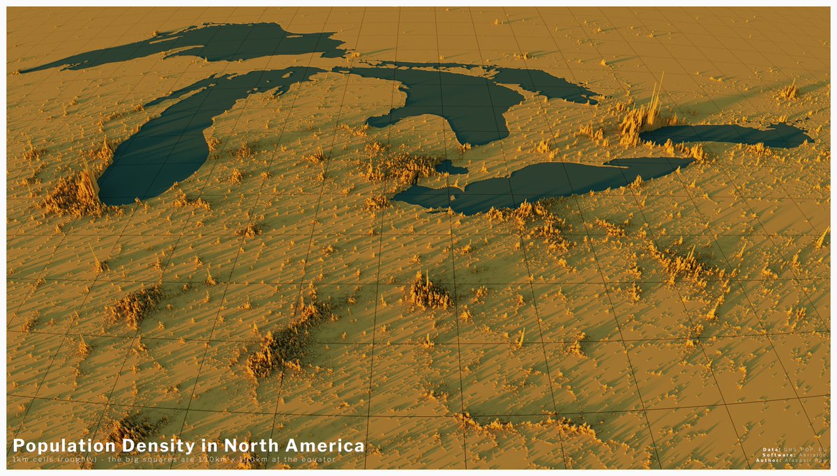
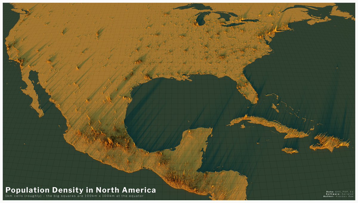
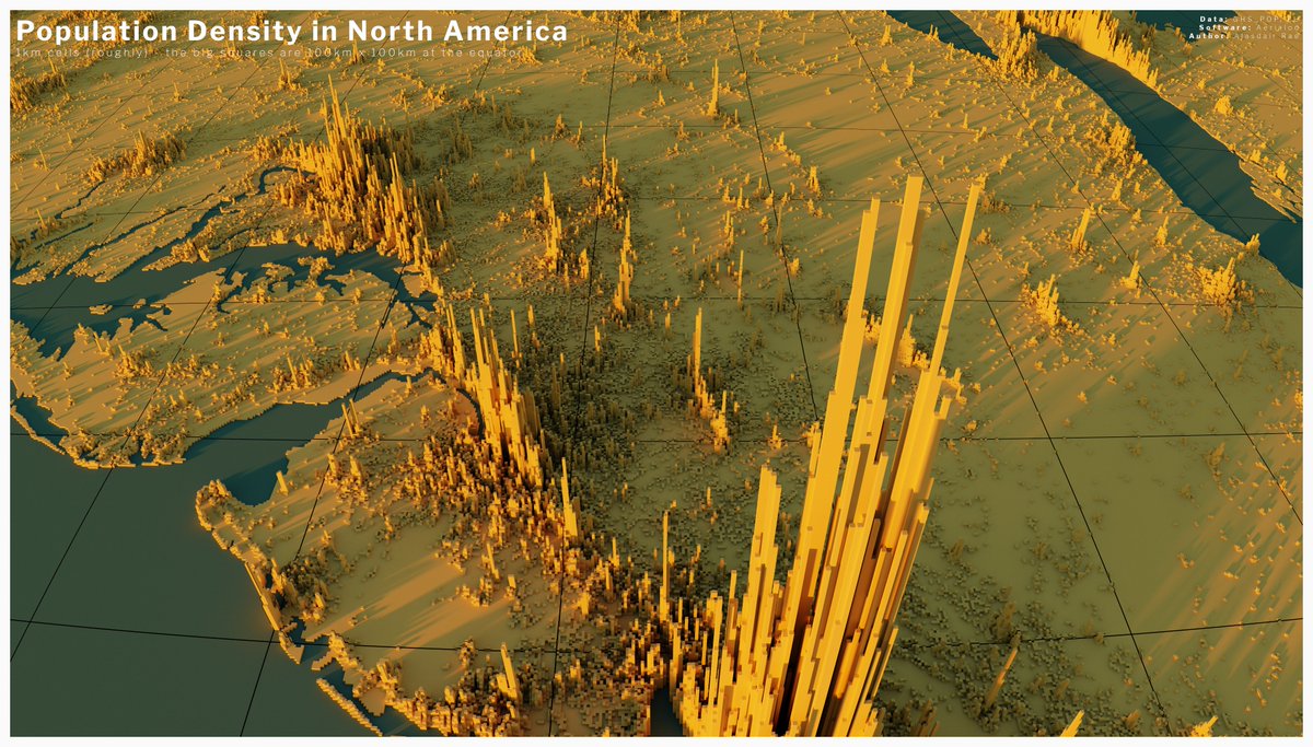
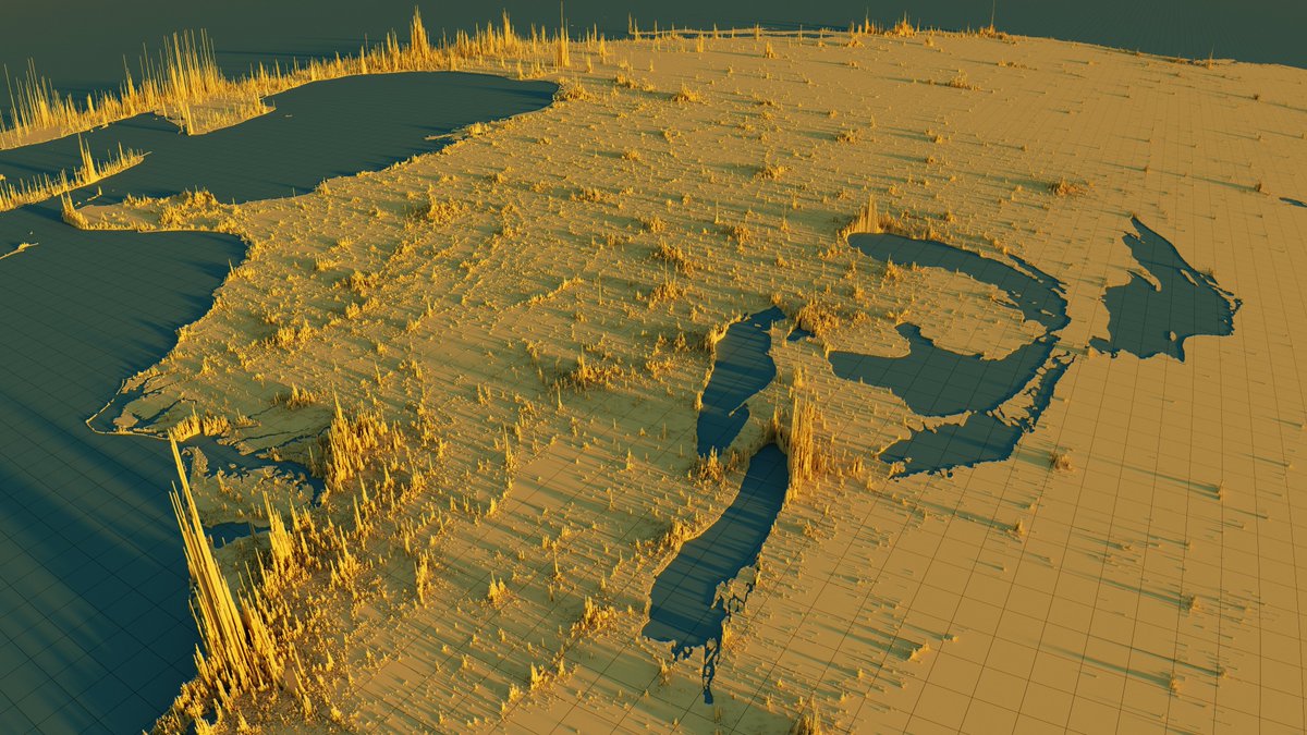
some renders of North American population density now - I think my favourite view here is around the Midwest and Great Lakes
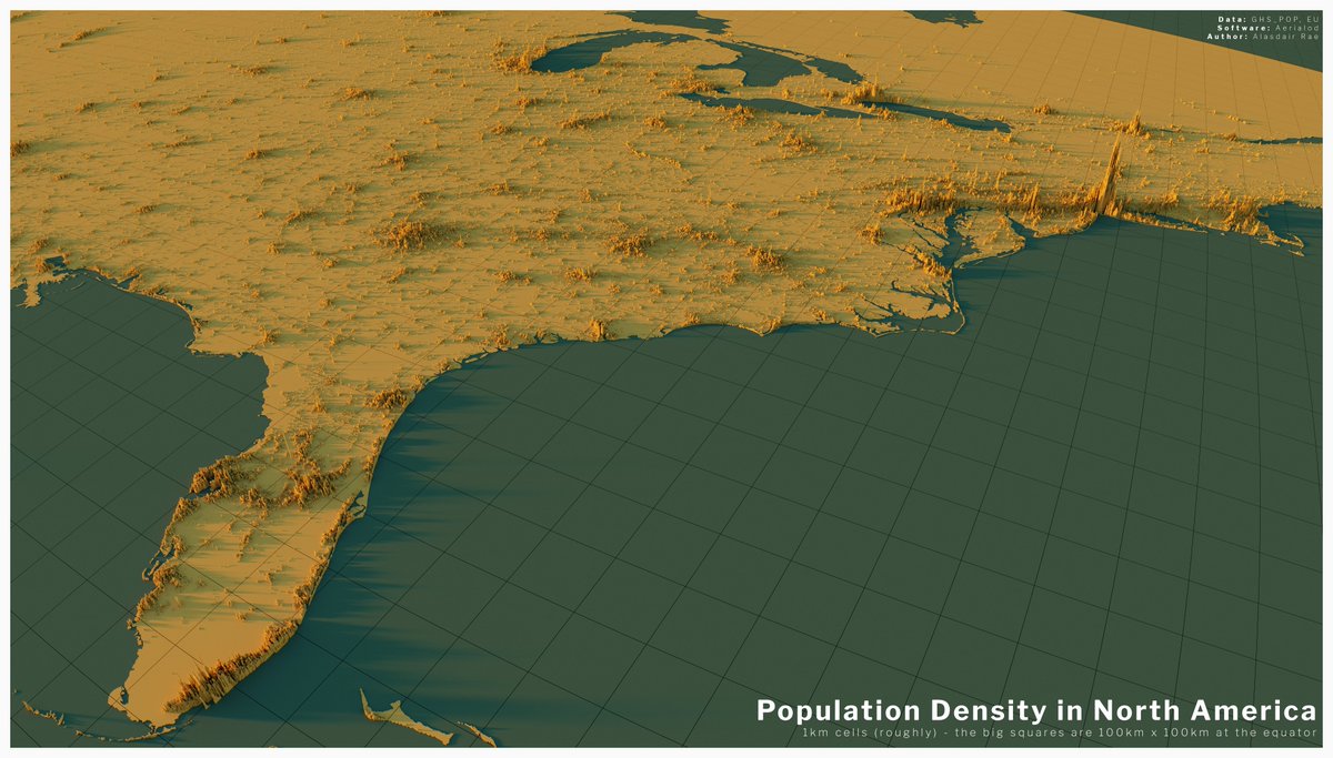
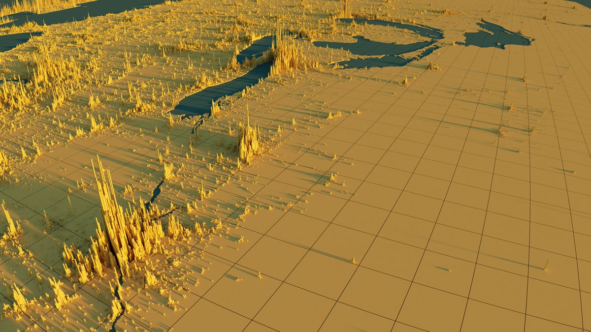
New York City is somewhat exceptional so here& #39;s a slightly ridiculous close up looking down the eastern seaboard
(I& #39;ll stop this now but may continue - we& #39;ll see)
(I& #39;ll stop this now but may continue - we& #39;ll see)
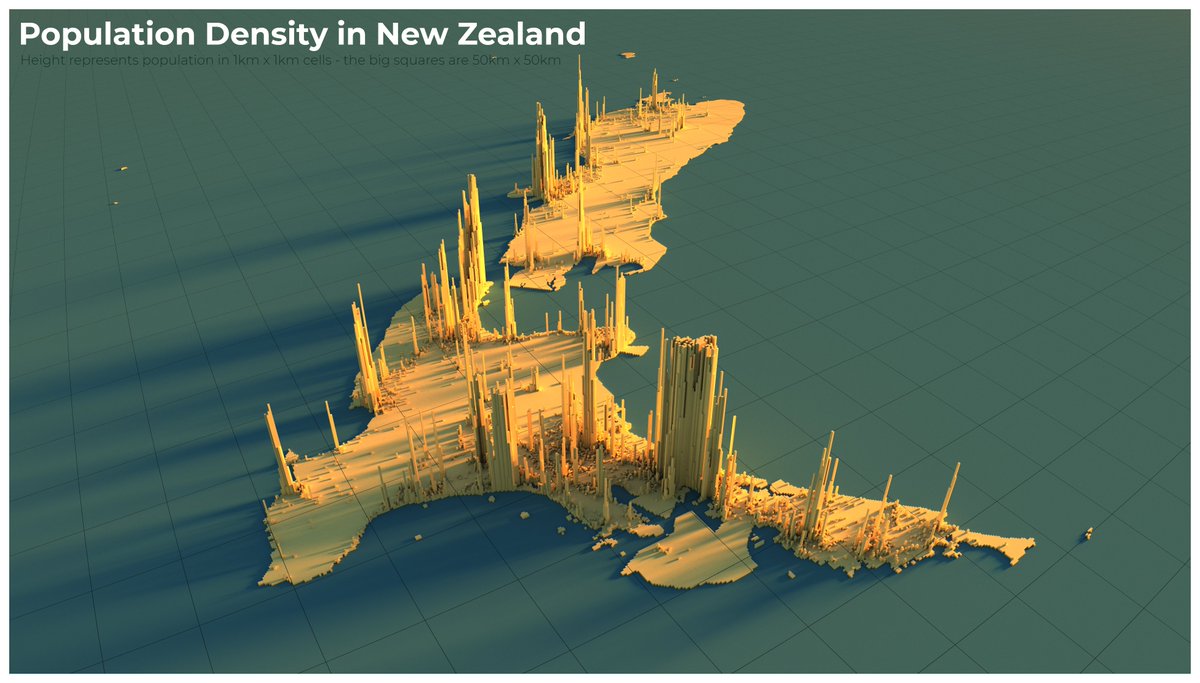
a re-render of New Zealand to show the full spikiness and range of Auckland& #39;s density because it kind of got chopped off in the original views
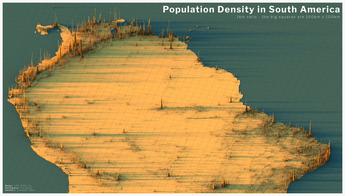
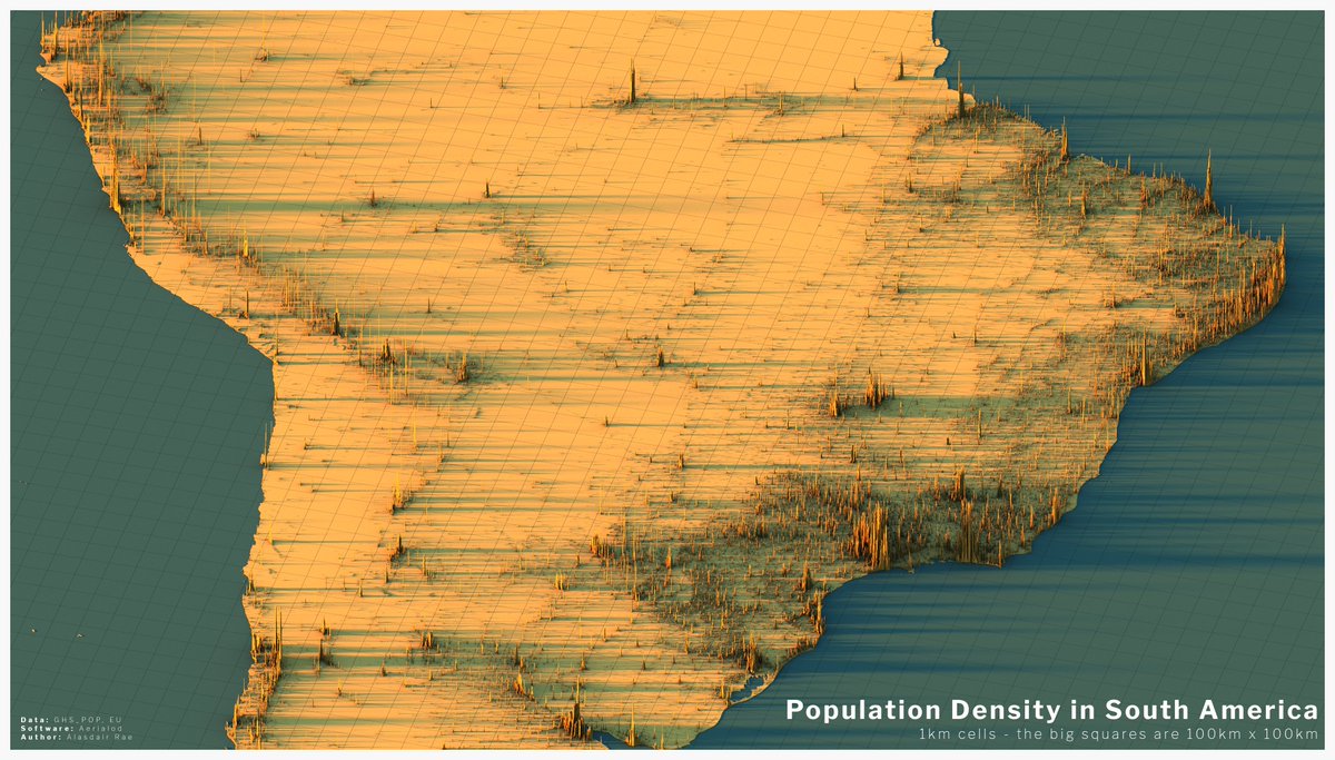
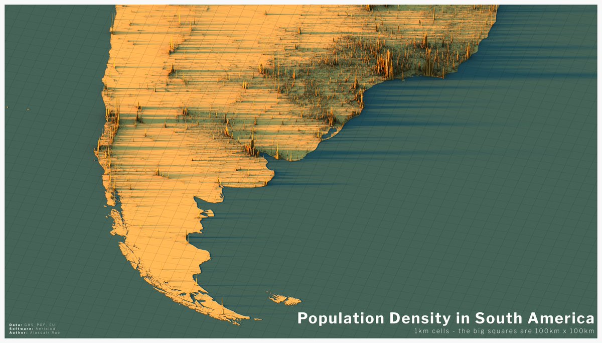
South America was a bit more difficult, but here are a few views of population density across the continent - looking closely, you can see some interesting patterns
- a link back to the original blog post, which provides links to the data source etc
http://www.statsmapsnpix.com/2020/04/population-density-in-europe.html">https://www.statsmapsnpix.com/2020/04/p...
- a link back to the original blog post, which provides links to the data source etc
http://www.statsmapsnpix.com/2020/04/population-density-in-europe.html">https://www.statsmapsnpix.com/2020/04/p...
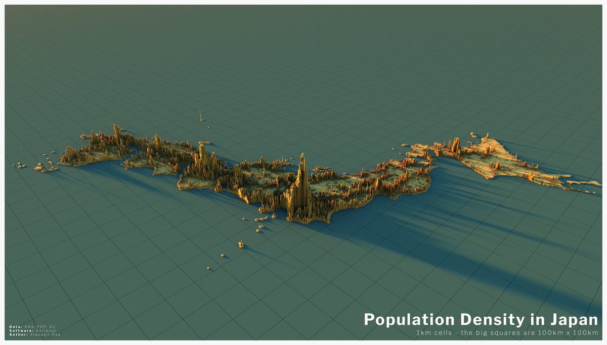
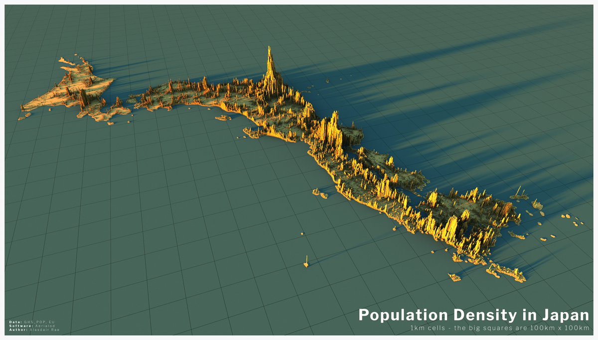
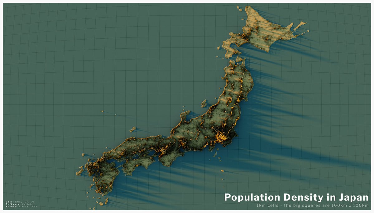
a few of Japan now - definitely one of the most interesting countries in relation to population distribution and density
(clearly this is now getting totally out of hand, but as lockdown activities go it could be a lot worse)
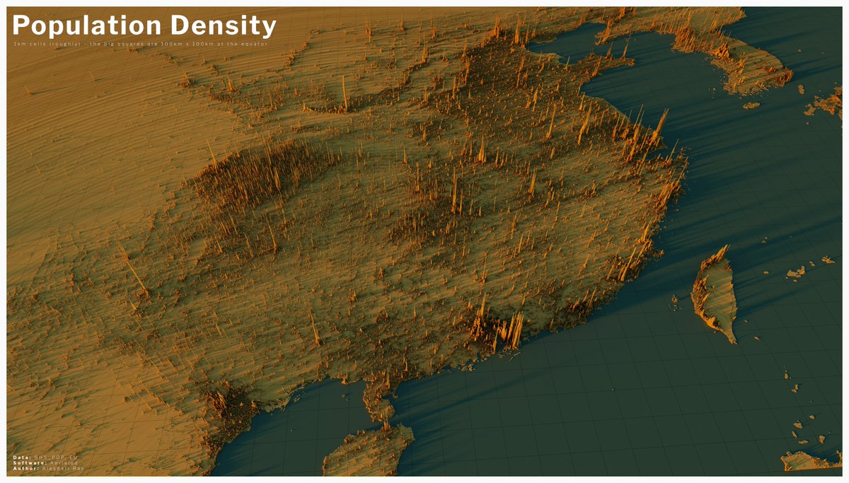
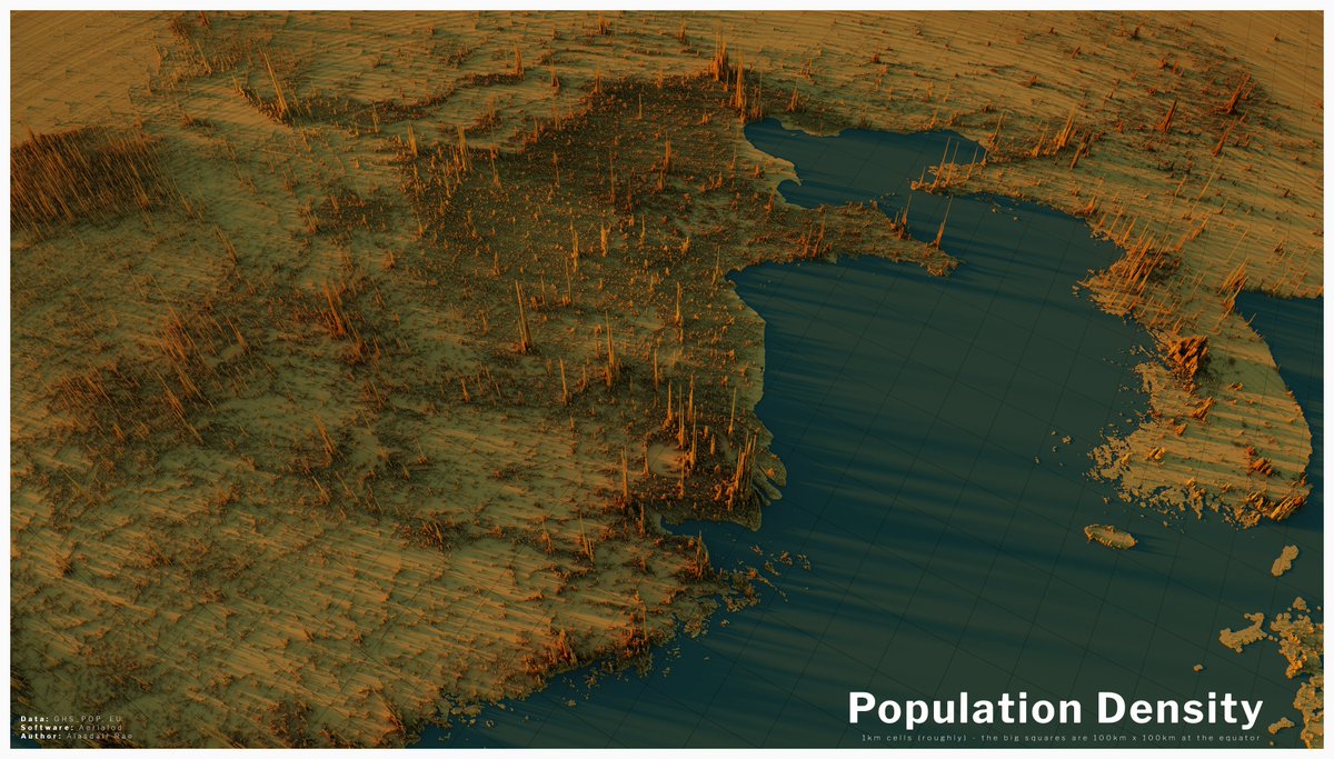
here are a couple of population density vistas centred on China, although you can see all the way from Hanoi in the bottom left to Seoul in the top right of the first one
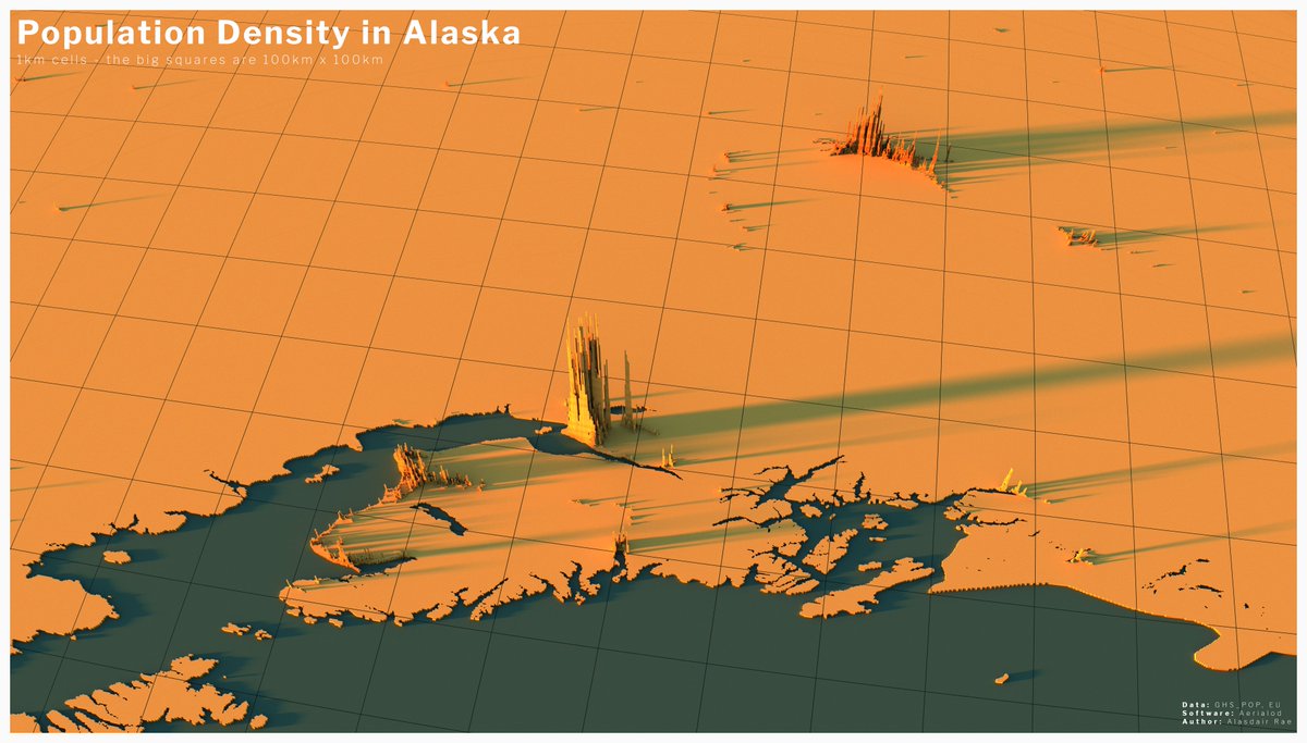
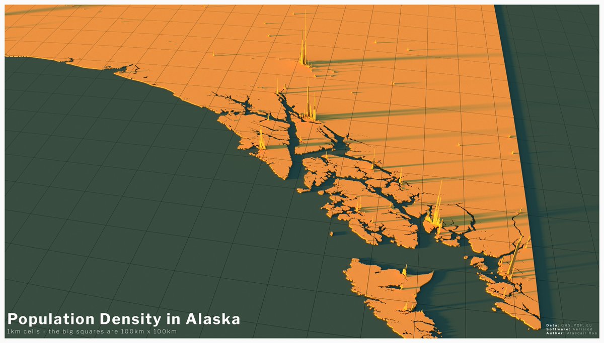
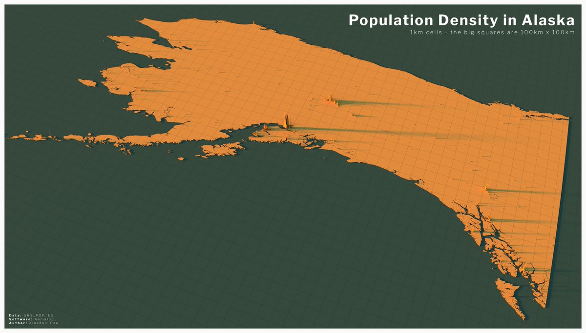
okay, time for some Alaskan population density (with a bit of BC, Yukon and Northwest Territories so I could fit in the panhandle)
Projection means the shape looks a bit more distorted than I& #39;d like but I think the pattern for Fairbnanks in particular is really interesting.
Projection means the shape looks a bit more distorted than I& #39;d like but I think the pattern for Fairbnanks in particular is really interesting.
I didn& #39;t really plan to map the entire world in this way but since people seem interested I will continue - plus I find exploring the world like this and I have nailed down the method (some African views next up, followed by India I think)
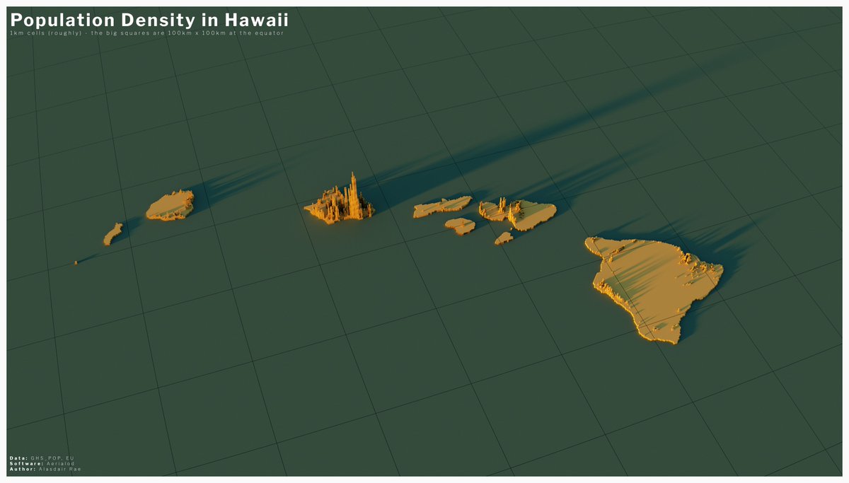
dipping back into this thread to say that if you do The Last frontier you really need to do the Aloha State as well, so here it is
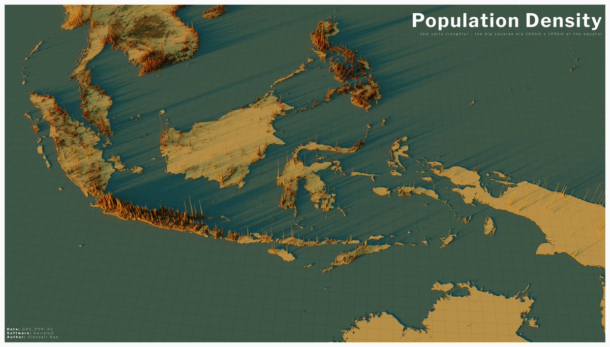
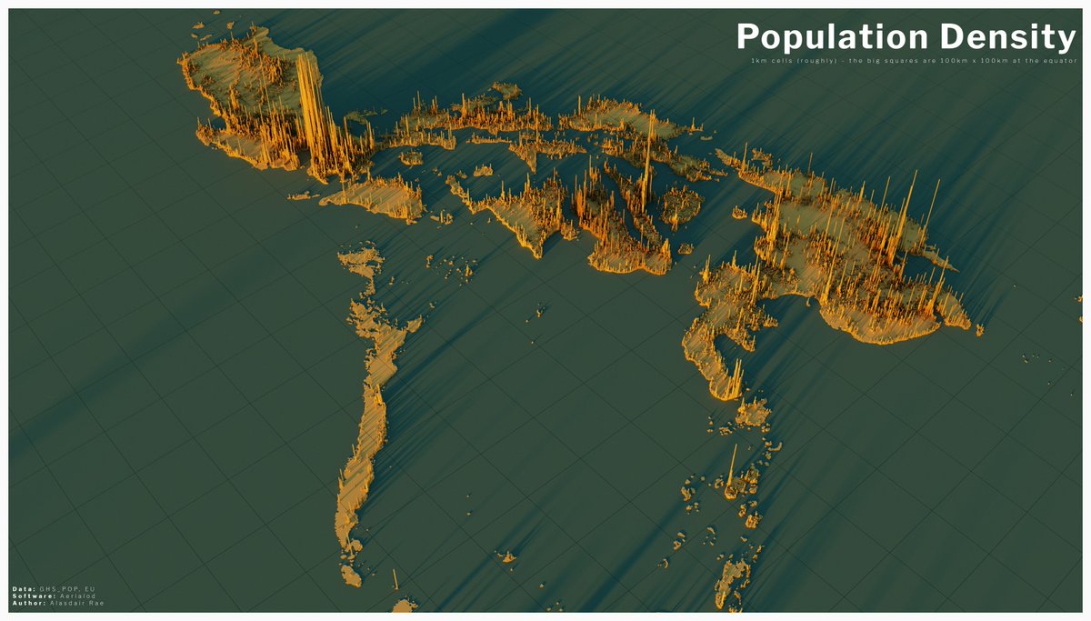
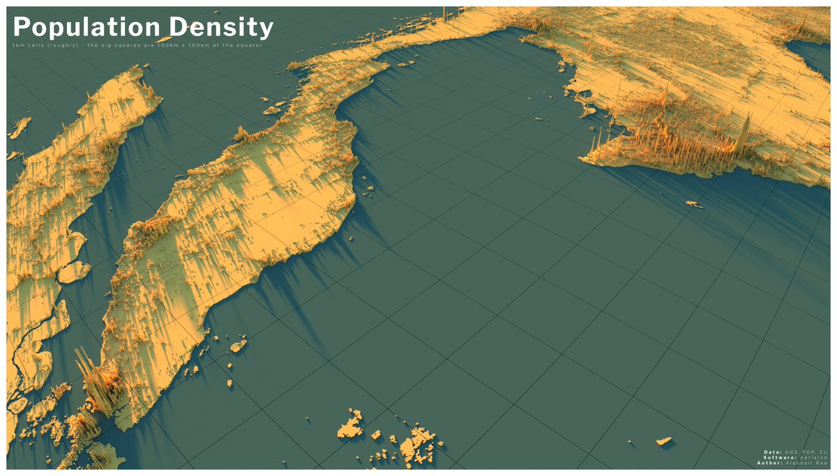
this one is centred on Indonesia but you can also see
- Malaysia
- Brunei
- Timor-Leste
- Singapore
- The Philippines
- parts of Thailand, Myanmar, Cambodia and Vietnam
- part of Australia
- Hainan
I find this one very interesting
- Malaysia
- Brunei
- Timor-Leste
- Singapore
- The Philippines
- parts of Thailand, Myanmar, Cambodia and Vietnam
- part of Australia
- Hainan
I find this one very interesting
I& #39;ll post the rest of these later on, but for now here& #39;s a closer view of the Philippines
(I may turn all these into a book, who knows)
(I may turn all these into a book, who knows)
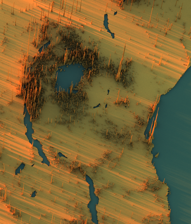
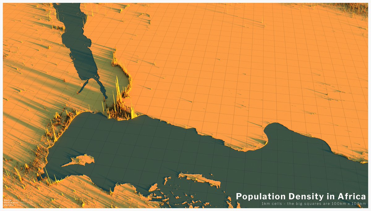
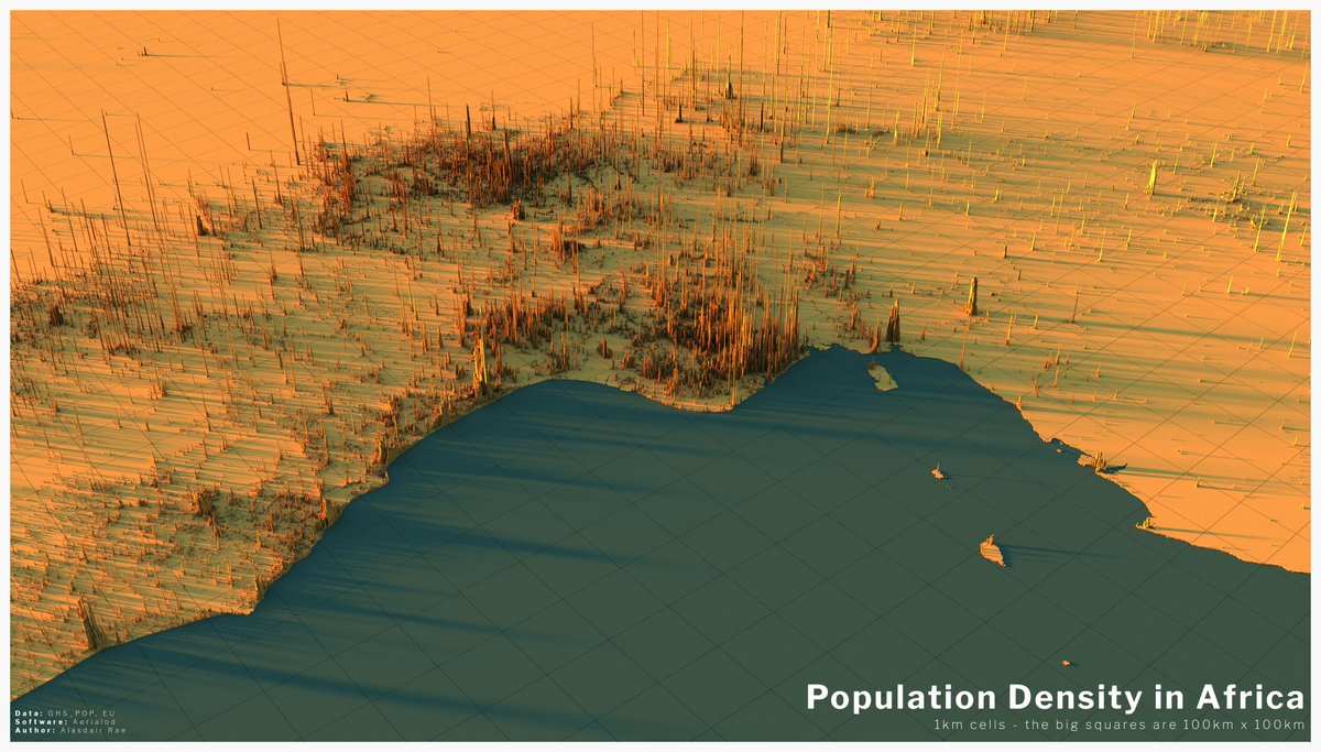
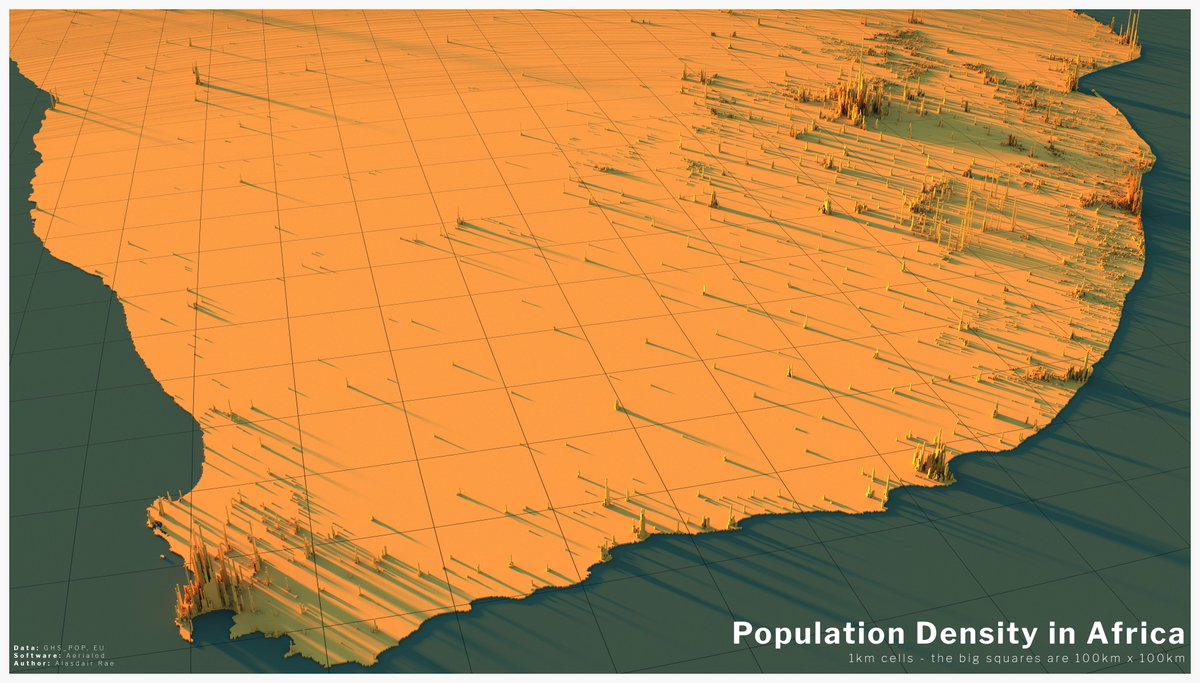
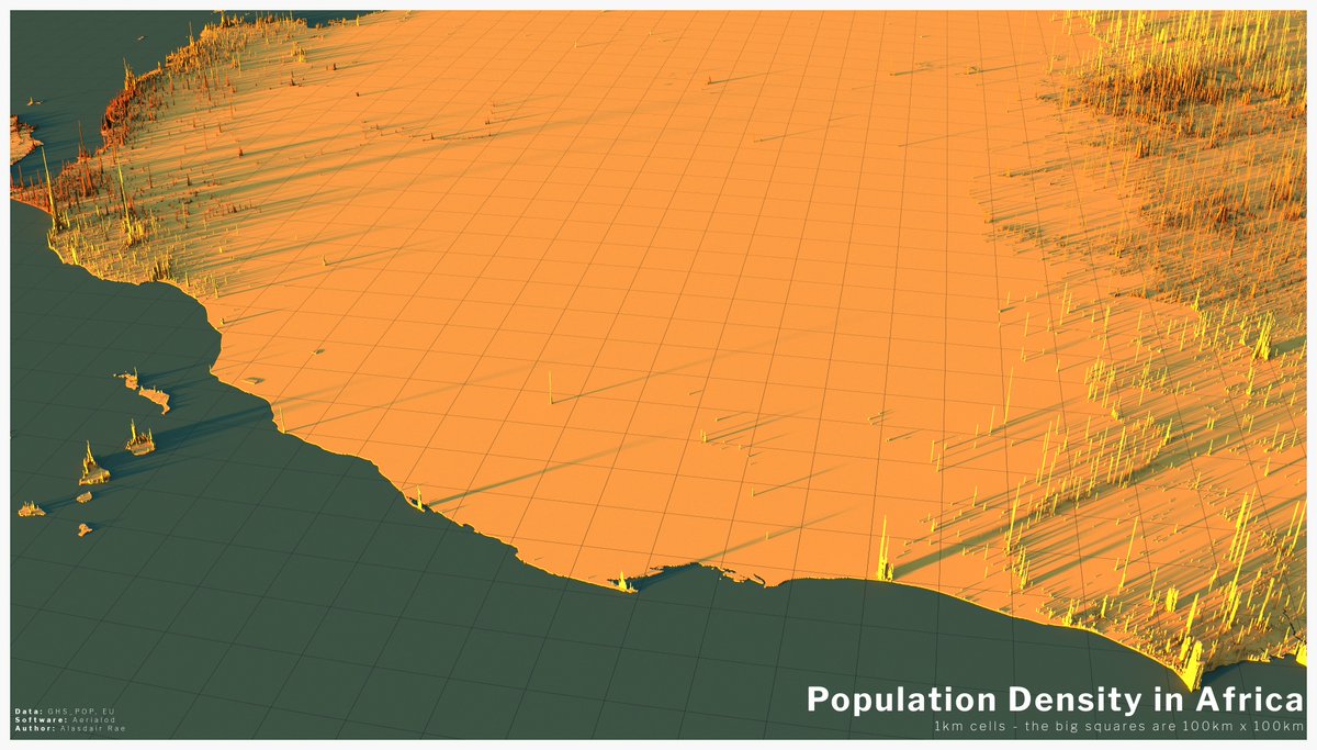
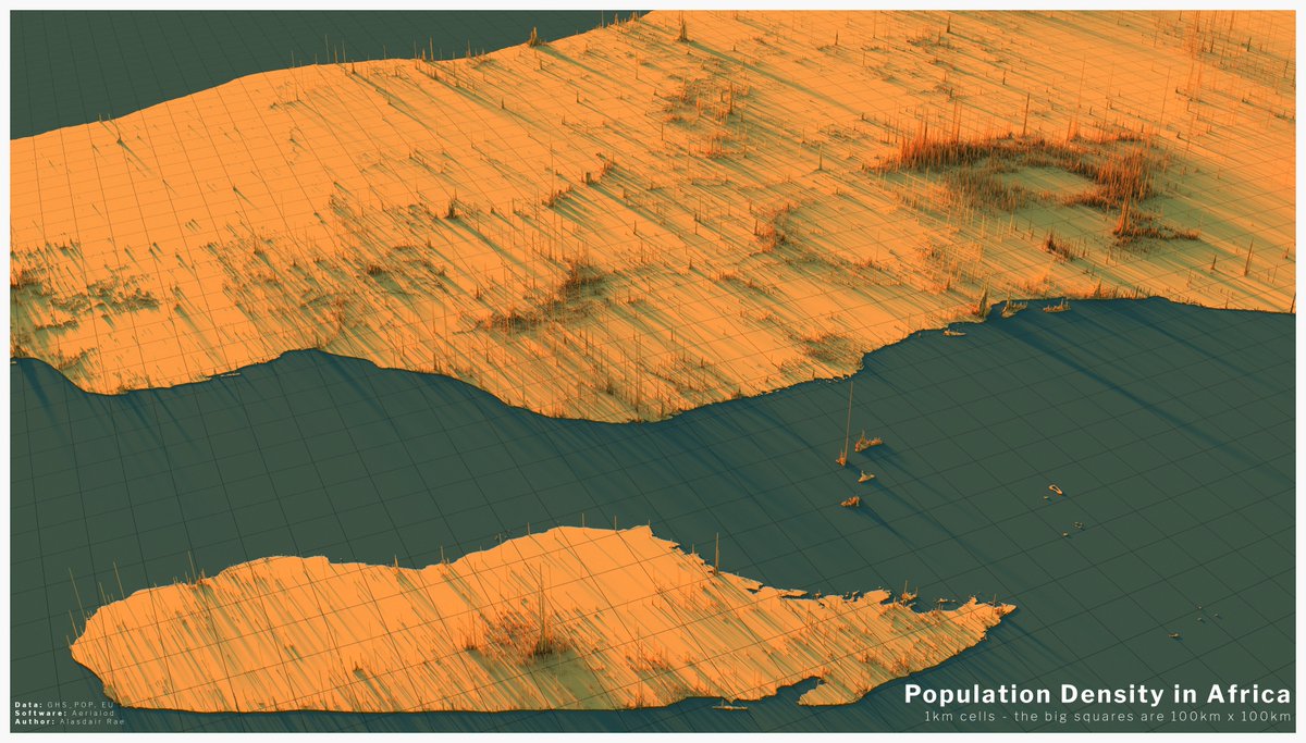
next two tweets are views of population density across Africa (a few anomalous spikes, it seems, but they are still quite interesting)
1. Looking south from the Med, over Egypt (spot the Nile!)
2. One looking towards Nigeria
3. Looking north over South Africa from Cape Town
1. Looking south from the Med, over Egypt (spot the Nile!)
2. One looking towards Nigeria
3. Looking north over South Africa from Cape Town
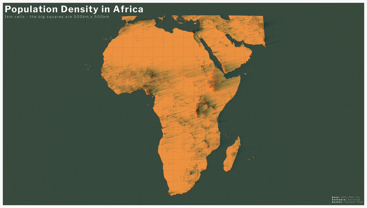
and now some slightly different views, starting with looking east across the empty Sahara, a view over Madagascar from the east, and then a view from above for the whole of Africa (plus neighbours)
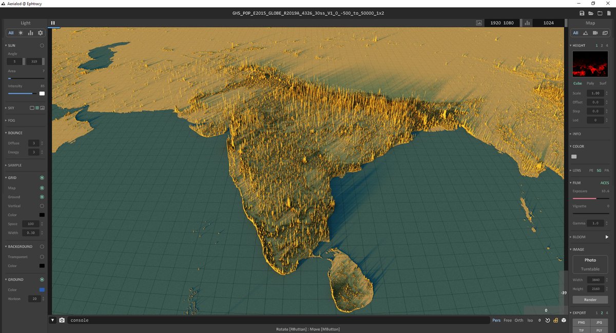
will bring this to a close soon when I post some views focused on India - here& #39;s what they look like before I leave them to render for 15-20 minutes - the outputs are 3840x2160 png files
now where was I?
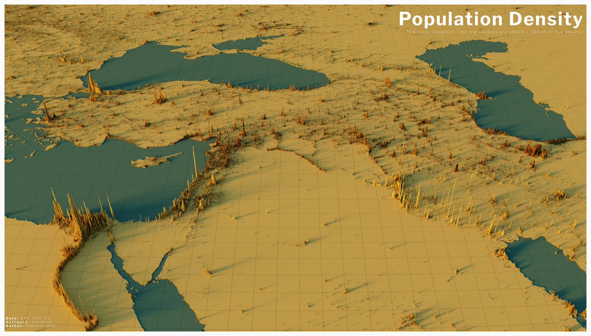
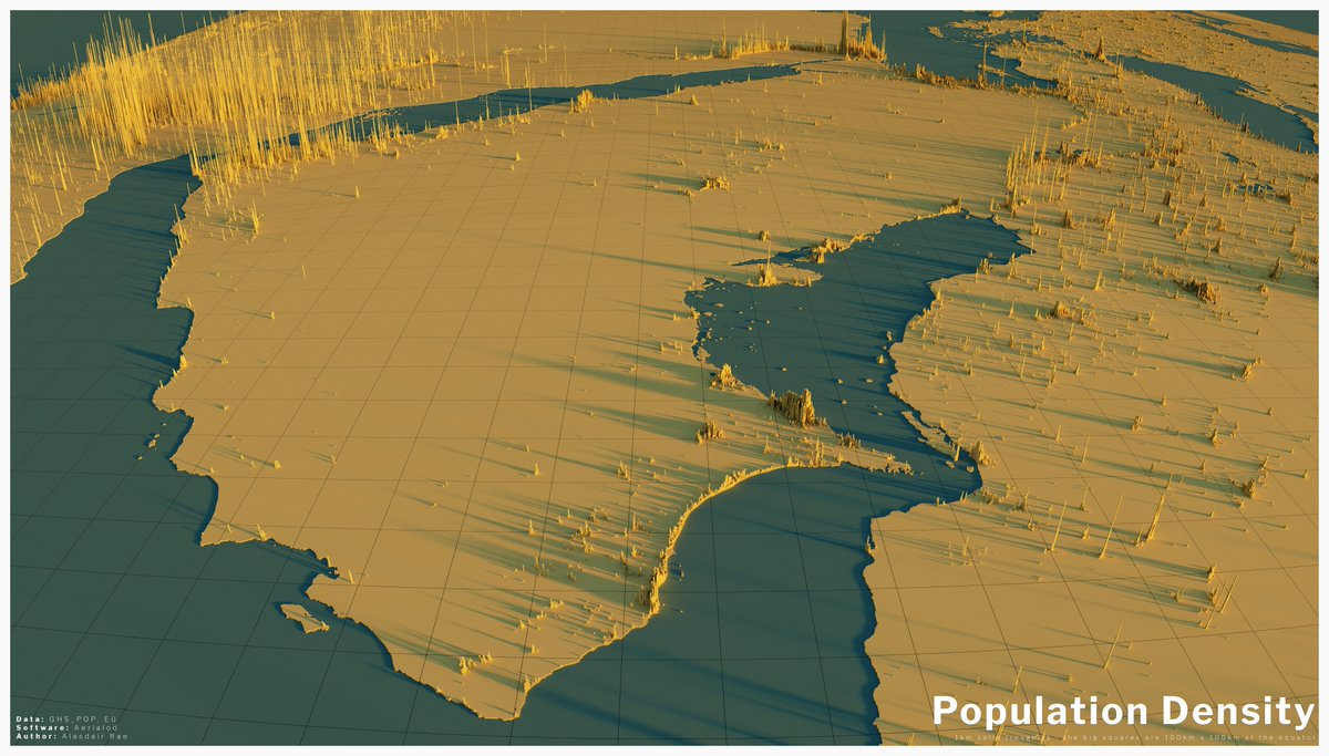
Oh yes, here& #39;s a view that includes Cairo, Istanbul, Tbilisi, Baku, Tehran, Baghdad and lots of other interesting places.
Oh yes, here& #39;s a view that includes Cairo, Istanbul, Tbilisi, Baku, Tehran, Baghdad and lots of other interesting places.
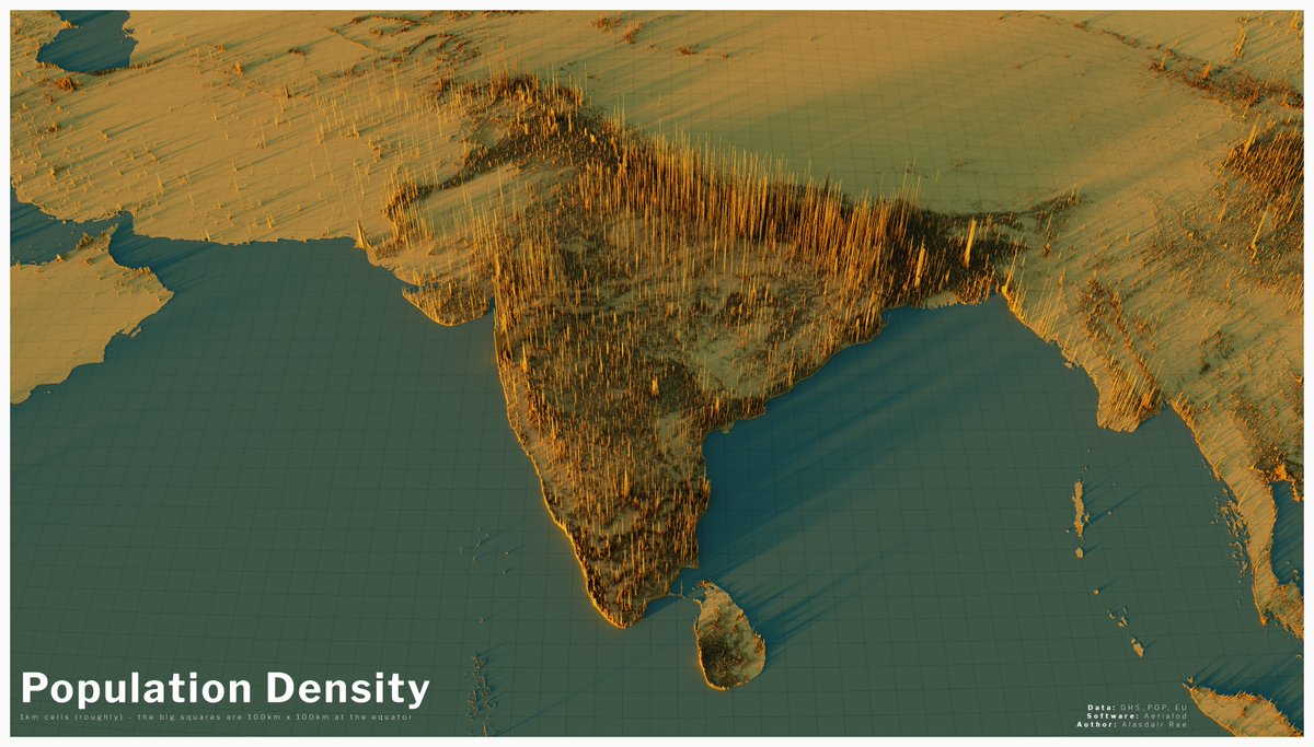
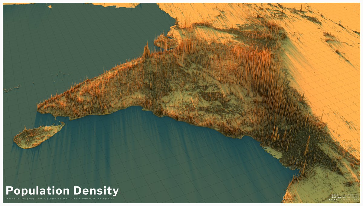
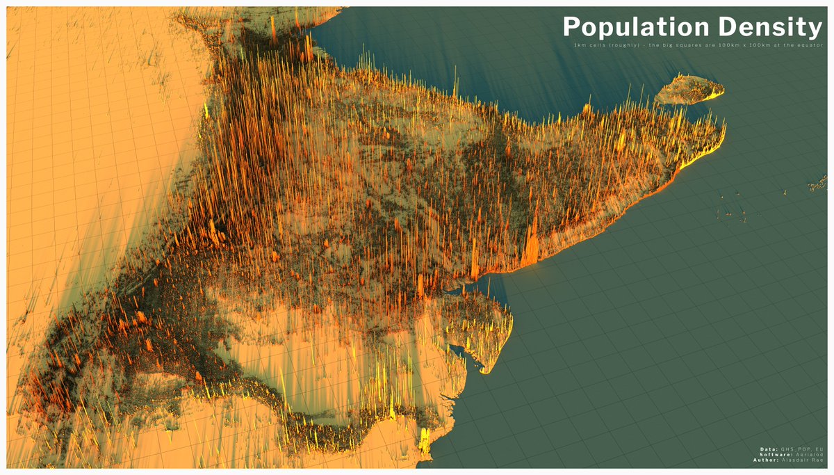
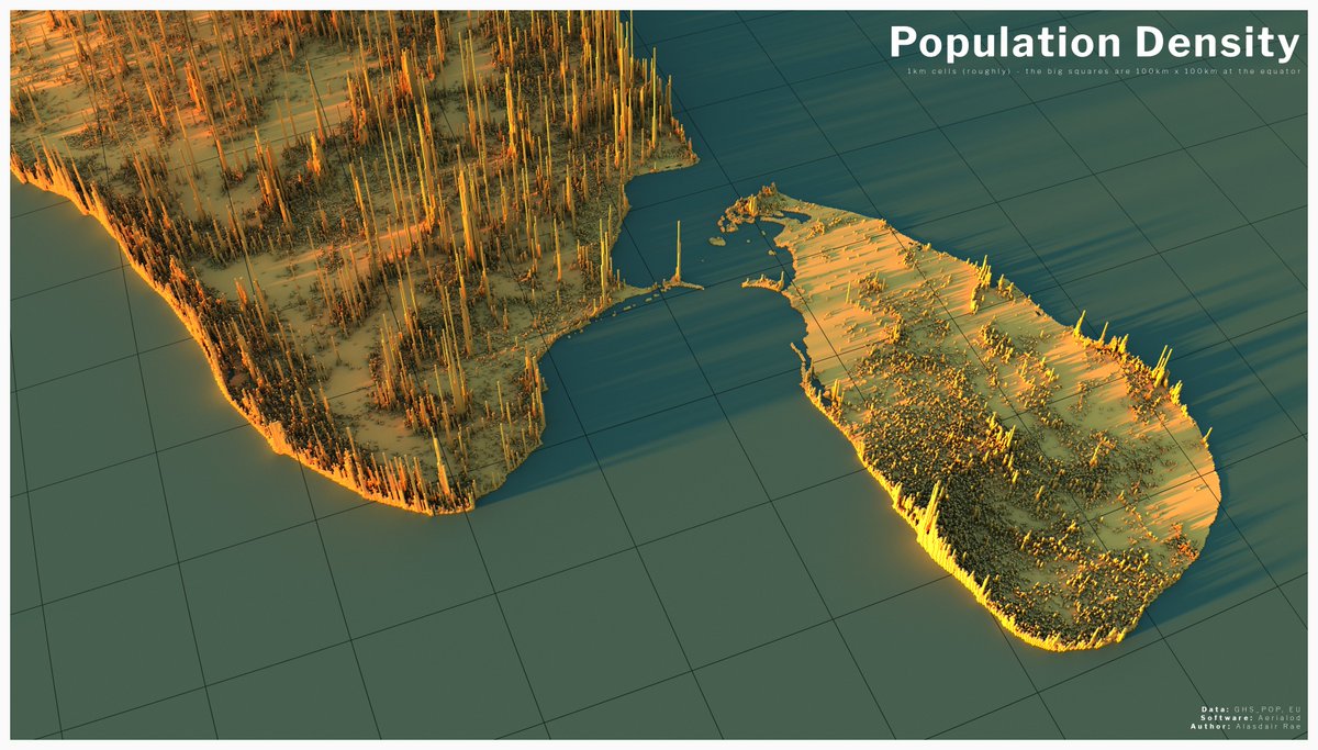
the final batch of these population density maps (for now) focuses on India and its neighbours, from different perspectives - with the final one offering a closer look at Sri Lanka
most of the population density vistas were quite conventional, but here I tried to fit in everything from New York City (in the bottom left), across the Great Lakes, with the west coast of the US visible in the distance, plus also Florida, the Gulf of Mexico, Mexico City and Cuba
Canada& #39;s size and population distribution made it a bit more challenging to do properly but I did export this view that takes in Montreal, Cornwall, Ottawa, Kingston, Toronto, Hamilton, North Bay, Sudbury and I think even Winnipeg in the far distance
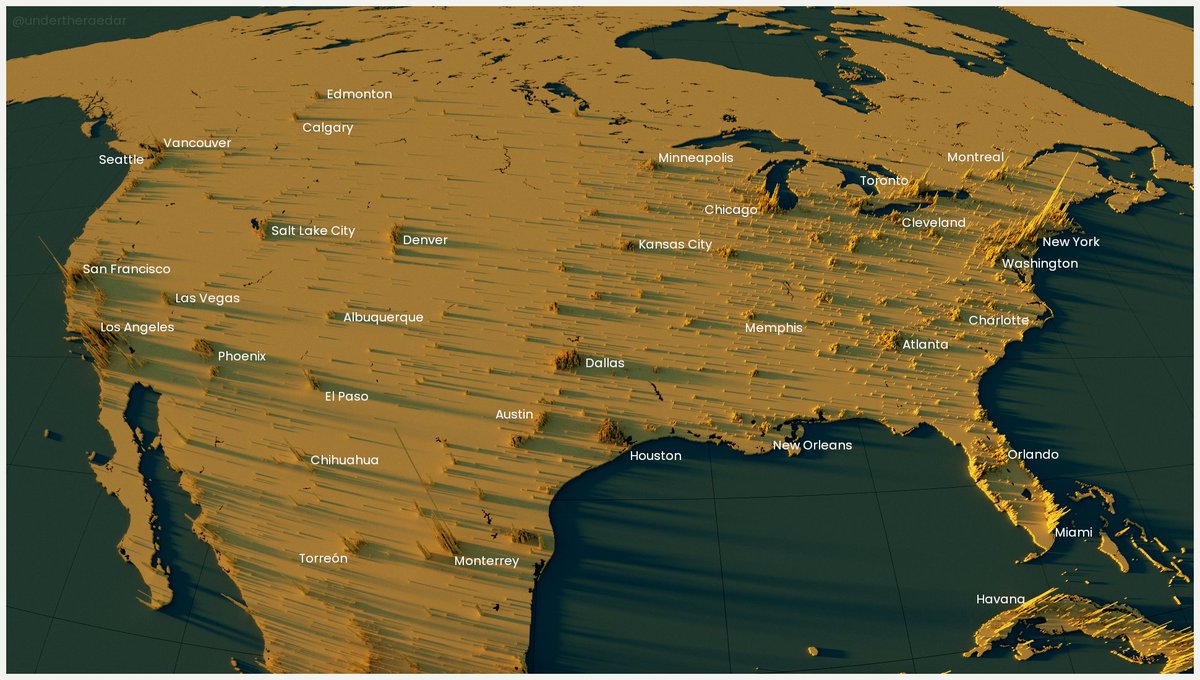
the last one of these population density renders was my attempt to capture the contiguous US (plus a good chunk of Canada and a bit of Mexico) looking east over California - the lighting is a bit too dramatic here but it does at least illuminate the peaks all the way to New York
I will actually, definitely, end this thread later on as I have a few final renders completed
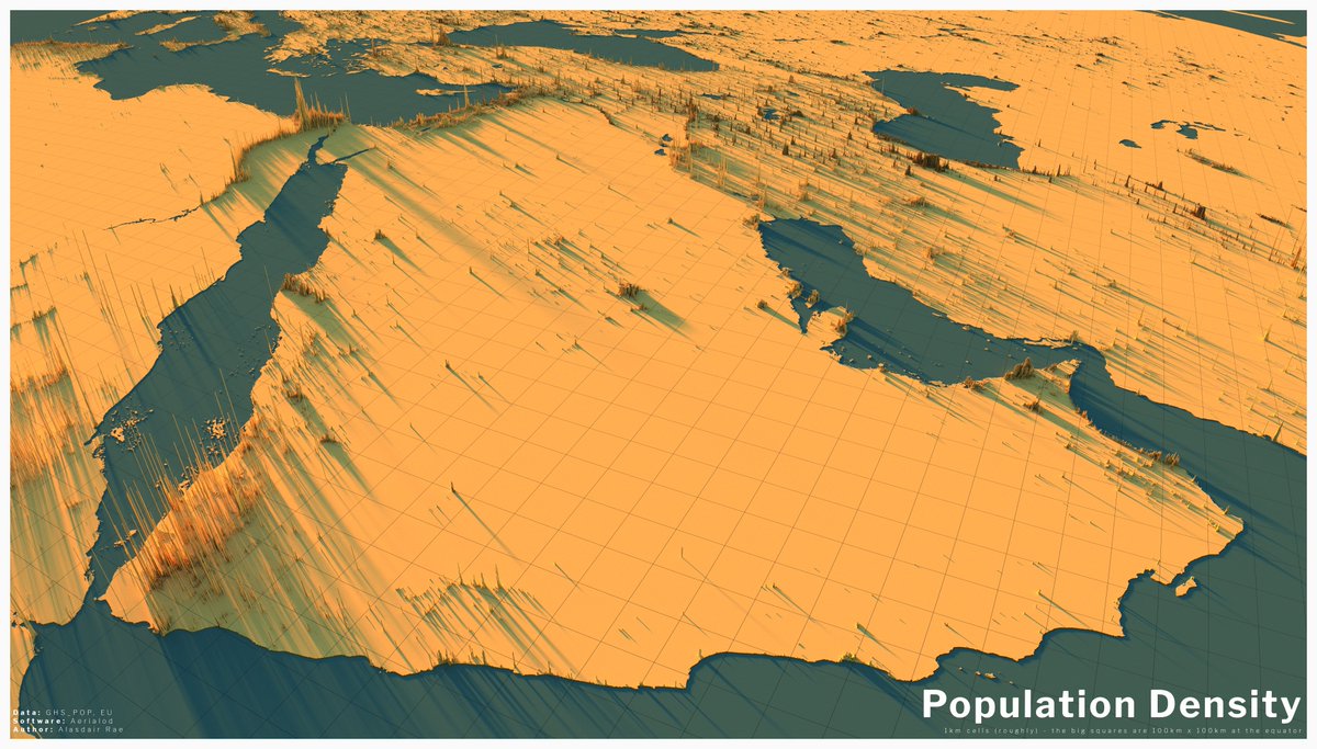
- full view of the Arabian peninsula
- view centred on the Gulf of Thailand
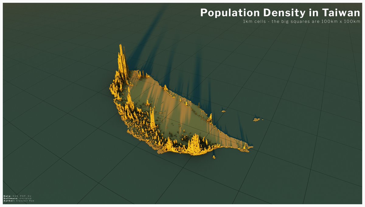
- close up of Taiwan
cc @Abiizes and @PhyllisFancy
- full view of the Arabian peninsula
- view centred on the Gulf of Thailand
- close up of Taiwan
cc @Abiizes and @PhyllisFancy
in this population density map overlooking the Gulf of Thailand you can see Singapore, KL, Medan, Aceh, Bangkok, Phnom Penh and Ho Chi Minh City - plus Hanoi in the top right if you look closely
and now we have a close up of population density in Taiwan, with a kind of sunset effect on the lighting
this is the penultimate tweet in this long population density thread - two views showing the entire Arabian Peninsula, plus more beyond.
See the next, final tweet for a single view of the entire world.
See the next, final tweet for a single view of the entire world.
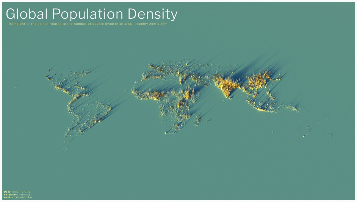
and, finally, here& #39;s a population density render of the entire world - zoom in, or open the image in another tab/window to see the fine detail here - it comes out quite well even at this scale
(this escalated slowly, but I got there in the end https://abs.twimg.com/emoji/v2/... draggable="false" alt="🌍" title="Earth globe europe-africa" aria-label="Emoji: Earth globe europe-africa">)
(this escalated slowly, but I got there in the end
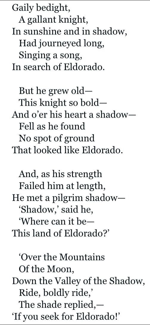
inspiration for the golden colour scheme and long shadows does - of course - come from Eldorado, the 1849 poem by Edgar Allan Poe
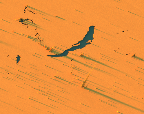
PS I now have a version of the global density map with the Great Lakes cut out, plus other large water bodies e.g. Lake Victoria, Lake Baikal - was a bit fiddly to process but I now have the global file compressed to under 2.5MB
"where there is water, there is life", as they say
"where there is water, there is life", as they say
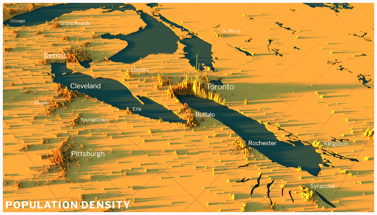
a little bit more mopping up of this thread, just to share a few final outputs - first up is a map of the eastern Great Lakes, this time with some labels - I didn& #39;t add labels to any of the others but I may do in future
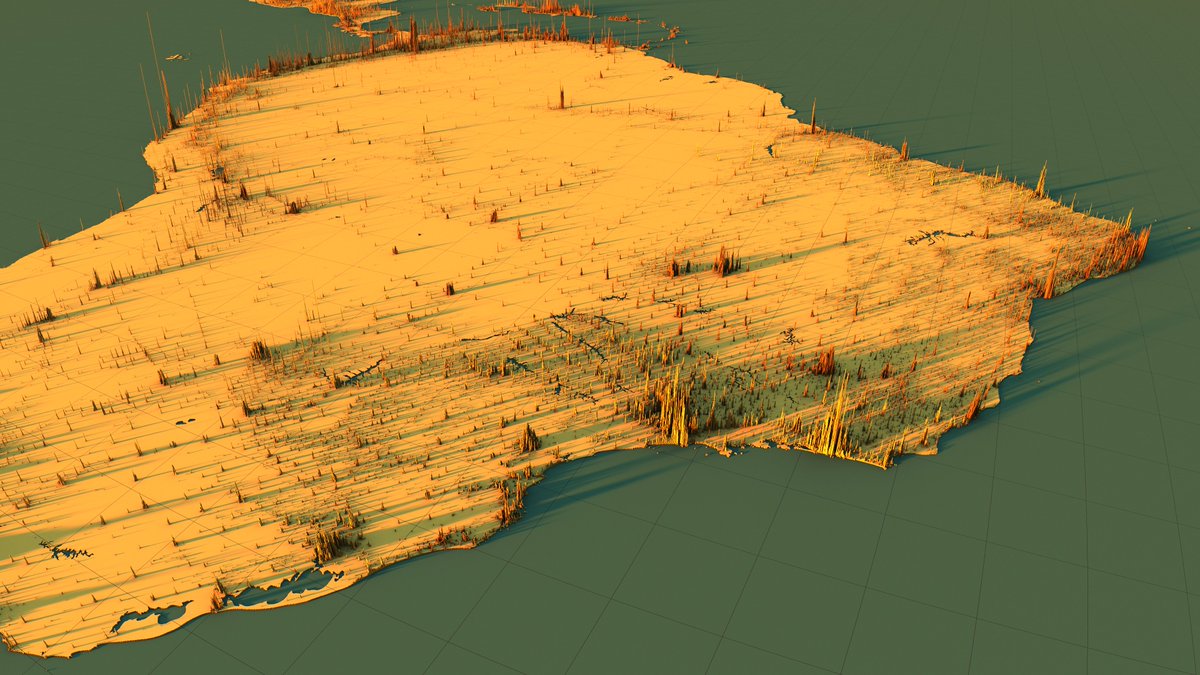
this one is without labels or title but this was an earlier attempt to fit in all of Brazil, plus some of its neighbours
and, as a little experiment, I did one with just spikes - no land. I think this makes it easier to see some places - e.g. check out New Zealand or Hawaii, or even Reykjavík if you look closely.

 Read on Twitter

 )" title="and, finally, here& #39;s a population density render of the entire world - zoom in, or open the image in another tab/window to see the fine detail here - it comes out quite well even at this scale (this escalated slowly, but I got there in the endhttps://abs.twimg.com/emoji/v2/... draggable="false" alt="🌍" title="Earth globe europe-africa" aria-label="Emoji: Earth globe europe-africa">)" class="img-responsive" style="max-width:100%;"/>
