Yesterday in Houston was one of the most impressive forecasting busts I& #39;ve witnessed & been part of in a long while. A lot of you have questions. So here are a few thoughts from myself. Too short for a post, too long for a couple tweets, so here& #39;s a thread. (1/x)
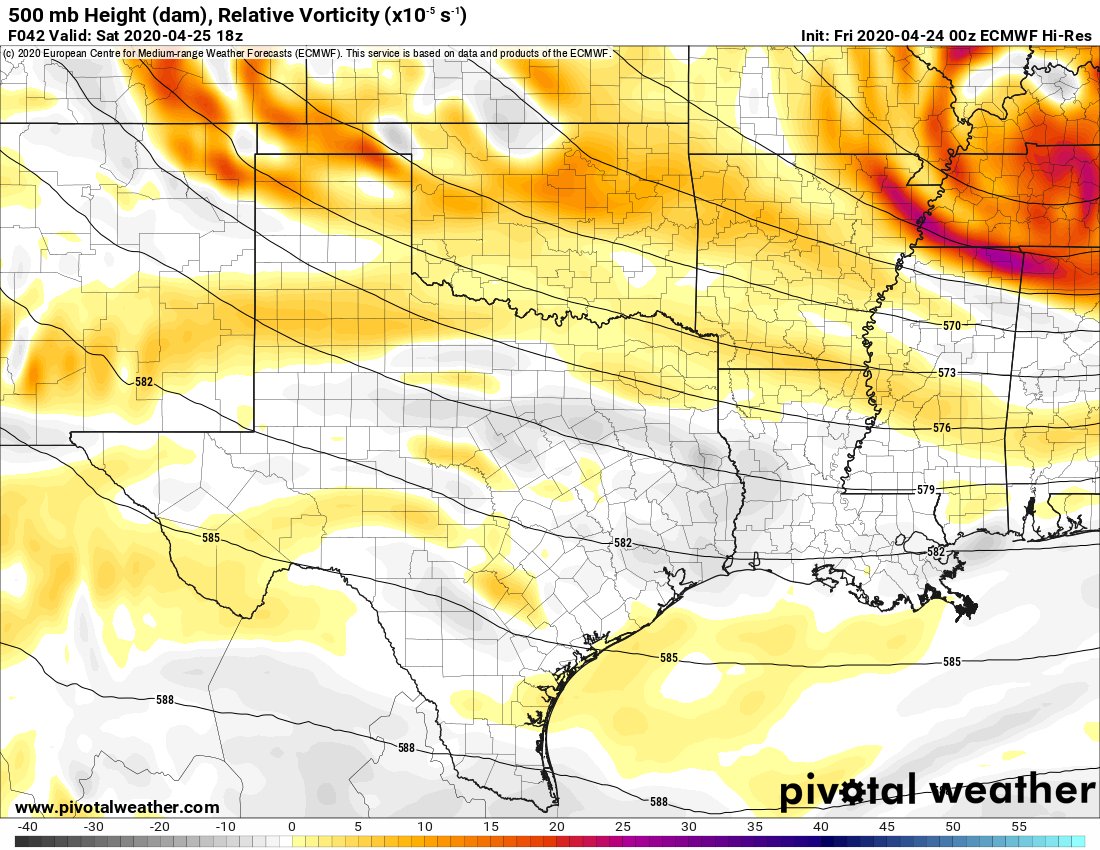
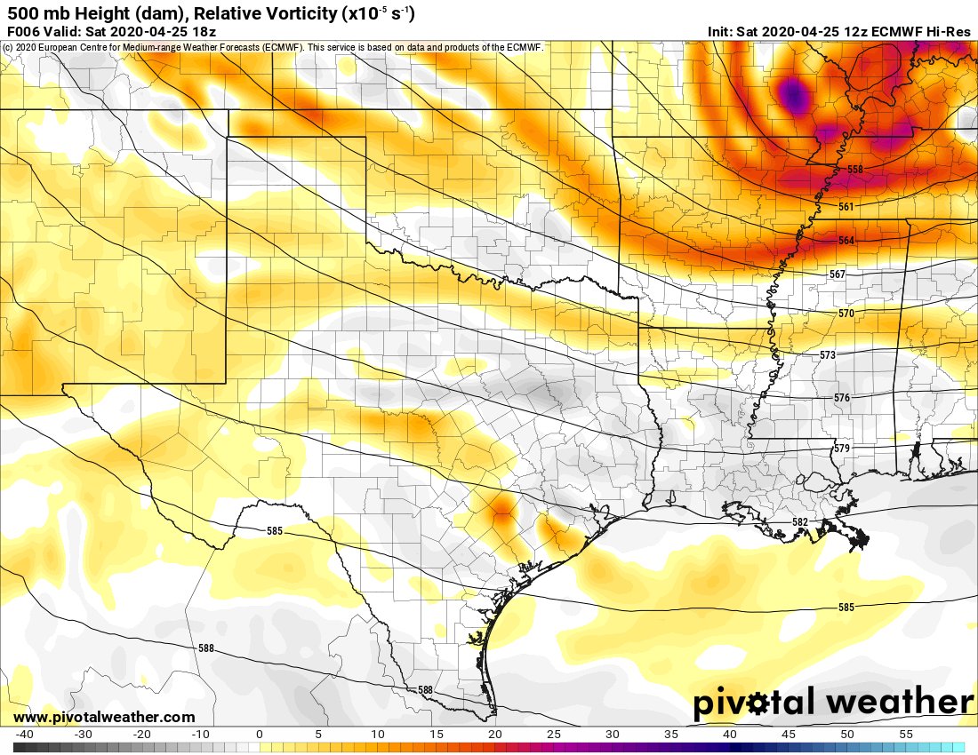
Using Euro model data from @PivotalWeather, here& #39;s a look at 500 mb vorticity....basically, what& #39;s happening 20,000& #39; up. Here& #39;s the forecast from 00z Friday& #39;s model (the one I used Friday morning). This is valid for 1 PM CT. You can see we& #39;ve got WNW flow & most vort in OK. (2/x)
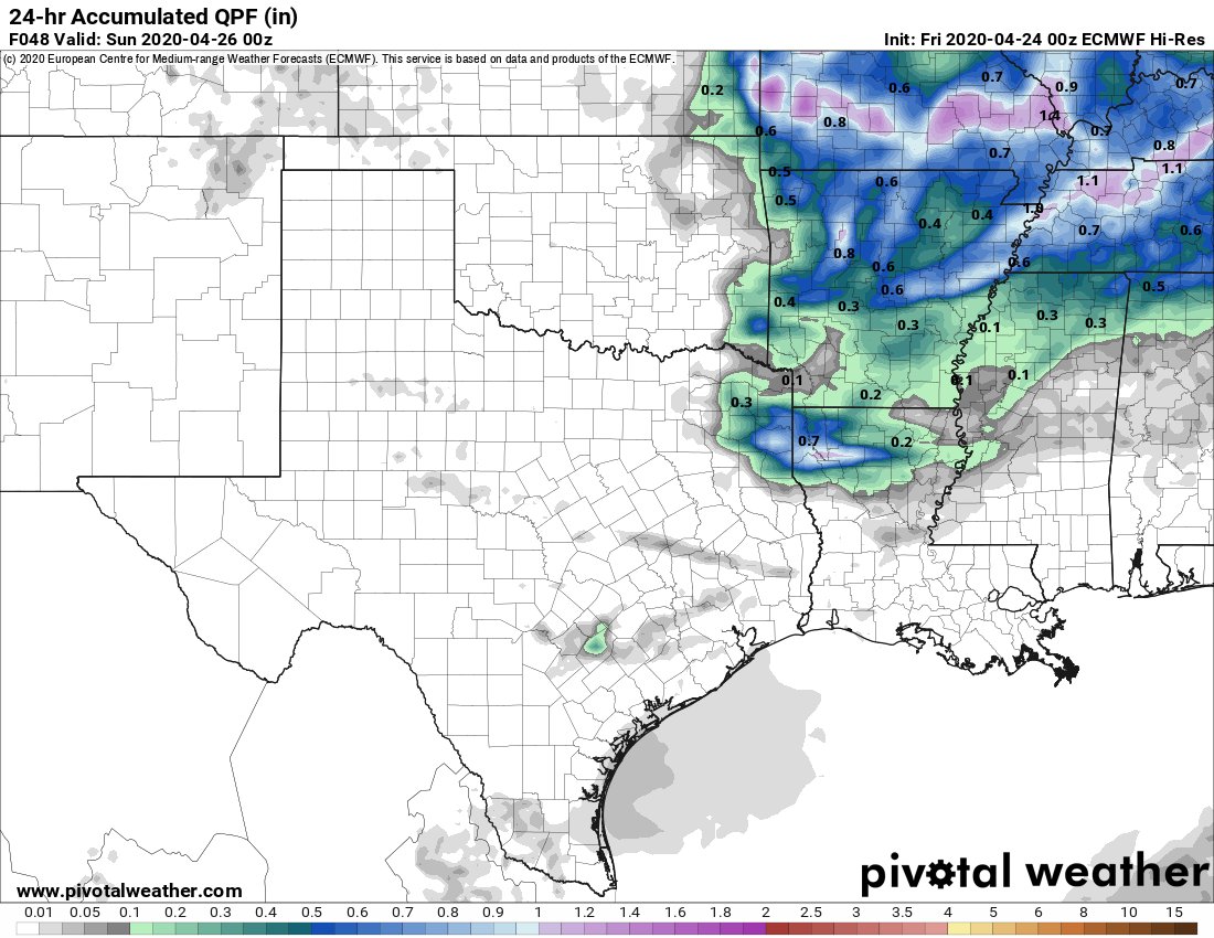
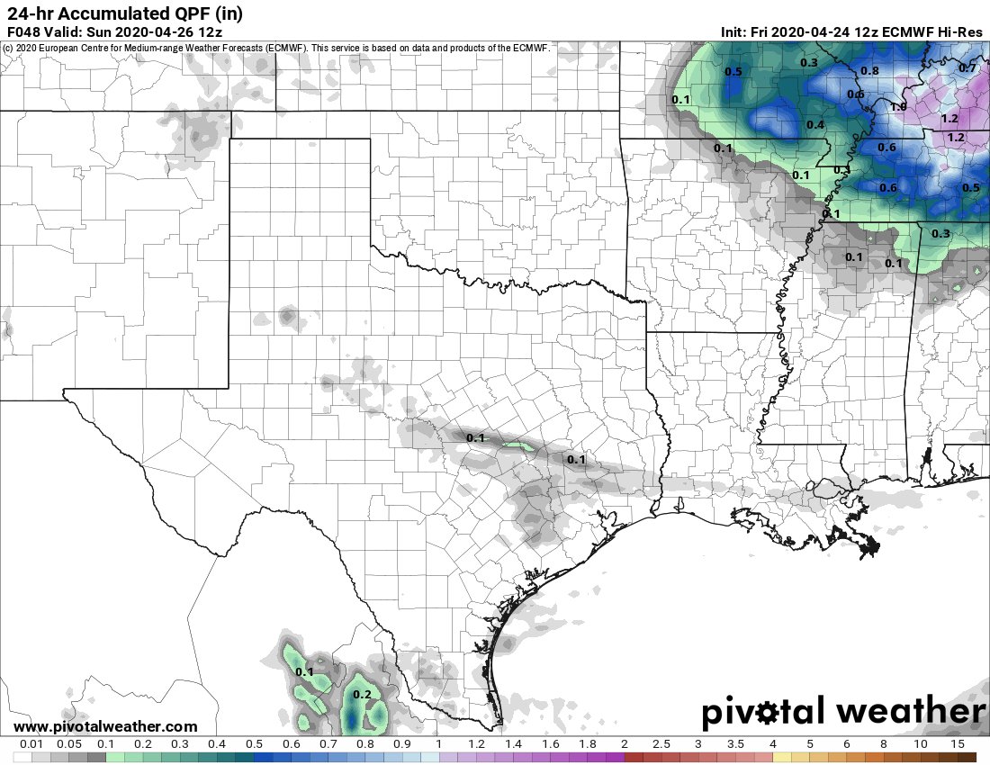
I didn& #39;t mention rain in my Friday AM @SpaceCityWX post. I just re-read the NWS Houston forecast discussion, and they had no mention of rain either. That same Euro run I noted above spit out this precip look for Saturday. You aren& #39;t gonna change much looking at this. (3/x)
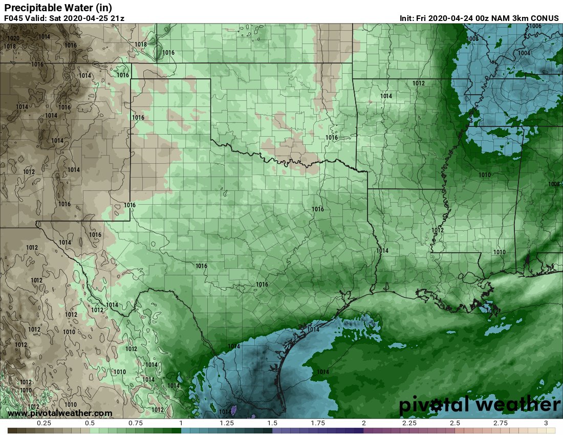
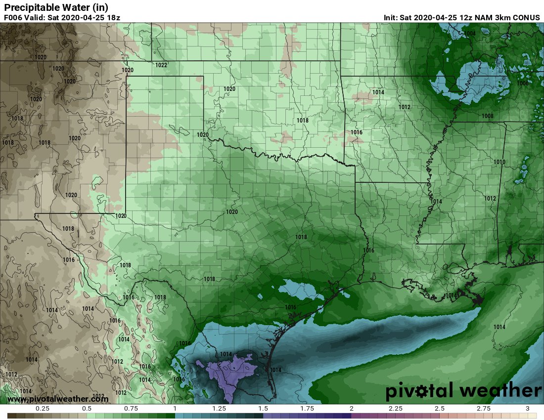
So we have weak vorticity advection w/ a weak trough swinging through Saturday, w/ a pretty dry air mass. The NAM model was forecasting precipitable water of around 0.75" Saturday, which is on the lower end of what we& #39;ve consider "average" for late April. Nothing nefarious. (4/x)
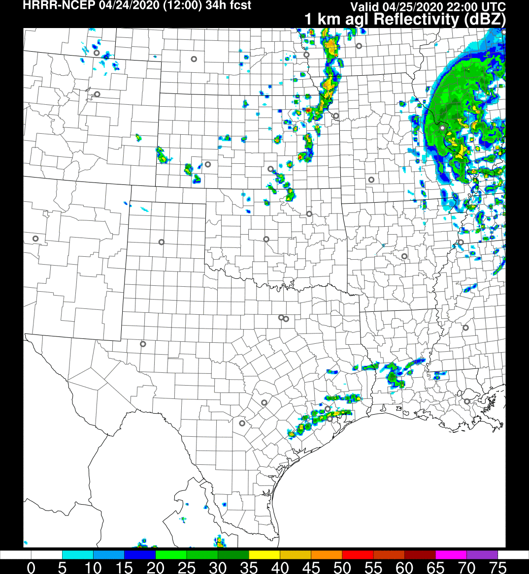
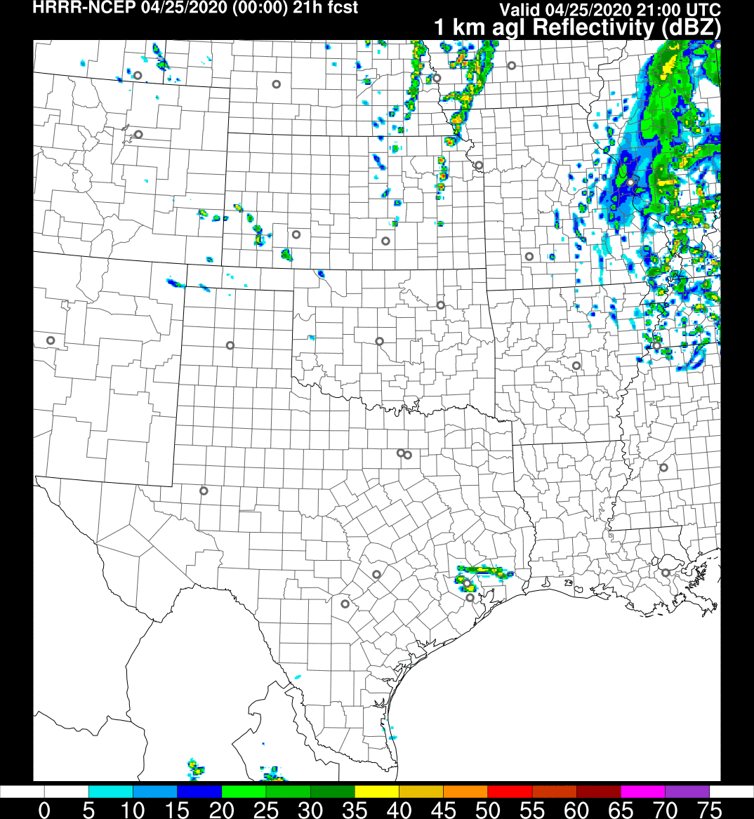
Putting all this together, there& #39;s no real reason to forecast or even mention rain. Euro precip was trace, GFS precip was trace, NAM precip was nil. Unless of course you used the HRRR model. Here& #39;s the HRRR precip forecast from its 12z Friday AM run for Saturday evening. (5/x)
The HRRR usually only goes out 18 hours, but 4x/day it runs a 36 hr forecast. However, it& #39;s notable for being a erratic and my own view is that it tends to overdo convection in Texas. I explicitly discounted this given that it was 32-36 hrs out & model history is erratic. (6/x)
Again, the Fri PM discussion from NWS Houston also didn& #39;t mention rain for Saturday. The 12z models on Friday, besides the HRRR showed little to no meaningful precip signal. The Euro/GFS showed minor amounts, but given the dry air mass, you would have discounted that too. (7/x)
The 00z runs didn& #39;t do much better. The HRRR remained basically the only one showing rain, with storms firing up at 4 PM. Even the HRRR was still off by 3-4 hours and showed nothing to our west. So while it may have had the signal right, it was way off on details. (8/x).
Even the Sat AM discussion from NWS Houston mentioned nothing. To be clear, I& #39;m not picking on them...we all missed this. But I want to underscore how there was literally almost no useful, consistent, reliable model signal for numerous daytime & evening storms on Saturday. (9/x)
So the 12z runs on Saturday had to nail this, right? Well, the NAM would have been the only useful one (besides the HRRR) that close in to the event, and it had widespr-- nothing. (10/x)
To the NAM& #39;s credit though, it did forecast higher precipitable water (PWAT) values though, up to about 0.9" on Saturday, which is still nothing special, but indicative of the air mass not being quite as dry as expected. (11/x)
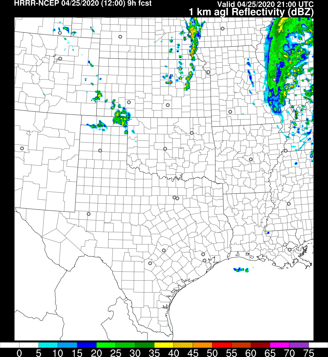
So then the HRRR nailed it, right? Here& #39;s the 12z Saturday run of the HRRR (same forecast time as tweet 8). All that, and it shows nothing. This is a 9 hour forecast from the best model tuned to forecasting convection in our arsenal. Inconsistency hurts a lot. (12/x)
So I& #39;m still scratching my head today as to what happened. I did look again at the 12z Euro& #39;s 500 mb vort maps, and it does show a good deal more vorticity over Texas than 24 hours prior. That could be a culprit -- I guess? (13/x)
So yesterday seems to have been a case where dynamics trumped what seemed at all levels to be a day where you wouldn& #39;t have expected much convection. None of our tools implied strongly enough to even really mention rain, even 6-8 hours before it began. (14/x)

 Read on Twitter