It is my belief that the fires could not come from a residential area as the volume of thick black smoke does not correspond to a residential fire, as seen in the @Sou https://twitter.com/andreasmoun/status/1254479268937191425">https://twitter.com/andreasmo...
A Google Earth geolocation attempt of the wider view of same photo (via https://twitter.com/warcoresponted/status/1254374267506044928?s=20)">https://twitter.com/warcoresp... was taken ESE of Mitiga Airport.
Note white buildings to the right, triangle of road with bush in the center.
Note white buildings to the right, triangle of road with bush in the center.
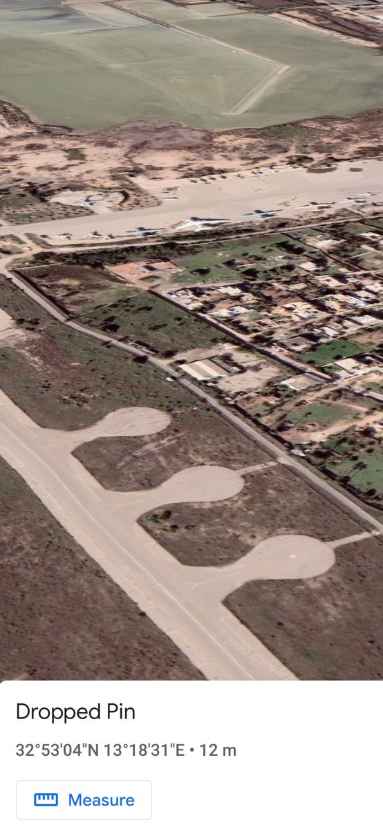
Using Google Earth, the location is presented below. Note same white buildi gs above and triangular traffic route with bush in center close by.
Using the pin as the focal point, I tried to determine what was smoking so badly. The direction of view has 3 apron circles and a tarmac beyond. Many of these aircraft on the tarmac are derelict.
There are also residential areas in between.
There are also residential areas in between.
It is my belief that the fires could not come from a residential area as the volume of thick black smoke does not correspond to a residential fire, as seen in the @southfronteng article on the subject. https://twitter.com/southfronteng/status/1254457545118429185?s=20">https://twitter.com/southfron...
Something glitched on making this thread. The above tweet was supposed to say how I was going to attempt to ascertain what was burning at Tripoli so badly.

 Read on Twitter


