I love the Earth and I love space. To celebrate the end of #EarthDay  https://abs.twimg.com/hashflags... draggable="false" alt="">, here& #39;s an unofficial and super casual thread of some of the cool satellites that take a look at our planet 1/
I like the Precipitation Measurement Missions ( @NASARain). They are a whole "train" of satellites between @JAXA_en and @NASA that can measure rain and snow in 3D. https://gpm.nasa.gov/precipitation-measurement-missions">https://gpm.nasa.gov/precipita... #EarthDay50 2/
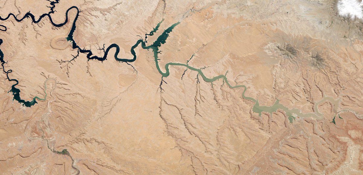
You probably heard of Landsat! There have been eight @NASA_Landsat missions built so far, only two are operational and still sending us very pretty photos in visible and infrared spectrums. (Pic is Lake Powell near UT/AZ, NASA/USGS) https://landsat.visibleearth.nasa.gov/ ">https://landsat.visibleearth.nasa.gov/">... #EarthDay50 3/
GRACE-Follow On, or GRACE-FO, is a gravity-sensing pair of satellites. One follows the other at a set distance. The distance can change from small fluctuations in gravity, that helps scientists measure the movement of masses like water. #EarthDay  https://abs.twimg.com/hashflags... draggable="false" alt=""> https://gracefo.jpl.nasa.gov/ ">https://gracefo.jpl.nasa.gov/">...
ICESAT-2! @NASA_ICE is looking at the Earth& #39;s poles, sending out little beams of photons to see how tall ice sheets & trees are. https://icesat-2.gsfc.nasa.gov/ ">https://icesat-2.gsfc.nasa.gov/">... Citizen scientists can validate tree heights for the mission w @NASAGO: https://observer.globe.gov/do-globe-observer/trees">https://observer.globe.gov/do-globe-... #EarthDay  https://abs.twimg.com/hashflags... draggable="false" alt=""> 5/
Sentinel-2A and 2B also have similar instruments onboard like Landsat. @CopernicusEU makes vivid pictures and help users look at changes in vegetation, ice, cities, heat, fires, and more. #EarthDay  https://abs.twimg.com/hashflags... draggable="false" alt=""> 6/

 Read on Twitter
 6/" title="Sentinel-2A and 2B also have similar instruments onboard like Landsat. @CopernicusEU makes vivid pictures and help users look at changes in vegetation, ice, cities, heat, fires, and more. #EarthDay https://abs.twimg.com/hashflags... draggable="false" alt=""> 6/" class="img-responsive" style="max-width:100%;"/>


