 Read on Twitter
Happy #EarthDay  https://abs.twimg.com/hashflags... draggable="false" alt="">! We have launched many of @NASA’s Earth Observing System satellites to orbit. They provide long-term global observations to enable a better understanding of https://abs.twimg.com/emoji/v2/... draggable="false" alt="🌎" title="Earth globe americas" aria-label="Emoji: Earth globe americas"> as an integrated system.
Learn about these currently operating satellites that study our homehttps://abs.twimg.com/emoji/v2/... draggable="false" alt="⤵️" title="Arrow pointing rightwards then curving downwards" aria-label="Emoji: Arrow pointing rightwards then curving downwards">
Learn about these currently operating satellites that study our home
Dec. 1999 https://abs.twimg.com/emoji/v2/... draggable="false" alt="🌎" title="Earth globe americas" aria-label="Emoji: Earth globe americas"> We launched Terra, the flagship mission of @NASA& #39;s Earth Observing System.
Terra is the first:
https://abs.twimg.com/emoji/v2/... draggable="false" alt="🛰️" title="Satellite" aria-label="Emoji: Satellite"> Earth-observing satellite
https://abs.twimg.com/emoji/v2/... draggable="false" alt="🔎" title="Right-pointing magnifying glass" aria-label="Emoji: Right-pointing magnifying glass"> satellite to look at Earth system science
Seen here is an image of @NASAKennedy and Cape Canaveral Air Force Station Terra captured.
Terra is the first:
Seen here is an image of @NASAKennedy and Cape Canaveral Air Force Station Terra captured.
 We launched Terra, the flagship mission of @NASA& #39;s Earth Observing System. Terra is the first: https://abs.twimg.com/emoji/v2/... draggable="false" alt="🛰️" title="Satellite" aria-label="Emoji: Satellite"> Earth-observing satellite https://abs.twimg.com/emoji/v2/... draggable="false" alt="🔎" title="Right-pointing magnifying glass" aria-label="Emoji: Right-pointing magnifying glass"> satellite to look at Earth system science Seen here is an image of @NASAKennedy and Cape Canaveral Air Force Station Terra captured." title="Dec. 1999 https://abs.twimg.com/emoji/v2/... draggable="false" alt="🌎" title="Earth globe americas" aria-label="Emoji: Earth globe americas"> We launched Terra, the flagship mission of @NASA& #39;s Earth Observing System. Terra is the first: https://abs.twimg.com/emoji/v2/... draggable="false" alt="🛰️" title="Satellite" aria-label="Emoji: Satellite"> Earth-observing satellite https://abs.twimg.com/emoji/v2/... draggable="false" alt="🔎" title="Right-pointing magnifying glass" aria-label="Emoji: Right-pointing magnifying glass"> satellite to look at Earth system science Seen here is an image of @NASAKennedy and Cape Canaveral Air Force Station Terra captured.">
 We launched Terra, the flagship mission of @NASA& #39;s Earth Observing System. Terra is the first: https://abs.twimg.com/emoji/v2/... draggable="false" alt="🛰️" title="Satellite" aria-label="Emoji: Satellite"> Earth-observing satellite https://abs.twimg.com/emoji/v2/... draggable="false" alt="🔎" title="Right-pointing magnifying glass" aria-label="Emoji: Right-pointing magnifying glass"> satellite to look at Earth system science Seen here is an image of @NASAKennedy and Cape Canaveral Air Force Station Terra captured." title="Dec. 1999 https://abs.twimg.com/emoji/v2/... draggable="false" alt="🌎" title="Earth globe americas" aria-label="Emoji: Earth globe americas"> We launched Terra, the flagship mission of @NASA& #39;s Earth Observing System. Terra is the first: https://abs.twimg.com/emoji/v2/... draggable="false" alt="🛰️" title="Satellite" aria-label="Emoji: Satellite"> Earth-observing satellite https://abs.twimg.com/emoji/v2/... draggable="false" alt="🔎" title="Right-pointing magnifying glass" aria-label="Emoji: Right-pointing magnifying glass"> satellite to look at Earth system science Seen here is an image of @NASAKennedy and Cape Canaveral Air Force Station Terra captured.">
April 1999 https://abs.twimg.com/emoji/v2/... draggable="false" alt="🌎" title="Earth globe americas" aria-label="Emoji: Earth globe americas"> We launched @NASA_Landsat 7 to continue building and refreshing a global archive of sun-lit, cloud-free images of the Earth’s landmass.
This Earth-observing satellite captured this image of Yosemite Valley, part of California’s @YosemiteNPS, in 2001.https://abs.twimg.com/emoji/v2/... draggable="false" alt="⛰️" title="Mountain" aria-label="Emoji: Mountain">
This Earth-observing satellite captured this image of Yosemite Valley, part of California’s @YosemiteNPS, in 2001.
 We launched @NASA_Landsat 7 to continue building and refreshing a global archive of sun-lit, cloud-free images of the Earth’s landmass.This Earth-observing satellite captured this image of Yosemite Valley, part of California’s @YosemiteNPS, in 2001. https://abs.twimg.com/emoji/v2/... draggable="false" alt="⛰️" title="Mountain" aria-label="Emoji: Mountain">" title="April 1999 https://abs.twimg.com/emoji/v2/... draggable="false" alt="🌎" title="Earth globe americas" aria-label="Emoji: Earth globe americas"> We launched @NASA_Landsat 7 to continue building and refreshing a global archive of sun-lit, cloud-free images of the Earth’s landmass.This Earth-observing satellite captured this image of Yosemite Valley, part of California’s @YosemiteNPS, in 2001. https://abs.twimg.com/emoji/v2/... draggable="false" alt="⛰️" title="Mountain" aria-label="Emoji: Mountain">">
 We launched @NASA_Landsat 7 to continue building and refreshing a global archive of sun-lit, cloud-free images of the Earth’s landmass.This Earth-observing satellite captured this image of Yosemite Valley, part of California’s @YosemiteNPS, in 2001. https://abs.twimg.com/emoji/v2/... draggable="false" alt="⛰️" title="Mountain" aria-label="Emoji: Mountain">" title="April 1999 https://abs.twimg.com/emoji/v2/... draggable="false" alt="🌎" title="Earth globe americas" aria-label="Emoji: Earth globe americas"> We launched @NASA_Landsat 7 to continue building and refreshing a global archive of sun-lit, cloud-free images of the Earth’s landmass.This Earth-observing satellite captured this image of Yosemite Valley, part of California’s @YosemiteNPS, in 2001. https://abs.twimg.com/emoji/v2/... draggable="false" alt="⛰️" title="Mountain" aria-label="Emoji: Mountain">">
May 2002 https://abs.twimg.com/emoji/v2/... draggable="false" alt="🌎" title="Earth globe americas" aria-label="Emoji: Earth globe americas"> We launched Aqua, a @NASAEarth Science satellite mission with six different Earth-observing instruments to study Earth’s water system. https://abs.twimg.com/emoji/v2/... draggable="false" alt="💧" title="Droplet" aria-label="Emoji: Droplet">
In 2010, the Aqua satellite captured this image of a massive phytoplankton bloom off the Atlantic coast of Patagonia.https://abs.twimg.com/emoji/v2/... draggable="false" alt="🌊" title="Water wave" aria-label="Emoji: Water wave">
In 2010, the Aqua satellite captured this image of a massive phytoplankton bloom off the Atlantic coast of Patagonia.
 We launched Aqua, a @NASAEarth Science satellite mission with six different Earth-observing instruments to study Earth’s water system. https://abs.twimg.com/emoji/v2/... draggable="false" alt="💧" title="Droplet" aria-label="Emoji: Droplet">In 2010, the Aqua satellite captured this image of a massive phytoplankton bloom off the Atlantic coast of Patagonia. https://abs.twimg.com/emoji/v2/... draggable="false" alt="🌊" title="Water wave" aria-label="Emoji: Water wave">" title="May 2002 https://abs.twimg.com/emoji/v2/... draggable="false" alt="🌎" title="Earth globe americas" aria-label="Emoji: Earth globe americas"> We launched Aqua, a @NASAEarth Science satellite mission with six different Earth-observing instruments to study Earth’s water system. https://abs.twimg.com/emoji/v2/... draggable="false" alt="💧" title="Droplet" aria-label="Emoji: Droplet">In 2010, the Aqua satellite captured this image of a massive phytoplankton bloom off the Atlantic coast of Patagonia. https://abs.twimg.com/emoji/v2/... draggable="false" alt="🌊" title="Water wave" aria-label="Emoji: Water wave">">
 We launched Aqua, a @NASAEarth Science satellite mission with six different Earth-observing instruments to study Earth’s water system. https://abs.twimg.com/emoji/v2/... draggable="false" alt="💧" title="Droplet" aria-label="Emoji: Droplet">In 2010, the Aqua satellite captured this image of a massive phytoplankton bloom off the Atlantic coast of Patagonia. https://abs.twimg.com/emoji/v2/... draggable="false" alt="🌊" title="Water wave" aria-label="Emoji: Water wave">" title="May 2002 https://abs.twimg.com/emoji/v2/... draggable="false" alt="🌎" title="Earth globe americas" aria-label="Emoji: Earth globe americas"> We launched Aqua, a @NASAEarth Science satellite mission with six different Earth-observing instruments to study Earth’s water system. https://abs.twimg.com/emoji/v2/... draggable="false" alt="💧" title="Droplet" aria-label="Emoji: Droplet">In 2010, the Aqua satellite captured this image of a massive phytoplankton bloom off the Atlantic coast of Patagonia. https://abs.twimg.com/emoji/v2/... draggable="false" alt="🌊" title="Water wave" aria-label="Emoji: Water wave">">
July 2004 https://abs.twimg.com/emoji/v2/... draggable="false" alt="🌎" title="Earth globe americas" aria-label="Emoji: Earth globe americas"> We launched Aura to measure ozone, aerosols and key gases in Earth& #39;s atmosphere. https://abs.twimg.com/emoji/v2/... draggable="false" alt="💨" title="Dash symbol" aria-label="Emoji: Dash symbol">
In 2019, Aura helped detect that the ozone hole was the smallest on record since its discovery due to weather patterns over Antarctica limiting ozone depletion.
In 2019, Aura helped detect that the ozone hole was the smallest on record since its discovery due to weather patterns over Antarctica limiting ozone depletion.
 We launched Aura to measure ozone, aerosols and key gases in Earth& #39;s atmosphere. https://abs.twimg.com/emoji/v2/... draggable="false" alt="💨" title="Dash symbol" aria-label="Emoji: Dash symbol">In 2019, Aura helped detect that the ozone hole was the smallest on record since its discovery due to weather patterns over Antarctica limiting ozone depletion." title="July 2004 https://abs.twimg.com/emoji/v2/... draggable="false" alt="🌎" title="Earth globe americas" aria-label="Emoji: Earth globe americas"> We launched Aura to measure ozone, aerosols and key gases in Earth& #39;s atmosphere. https://abs.twimg.com/emoji/v2/... draggable="false" alt="💨" title="Dash symbol" aria-label="Emoji: Dash symbol">In 2019, Aura helped detect that the ozone hole was the smallest on record since its discovery due to weather patterns over Antarctica limiting ozone depletion.">
 We launched Aura to measure ozone, aerosols and key gases in Earth& #39;s atmosphere. https://abs.twimg.com/emoji/v2/... draggable="false" alt="💨" title="Dash symbol" aria-label="Emoji: Dash symbol">In 2019, Aura helped detect that the ozone hole was the smallest on record since its discovery due to weather patterns over Antarctica limiting ozone depletion." title="July 2004 https://abs.twimg.com/emoji/v2/... draggable="false" alt="🌎" title="Earth globe americas" aria-label="Emoji: Earth globe americas"> We launched Aura to measure ozone, aerosols and key gases in Earth& #39;s atmosphere. https://abs.twimg.com/emoji/v2/... draggable="false" alt="💨" title="Dash symbol" aria-label="Emoji: Dash symbol">In 2019, Aura helped detect that the ozone hole was the smallest on record since its discovery due to weather patterns over Antarctica limiting ozone depletion.">
April 2006 https://abs.twimg.com/emoji/v2/... draggable="false" alt="🌎" title="Earth globe americas" aria-label="Emoji: Earth globe americas"> We launched CALIPSO and CloudSat to study clouds from orbit. Together they provide 3D perspectives of how clouds and aerosols form, evolve and affect weather and climate. https://abs.twimg.com/emoji/v2/... draggable="false" alt="☁️" title="Cloud" aria-label="Emoji: Cloud">
Seen here is an image from CloudSat peering into the eye of Typhoon Dolphin in 2015.https://abs.twimg.com/emoji/v2/... draggable="false" alt="🌧️" title="Cloud with rain" aria-label="Emoji: Cloud with rain">
Seen here is an image from CloudSat peering into the eye of Typhoon Dolphin in 2015.
 We launched CALIPSO and CloudSat to study clouds from orbit. Together they provide 3D perspectives of how clouds and aerosols form, evolve and affect weather and climate. https://abs.twimg.com/emoji/v2/... draggable="false" alt="☁️" title="Cloud" aria-label="Emoji: Cloud">Seen here is an image from CloudSat peering into the eye of Typhoon Dolphin in 2015. https://abs.twimg.com/emoji/v2/... draggable="false" alt="🌧️" title="Cloud with rain" aria-label="Emoji: Cloud with rain">" title="April 2006 https://abs.twimg.com/emoji/v2/... draggable="false" alt="🌎" title="Earth globe americas" aria-label="Emoji: Earth globe americas"> We launched CALIPSO and CloudSat to study clouds from orbit. Together they provide 3D perspectives of how clouds and aerosols form, evolve and affect weather and climate. https://abs.twimg.com/emoji/v2/... draggable="false" alt="☁️" title="Cloud" aria-label="Emoji: Cloud">Seen here is an image from CloudSat peering into the eye of Typhoon Dolphin in 2015. https://abs.twimg.com/emoji/v2/... draggable="false" alt="🌧️" title="Cloud with rain" aria-label="Emoji: Cloud with rain">">
 We launched CALIPSO and CloudSat to study clouds from orbit. Together they provide 3D perspectives of how clouds and aerosols form, evolve and affect weather and climate. https://abs.twimg.com/emoji/v2/... draggable="false" alt="☁️" title="Cloud" aria-label="Emoji: Cloud">Seen here is an image from CloudSat peering into the eye of Typhoon Dolphin in 2015. https://abs.twimg.com/emoji/v2/... draggable="false" alt="🌧️" title="Cloud with rain" aria-label="Emoji: Cloud with rain">" title="April 2006 https://abs.twimg.com/emoji/v2/... draggable="false" alt="🌎" title="Earth globe americas" aria-label="Emoji: Earth globe americas"> We launched CALIPSO and CloudSat to study clouds from orbit. Together they provide 3D perspectives of how clouds and aerosols form, evolve and affect weather and climate. https://abs.twimg.com/emoji/v2/... draggable="false" alt="☁️" title="Cloud" aria-label="Emoji: Cloud">Seen here is an image from CloudSat peering into the eye of Typhoon Dolphin in 2015. https://abs.twimg.com/emoji/v2/... draggable="false" alt="🌧️" title="Cloud with rain" aria-label="Emoji: Cloud with rain">">
Feb. 2013 https://abs.twimg.com/emoji/v2/... draggable="false" alt="🌎" title="Earth globe americas" aria-label="Emoji: Earth globe americas"> We launched @NASA_Landsat 8 in partnership with @USGS to continue global land observations.
Seen here is Colorado’s Rocky Mountain National Park captured by Landsat 8 in Sept. 2014.https://abs.twimg.com/emoji/v2/... draggable="false" alt="🏔️" title="Snow capped mountain" aria-label="Emoji: Snow capped mountain">
Seen here is Colorado’s Rocky Mountain National Park captured by Landsat 8 in Sept. 2014.
 We launched @NASA_Landsat 8 in partnership with @USGS to continue global land observations. Seen here is Colorado’s Rocky Mountain National Park captured by Landsat 8 in Sept. 2014. https://abs.twimg.com/emoji/v2/... draggable="false" alt="🏔️" title="Snow capped mountain" aria-label="Emoji: Snow capped mountain">" title="Feb. 2013 https://abs.twimg.com/emoji/v2/... draggable="false" alt="🌎" title="Earth globe americas" aria-label="Emoji: Earth globe americas"> We launched @NASA_Landsat 8 in partnership with @USGS to continue global land observations. Seen here is Colorado’s Rocky Mountain National Park captured by Landsat 8 in Sept. 2014. https://abs.twimg.com/emoji/v2/... draggable="false" alt="🏔️" title="Snow capped mountain" aria-label="Emoji: Snow capped mountain">">
 We launched @NASA_Landsat 8 in partnership with @USGS to continue global land observations. Seen here is Colorado’s Rocky Mountain National Park captured by Landsat 8 in Sept. 2014. https://abs.twimg.com/emoji/v2/... draggable="false" alt="🏔️" title="Snow capped mountain" aria-label="Emoji: Snow capped mountain">" title="Feb. 2013 https://abs.twimg.com/emoji/v2/... draggable="false" alt="🌎" title="Earth globe americas" aria-label="Emoji: Earth globe americas"> We launched @NASA_Landsat 8 in partnership with @USGS to continue global land observations. Seen here is Colorado’s Rocky Mountain National Park captured by Landsat 8 in Sept. 2014. https://abs.twimg.com/emoji/v2/... draggable="false" alt="🏔️" title="Snow capped mountain" aria-label="Emoji: Snow capped mountain">">
July 2014 https://abs.twimg.com/emoji/v2/... draggable="false" alt="🌎" title="Earth globe americas" aria-label="Emoji: Earth globe americas"> We launched the Orbiting Carbon Observatory-2, @NASA’s first dedicated Earth remote sensing satellite, to study atmospheric carbon dioxide from space. https://abs.twimg.com/emoji/v2/... draggable="false" alt="🛰️" title="Satellite" aria-label="Emoji: Satellite">
Learn how OCO-2 offers urban carbon dioxide insights: http://go.nasa.gov/353ItOz ">https://go.nasa.gov/353ItOz&q... #EarthDayhttps://abs.twimg.com/hashflags... draggable="false" alt="">
Learn how OCO-2 offers urban carbon dioxide insights: http://go.nasa.gov/353ItOz ">https://go.nasa.gov/353ItOz&q... #EarthDay
 We launched the Orbiting Carbon Observatory-2, @NASA’s first dedicated Earth remote sensing satellite, to study atmospheric carbon dioxide from space. https://abs.twimg.com/emoji/v2/... draggable="false" alt="🛰️" title="Satellite" aria-label="Emoji: Satellite">Learn how OCO-2 offers urban carbon dioxide insights: https://go.nasa.gov/353ItOz&q... #EarthDay https://abs.twimg.com/hashflags... draggable="false" alt="">" title="July 2014 https://abs.twimg.com/emoji/v2/... draggable="false" alt="🌎" title="Earth globe americas" aria-label="Emoji: Earth globe americas"> We launched the Orbiting Carbon Observatory-2, @NASA’s first dedicated Earth remote sensing satellite, to study atmospheric carbon dioxide from space. https://abs.twimg.com/emoji/v2/... draggable="false" alt="🛰️" title="Satellite" aria-label="Emoji: Satellite">Learn how OCO-2 offers urban carbon dioxide insights: https://go.nasa.gov/353ItOz&q... #EarthDay https://abs.twimg.com/hashflags... draggable="false" alt="">" class="img-responsive" style="max-width:100%;"/>
Jan. 2015 https://abs.twimg.com/emoji/v2/... draggable="false" alt="🌎" title="Earth globe americas" aria-label="Emoji: Earth globe americas"> We launched SMAP on a mission to study global coverage of soil moisture and freeze/thaw measurements.
This map, created with SMAP data from May 16 to 18, 2018, shows green where soils are wetter than normal and brown where soils are drier than normal.https://abs.twimg.com/emoji/v2/... draggable="false" alt="🗺️" title="World map" aria-label="Emoji: World map">
This map, created with SMAP data from May 16 to 18, 2018, shows green where soils are wetter than normal and brown where soils are drier than normal.
 We launched SMAP on a mission to study global coverage of soil moisture and freeze/thaw measurements. This map, created with SMAP data from May 16 to 18, 2018, shows green where soils are wetter than normal and brown where soils are drier than normal. https://abs.twimg.com/emoji/v2/... draggable="false" alt="🗺️" title="World map" aria-label="Emoji: World map">" title="Jan. 2015 https://abs.twimg.com/emoji/v2/... draggable="false" alt="🌎" title="Earth globe americas" aria-label="Emoji: Earth globe americas"> We launched SMAP on a mission to study global coverage of soil moisture and freeze/thaw measurements. This map, created with SMAP data from May 16 to 18, 2018, shows green where soils are wetter than normal and brown where soils are drier than normal. https://abs.twimg.com/emoji/v2/... draggable="false" alt="🗺️" title="World map" aria-label="Emoji: World map">">
 We launched SMAP on a mission to study global coverage of soil moisture and freeze/thaw measurements. This map, created with SMAP data from May 16 to 18, 2018, shows green where soils are wetter than normal and brown where soils are drier than normal. https://abs.twimg.com/emoji/v2/... draggable="false" alt="🗺️" title="World map" aria-label="Emoji: World map">" title="Jan. 2015 https://abs.twimg.com/emoji/v2/... draggable="false" alt="🌎" title="Earth globe americas" aria-label="Emoji: Earth globe americas"> We launched SMAP on a mission to study global coverage of soil moisture and freeze/thaw measurements. This map, created with SMAP data from May 16 to 18, 2018, shows green where soils are wetter than normal and brown where soils are drier than normal. https://abs.twimg.com/emoji/v2/... draggable="false" alt="🗺️" title="World map" aria-label="Emoji: World map">">
Dec. 2016 https://abs.twimg.com/emoji/v2/... draggable="false" alt="🌎" title="Earth globe americas" aria-label="Emoji: Earth globe americas"> We launched CYGNSS to measure wind speeds over Earth’s oceans for more accurate hurricane predictions. https://abs.twimg.com/emoji/v2/... draggable="false" alt="🌊" title="Water wave" aria-label="Emoji: Water wave">
This map with data from CYGNSS shows the coverage of ocean surface wind speeds over the course of four orbits (~six hours) recorded in Feb. 2017.https://abs.twimg.com/emoji/v2/... draggable="false" alt="💨" title="Dash symbol" aria-label="Emoji: Dash symbol"> #EarthDay https://abs.twimg.com/hashflags... draggable="false" alt="">
This map with data from CYGNSS shows the coverage of ocean surface wind speeds over the course of four orbits (~six hours) recorded in Feb. 2017.
 We launched CYGNSS to measure wind speeds over Earth’s oceans for more accurate hurricane predictions. https://abs.twimg.com/emoji/v2/... draggable="false" alt="🌊" title="Water wave" aria-label="Emoji: Water wave">This map with data from CYGNSS shows the coverage of ocean surface wind speeds over the course of four orbits (~six hours) recorded in Feb. 2017. https://abs.twimg.com/emoji/v2/... draggable="false" alt="💨" title="Dash symbol" aria-label="Emoji: Dash symbol"> #EarthDay https://abs.twimg.com/hashflags... draggable="false" alt="">" title="Dec. 2016 https://abs.twimg.com/emoji/v2/... draggable="false" alt="🌎" title="Earth globe americas" aria-label="Emoji: Earth globe americas"> We launched CYGNSS to measure wind speeds over Earth’s oceans for more accurate hurricane predictions. https://abs.twimg.com/emoji/v2/... draggable="false" alt="🌊" title="Water wave" aria-label="Emoji: Water wave">This map with data from CYGNSS shows the coverage of ocean surface wind speeds over the course of four orbits (~six hours) recorded in Feb. 2017. https://abs.twimg.com/emoji/v2/... draggable="false" alt="💨" title="Dash symbol" aria-label="Emoji: Dash symbol"> #EarthDay https://abs.twimg.com/hashflags... draggable="false" alt="">">
 We launched CYGNSS to measure wind speeds over Earth’s oceans for more accurate hurricane predictions. https://abs.twimg.com/emoji/v2/... draggable="false" alt="🌊" title="Water wave" aria-label="Emoji: Water wave">This map with data from CYGNSS shows the coverage of ocean surface wind speeds over the course of four orbits (~six hours) recorded in Feb. 2017. https://abs.twimg.com/emoji/v2/... draggable="false" alt="💨" title="Dash symbol" aria-label="Emoji: Dash symbol"> #EarthDay https://abs.twimg.com/hashflags... draggable="false" alt="">" title="Dec. 2016 https://abs.twimg.com/emoji/v2/... draggable="false" alt="🌎" title="Earth globe americas" aria-label="Emoji: Earth globe americas"> We launched CYGNSS to measure wind speeds over Earth’s oceans for more accurate hurricane predictions. https://abs.twimg.com/emoji/v2/... draggable="false" alt="🌊" title="Water wave" aria-label="Emoji: Water wave">This map with data from CYGNSS shows the coverage of ocean surface wind speeds over the course of four orbits (~six hours) recorded in Feb. 2017. https://abs.twimg.com/emoji/v2/... draggable="false" alt="💨" title="Dash symbol" aria-label="Emoji: Dash symbol"> #EarthDay https://abs.twimg.com/hashflags... draggable="false" alt="">">
Sept. 2018 https://abs.twimg.com/emoji/v2/... draggable="false" alt="🌎" title="Earth globe americas" aria-label="Emoji: Earth globe americas"> We launched the ICESat-2 mission to measure the changing height of Earth’s ice. https://abs.twimg.com/emoji/v2/... draggable="false" alt="🧊" title="Ice cube" aria-label="Emoji: Ice cube">
By timing how long it takes laser beams to travel from the satellite to Earth and back, scientists can calculate the height of glaciers, sea ice, forests, lakes and more.https://abs.twimg.com/emoji/v2/... draggable="false" alt="📏" title="Straight ruler" aria-label="Emoji: Straight ruler">https://abs.twimg.com/emoji/v2/... draggable="false" alt="🌊" title="Water wave" aria-label="Emoji: Water wave">
By timing how long it takes laser beams to travel from the satellite to Earth and back, scientists can calculate the height of glaciers, sea ice, forests, lakes and more.
 We launched the ICESat-2 mission to measure the changing height of Earth’s ice. https://abs.twimg.com/emoji/v2/... draggable="false" alt="🧊" title="Ice cube" aria-label="Emoji: Ice cube">By timing how long it takes laser beams to travel from the satellite to Earth and back, scientists can calculate the height of glaciers, sea ice, forests, lakes and more. https://abs.twimg.com/emoji/v2/... draggable="false" alt="📏" title="Straight ruler" aria-label="Emoji: Straight ruler">https://abs.twimg.com/emoji/v2/... draggable="false" alt="🌊" title="Water wave" aria-label="Emoji: Water wave">" title="Sept. 2018 https://abs.twimg.com/emoji/v2/... draggable="false" alt="🌎" title="Earth globe americas" aria-label="Emoji: Earth globe americas"> We launched the ICESat-2 mission to measure the changing height of Earth’s ice. https://abs.twimg.com/emoji/v2/... draggable="false" alt="🧊" title="Ice cube" aria-label="Emoji: Ice cube">By timing how long it takes laser beams to travel from the satellite to Earth and back, scientists can calculate the height of glaciers, sea ice, forests, lakes and more. https://abs.twimg.com/emoji/v2/... draggable="false" alt="📏" title="Straight ruler" aria-label="Emoji: Straight ruler">https://abs.twimg.com/emoji/v2/... draggable="false" alt="🌊" title="Water wave" aria-label="Emoji: Water wave">" class="img-responsive" style="max-width:100%;"/>
That completes our #EarthDay https://abs.twimg.com/hashflags... draggable="false" alt=""> thread. Thank you for following along!
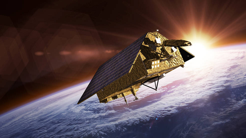
We look forward to launching upcoming Earth science missions including Sentinel-6 Michael Freilich that will study our oceans and @NASA_Landsat 9 that will continue global land observations.
We look forward to launching upcoming Earth science missions including Sentinel-6 Michael Freilich that will study our oceans and @NASA_Landsat 9 that will continue global land observations.
 thread. Thank you for following along! We look forward to launching upcoming Earth science missions including Sentinel-6 Michael Freilich that will study our oceans and @NASA_Landsat 9 that will continue global land observations." title="That completes our #EarthDay https://abs.twimg.com/hashflags... draggable="false" alt=""> thread. Thank you for following along! We look forward to launching upcoming Earth science missions including Sentinel-6 Michael Freilich that will study our oceans and @NASA_Landsat 9 that will continue global land observations.">
 thread. Thank you for following along! We look forward to launching upcoming Earth science missions including Sentinel-6 Michael Freilich that will study our oceans and @NASA_Landsat 9 that will continue global land observations." title="That completes our #EarthDay https://abs.twimg.com/hashflags... draggable="false" alt=""> thread. Thank you for following along! We look forward to launching upcoming Earth science missions including Sentinel-6 Michael Freilich that will study our oceans and @NASA_Landsat 9 that will continue global land observations.">


