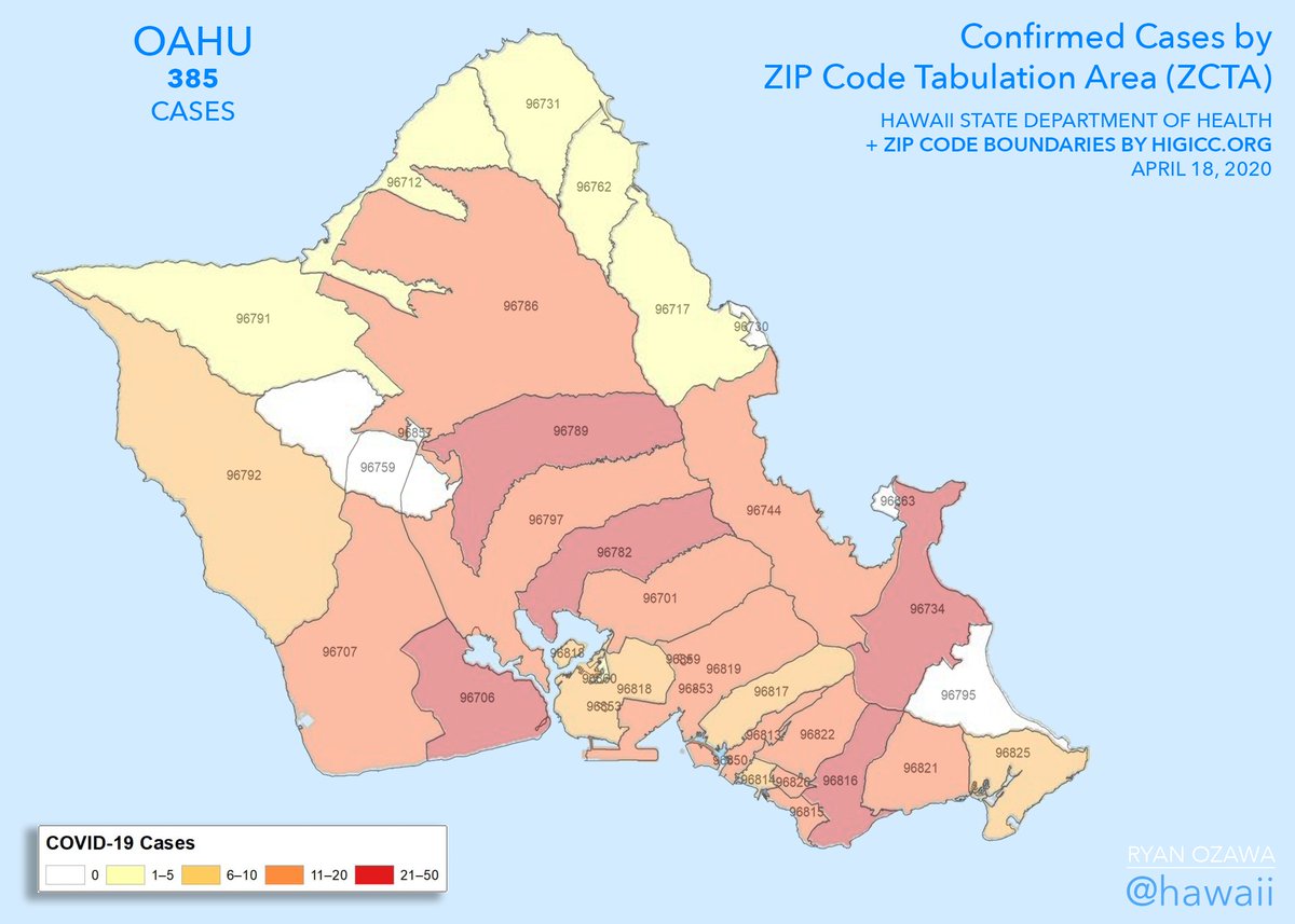
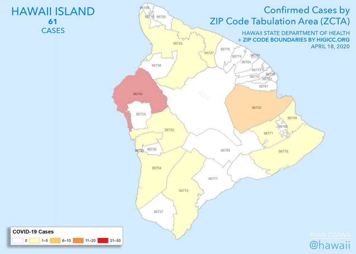
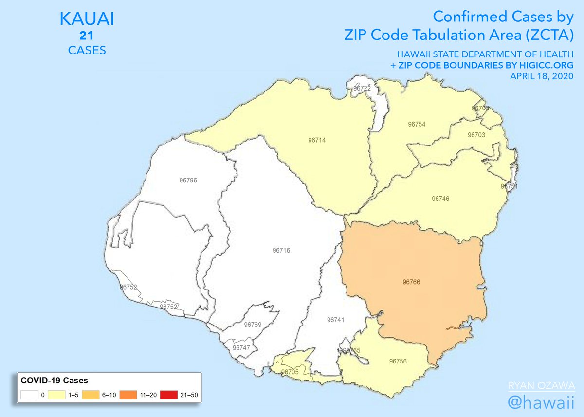
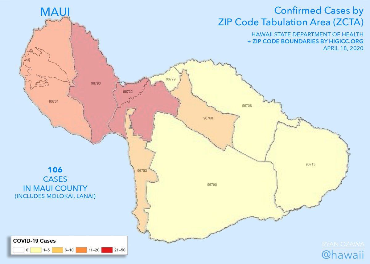
The Sunday map update brings a new mystery: what does it mean when an area gets lighter on the @HIgov_Health maps? Maps attached, commentary follows. #hawaiicovid19
Zones got lighter today. I didn& #39;t know the numbers could go down. So are these maps showing us cumulative counts? Or currently active cases? Are these changes just corrections? perhaps someone was counted in the wrong ZIP code?
After noting that Kauai& #39;s map hasn& #39;t changed since April 4, it changed today... even though there& #39;s no change in case counts. Not only that, but Hanapepe (96716) went from yellow to white. It lightened, from 1-5 cases to zero. A drop in active cases or a correction?
Only the DOH knows for sure.
On Oahu, Mililani (96789) darkened to the top range (21+ cases) today. Urban Honolulu (96813) darkened for the second straight day. But, Halawa/JBPPHH (96818) lightened, after darkening yesterday. How about that?
On Oahu, Mililani (96789) darkened to the top range (21+ cases) today. Urban Honolulu (96813) darkened for the second straight day. But, Halawa/JBPPHH (96818) lightened, after darkening yesterday. How about that?
On Hawaii Island, Honokaa (96727) darkened, from zero to 1-5 cases. But Waikoloa/Puako (96738) lightened, from 1-5 cases to zero. Huh. Only Maui& #39;s map didn& #39;t change today, by the way, but they had a rough week.
If you made it this far, enjoy the updated Oahu animated map.

 Read on Twitter


