
 Read on Twitter
1/14 Hello, Let me please intro myself: John Winterburn, Landscape and Modern Conflict Archaeologist
My paper will take you to southern Jordan, where I have been researching landscapes for 15 years. I hope you enjoy it. Today, I mainly look at the early 20th C
#PMAC20

My paper will take you to southern Jordan, where I have been researching landscapes for 15 years. I hope you enjoy it. Today, I mainly look at the early 20th C
#PMAC20
2/14 Planes, Trains, Automobiles & Archaeologists: Technology mediated engagements with a desert landscape.
The desert landscapes, of what is today southern Jordan, were defined by traders for millennia and pilgrims for centuries.
#PMAC20

The desert landscapes, of what is today southern Jordan, were defined by traders for millennia and pilgrims for centuries.
#PMAC20
3/14 These medieval landscapes were industrialised at the start of the twentieth century by a railway that radically changed the modality of travel in the region.
Conflict Landscape 1916-1918. British Empire plus Hashemite led Arab tribes against the Ottoman Empire.
#PMAC20

Conflict Landscape 1916-1918. British Empire plus Hashemite led Arab tribes against the Ottoman Empire.
#PMAC20
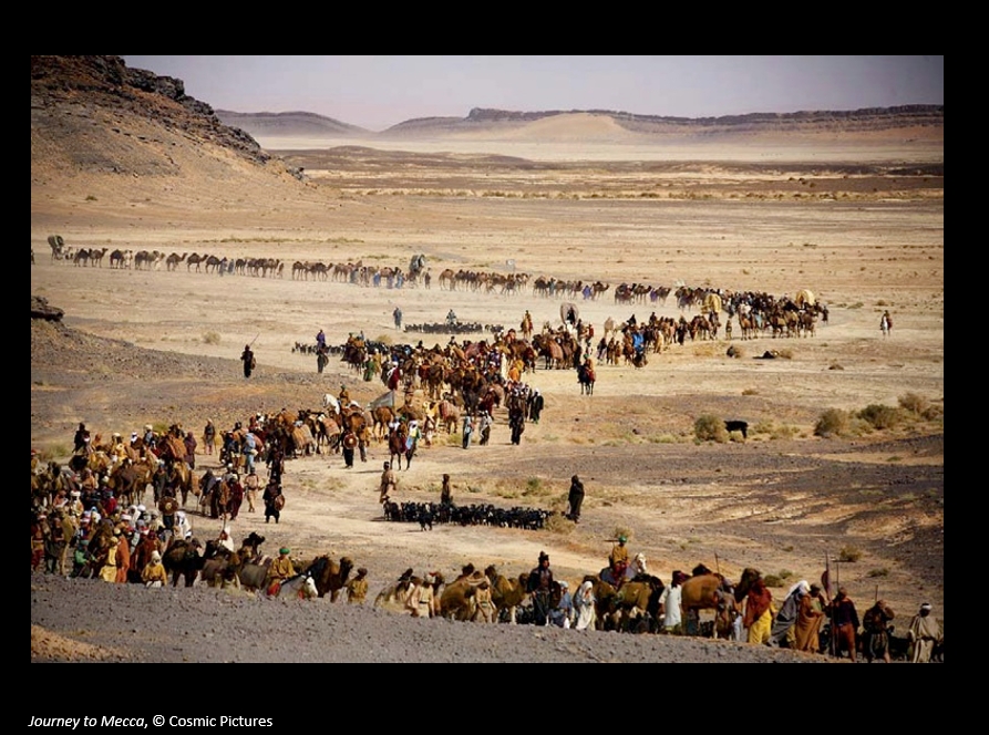
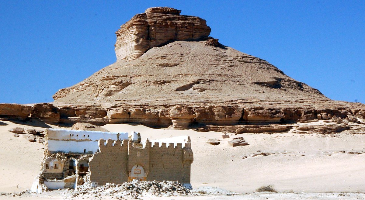
4/14 Hajj pilgrims travelled to Mecca, on the Syrian hajj route, for centuries. Wayfaring across the landscape. The Ottomans built forts for their protection and pilgrims went from fort to fort over 40 days.
For more on Ottoman Hajj Forts see: https://bit.ly/PMAC20_3
https://bit.ly/PMAC20_3&... href="https://twtext.com//hashtag/PMAC20"> #PMAC20
For more on Ottoman Hajj Forts see: https://bit.ly/PMAC20_3
 #PMAC20" title="4/14 Hajj pilgrims travelled to Mecca, on the Syrian hajj route, for centuries. Wayfaring across the landscape. The Ottomans built forts for their protection and pilgrims went from fort to fort over 40 days. For more on Ottoman Hajj Forts see: https://bit.ly/PMAC20_3&... href="https://twtext.com//hashtag/PMAC20"> #PMAC20">
 #PMAC20" title="4/14 Hajj pilgrims travelled to Mecca, on the Syrian hajj route, for centuries. Wayfaring across the landscape. The Ottomans built forts for their protection and pilgrims went from fort to fort over 40 days. For more on Ottoman Hajj Forts see: https://bit.ly/PMAC20_3&... href="https://twtext.com//hashtag/PMAC20"> #PMAC20">
5/14 The Hejaz Railway completed by 1908 transported pilgrims from Damascus to Medina in 4 days. For the first time, wheeled transport in remote areas and passengers carried through the landscape at speed. Pilgrims removed from direct contact with the landscape.
#PMAC20


#PMAC20
6/14 Trains removed engagement with landscape and changed the environment for pilgrims. No longer travelling through landscape but above and across.Bodily experiences, replaced by the industrial smell of coal & “click-clack,” of wheels, a reminder of speed and distance.
#PMAC20

#PMAC20
7/14 British & Ottoman empires clash in 1916-1918. Railway threatens Brits & Otts defend landscape. Rolls Royce armoured cars and aeroplanes arrive for first time in medieval landscape. Planes extend & #39;landscapes& #39; into 3rd dimension.
#PMAC20


#PMAC20
8/14 Ottoman defences first recorded on sketch maps made by British pilots in 1917 These enabled me to use satellite imagery to & #39;re-locate& #39; the archaeology and program coordinates into hand-held GPS units which were taken into the field. Technology mediating engagements
#PMAC20


#PMAC20
9/14 Satellite imagery enabled old image (1918)of Rolls Royce cars to be found. GPS guided us to the remote location. Archaeology on the surface included rum jars, Bristol cigarette tins, spark-plugs and gin bottles and ammunition cases.
#PMAC20
of Rolls Royce cars to be found. GPS guided us to the remote location. Archaeology on the surface included rum jars, Bristol cigarette tins, spark-plugs and gin bottles and ammunition cases. #PMAC20")
of Rolls Royce cars to be found. GPS guided us to the remote location. Archaeology on the surface included rum jars, Bristol cigarette tins, spark-plugs and gin bottles and ammunition cases. #PMAC20")
of Rolls Royce cars to be found. GPS guided us to the remote location. Archaeology on the surface included rum jars, Bristol cigarette tins, spark-plugs and gin bottles and ammunition cases. #PMAC20")
#PMAC20
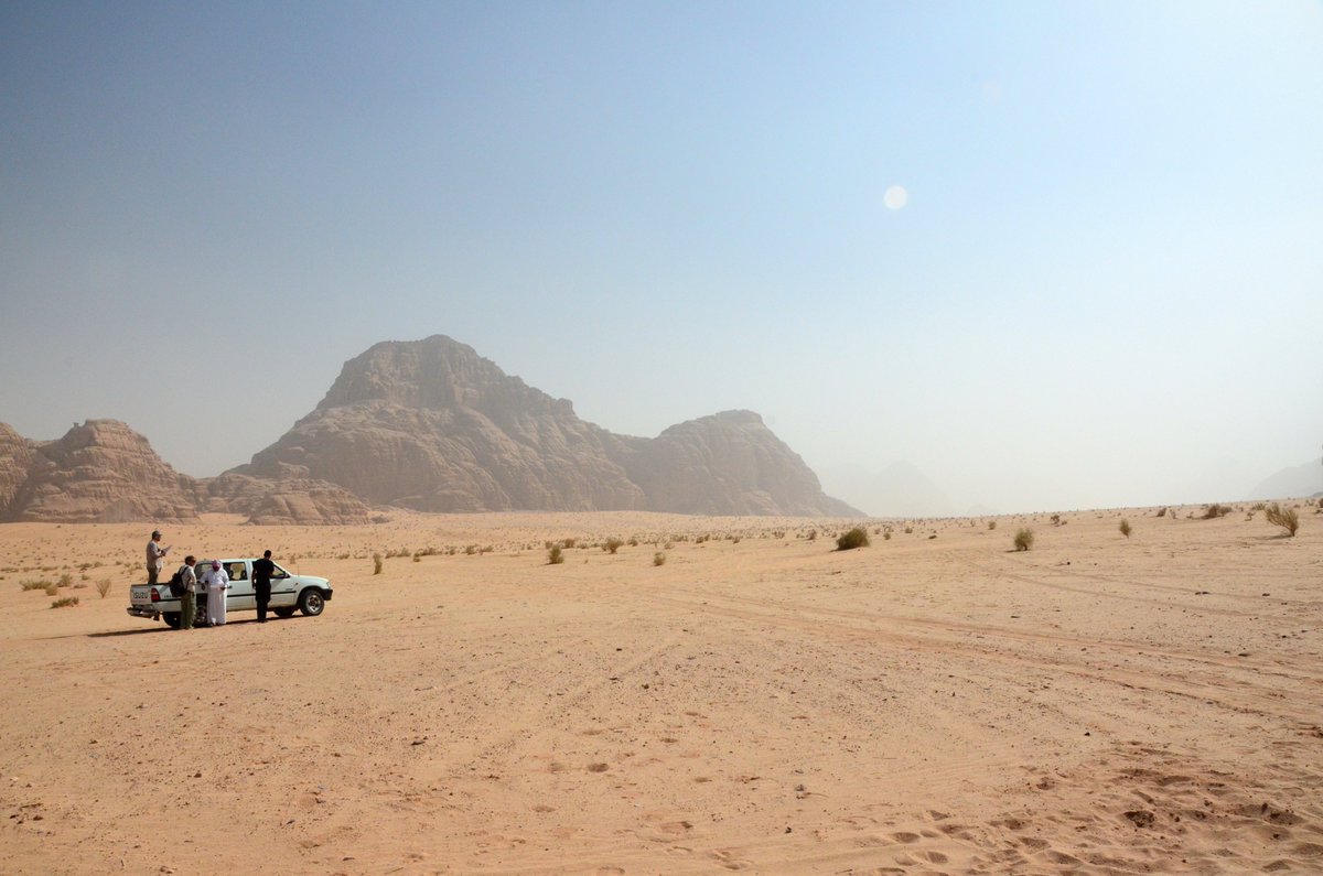
10/14 Using satellite imagery I can search for archaeol in Jordan from home. Flying over the landscape allows me to see things pilots in 1918 experienced. Autos and trains also used to explore. The more tech you use- fewer senses engaged
See https://bit.ly/2RJBftN
https://bit.ly/2RJBftN&q... href="https://twtext.com//hashtag/PMAC20"> #PMAC20
See https://bit.ly/2RJBftN
 #PMAC20" title="10/14 Using satellite imagery I can search for archaeol in Jordan from home. Flying over the landscape allows me to see things pilots in 1918 experienced. Autos and trains also used to explore. The more tech you use- fewer senses engagedSee https://bit.ly/2RJBftN&q... href="https://twtext.com//hashtag/PMAC20"> #PMAC20" class="img-responsive" style="max-width:100%;"/>
11/14 Early Hajj pilgrims fully engaged with landscapes, using tracks, stars and cairns to navigate. Are archaeologists also pilgrims? We walk landscapes toward a goal, enthuse our work, endure hardship, have purpose to understand and return home enlightened.
#PMAC20
#PMAC20
12/14 The ‘archaeological pilgrimage, walking landscapes establishes a connection with travellers. You experience sights, sounds, smells and textures that are often removed by technology-mediated engagements.
#PMAC20
#PMAC20
13/14 Technology mediates engagements with landscapes. It gives reference to locations, mobility to find & tools to record archaeology. It removes our corporeal engagement & some senses. To paraphrase Hoskins. there is no substitute for & #39;getting one’s boots dusty& #39;
#PMAC 20

#PMAC 20
14/14 Jordan is a great country, wonderful people, amazing archaeology and landscapes. Please put a visit on your bucket list. Here are a few Post Med Arch images.
And some further reading https://bit.ly/2RO10ZK
Thanks">https://bit.ly/2RO10ZK&q... for reading.
#PMAC20


And some further reading https://bit.ly/2RO10ZK
Thanks">https://bit.ly/2RO10ZK&q... for reading.
#PMAC20


