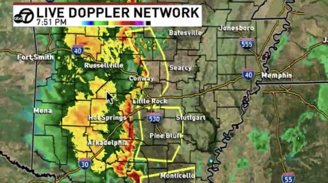
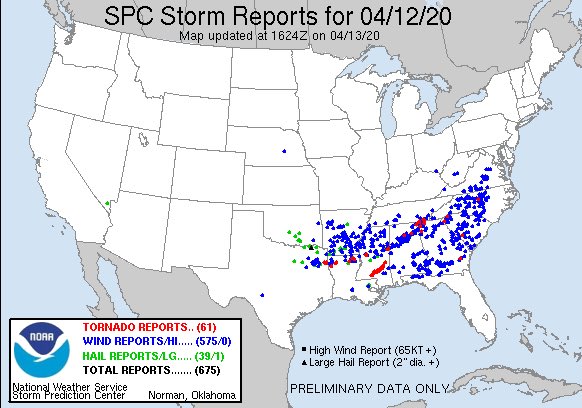
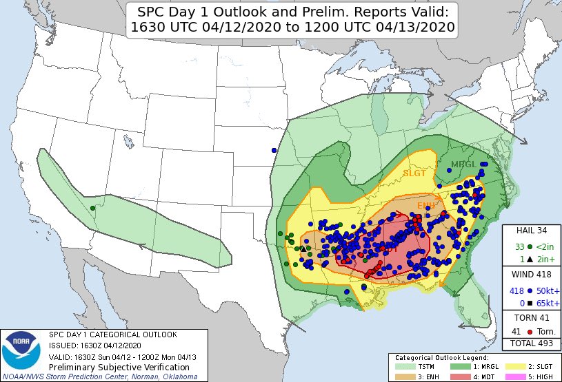
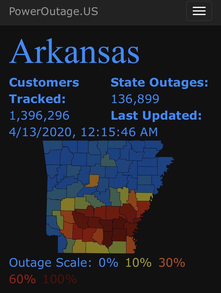
THREAD: We saw widespread damaging winds yesterday. The number of wind reports would place this event in the top tier of wind events we’ve had in this state. Ive been doing some reading & here are some technical reasons that led to so much damage. I’m about to get REAL technical:
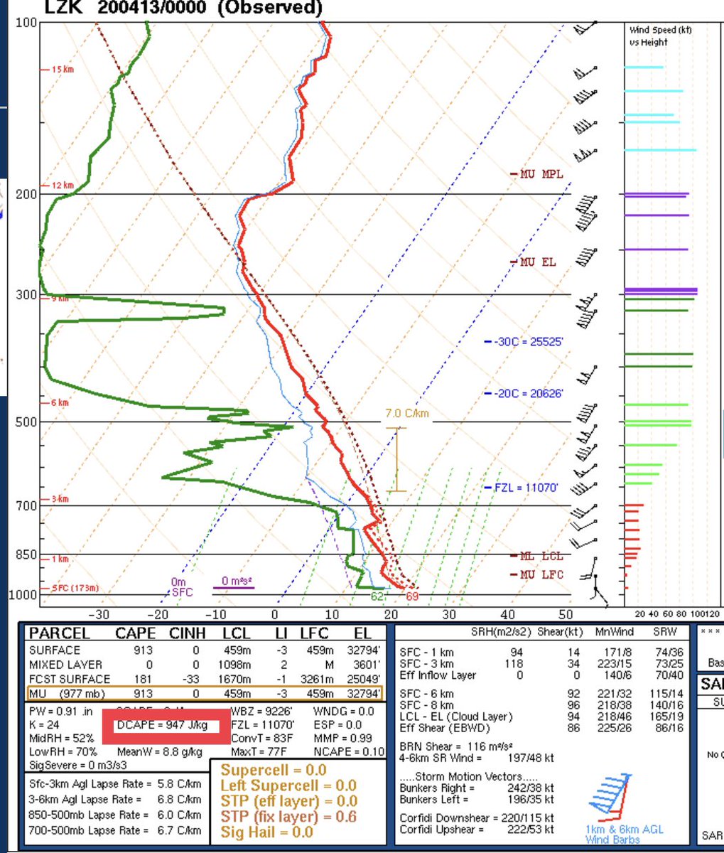
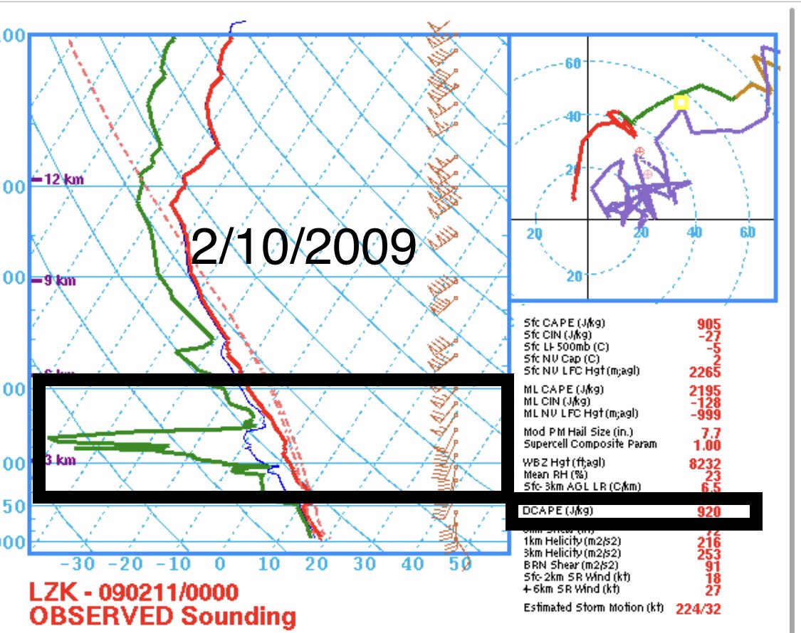
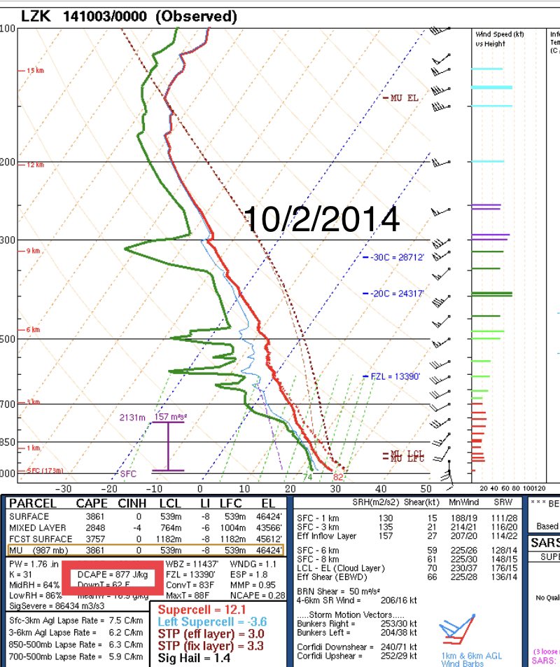
Yesterday mornings storms no doubt led to some stabilization, but sunshine and a little bit of moisture recovery led to just enough instability for a big severe threat Sun PM. One thing that caught my eye was the presence of downdraft CAPE in the evening sounding at LZK yesterday
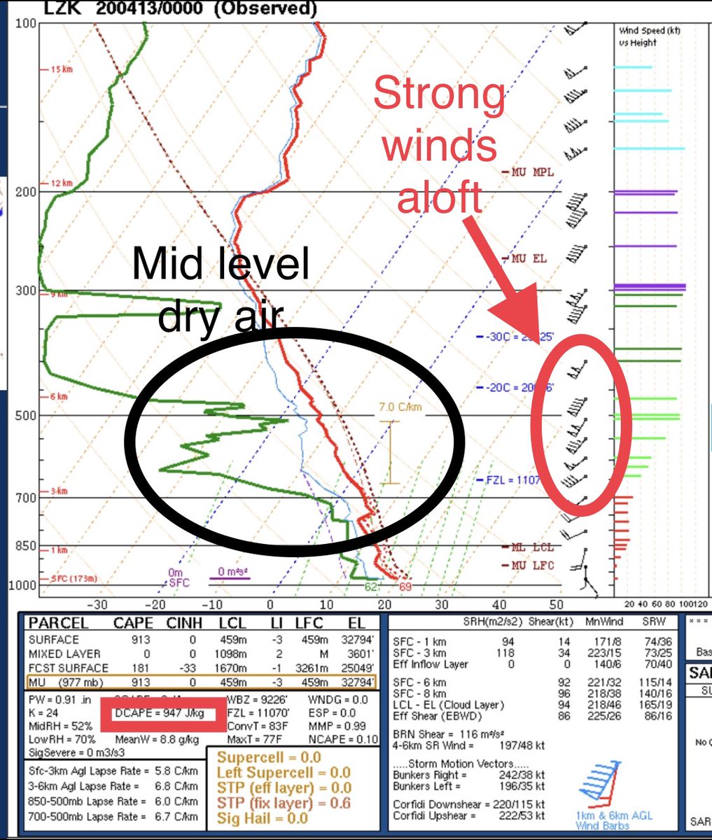
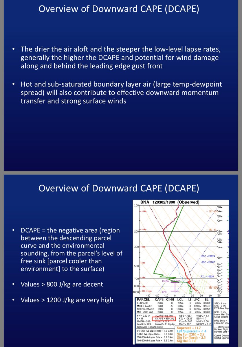
Downdraft CAPE is an index that helps meteorologists assess the potential for damaging winds. This index goes up when more dry air is present aloft (3-7km) that corresponds with a pocket of strong winds that could be transported downward by strong convection (storms).
There was a strong push of dry air at the mid levels corresponding the the base of the trough and an area of low pressure that was moving through the state. Winds aloft in this region were 40-80kts. A pocket of midlevel dry air is usually present on high end severe weather days.
Evaporational cooling occurs when water evaporates falling through a dry layer of air. This process in a strong thunderstorm can transport winds aloft at those levels to the surface. Many gusts last night across Arkansas reached 40-60 MPH, with spotty areas of 70-90 MPH noted.
The dry air aloft lead to an increase in downdraft CAPE values at Little Rock and points south ~1000 J/kg. These values are anomalously high and represented the significant potential for downward transport of strong winds.
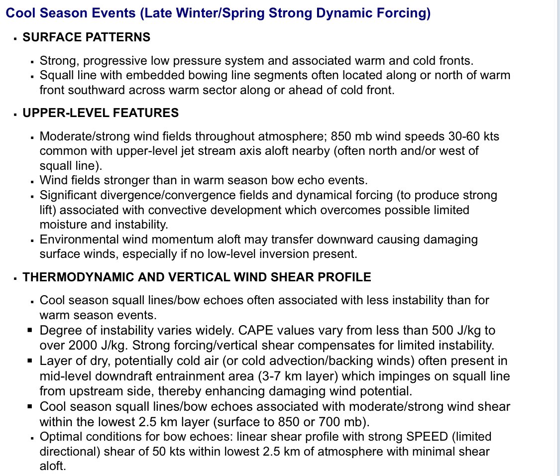
We checked off many boxes on the list of ingredients needed for widespread damaging winds. Even though we didnt have tons of instability, the strong forcing along the pacific cold front/dry air aloft compensated for this. Low level winds werent strong, but we overcame this too...
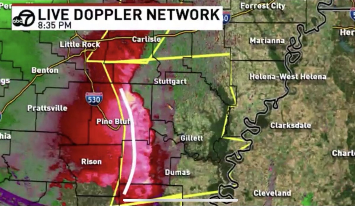
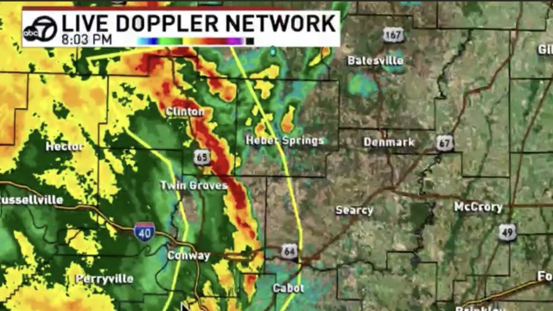
So storms quickly formed into a strong line & took advantage of the parameters over us, especially in southern parts of the state. Along the line certain areas “bowed” out. We saw the presence of a rear inflow jet along these areas which is where we saw the worst wind damage.
Let’s compare this to other Arkansas widespread wind damage events:
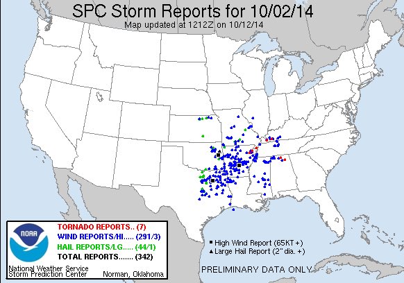
Significant “cool season” events like 2/10/2009 or 10/2/2014 each had downdraft CAPE values >800, enough for damaging winds, but last nights parameters were slightly better than these.
Significant “cool season” events like 2/10/2009 or 10/2/2014 each had downdraft CAPE values >800, enough for damaging winds, but last nights parameters were slightly better than these.
When compared to some more recent warm season derechos (long lived wind events), Dcape parameters were similar to last night, but with more instability due to summer air masses.
For reference: 7/20/2018 (tons of damage in central AR) had a downdraft cape parameter of ~1500 j/kg
For reference: 7/20/2018 (tons of damage in central AR) had a downdraft cape parameter of ~1500 j/kg
Also: Low level shear was fairly weak last night which is why it appears brief tornadoes didn’t develop along the leading edge of bows like we have seen in other past events like this. There was some rotation at times, but nothing was ever able to truly become tornadic.
ALL of this to finally say that last nights setup realized its full potential. Storms were able to transport strong winds aloft right to the ground over a large area. Hindsight is 20/20, but given the setup that’s about as bad as it could’ve been without having any tornadoes.
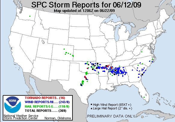
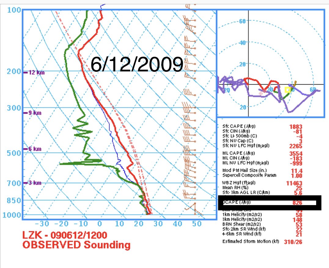
Soft/wet ground made it worse, but given the number of wind reports/extent of damage + the fatality, I’d place this event up there with the top wind producing events in Arkansas in the last 20 years. For Arkansas it’s right on par with 7/20/18, 6/12/2009, 4/4/2011, and 4/15/2011.
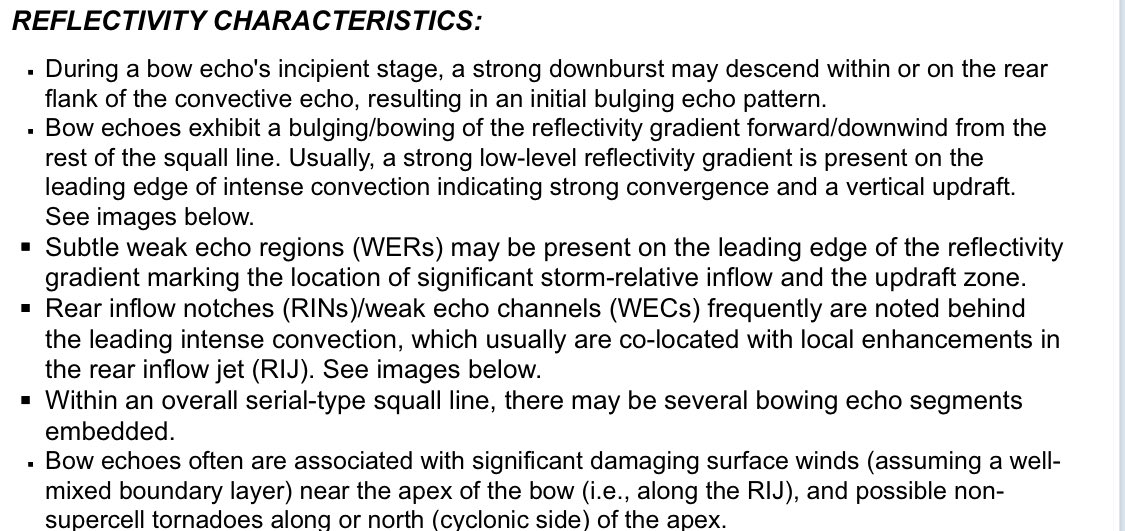
Some references: https://www.weather.gov/lmk/squallbow
https://www.weather.gov/lmk/squal... href=" https://www.weather.gov/media/lmk/soo/DCAPE_Web.pdf">https://www.weather.gov/media/lmk...

 Read on Twitter