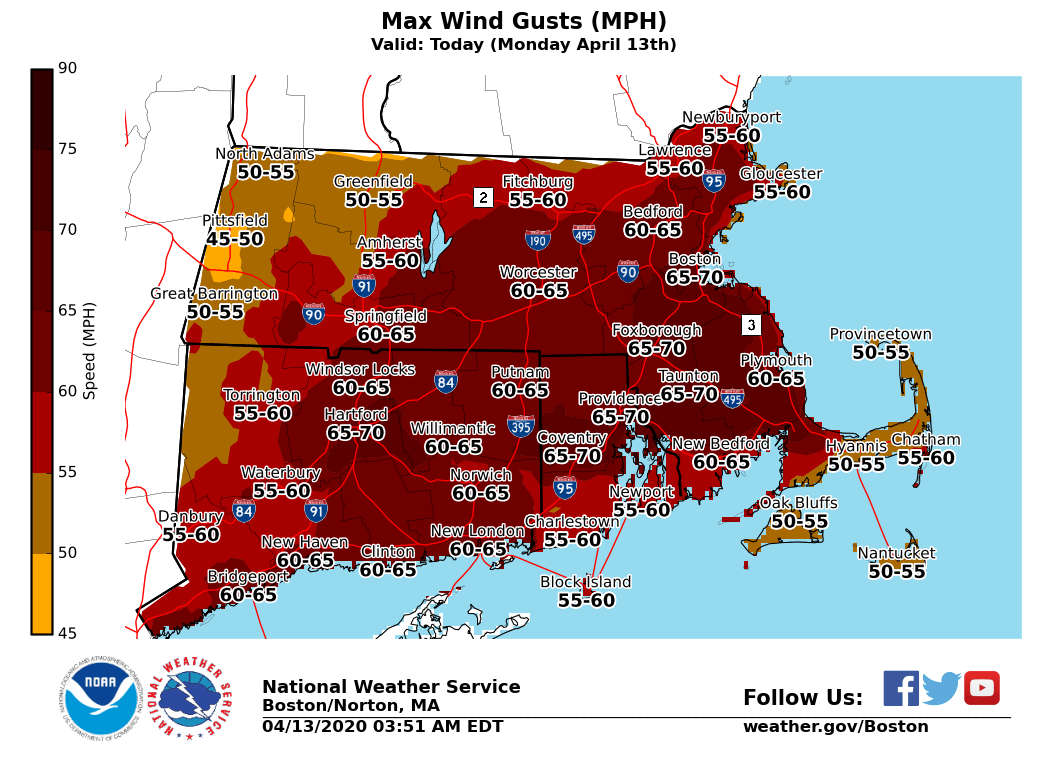
(1/1) A thread about wind. Here are the possible peak wind gusts this afternoon/early eve. Definitely some damage potential.
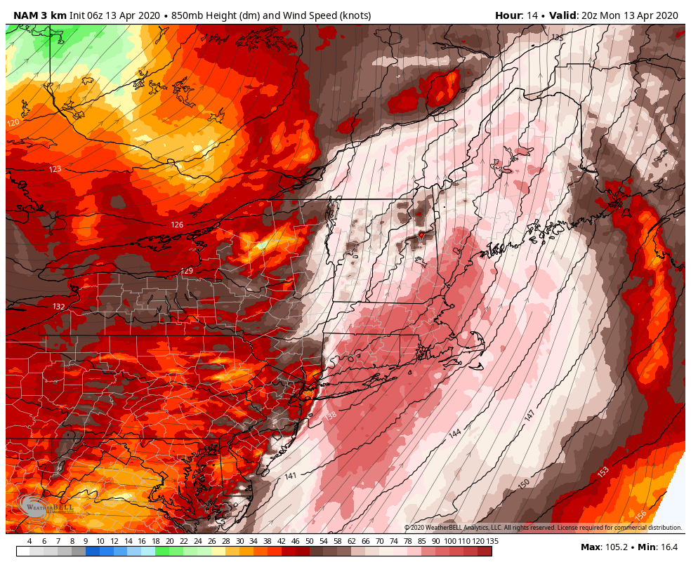
(2/2) The strong winds are found in a low-level jet roaring several thousand feet above our heads. There are two ways to bring it down to where we live. 1) Mixing where air temp at surface warms to as warm/warmer as what's aloft 2) Convection (storms) drag it down
(3/5) The reason peak gusts look a little lower on the south coast is because wind off the water brings cooler temps this time of year = a bit more stable than inland areas that will be 5-8F warmer
(4/5) It's tough to get exceptional south winds here. Normally, I'd take about 25% off the low-level jet. That's still a lot of wind. Gusts over 50mph can certainly take down trees/lines. Peak wind will be with peak temps & storms around (about 1p to 7p)
(5/5) As for the type of wind...you'll see it in fits in spurts instead of constant strong wind today. Gradually getting more bursts down to the ground as we head into the afternoon. It'll be a battle against that warmer air aloft and seeing how many downpours/storms develop
You can follow @ericfisher.
Tip: mention @twtextapp on a Twitter thread with the keyword “unroll” to get a link to it.

Latest Threads Unrolled: