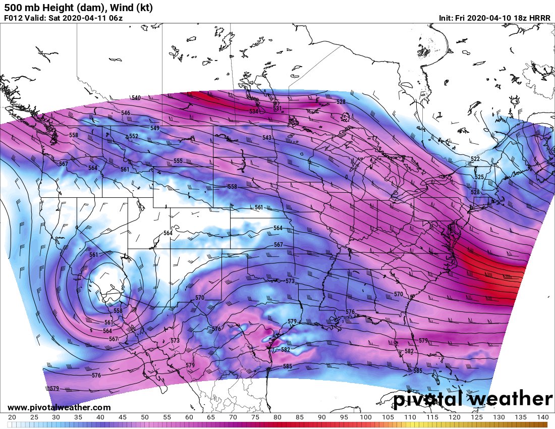
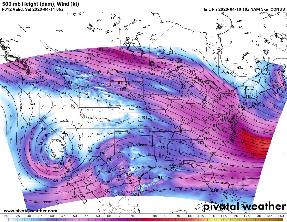
Time to talk about the Saturday sleeper day. Biiiig model divergence only 24 hours ahead, always a fun kind of event to disco.
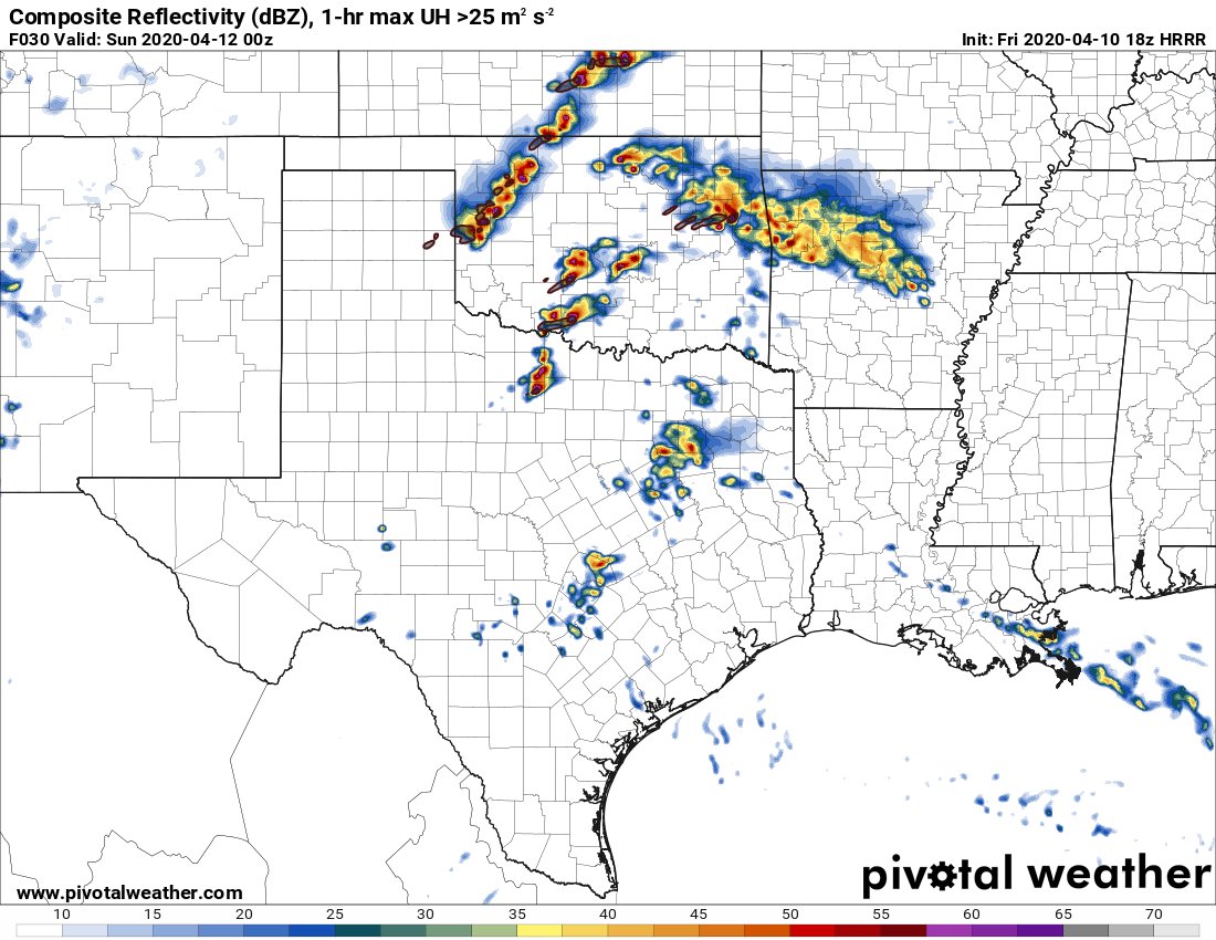
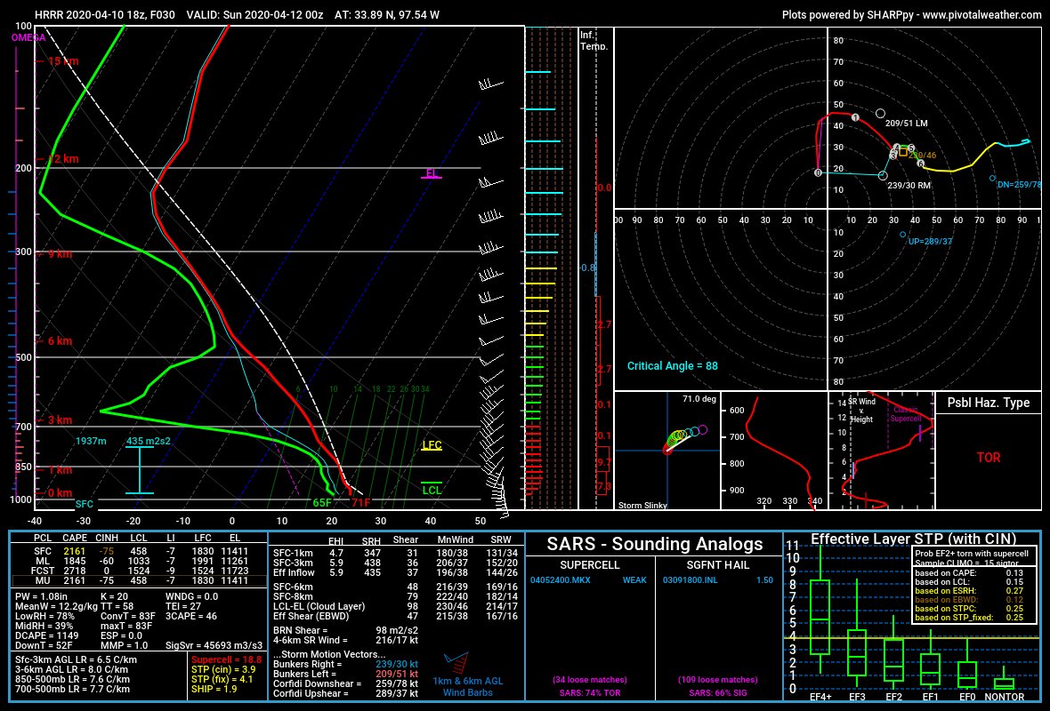
Let& #39;s start with the HOLY SMOKES +/-F5 WEJJFEST perspective, cause it& #39;s fun to build up hype and then give it the ol& #39; arrow to the knee. The ever-reliable storm printer is going HRRR once again, advecting MID 60S dews up to the KS border by 0z with impressive backing in S OK.
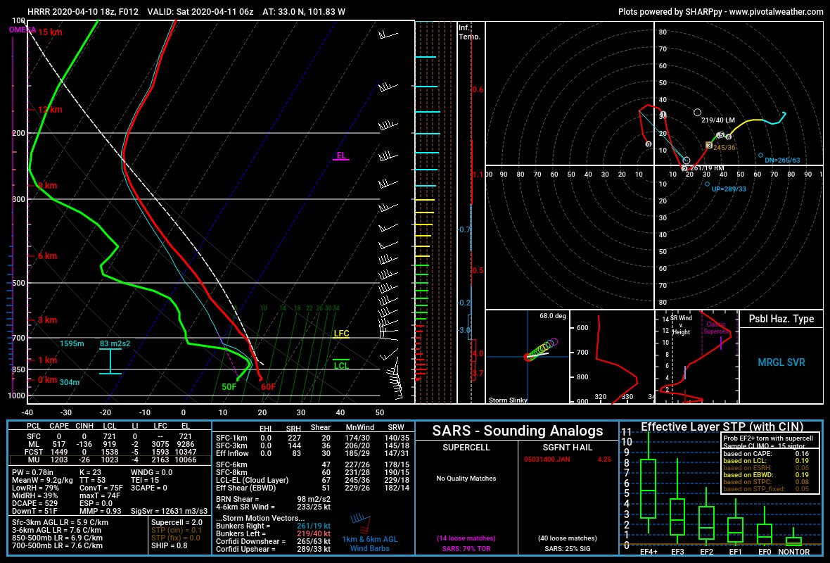
From south of Ardmore. CAPE in the bottom of the sounding is ehhh but not bad aloft, and the hodograph is one you& #39;ll want to pin up on your wall. *chef kiss* it& #39;s just ~sublime~. This is a tornadic supercell sounding.
How do we get here? As seen in the dewp gif, rapid moisture transport from N TX into OK after 13z Sat. Culprit? LLJ at 850 and below that develops over the day in response to the 500mb jet nosing in and deepening a low over SE CO. Textbook OK tornado setup.
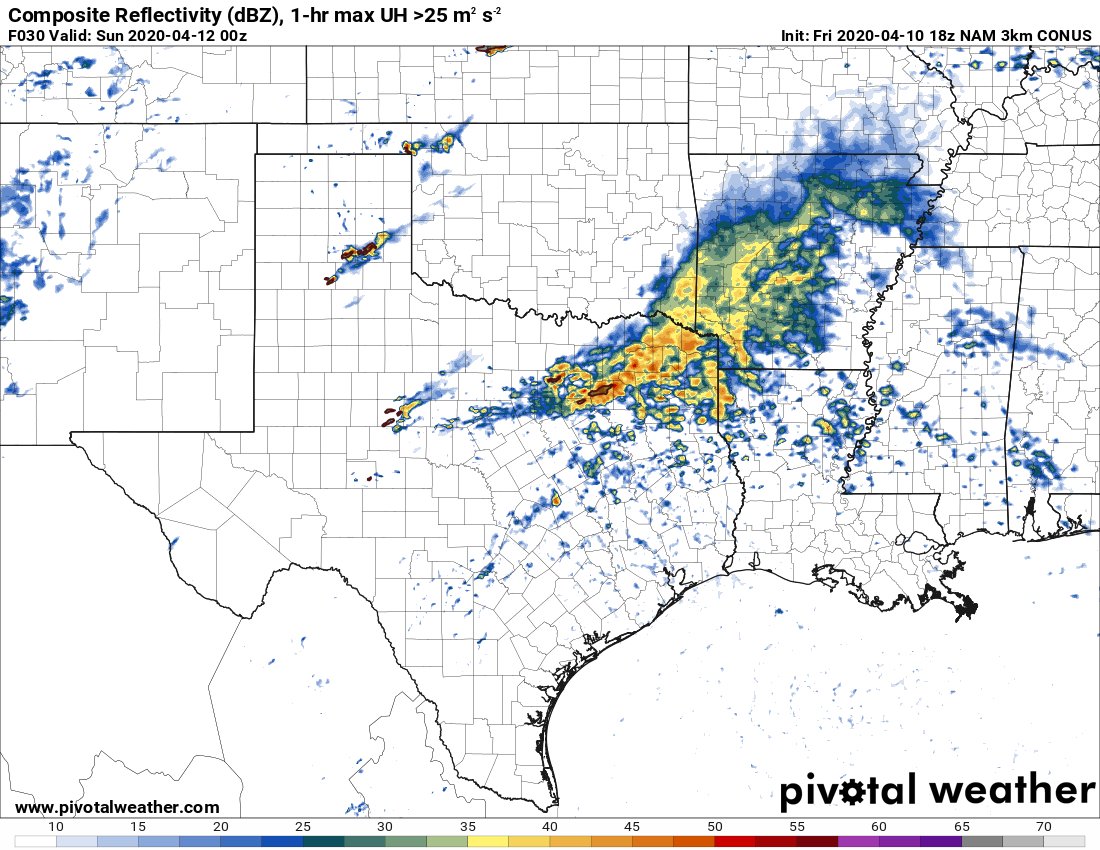
And so, we turn to the model reflectivity. Gonna use this part of the threat as a reminder that models are a fantasy future, not reality. One of many potential futures.
wellthatescalatedquickly.gif
So, tl:dr - the HRRR is raring to go big bad wolf on us here in OK tomorrow with an environment primed for isolated supercells and potentially tornadoes. Big moisture transport, fantastic kinematics, solid CAPE. This isn& #39;t the end of the story though.
On the other end of the spectrum here, we have the 3km NAM. 60+ dewps actually retreat away from the Red River valley during the daylight hours amidst 10-15kt surface SSE winds, while a thin area of moisture return exists in far SW OK. Not exactly supportive of supercells.
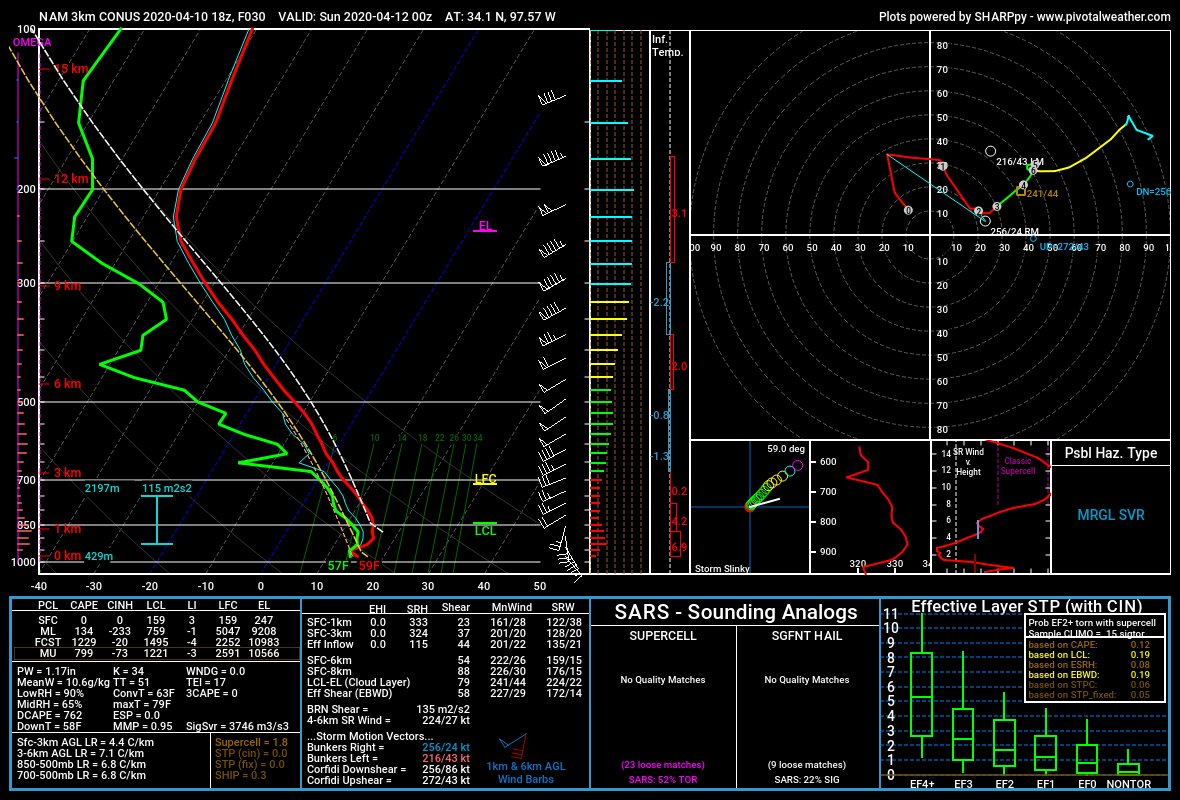
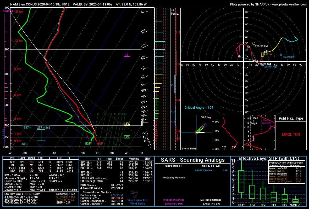
Lets compare the sounding S of Ardmore. No surface based CAPE, with an inversion noted above 900mb. Hodograph is sloppy - quite a noticeable weakness between 1-3km, any storm that forms here will be elevated and likely won& #39;t be spinning.
But what about the LLJ strengthening following the deepening of the low in CO? Doesn& #39;t even make it to OK, stops cold south of the Red River - right along where the dewps were retreating. Hmm.
The culprit is an age-old foe of storm chasers: elevated morning convection. Overnight storms SW of Lubbock grow upscale overnight, powered by the LLJ. This MCS chugs along just south of the Red River, gobbling up that primed environment and leaving behind a beefy cold pool.
So if this convection is the key difference between the models, why does it form in one and not the other? 500mb winds and heights are nearly identical between the two, suggesting a sneaky shortwave isn& #39;t the culprit.
Checking soundings, we see a potential subtle difference. The HRRR has less moisture at 1km AGL, leading to less MUCAPE. Perhaps ascent in the HRRR fails to fire elevated storms because of this. Also a bit more lift aloft on the 3kmNAM than the HRRR, and a stronger LLJ.
So what does this mean? Personally, I& #39;d lean on the 3kmNAM solution here. The other hi-res models support initiation and upscale growth in N TX, limiting N extent of moisture. HRRR not initiating also seems unrealistic - synoptic ascent is favored by the nose of the jet there.
Thus, we are left with a forecast. Though I expect overnight convection to stop afavorable environment from reaching OK, weaker/less widespread morning convection in the Red River valley could allow supercells to form in S OK tomorrow evening. Watch obs carefully tomorrow AM!

 Read on Twitter