Exploring the conditional threat for tornadic supercells across a rare SPC Day 3 Moderate Risk:
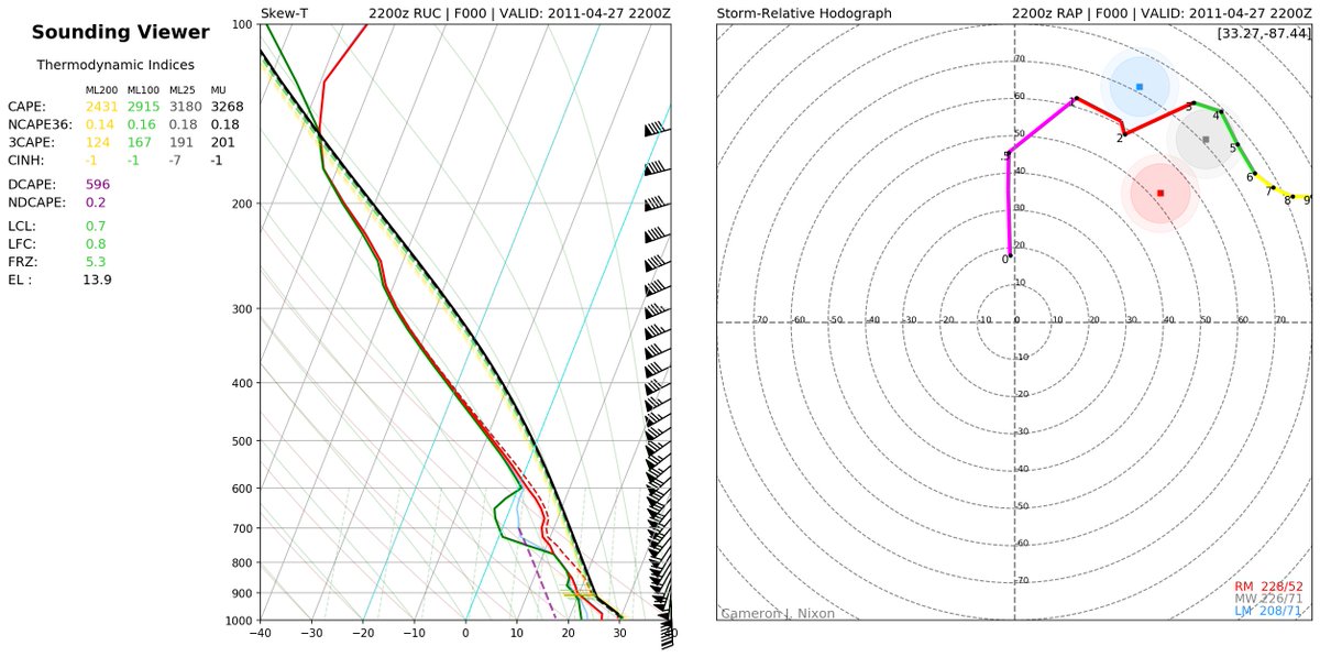
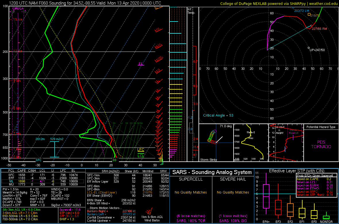
Though not quite 4/27/11 (left: Tuscaloosa), even global models unanimously feature environments analogous to long-lived, powerful tornadoes over an expansive spatiotemporal area.
Though not quite 4/27/11 (left: Tuscaloosa), even global models unanimously feature environments analogous to long-lived, powerful tornadoes over an expansive spatiotemporal area.
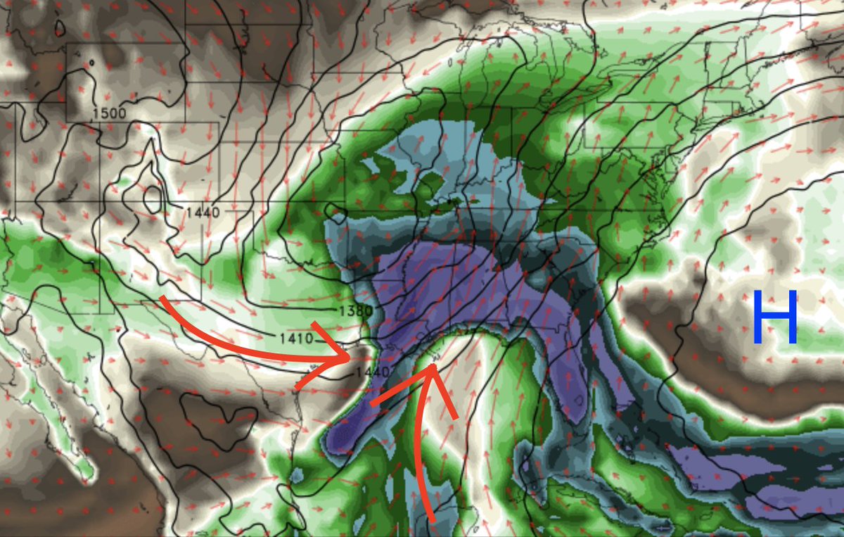
Given current signals, it appears 3 main spatial regimes may transpire:
1) a strong main mid-level shortwave moving through the northern outlook area
2) an expansive low-level prefrontal convergence zone
3) a Pacific Front which could pose a threat for the western outlook area
1) a strong main mid-level shortwave moving through the northern outlook area
2) an expansive low-level prefrontal convergence zone
3) a Pacific Front which could pose a threat for the western outlook area
1) This mid-level shortwave will likely be driven by the mixed-mode convection it initiates in the TX Hill Country overnight and quickly align itself roughly shear-parallel. As it amplifies, it will likely continue being a source for forced linear convection with QLCS hazards...
Though this quasi-"cold-core" regime will generate the highest CAPE, shear-parallel forcing and straight hodos, as well as a deep moist-adiabatic layer coincident with strongest synoptic ascent, will heavily discourage supercell growth and propagation off this feature.
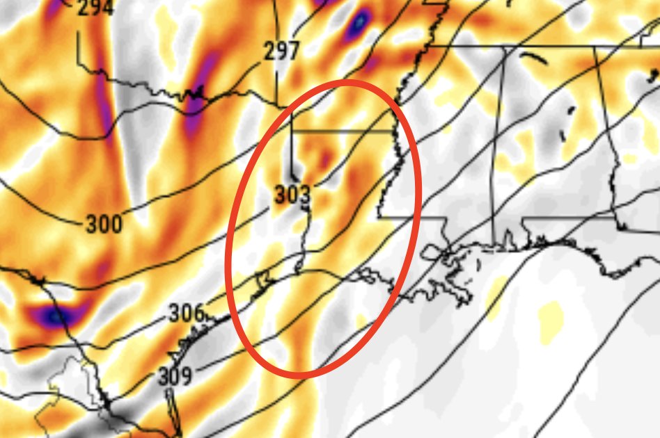
2) This moisture-laden pre-frontal convergence zone is well-advertised, due to its origins as the synoptic convergence between the crashing Pacific front and an expansive subtropical high. This is predominantly an off-the-deck (not surface) feature...
Initiation of storms hinges on the degree of stout capping from a prolonged downslope flow over the Mexican Plateau, with strong low-level advective flow pulling this warmth into the warm sector...
Given (likely) cloudiness and perhaps strong 850mb convergence, it is possible that elevated convection is most likely at least initially, before forcing encourages more of a linear/mixed-mode evolution. If supercells do "break the cap" initially, tornado threat will be realized.
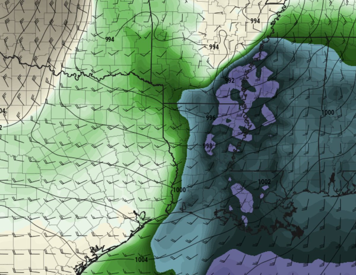
3) Many big Dixie Alley days feature a Pacific Front. For this event, one exists, but GFS/NAM suggeest it may become "washed out" during the day if the sfc low develops substantially far ahead of it, veering the winds and weakening convergence across it (theta-e shown)...
With this solution, initiation of storms off this feature is unlikely, and if it does happen, some signal for "folded" low-level hodographs (within in strong, amplified upper-level flow and behind the main low-level jet) may discourage quick development of storms into supercells.
However... ECMWF advertises a small but potent extension of the main shortwave down south into the pacific front regime, resulting in a completely different story. With amplification of low-level flow to support large hodos from the start, this is lkly the worst-case scenario....
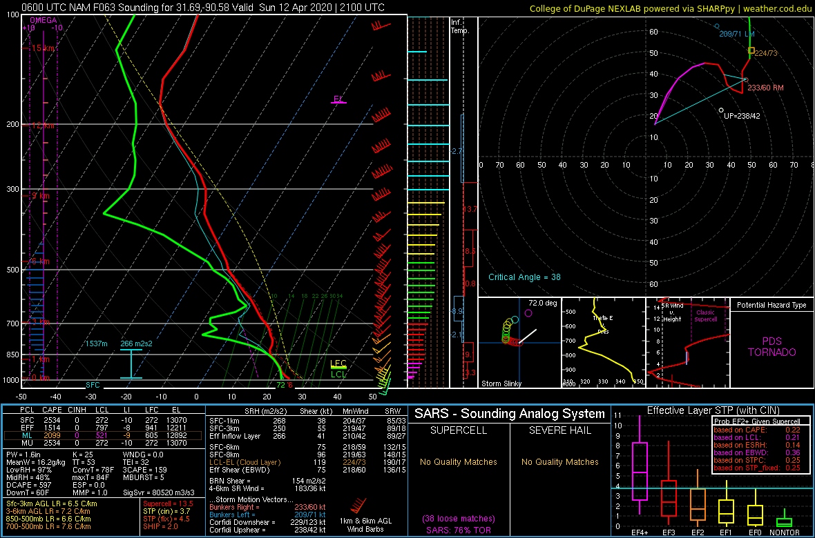
In this regime, models have unanimously advertised the most "balanced" character with respect to low-level capping and hodographs. *Should* this area be utilized (which is far from unanimous), a "classic" outbreak of supercells with long-tracked, powerful tornadoes is possible.
Predictability for the evening/overnight event (esp. eastern AL into the rest of the outlook area) may be a bit higher, with a linear/mixed-mode event dominating esp. if linear convection from main shortwave phases with prefrontal zone. Typical QLCS hazards will then ensue.

 Read on Twitter