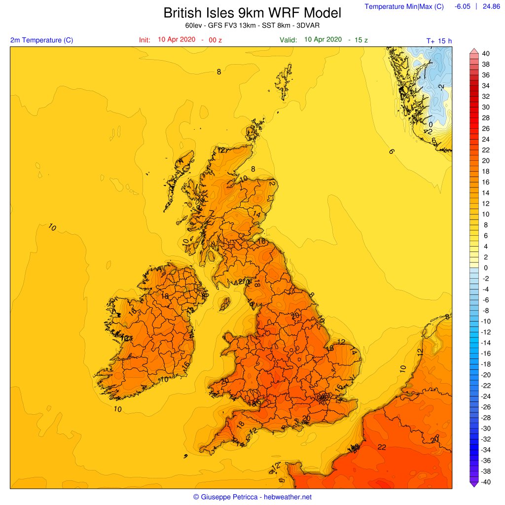
[Thread] 1/4 - #Friday #WRF - Today has been a warm day all over the #UK and #Ireland, due to S currents bringing warmer air towards the #BritishIsles. Many stations over 23°C as of now
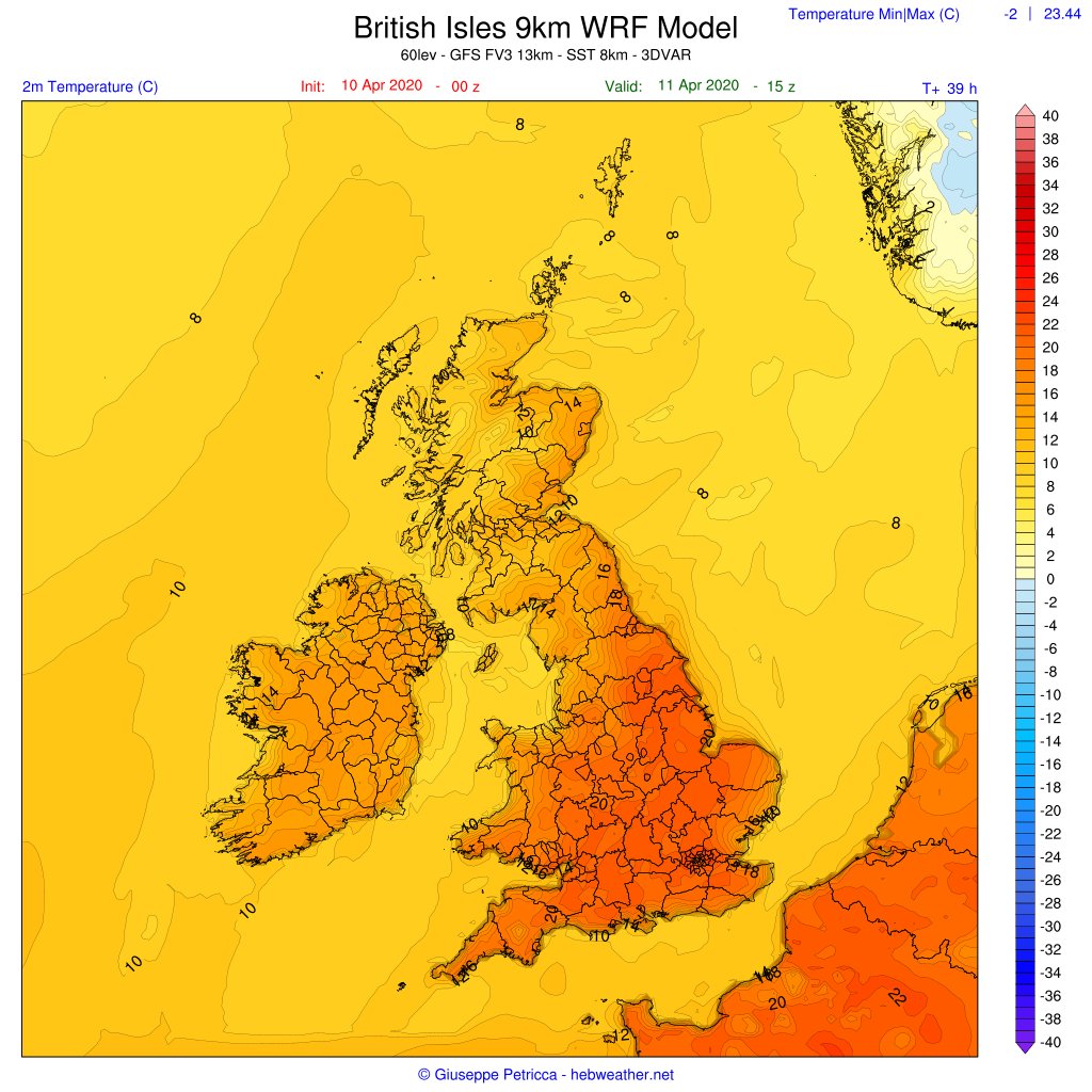
This will change from tomorrow, when a cooler airmass will approach from the NW.
This will change from tomorrow, when a cooler airmass will approach from the NW.
2/4 - The cooler air will make more of an impact on the maximum temperatures in the NW #UK, #Scotland and #Ireland, while the rest of the country will see values similar to today.
Precipitations will be patchy while winds will me mostly calm today, increasing in the N tomorrow.
Precipitations will be patchy while winds will me mostly calm today, increasing in the N tomorrow.

 Read on Twitter

![4/4 - Peak winds ~30+mph for #Scotland N side, especially over #Hebrides #Orkney #Shetland with the transit of two consecutive throughs, one smaller and weaker (2nd map), and one a bit more structured.Pressure will continue decreasing, nothing out of the ordinary. [End Thread] 4/4 - Peak winds ~30+mph for #Scotland N side, especially over #Hebrides #Orkney #Shetland with the transit of two consecutive throughs, one smaller and weaker (2nd map), and one a bit more structured.Pressure will continue decreasing, nothing out of the ordinary. [End Thread]](https://pbs.twimg.com/media/EVQCuviUwAAPPLm.jpg)
![4/4 - Peak winds ~30+mph for #Scotland N side, especially over #Hebrides #Orkney #Shetland with the transit of two consecutive throughs, one smaller and weaker (2nd map), and one a bit more structured.Pressure will continue decreasing, nothing out of the ordinary. [End Thread] 4/4 - Peak winds ~30+mph for #Scotland N side, especially over #Hebrides #Orkney #Shetland with the transit of two consecutive throughs, one smaller and weaker (2nd map), and one a bit more structured.Pressure will continue decreasing, nothing out of the ordinary. [End Thread]](https://pbs.twimg.com/media/EVQCvKyUYAUIu2b.jpg)


