Good Morning – I’ll be your guide today on this tour. I have been an archaeologist for MOD on Salisbury Plain for over 15 years now. We’ll see some highlights but please do tweet your own photos, drawings, films, links and objects that this prompts #SPTAarchaeology
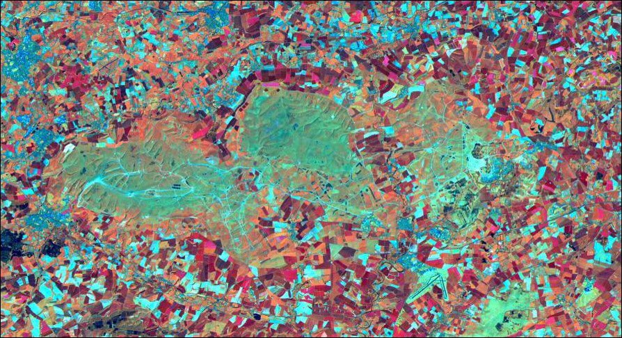
MOD has owned parts of the Plain since 1897 – and this is the reason for its preservation; no deep ploughing, fewer houses and road schemes. This satellite image demonstrates the case with the lack of fields and development #SPTAarchaeology
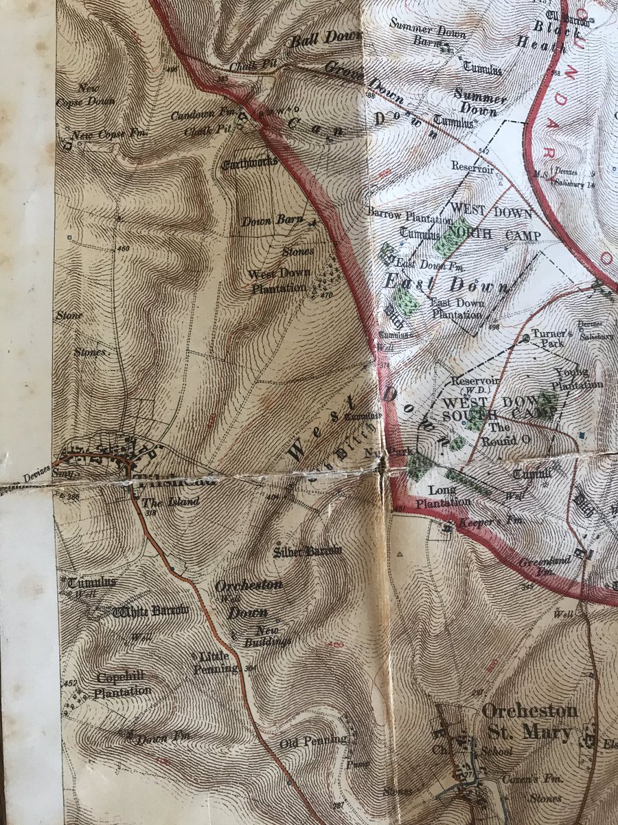
Today we are on the WEST of the Plain – the most restricted access. This area was bought later than others so not appearing on the 1906 military map. Another restriction – metal detection is prohibited on military training land perhaps for obvious reasons (BANG) #SPTAarchaeology
We start from Westdown Camp and will use the modern military map to guide us round. When you see a Number in brackets such as [1] this refers to a stop marked on the map. Lets go! #SPTAarchaeology
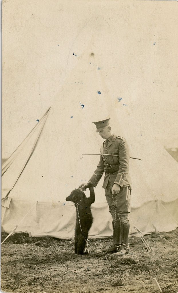
Driving through Tilshead and a first stop [1]. On our right, the village Hall – Canadian HQ for the area in WW1. A plaque on the Wall denotes the presence of the most famous visitor to the Plain. Perhaps ever! #SPTAarchaeology
Winnipeg the bear was a Canadian mascot that was given to London Zoo as the prospect for facing the Germans was dangerous enough without heavily toothed/clawed bear. It became a favourite of Christopher Robin who named his Teddy after it… #SPTAarchaeology
#WinniethePooh
#WinniethePooh
2] This is the Old Ditch longbarrow – one of 27 on the Plain. The BIGGEST in Britain at 120m long. These often had a platform with a number of individuals at one end and sometime as pit (or socket) for a standing stone. #SPTAarchaeology
For more on Winnie the Pooh (the war years) - see https://www.cbc.ca/radio/thecurrent/the-current-for-november-11-2015-1.3313661/the-true-tale-of-winnie-the-pooh-an-unlikely-first-world-war-legacy-1.3313681">https://www.cbc.ca/radio/the...
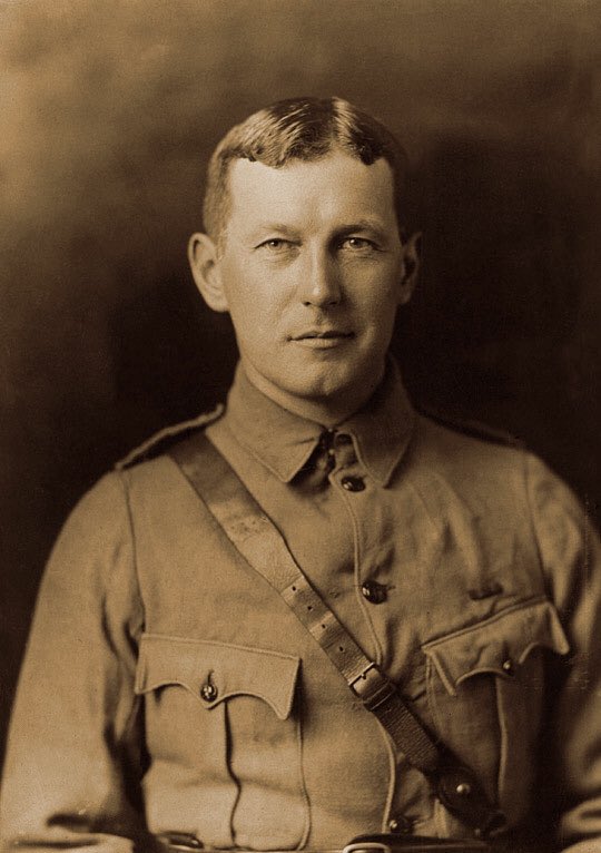
Behind this is Tilshead Church which holds the remains of three of the earliest casualties of the Great War including Percy Sawyer, kicked to death by a horse, medical attention was given to him by one John Macrae. World famous for the poem ‘In Flanders Fields’ #SPTAarchaeology
So, up the hill and onto the training area. Curious trees around as this was the old arboretum of Tilshead Lodge. [2] The garden (and Parish) boundary is provided by a Late Bronze Age linear (the old ditch) which also sites upon an even earlier entity #SPTAarchaeology
[2] These seem to stand at the tops of re-entrants and hence may be some sort of community marker. Best source is the brilliant book by Dave Field #SPTAarchaeology

 Read on Twitter

![We start from Westdown Camp and will use the modern military map to guide us round. When you see a Number in brackets such as [1] this refers to a stop marked on the map. Lets go! #SPTAarchaeology We start from Westdown Camp and will use the modern military map to guide us round. When you see a Number in brackets such as [1] this refers to a stop marked on the map. Lets go! #SPTAarchaeology](https://pbs.twimg.com/media/EVFCGNGXQAAIWKn.jpg)
![Driving through Tilshead and a first stop [1]. On our right, the village Hall – Canadian HQ for the area in WW1. A plaque on the Wall denotes the presence of the most famous visitor to the Plain. Perhaps ever! #SPTAarchaeology Driving through Tilshead and a first stop [1]. On our right, the village Hall – Canadian HQ for the area in WW1. A plaque on the Wall denotes the presence of the most famous visitor to the Plain. Perhaps ever! #SPTAarchaeology](https://pbs.twimg.com/media/EVFCTVmXsAExh6l.jpg)

![2] This is the Old Ditch longbarrow – one of 27 on the Plain. The BIGGEST in Britain at 120m long. These often had a platform with a number of individuals at one end and sometime as pit (or socket) for a standing stone. #SPTAarchaeology 2] This is the Old Ditch longbarrow – one of 27 on the Plain. The BIGGEST in Britain at 120m long. These often had a platform with a number of individuals at one end and sometime as pit (or socket) for a standing stone. #SPTAarchaeology](https://pbs.twimg.com/media/EVFD4EOX0AA1NaT.jpg)

![So, up the hill and onto the training area. Curious trees around as this was the old arboretum of Tilshead Lodge. [2] The garden (and Parish) boundary is provided by a Late Bronze Age linear (the old ditch) which also sites upon an even earlier entity #SPTAarchaeology So, up the hill and onto the training area. Curious trees around as this was the old arboretum of Tilshead Lodge. [2] The garden (and Parish) boundary is provided by a Late Bronze Age linear (the old ditch) which also sites upon an even earlier entity #SPTAarchaeology](https://pbs.twimg.com/media/EVFDoShXkAAT1rP.jpg)
![[2] These seem to stand at the tops of re-entrants and hence may be some sort of community marker. Best source is the brilliant book by Dave Field #SPTAarchaeology [2] These seem to stand at the tops of re-entrants and hence may be some sort of community marker. Best source is the brilliant book by Dave Field #SPTAarchaeology](https://pbs.twimg.com/media/EVFEieOXsAAyRkz.jpg)


