In 1500 AD, When Renfrew was a thriving town of some 4,000 souls Glasgow had hardly three quarters of that number.Wogan& #39;s Gazetteer, published in that year, described Glasgow as & #39;& #39; the paradise of Scotland & #39;& #39;, hardly a description of a bustling City.
Even 150 years later when it& #39;s population had increased fourfold it was described as & #39;& #39; one of the most beautiful little towns in Scotland & #39;& #39;. At That time Glasgow had not registered a single ship when Renfrew was the port of registry of 60!
When the Glasgow shipping register was commenced in 1697 it bore only 6 entries.
Not until 1700 , do we find Glasgow being called a city. In that year the spy, Daniel Defoe describes it as & #39;& #39; one of the cleanliest, most beautiful and best built Cities in Britain & #39;& #39;. Some thirty years later he was still able to describe it as & #39;& #39; to outward appearance
,one of the most elegant Cities I have ever seen & #39;& #39;.
Why was Glasgow relatively slow to develop?
Why was Glasgow relatively slow to develop?
The reason was simple. At that time, the six mile stretch of river between Yoker and the Saltmarket was virtually useless for shipping. A series of sandy islands, Newshot, Sandy Inch, King& #39;s Inch, Buck Inch, Whyte Inch, Water Inch and a few others, blocked the river for all
but a few small craft.
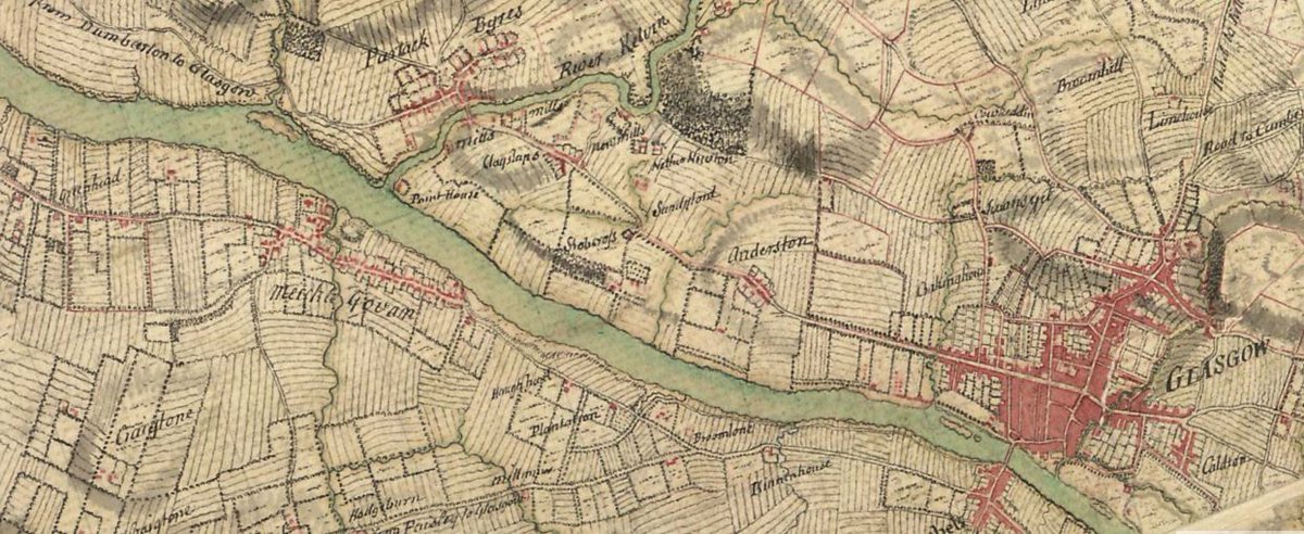
Water Inch lay 150 yards west of the point where the Kelvin meets the Clyde. Until 1800, pike and eels were plentiful here.
Water Inch, Whyte Inch, Packman& #39;s or Buck Inch and a few small islets, were later to become joined to the North bank of the river
Water Inch lay 150 yards west of the point where the Kelvin meets the Clyde. Until 1800, pike and eels were plentiful here.
Water Inch, Whyte Inch, Packman& #39;s or Buck Inch and a few small islets, were later to become joined to the North bank of the river
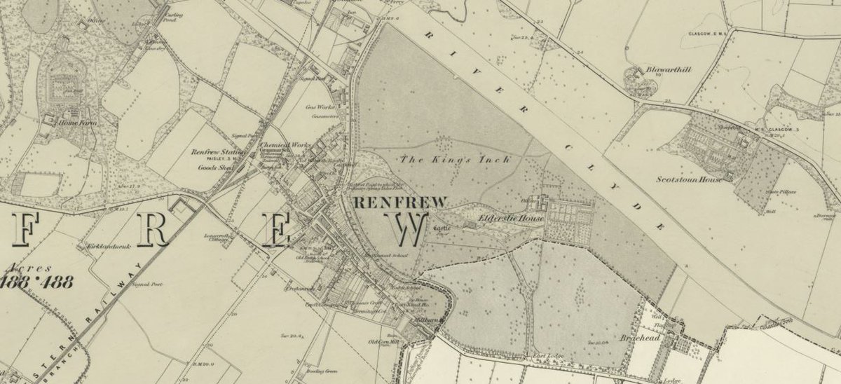
while King& #39;s Inch, Sand Inch and Newshot became part of the South Bank.Buck Inch became part of Scotstoun Estate.
With thanks to - https://randomscottishhistory.com/2018/10/12/the-castle-and-the-manor-houses-of-the-bishops-pp-116-124/">https://randomscottishhistory.com/2018/10/1...
Braehead Power station would be built on the largest of these islands, King& #39;s Inch, which may well have taken it& #39;s name from King Robert de Bruce. It is certain that he lived here and regularly fished the river for salmon. Sand Inch was cut-into to make a dock for Simon & Lobnitz
of Renfrew. Part of Sand Inch was the site of the Ferry landing stage.
An 1850 description of the Parish of Renfrew refers to & #39;& #39; the Kings meadow on the north bank of the river& #39;& #39;. This stretch of the river was occupied by Barclay & Curle& #39;s shipyard and Drysdale& #39;s factory is
An 1850 description of the Parish of Renfrew refers to & #39;& #39; the Kings meadow on the north bank of the river& #39;& #39;. This stretch of the river was occupied by Barclay & Curle& #39;s shipyard and Drysdale& #39;s factory is
not to be confused with King& #39;s Inch lying on the opposite bank.
True, Glasgow was growing. The population of 7644 in the year 1610, had in the next fifty years, almost doubled to 14678. It& #39;s prosperity , however, depended almost wholly on it& #39;s north-south trade over the fine stone bridge built in 1345 by Bishop Rae.
The wonderful possibilities of the river leading to the Western Isles , the English coast, Europe and the Oceans of the world were not fully realised and certainly not utilised.
It is true, also, that during the 16th century there were no fewer than 900 boats fishing on the Clyde, above Gourock and that a substantial part of their catches, came to Glasgow but the journey was by road ! Only in times of exceptionally high tide, was it occasionally
possible for small ships to reach Glasgow. Even then, they had to be unloaded by porters wading ashore with cargo on their backs.
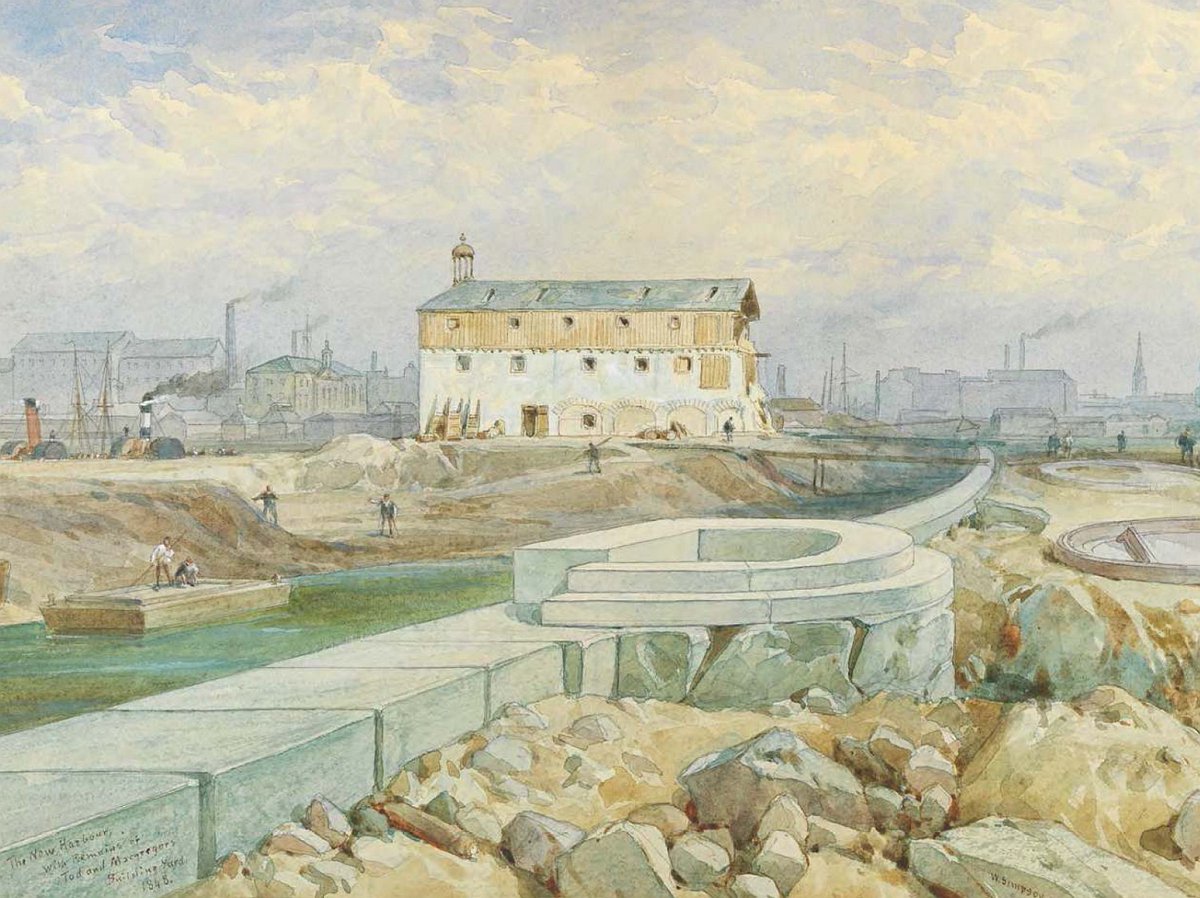
Not until 1663 did Glasgow build a quay& #39; for the commodious loading and landing of boats & #39;. It was constructed of stone, faced with timber but the very next year it was in urgent need of repair and oak beams from the roof of the cathedral were used to replace the rotten timber.
As late as 1782 and again in 1795 the tides were so high that hundreds of families were made homeless by flooding and large quantities of sugar,tobacco and other merchandise, in City warehouses, were destroyed.
Putting the problems of the rivers islands to one side.Glasgow had a few other obstacles to overcome, before overcoming their isolation as a shipping City.
There were 12 shoals which reduced the depth of the river to 15 inches or so, at low tide. But there were also
There were 12 shoals which reduced the depth of the river to 15 inches or so, at low tide. But there were also
two rocky bars stretching into or across the river , one at Bowling and one opposite at Blawarthill, which made the river virtually unnavigable. Even at high water when the depth the Broomielaw was 4 foot, there was a mere 2 feet at Bowling.
In 1560, during the reign of Mary queen of Scots, hundreds of inhabitants of Glasgow, Renfrew and Dumbarton spent a summer at Bowling, living in tents and huts and endeavouring to remove the obstructions in the river. But they no success and it was a matter of common debate
whether removal would ever be possible.
Strangely, Irvine on the Ayrshire coast was for many years the port of Glasgow.Ships were unloaded there and their cargoes brought 25 miles, overland, by pack-horse, a slow, difficult and wasteful proceeding.
Strangely, Irvine on the Ayrshire coast was for many years the port of Glasgow.Ships were unloaded there and their cargoes brought 25 miles, overland, by pack-horse, a slow, difficult and wasteful proceeding.
In 1609, Glasgow magistrates had become so desperate about gaining access to the sea via their river that experimental dredging was tried. Almost immediately, however, the river bed silted back-up again and the efforts had to be abandoned.
Glasgow merchants in 1660 sought permission from the magistrates of Dumbarton, to have a harbour built there and thus halve the overland journey for exports and imports. The worthy bailies of that town, however, declined the suggestion
& #39; lest the influx of mariners should raise the price of butter and eggs to the townsmen ! & #39;How history might have been altered had they decided otherwise.
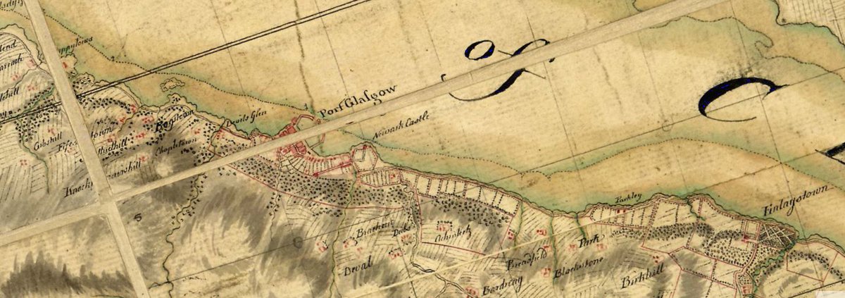
A few years later, however, in 1668 a fine new harbour was built further downstream at Newark Bay and Port Glasgow was born
A few years later, however, in 1668 a fine new harbour was built further downstream at Newark Bay and Port Glasgow was born
Glasgow& #39;s growth was rapid. Trade far in excess of the highest hopes was attracted to the Port and in no time it was quite unable to cope with all the shipping wishing to use the new port.
Port Glasgow& #39;s gain was, of course, Irvine& #39;s loss.
Port Glasgow& #39;s gain was, of course, Irvine& #39;s loss.
Unfortunately even this new port was still too far from the City it was built to serve.
The matter of making the river thoroughly usable became urgent. Various schemes were tried. All failed.
1768 was a great year for Glasgow for it was then that the great Navigational
The matter of making the river thoroughly usable became urgent. Various schemes were tried. All failed.
1768 was a great year for Glasgow for it was then that the great Navigational
engineer, John Golborne of Chester, was engaged to device a plan, along with James Watt, to make the river navigable.
In collaboration with James Watt of steam engine fame, he designed a system of no fewer than 117 & #39; piers & #39; as he called them which deflected the river at selected points into narrow channels.The natural scour of the water cut deep into the bed, exactly where this was required.
But because of the existence of the notorious & #39; whin sill & #39; , 300 hundred yards long between Blawarthill and Kings& #39;s Inchand the obstruction, 600 yards long at Bowling, the river, navigable now from Glasgow to open-sea
could still only take relatively small ships.
The work, so far, was the beginning of the process which was to make the Clyde, one of the greatest waterways in the world. And a Yoker man appears to have played a significant part...
The work, so far, was the beginning of the process which was to make the Clyde, one of the greatest waterways in the world. And a Yoker man appears to have played a significant part...
(Sources so far - Riddell, John F (1999). "Improving the Clyde: the eighteenth century phase".
"River Clyde". Encyclopaedia Britannica.
Harris, Hilary. "Seaward the Great Ships"
Clyde Panorama
"Inner Clyde Estuary". Ramsar)
more to follow......
"River Clyde". Encyclopaedia Britannica.
Harris, Hilary. "Seaward the Great Ships"
Clyde Panorama
"Inner Clyde Estuary". Ramsar)
more to follow......
..in the great undertaking for a Headstone in Renfrew Kirkyard dates 1778 reads - & #39;& #39; John Bennet of Blawarthill, overlord of the deepening of the River Clyde & #39;& #39;
In 1755 the Clyde at Glasgow, had been only 15 inches deep at low tide and 44 inches, at high. By 1792 ships drawing 6 feet of water were reaching the Broomielaw for the first time.

 Read on Twitter
![- A Tale of a River - [ in many, many parts ] - A Tale of a River - [ in many, many parts ]](https://pbs.twimg.com/media/EU7Dc-qXgAIlaya.jpg)


