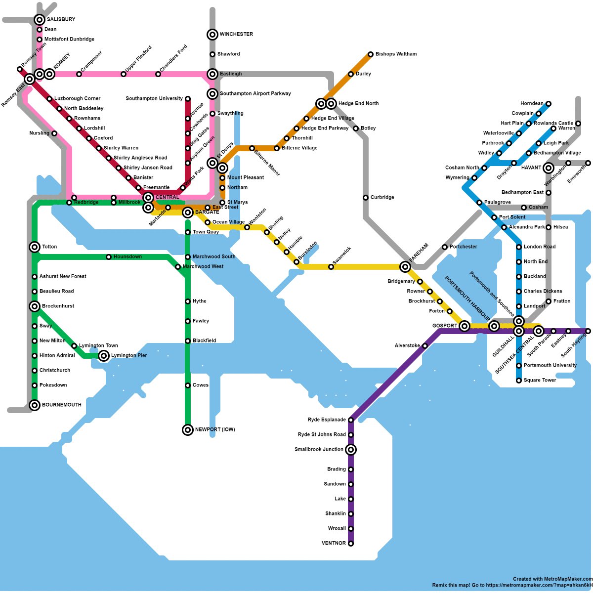
I was bored and did a map of an imaginary Metro and tram system for my home town of Southampton (plus Portsmouth and other nearby places). How& #39;s your social distancing weekend going?
Green: Forest Line (metro)  https://abs.twimg.com/emoji/v2/... draggable="false" alt="🚈" title="Light rail" aria-label="Emoji: Light rail">
Pink: Test Line (metro) https://abs.twimg.com/emoji/v2/... draggable="false" alt="🚈" title="Light rail" aria-label="Emoji: Light rail">
Yellow: Solent Line (high frequency metro) https://abs.twimg.com/emoji/v2/... draggable="false" alt="🚇" title="Metro" aria-label="Emoji: Metro">
Red: City Line (light rail/ tram) https://abs.twimg.com/emoji/v2/... draggable="false" alt="🚃" title="Railway car" aria-label="Emoji: Railway car">
Orange: Itchen Line (light rail/ tram) https://abs.twimg.com/emoji/v2/... draggable="false" alt="🚃" title="Railway car" aria-label="Emoji: Railway car">
Purple: Island Line (metro) https://abs.twimg.com/emoji/v2/... draggable="false" alt="🚈" title="Light rail" aria-label="Emoji: Light rail">
Blue: Portsea Line (tram) https://abs.twimg.com/emoji/v2/... draggable="false" alt="🚃" title="Railway car" aria-label="Emoji: Railway car">
@MarxdeMorais
Pink: Test Line (metro)
Yellow: Solent Line (high frequency metro)
Red: City Line (light rail/ tram)
Orange: Itchen Line (light rail/ tram)
Purple: Island Line (metro)
Blue: Portsea Line (tram)
@MarxdeMorais
Tunnels. Ditto under Southampton Water and Portsmouth Harbour. The city centre stretches of the Island and Forest Lines are underground anyway
Mapped on an online thing called http://metromapmaker.com"> http://metromapmaker.com which is in the style of the Washington DC metro @GrahamSmith_

 Read on Twitter


