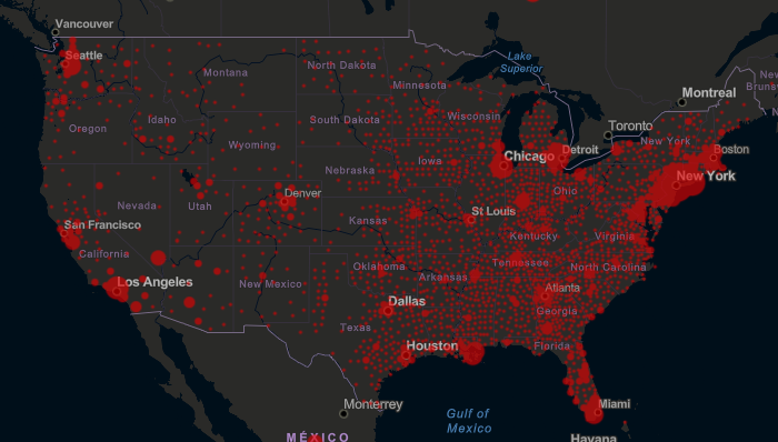
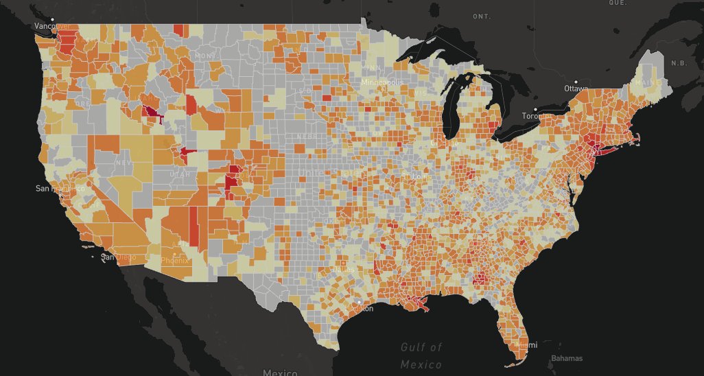
1. A tale of 2 #COVID19 case maps:
Left: Shows total cases (bigger circles, more cases) https://www.arcgis.com/apps/opsdashboard/index.html#/bda7594740fd40299423467b48e9ecf6
Right:">https://www.arcgis.com/apps/opsd... Shows cases per 10,000 residents. Much easier to see very concerning #rural outbreaks in ID, LA, CO, ID
https://geodacenter.github.io/covid/map.html#
thread">https://geodacenter.github.io/covid/map...
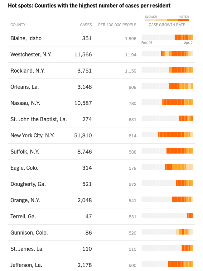
2. Focusing on #COVID19 cases per 10,000 people helps identify locations that are likely going to exceed local hospital capabilities very quickly. See rank list here. Blaine, ID (tourist ski area) has the highest infection rate in the country
#cases">https://www.nytimes.com/interactive/2020/us/coronavirus-us-cases.html #cases">https://www.nytimes.com/interacti...
#cases">https://www.nytimes.com/interactive/2020/us/coronavirus-us-cases.html #cases">https://www.nytimes.com/interacti...
3. Many hospitals in #rural areas have very small ICUs if they have ICUs at all and limited capacity. See this thread from a small community hospital in #Louisiana overwhelmed by #COVID19 https://twitter.com/kit_delgadoMD/status/1245538207200149505?s=20">https://twitter.com/kit_delga...

 Read on Twitter


