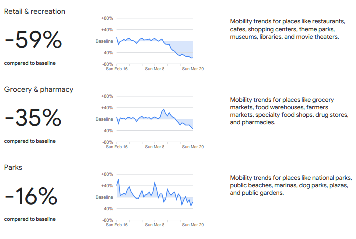
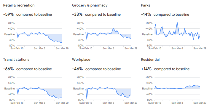
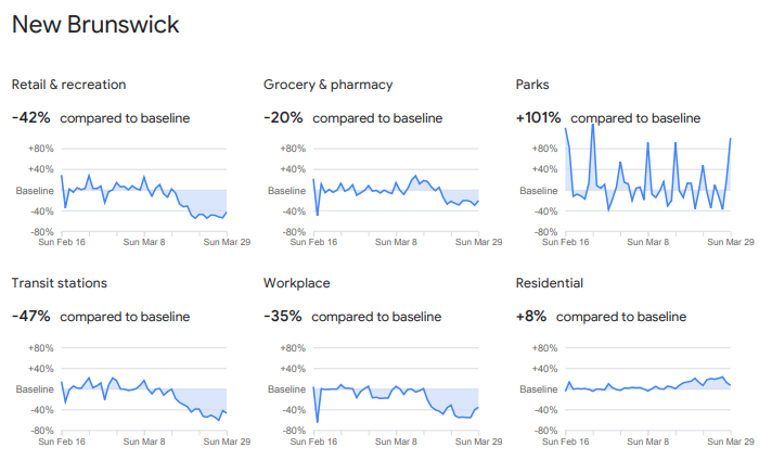
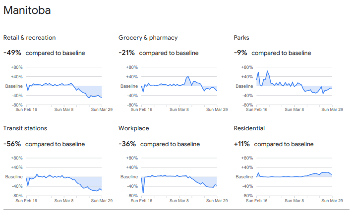
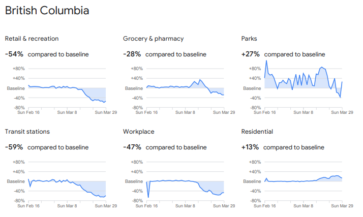
Google has released data based on anonymous locators from people& #39;s phones and Google Maps to suggest how well Canadians are abiding by & #39;stay home& #39; orders during the coronavirus outbreak. Charts for the country as a whole, plus Ontario, Quebec and BC, are shown here:
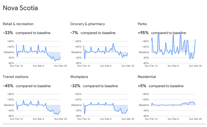
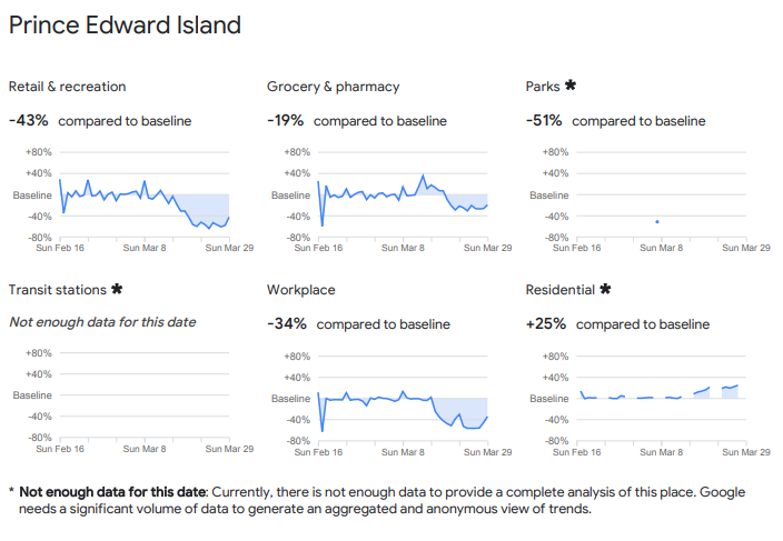
Here are the Google COVID-19 Community Mobility Reports charts showing how people& #39;s whereabouts have changed in the 4 Atlantic provinces: Newfoundland and Labrador; Nova Scotia; Prince Edward Island and New Brunswick. Google says the maps will be updated daily.

 Read on Twitter