I am slowly figuring out the structure of the Animal Crossing map in save files by poking the game’s memory in moderately upsetting ways
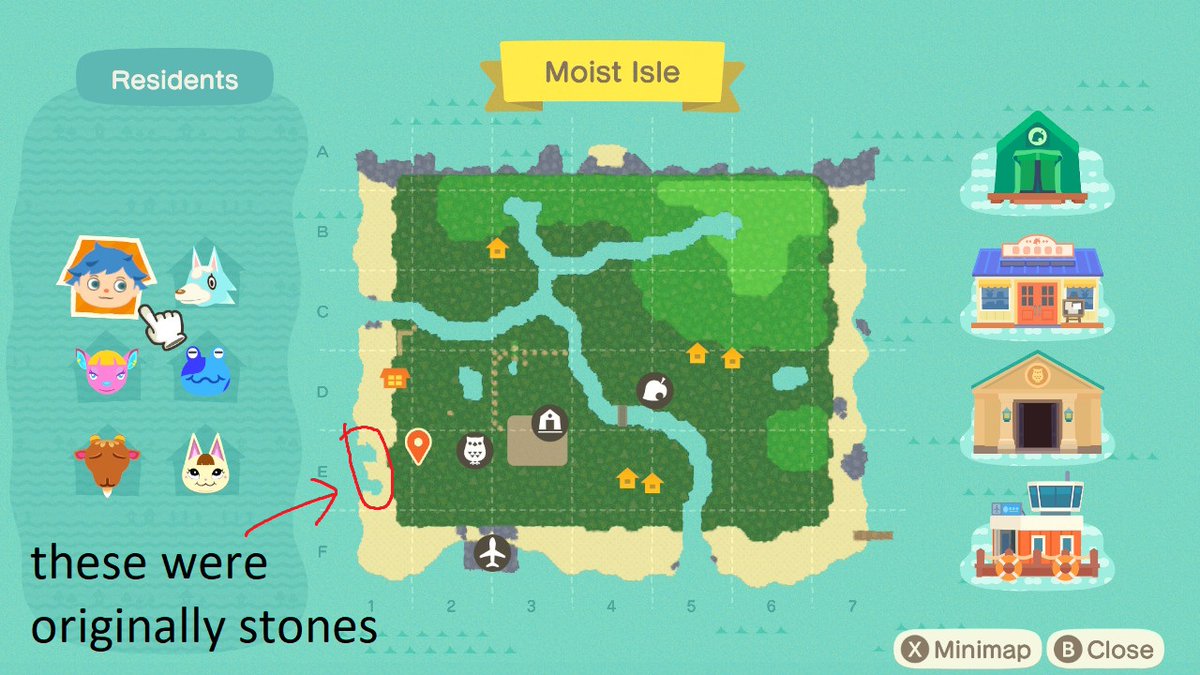
After a bit more research I’ve gathered info for almost everything that goes into the island: the terrain layout, the items, the layout of the blocks that form the map boundaries, and the locations of the structures
… I’ve spent too much time on this already :/
… I’ve spent too much time on this already :/
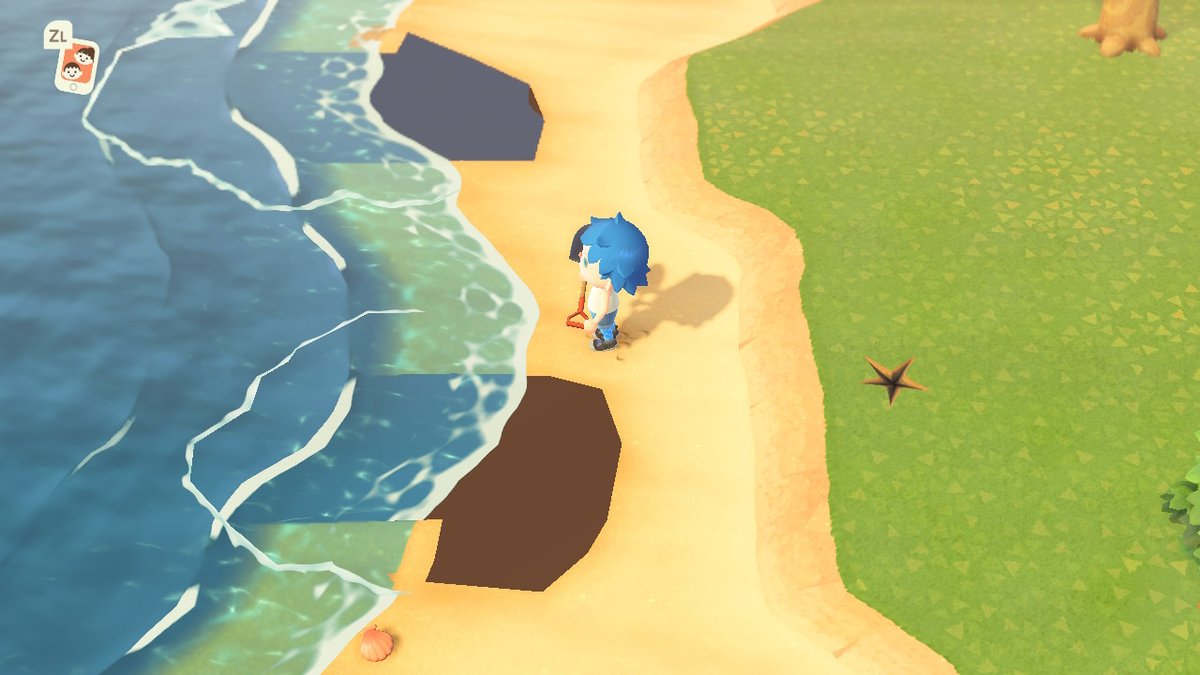
I regret to inform you that I have made a hole in the world. Please do NOT fall in
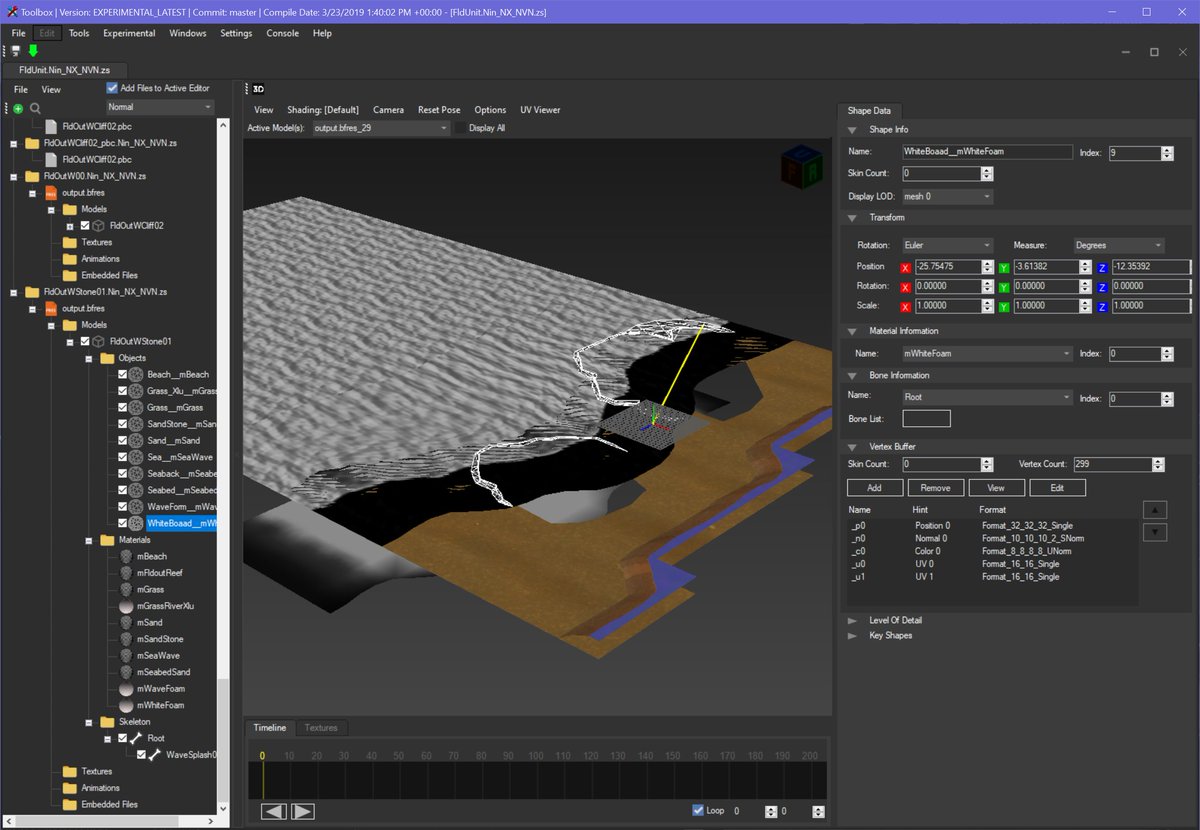
Explanation: I swapped out the .pbc file for this chunk of the map with the one for a "just beach" chunk, but kept the model
So this file seems to contain the ground height info for the chunk, and info for which squares are used for what (blocked / walkable / editable map)
So this file seems to contain the ground height info for the chunk, and info for which squares are used for what (blocked / walkable / editable map)
I wanted to figure out how AC generates the 2D overview map. There& #39;s got to be a 2D bitmap representation of these chunks, right...?
Nope! The game just renders the 3D model from the top and uses *that*. I deleted one object from the model, and the change reflected on the map
Nope! The game just renders the 3D model from the top and uses *that*. I deleted one object from the model, and the change reflected on the map
Turns out this was under my nose all along, in the exact models I& #39;d been looking at...
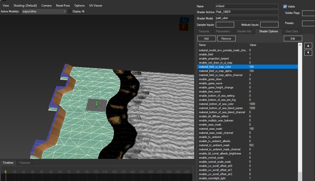
Each material has shader options which I& #39;d overlooked as I assumed they were all generic NintendoWare fare. Nope!
These options control how and if a material appears in the 2D map render
Each material has shader options which I& #39;d overlooked as I assumed they were all generic NintendoWare fare. Nope!
These options control how and if a material appears in the 2D map render
What have you done to my island, Tom Nook
My trees are being waterlogged
My trees are being waterlogged
If you push villagers out of the editable map region (the central 5x4 chunks plus the one-chunk border) they can’t move until you push them back and it’s absolutely hilarious
Fishing in the fake sea:  https://abs.twimg.com/emoji/v2/... draggable="false" alt="✅" title="White heavy check mark" aria-label="Emoji: White heavy check mark"> yes
Fishing for apples: https://abs.twimg.com/emoji/v2/... draggable="false" alt="🚫" title="No entry sign" aria-label="Emoji: No entry sign"> no
Fishing for apples:
I put the event plaza at Y position 0 and I can just about see Mabel in the horizon from the top of my island
… I should really stop playing with this game and go do something productive.
… I should really stop playing with this game and go do something productive.

 Read on Twitter


