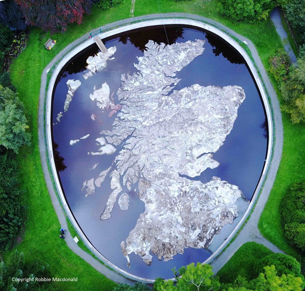
The Polish Map of Scotland is a concrete scale model of Scotland.
The brainchild of Polish war veteran Jan Tomasik, it was built between 1974-79 and is claimed to be the world’s largest terrain relief model.
The brainchild of Polish war veteran Jan Tomasik, it was built between 1974-79 and is claimed to be the world’s largest terrain relief model.
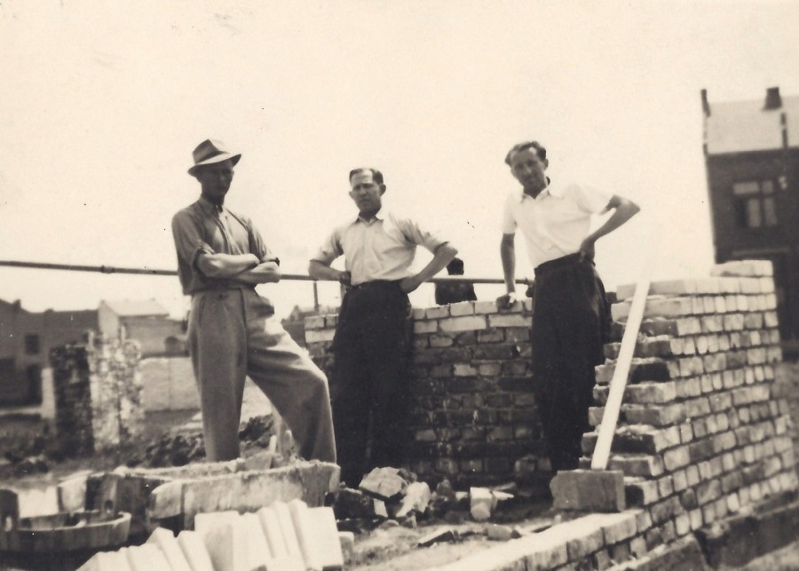
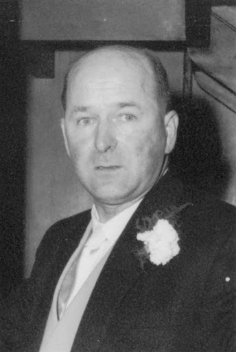
Jan Tomasik (left) was born on the outskirts of Kraków, and became a bricklayer to trade. He achieved the professional title of a master builder, but also had become a company co-owner.
When World War II broke out, Jan set off to fight the Germans.
When World War II broke out, Jan set off to fight the Germans.
Krakow, August 1939.
Jan has answered the call to arms. His country will soon be at war but unable to withstand the combined might of Nazi Germany and Soviet Russia. He knew his future was uncertain.
Jan has answered the call to arms. His country will soon be at war but unable to withstand the combined might of Nazi Germany and Soviet Russia. He knew his future was uncertain.
France 1940 – "Poland has not yet perished”.
.
Jan stands in the centre of the group, his face sideways, looking down. No-one yet foresees the events of May and France’s rapid defeat.
.
Jan stands in the centre of the group, his face sideways, looking down. No-one yet foresees the events of May and France’s rapid defeat.
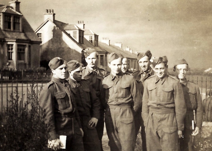
The Fall of France sees Polish soldiers evacuated from Dunkirk and rescued by the Polish Navy from the ports of western France. Many make their way to Britain whichever way they can. These ones have set up temporary camp at Crawford, Lanarkshire in September 1940.
October 1940.
Douglas, Lanarkshire. Jan (3rd from left) and his comrades are settling in to a new life they hadn’t planned for. They’re on their way to hear a lecture given at the local coalmine.
Douglas, Lanarkshire. Jan (3rd from left) and his comrades are settling in to a new life they hadn’t planned for. They’re on their way to hear a lecture given at the local coalmine.
Oct 1940.
Barry Buddon camp near Carnoustie in Angus. The Poles have been deployed to strengthen the defences of this part of Scotland’s North Sea coast.
Jan is lying on his stomach looking at the camera.
The British Army like the camp so much, they call it “Barry Butlins”
Barry Buddon camp near Carnoustie in Angus. The Poles have been deployed to strengthen the defences of this part of Scotland’s North Sea coast.
Jan is lying on his stomach looking at the camera.
The British Army like the camp so much, they call it “Barry Butlins”
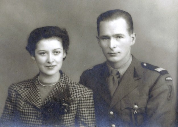
Jan met and fell in love with Catherine Kimlin of Edinburgh. They married in in September 1942.
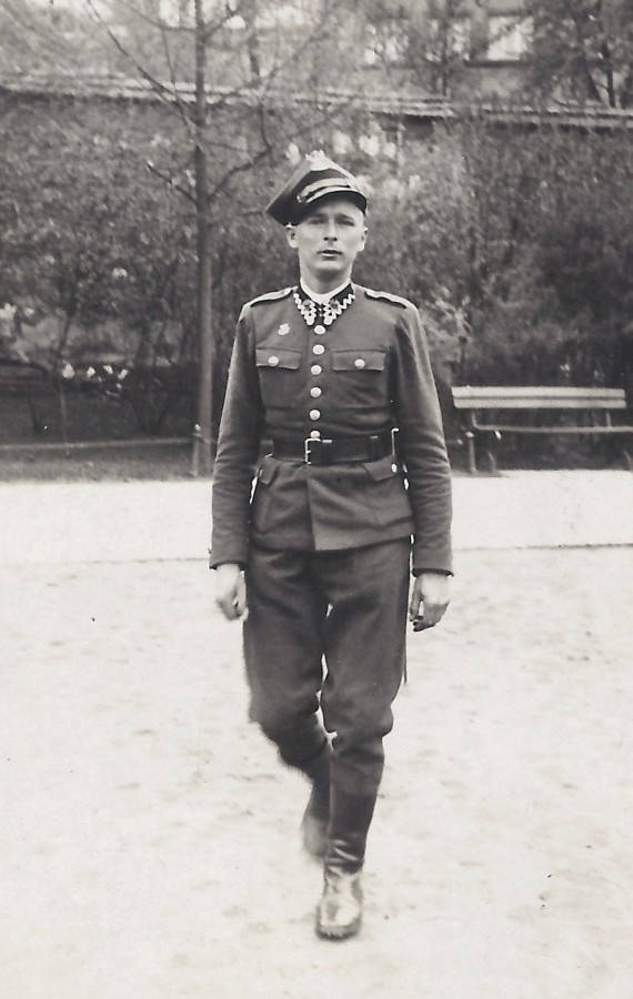
Note the ‘Poland’ patch and ‘Winged Hussar’ insignia of the 1st Armoured Division on the shoulder of Jan’s tunic. The three stripes on his epaulette show he is a lance-sergeant.
Note the ‘Poland’ patch and ‘Winged Hussar’ insignia of the 1st Armoured Division on the shoulder of Jan’s tunic. The three stripes on his epaulette show he is a lance-sergeant.
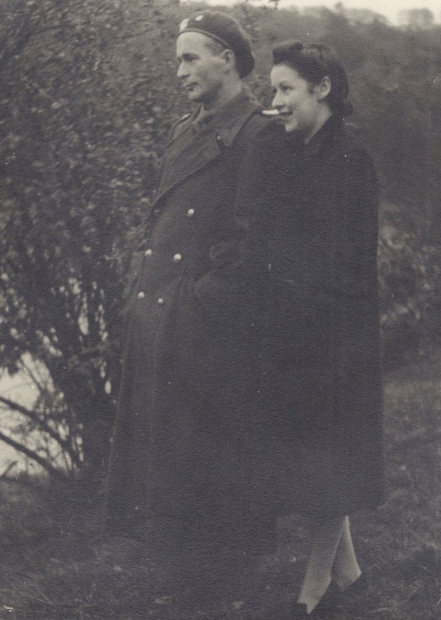
Jan and Catherine on the banks of the Tweed in October 1942.
Sooner or later the Allies will open up a Second Front in the West and Jan will go. Whether he will return, fate will decide.
Sooner or later the Allies will open up a Second Front in the West and Jan will go. Whether he will return, fate will decide.
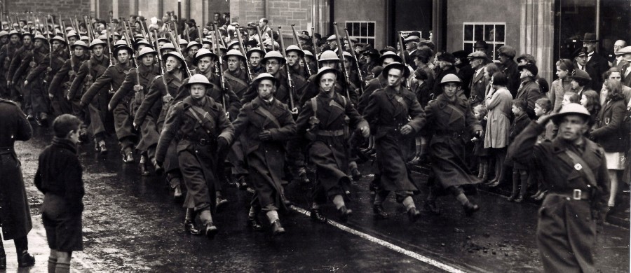
Newmarket, Suffolk, July 1943.
After a few months the men return to Scotland and await the order to liberate Europe – “For Our Freedom And Yours”. Jan marches with his comrades-in-arms (3rd rank from the front, in the centre and instantly recognisable by his moustache).
After a few months the men return to Scotland and await the order to liberate Europe – “For Our Freedom And Yours”. Jan marches with his comrades-in-arms (3rd rank from the front, in the centre and instantly recognisable by his moustache).
Jan was one of the lucky ones. He returned home, to a place he fell in love with, Scotland.
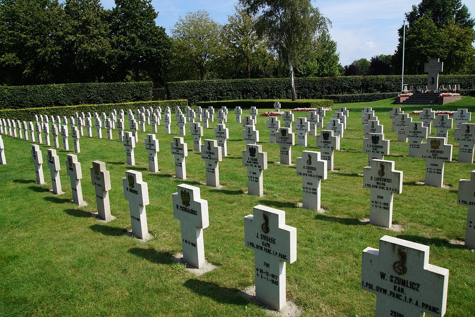
Others in the photograph did not. Many lie today in cemeteries like the Polish-Canadian Military Cemetery in Breda in the Netherlands.
Others in the photograph did not. Many lie today in cemeteries like the Polish-Canadian Military Cemetery in Breda in the Netherlands.
Jan became a successful hotelier and added Black Barony to his properties in 1968.
He met Professor Mieczyslaw Klimaszewski (below), head of the Institute of Geography at the University of Krakow and proposed creating a physical relief map of Scotland in the grounds of his hotel
He met Professor Mieczyslaw Klimaszewski (below), head of the Institute of Geography at the University of Krakow and proposed creating a physical relief map of Scotland in the grounds of his hotel
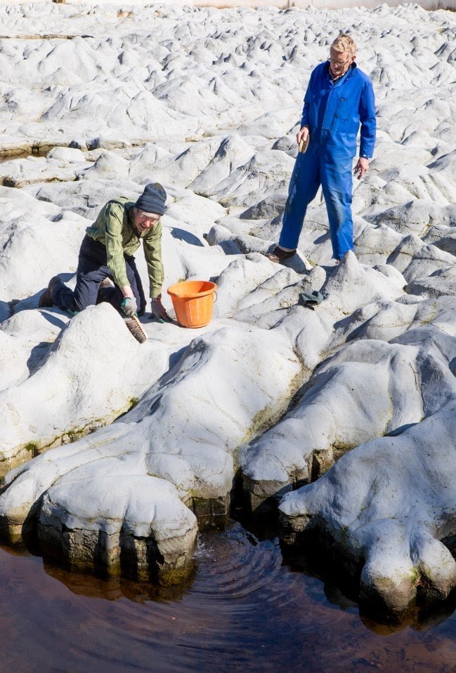
The map took six years to build and was not only accurately painted, but even had water pumped through it to represent the rivers and lochs of our country.
Photo below during the recent restoration, via Media Scotland.
Photo below during the recent restoration, via Media Scotland.
“I shall die, but I shall leave my map as a gift to the Scottish people to thank them for the hospitality they showed the Poles in their time of need” - Jan Tomasik.
Jan sadly passed away in 1991, and what an extraordinary gift it was he left our nation.
Thank you, Jan
 https://abs.twimg.com/emoji/v2/... draggable="false" alt="🏴" title="Flagge von Schottland" aria-label="Emoji: Flagge von Schottland">
  https://abs.twimg.com/emoji/v2/... draggable="false" alt="❤" title="Rotes Herz" aria-label="Emoji: Rotes Herz">
  https://abs.twimg.com/emoji/v2/... draggable="false" alt="🇵🇱" title="Flagge von Polen" aria-label="Emoji: Flagge von Polen">
Jan sadly passed away in 1991, and what an extraordinary gift it was he left our nation.
Thank you, Jan
Details on the map location, how to get there and opening hours via link below.
http://www.mapascotland.org/home/ ">https://www.mapascotland.org/home/&quo...
http://www.mapascotland.org/home/ ">https://www.mapascotland.org/home/&quo...

 Read on Twitter




 https://abs.twimg.com/emoji/v2/... draggable="false" alt="❤" title="Rotes Herz" aria-label="Emoji: Rotes Herz"> https://abs.twimg.com/emoji/v2/... draggable="false" alt="🇵🇱" title="Flagge von Polen" aria-label="Emoji: Flagge von Polen">" title="“I shall die, but I shall leave my map as a gift to the Scottish people to thank them for the hospitality they showed the Poles in their time of need” - Jan Tomasik.Jan sadly passed away in 1991, and what an extraordinary gift it was he left our nation.Thank you, Janhttps://abs.twimg.com/emoji/v2/... draggable="false" alt="🏴" title="Flagge von Schottland" aria-label="Emoji: Flagge von Schottland"> https://abs.twimg.com/emoji/v2/... draggable="false" alt="❤" title="Rotes Herz" aria-label="Emoji: Rotes Herz"> https://abs.twimg.com/emoji/v2/... draggable="false" alt="🇵🇱" title="Flagge von Polen" aria-label="Emoji: Flagge von Polen">" class="img-responsive" style="max-width:100%;"/>


