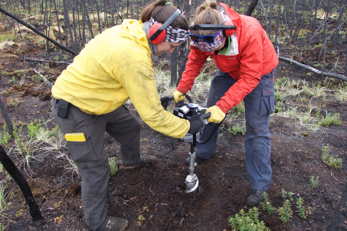
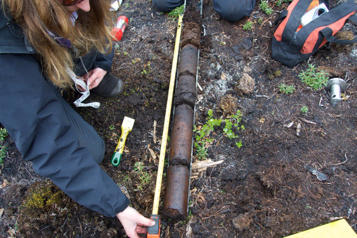
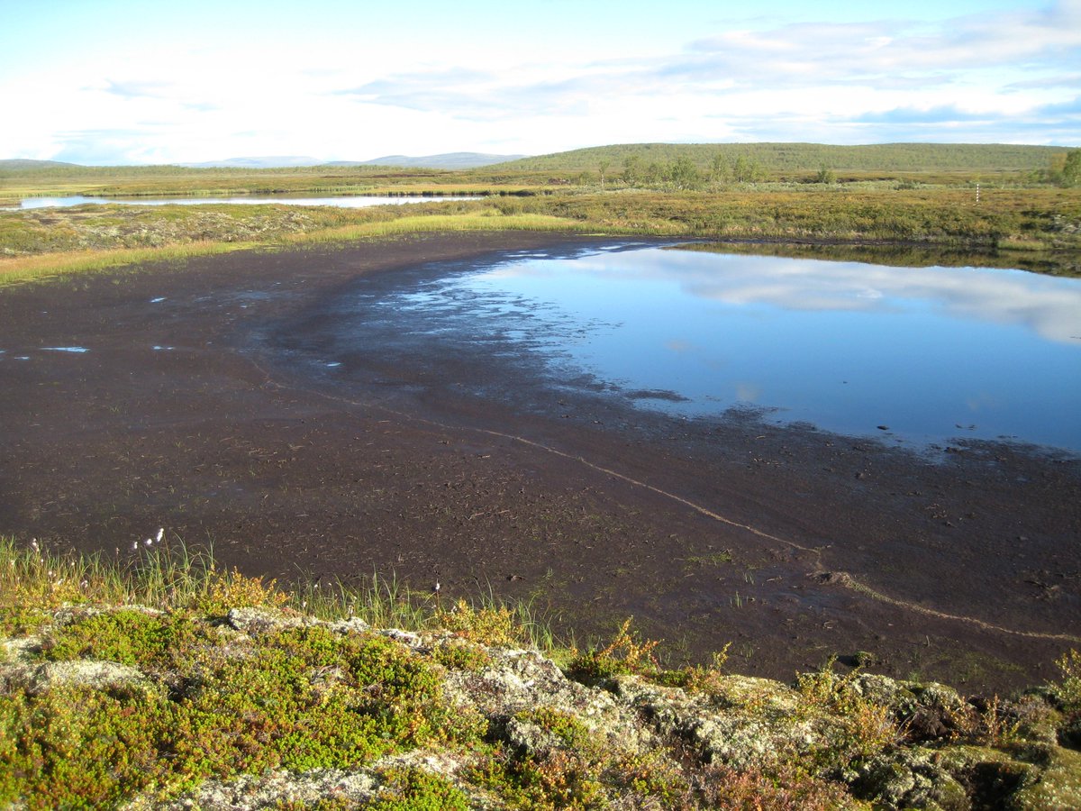
It& #39;s the perfect morning for a permafrost twitter-tour!
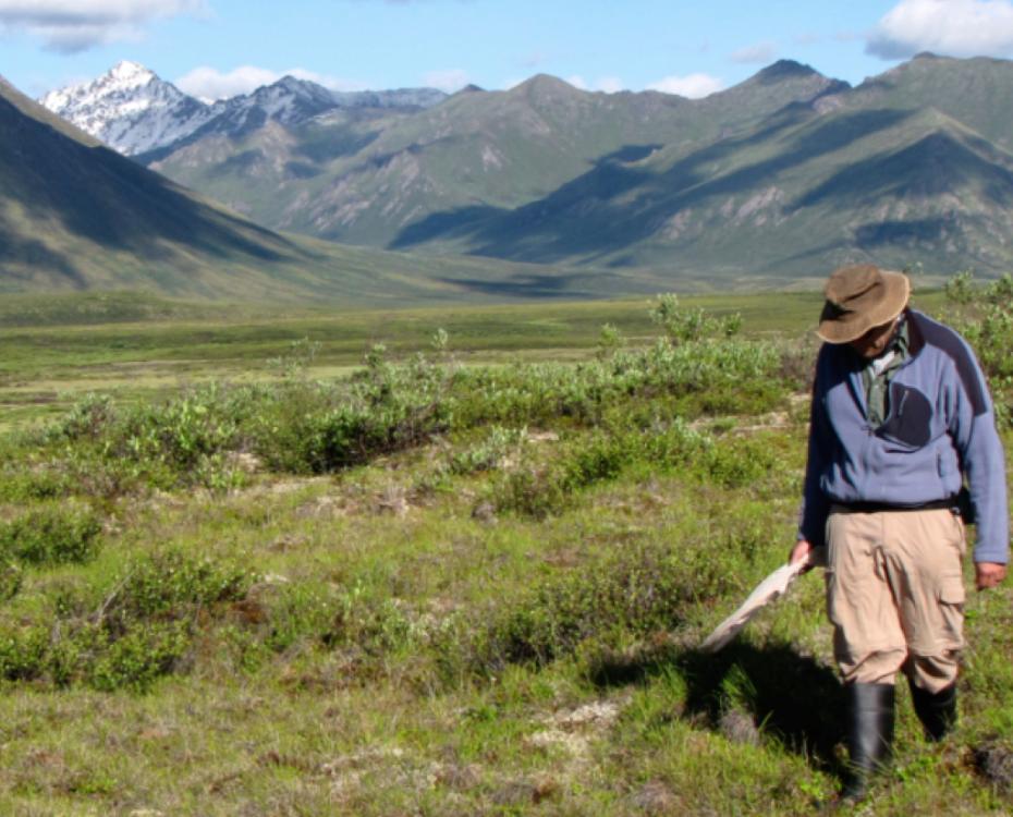
So what is permafrost? Permafrost is frozen ground that remains in a frozen state for multiple years. But it& #39;s way more complicated than that. You can be walking on permafrost & not even know it. Image: C.Buddle, McGill
So what is permafrost? Permafrost is frozen ground that remains in a frozen state for multiple years. But it& #39;s way more complicated than that. You can be walking on permafrost & not even know it. Image: C.Buddle, McGill
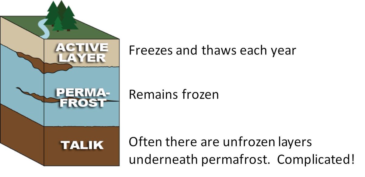
Here& #39;s where it gets complicated. Permafrost is buried under an active layer that freezes/thaws each year. To study permafrost, we have to get deep! This means we can& #39;t easily use satellites to help us study permafrost. But we& #39;re working on that. Right @NASAEarth @NASA_ABoVE?
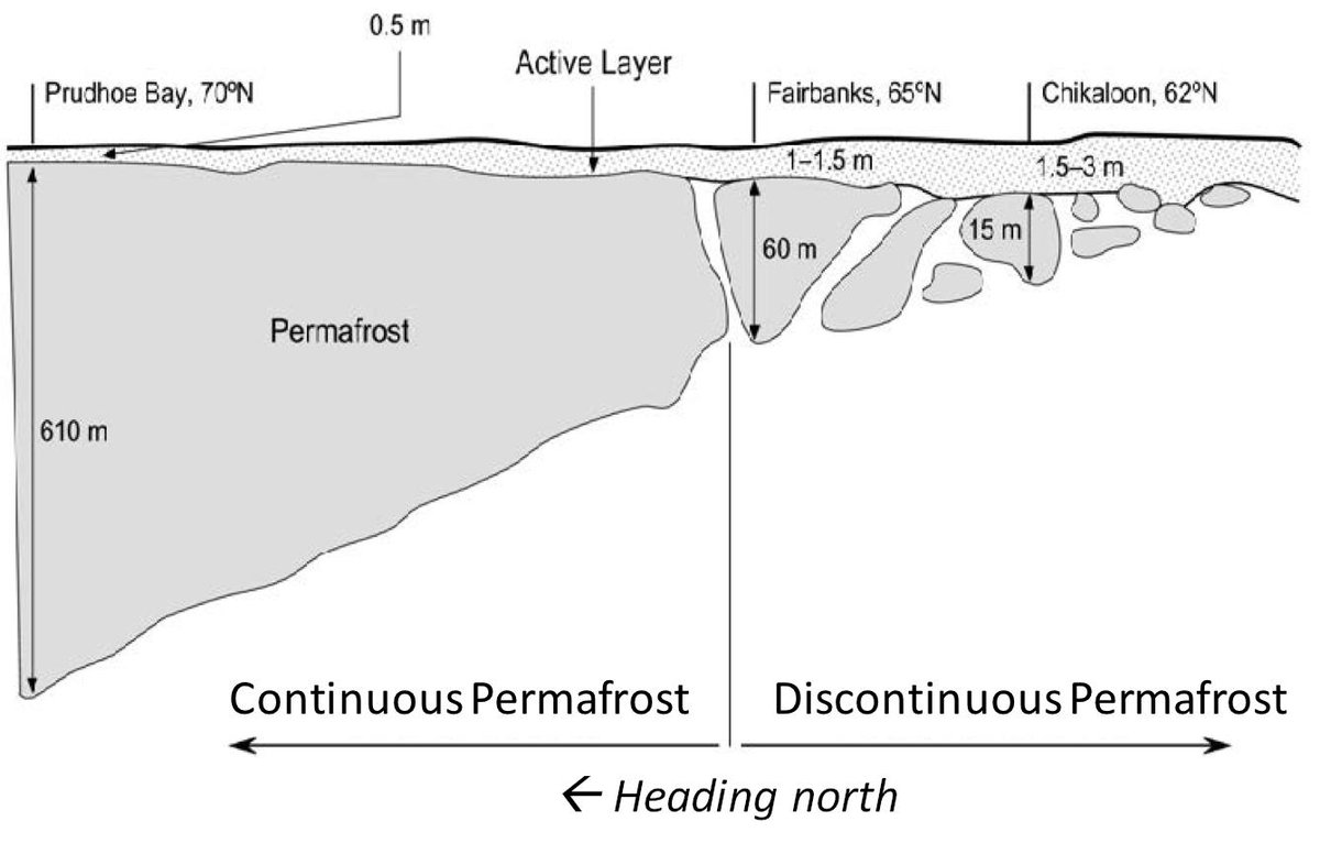
Far north, thick permafrost is found everywhere (continuous). We call this climate-driven permafrost. Further south, permafrost is thinner & patchy. We think of this as ecosystem-protected permafrost. What& #39;s on the surface matters, like my beloved peat (aka permafrost blanket)!
Permafrost or frozen ground can be made up of a lot of things - frozen rock, sand, soil, etc. often w/ pockets of ice mixed in. If frozen rock thaws, not much changes. But if the ground ice in permafrost melts, that& #39;s where things get crazy.
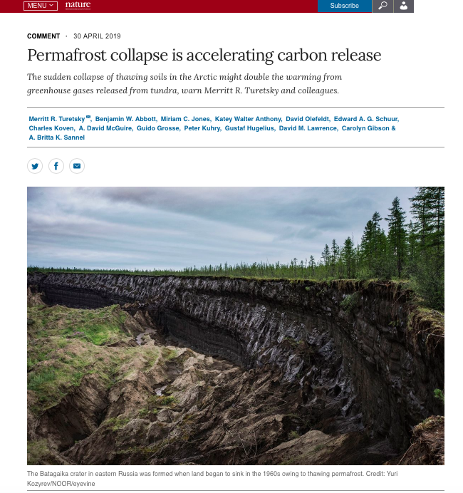
A main message is that the fate of permafrost carbon depends on ground ice. Where ground ice is low, thaw means drier soils & deeper rooting zone -> happy plants. But where ground ice is high, thaw means wetter soils, unstable land, & abrupt change. See: https://www.nature.com/articles/d41586-019-01313-4">https://www.nature.com/articles/...
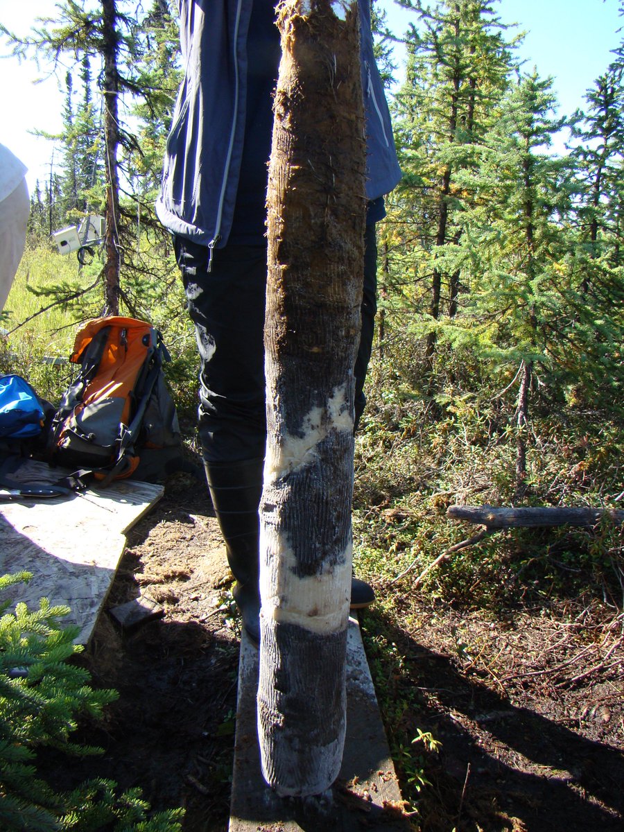
So what does ground ice look like? When we take a permafrost core from the surface of a field site, we often drill into ice lenses. They can look like this. Image: Miriam Jones @USGS
But here is what ground ice can look in profile form. This image shows a cliff of ground ice! Massive segregated ice exposed in a retrogressive thaw slump in a High Arctic environment [on the Fosheim Peninsula, Ellesmere Island]. Photo credit Toni Lewkowicz.
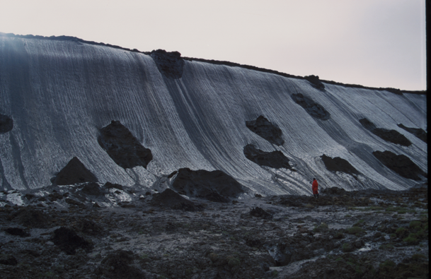
Check out this ice-rich Yedoma permafrost with huge ice wedges. The ground ice forms a massive ice wall on the coast of the Dmitri-Laptev-Strait in NE Siberia. Person for scale! Image by Guido Grosse.
We can map areas that are less prone to abrupt permafrost thaw, Here is an image of carbon-poor soils in a mountainous permafrost landscape in eastern Greenland with limited segregated ice or signs of thermokarst. Gradual thaw likely to dominate here. Photo by Gustaf Hugelius
And vice versa, we can map areas that are likely to experience abrupt thaw, such as this coastal exposure of ice-rich Yedoma permafrost on the Baldwin Peninsula in NW Alaska. Image by Guido Gross and check out Jens Strauss hiding in the photo for scale!
All of this information led us to focus a synthesis study on abrupt permafrost thaw. This was a study I led with @DavidOlefeldt, @thermokarst, @cdkoven @CarolynG_22 @tedschuur et al. as part of the Permafrost Carbon Network. Check us out at http://www.permafrostcarbon.org"> http://www.permafrostcarbon.org
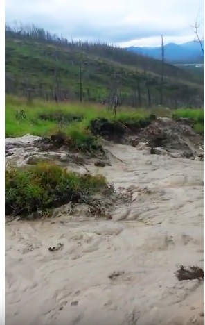
What do we know? We know that gradual permafrost thaw affects cm of permafrost over decades. Abrupt thaw affects meters of soil/sediment in months to years. Check out this wild video showing a thaw-induced landslide in action. https://www.youtube.com/watch?v=y5Gd7Cl27Bo">https://www.youtube.com/watch...
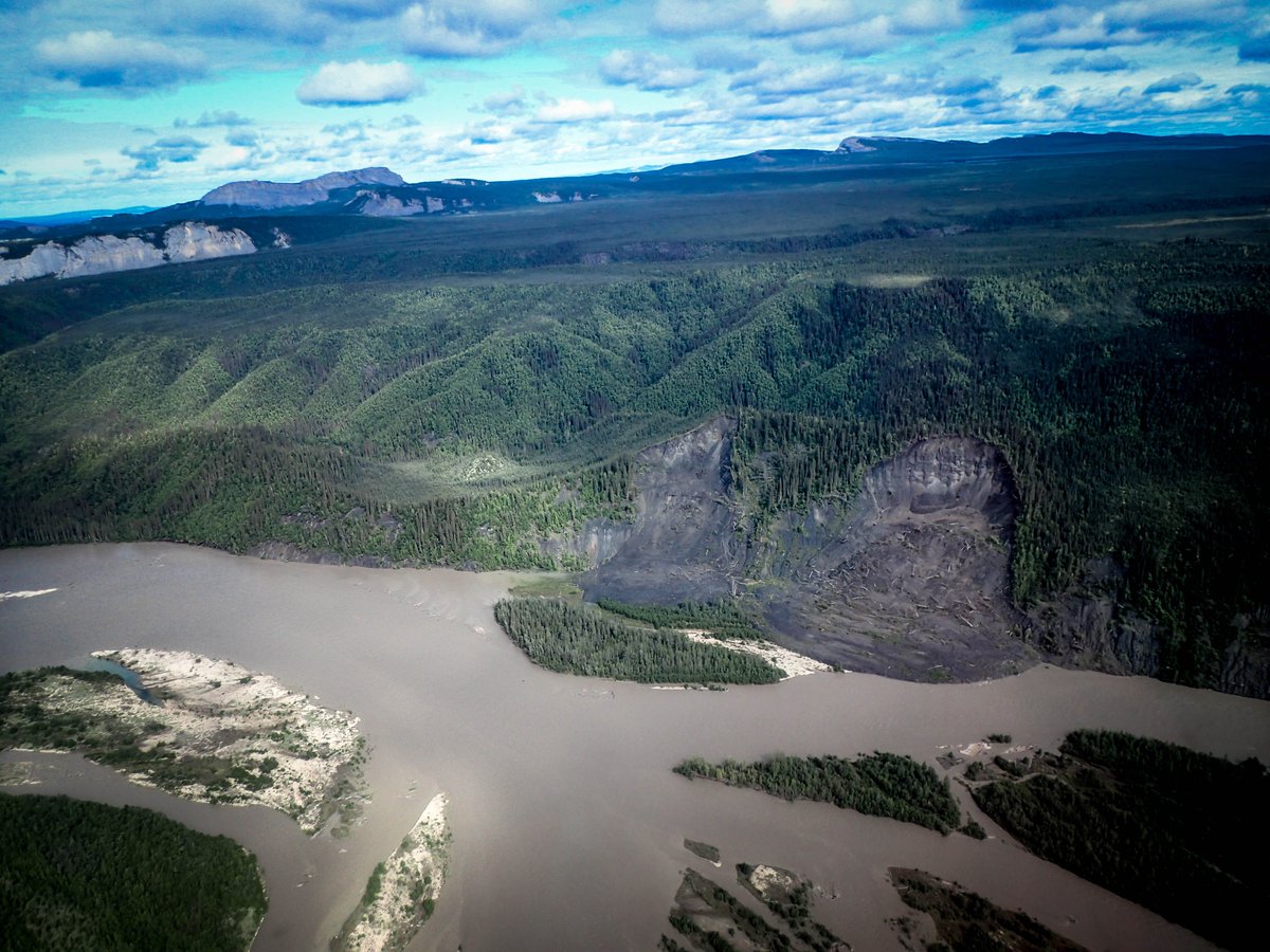
After watching the video above, it& #39;s easy to understand how abrupt permafrost thaw can have huge consequences for water quality, fishing grounds, and river travel. Check out this image of a thaw slump affecting waters in the Northwest Territories, Canada. Image by @CarolynG_22
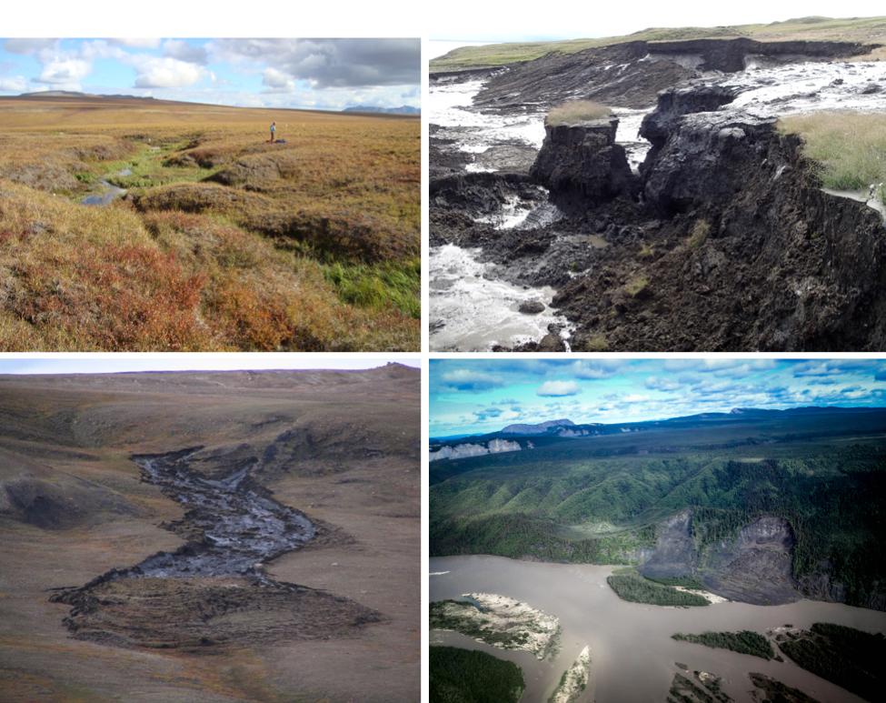
In hills & mountains, abrupt thaw means landslides & erosion. L top- gully in N Alaska ( @thermokarst); L bottom- detachment slide on Ellesmere Isle  https://abs.twimg.com/emoji/v2/... draggable="false" alt="🇨🇦" title="Flagge von Kanada" aria-label="Emoji: Flagge von Kanada"> (T. Lewkowicz). R top- thaw slump on Herschel Isle
  https://abs.twimg.com/emoji/v2/... draggable="false" alt="🇨🇦" title="Flagge von Kanada" aria-label="Emoji: Flagge von Kanada"> (G. Hugelius); R bottom- thaw slump near Mackenzie River NWT ( @CarolynG_22)
Check out this video of a mega-slump in the Peel Plateau of the Northwest Territories  https://abs.twimg.com/emoji/v2/... draggable="false" alt="🇨🇦" title="Flagge von Kanada" aria-label="Emoji: Flagge von Kanada">. These are HUGE features created by abrupt thaw and mass movement of soil/sediment, and you can literally see the erosion in action in this video. https://www.youtube.com/watch?v=5GnC_Hvavqc">https://www.youtube.com/watch...
This video is a time lapse compiled by the @GNWT_ITI (NTGS). Watch how the mud/debris flows speed up over time, eventually breaching & draining the lake. Rumour is that this thaw slump was discovered through local Indigenous knowledge, helping scientists! https://www.youtube.com/watch?v=oDK2phW6QTI">https://www.youtube.com/watch...
In flat poorly drained areas, abrupt thaw creates lakes or wetlands. I  https://abs.twimg.com/emoji/v2/... draggable="false" alt="❤️" title="Rotes Herz" aria-label="Emoji: Rotes Herz"> peat, so let& #39;s start with thaw wetlands! Permafrost peatlands are dry enough to support forests. The trees might be stunted & old, but they are survivors. I think black spruce should be
  https://abs.twimg.com/emoji/v2/... draggable="false" alt="🇨🇦" title="Flagge von Kanada" aria-label="Emoji: Flagge von Kanada"> national tree!
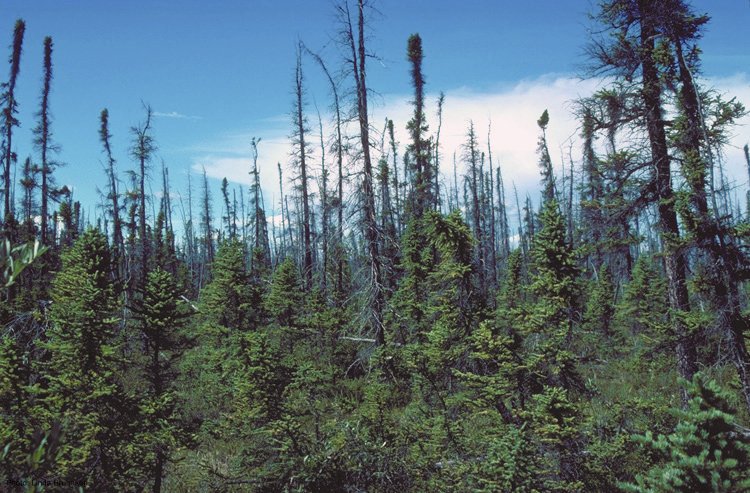
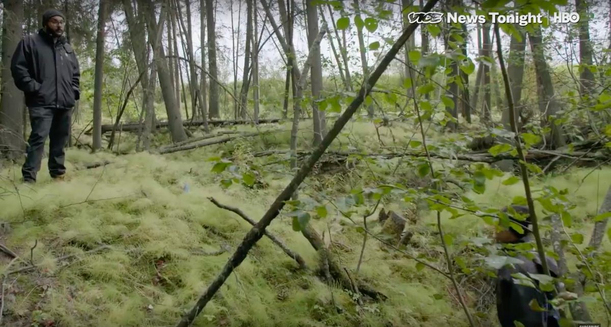
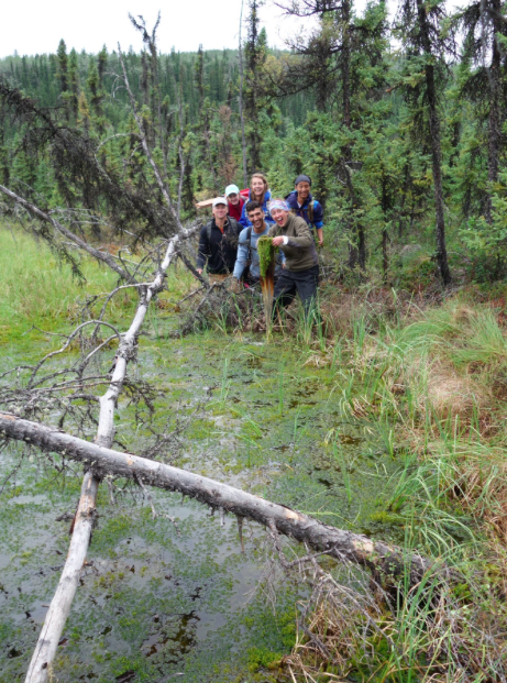
Here is what happens to our field sites when permafrost thaws in these peatlands. Lots of thaw in ice-rich permafrost means surface subsidence, drunken forests (trees tipping over) and eventually death of the trees. We call these features "collapse scar wetlands".
Look at what I just found @NASA_ABoVE @NASA! This shows some nice shots of drunken forests, subsidence with abrupt thaw, and an overview of what NASA& #39;s newest northern campaign is hoping to achieve.
https://www.youtube.com/watch?v=-2TUQxpQmaU">https://www.youtube.com/watch...
https://www.youtube.com/watch?v=-2TUQxpQmaU">https://www.youtube.com/watch...
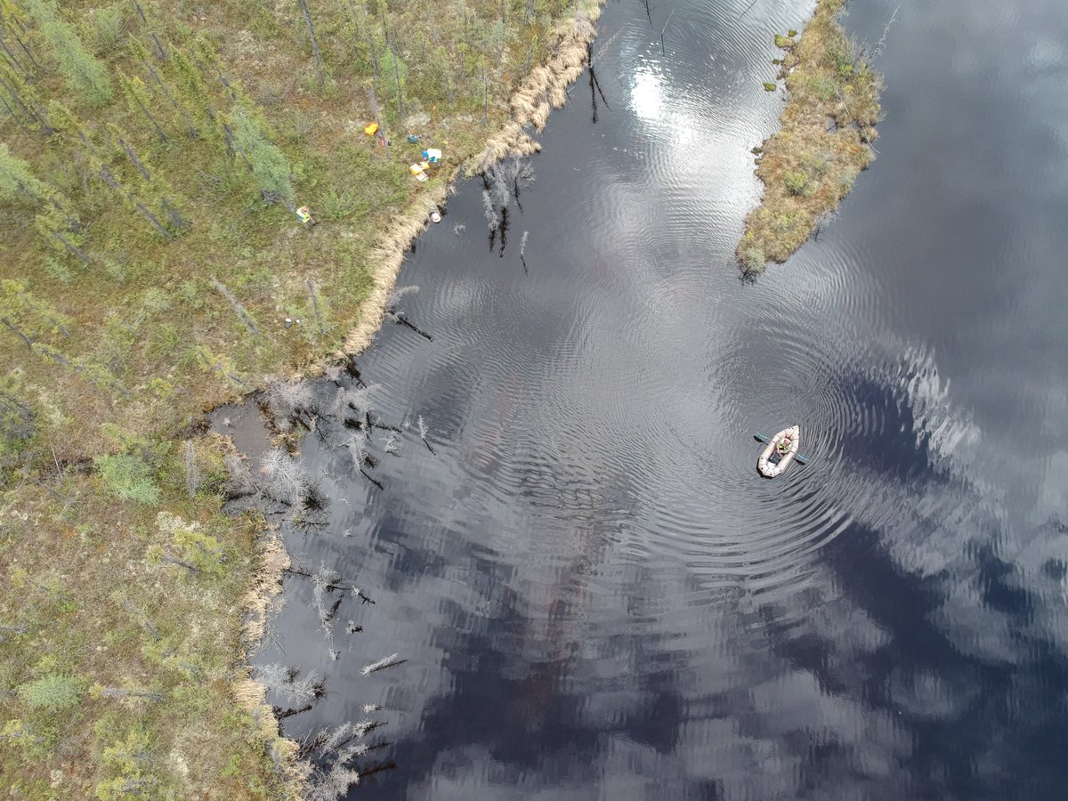
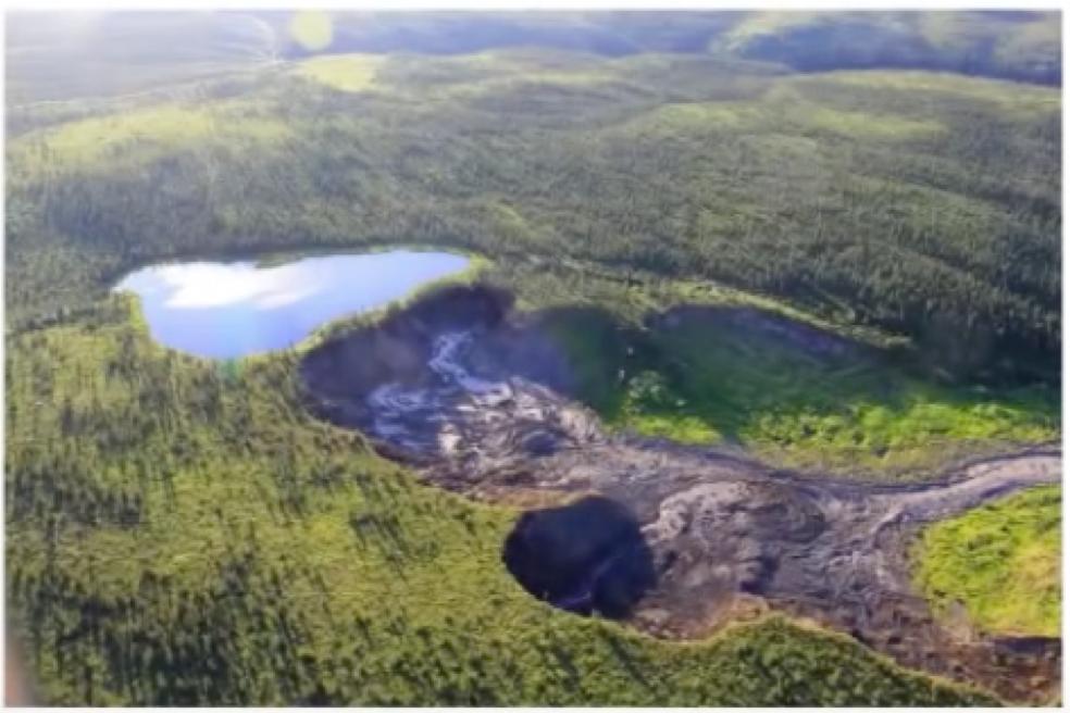
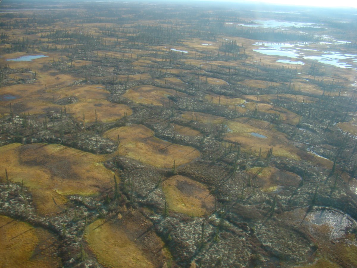
And here is what abrupt permafrost thaw does to wetland regions from a bird& #39;s eye view. Large patches of relatively dry permafrost peatland become scarred by these very wet thaw features, which ultimately join together and influence water flows at larger scales
Collapse scar wetlands are warm, wet produce a lot of methane. Methane is a stronger greenhouse gas than CO2, so we need to understand how permafrost C is released as CO2 vs methane. However, these wetlands become home to mosses that grow quickly & take carbon up from the air.
Personal rant If you think I am enthusiastic about peat, wait until you see me talk about Sphagnum moss! Back to permafrost.....
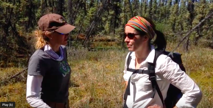
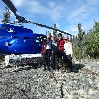
@forestecogrp and I are working on a number of issues related to  https://abs.twimg.com/emoji/v2/... draggable="false" alt="🔥" title="Feuer" aria-label="Emoji: Feuer"> and permafrost thaw in the Northwest Territories. Here is a video of us doing some field detective work in a collapse scar wetland. https://www.youtube.com/watch?v=O2-vbHUboMM&t=18s">https://www.youtube.com/watch...
Lots left to learn in these ecosystems. But we know this - lichens love to grow in permafrost peatlands & caribou love to eat lichens. So permafrost thaw is  https://abs.twimg.com/emoji/v2/... draggable="false" alt="☹️" title="Stirnrunzelndes Gesicht" aria-label="Emoji: Stirnrunzelndes Gesicht"> news for lichens, caribou, & country foods that sustain northern communities. Image: @ge_d_timmons @NWF_Research
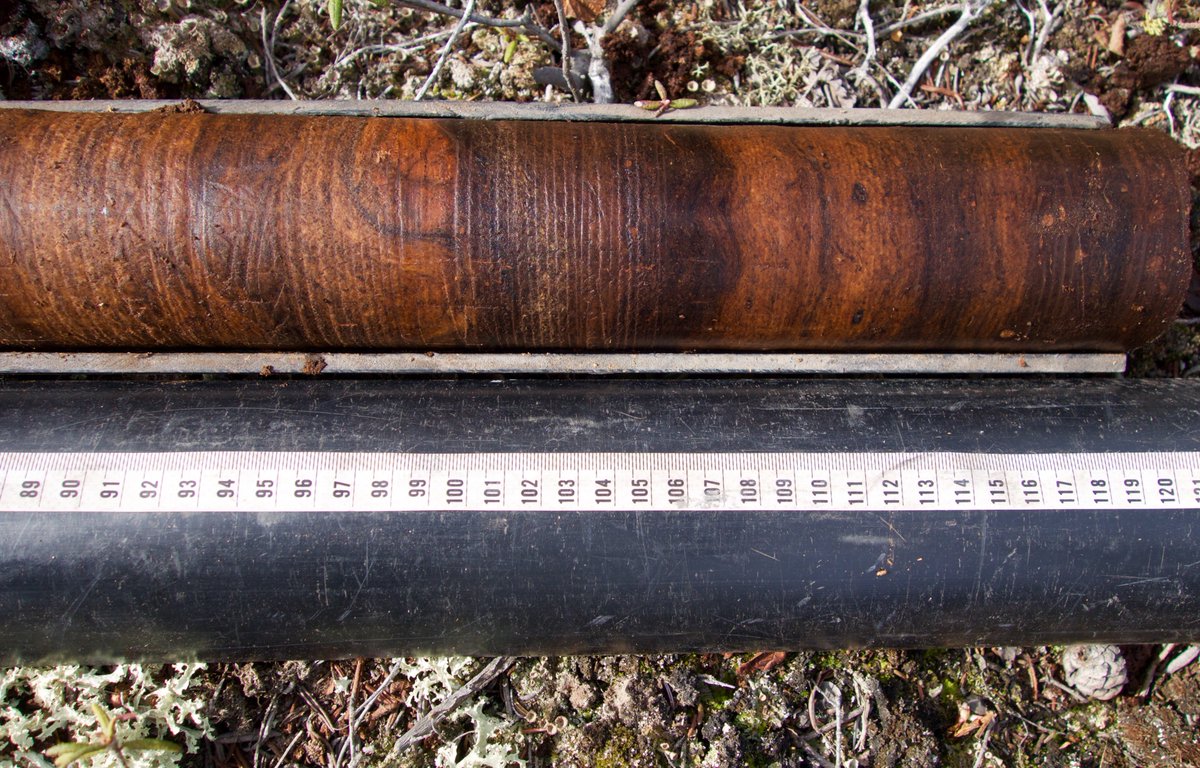
Last comment- it& #39;s really fun to sample permafrost peatlands! Look at those beautiful samples. They are largely derived from wood, again reflecting the forested history. Sampling in collapse scar wetlands is really really tough. One part peat sampling, equal parts limnology.
Next - onto abrupt thaw that forms thaw lakes. I intentionally saved this for last, and only because these are the systems that have up until now received the most scientific attention in terms of permafrost carbon release. Image: @DavidOlefeldt

 Read on Twitter

![But here is what ground ice can look in profile form. This image shows a cliff of ground ice! Massive segregated ice exposed in a retrogressive thaw slump in a High Arctic environment [on the Fosheim Peninsula, Ellesmere Island]. Photo credit Toni Lewkowicz. But here is what ground ice can look in profile form. This image shows a cliff of ground ice! Massive segregated ice exposed in a retrogressive thaw slump in a High Arctic environment [on the Fosheim Peninsula, Ellesmere Island]. Photo credit Toni Lewkowicz.](https://pbs.twimg.com/media/D5frsGHV4AA6dRB.jpg)


 (T. Lewkowicz). R top- thaw slump on Herschel Isle https://abs.twimg.com/emoji/v2/... draggable="false" alt="🇨🇦" title="Flagge von Kanada" aria-label="Emoji: Flagge von Kanada"> (G. Hugelius); R bottom- thaw slump near Mackenzie River NWT ( @CarolynG_22)" title="In hills & mountains, abrupt thaw means landslides & erosion. L top- gully in N Alaska ( @thermokarst); L bottom- detachment slide on Ellesmere Isle https://abs.twimg.com/emoji/v2/... draggable="false" alt="🇨🇦" title="Flagge von Kanada" aria-label="Emoji: Flagge von Kanada"> (T. Lewkowicz). R top- thaw slump on Herschel Isle https://abs.twimg.com/emoji/v2/... draggable="false" alt="🇨🇦" title="Flagge von Kanada" aria-label="Emoji: Flagge von Kanada"> (G. Hugelius); R bottom- thaw slump near Mackenzie River NWT ( @CarolynG_22)" class="img-responsive" style="max-width:100%;"/>
 . These are HUGE features created by abrupt thaw and mass movement of soil/sediment, and you can literally see the erosion in action in this video. https://www.youtube.com/watch..." title="Check out this video of a mega-slump in the Peel Plateau of the Northwest Territories https://abs.twimg.com/emoji/v2/... draggable="false" alt="🇨🇦" title="Flagge von Kanada" aria-label="Emoji: Flagge von Kanada">. These are HUGE features created by abrupt thaw and mass movement of soil/sediment, and you can literally see the erosion in action in this video. https://www.youtube.com/watch..." class="img-responsive" style="max-width:100%;"/>
 peat, so let& #39;s start with thaw wetlands! Permafrost peatlands are dry enough to support forests. The trees might be stunted & old, but they are survivors. I think black spruce should be https://abs.twimg.com/emoji/v2/... draggable="false" alt="🇨🇦" title="Flagge von Kanada" aria-label="Emoji: Flagge von Kanada"> national tree!" title="In flat poorly drained areas, abrupt thaw creates lakes or wetlands. I https://abs.twimg.com/emoji/v2/... draggable="false" alt="❤️" title="Rotes Herz" aria-label="Emoji: Rotes Herz"> peat, so let& #39;s start with thaw wetlands! Permafrost peatlands are dry enough to support forests. The trees might be stunted & old, but they are survivors. I think black spruce should be https://abs.twimg.com/emoji/v2/... draggable="false" alt="🇨🇦" title="Flagge von Kanada" aria-label="Emoji: Flagge von Kanada"> national tree!" class="img-responsive" style="max-width:100%;"/>


 and permafrost thaw in the Northwest Territories. Here is a video of us doing some field detective work in a collapse scar wetland. https://www.youtube.com/watch..." title=" @forestecogrp and I are working on a number of issues related to https://abs.twimg.com/emoji/v2/... draggable="false" alt="🔥" title="Feuer" aria-label="Emoji: Feuer"> and permafrost thaw in the Northwest Territories. Here is a video of us doing some field detective work in a collapse scar wetland. https://www.youtube.com/watch..." class="img-responsive" style="max-width:100%;"/>
 news for lichens, caribou, & country foods that sustain northern communities. Image: @ge_d_timmons @NWF_Research" title="Lots left to learn in these ecosystems. But we know this - lichens love to grow in permafrost peatlands & caribou love to eat lichens. So permafrost thaw is https://abs.twimg.com/emoji/v2/... draggable="false" alt="☹️" title="Stirnrunzelndes Gesicht" aria-label="Emoji: Stirnrunzelndes Gesicht"> news for lichens, caribou, & country foods that sustain northern communities. Image: @ge_d_timmons @NWF_Research" class="img-responsive" style="max-width:100%;"/>
